-
DateThursday May 25, 2017 at 5:45pm PDT
past event -
TypeRaceEnduro
-
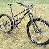
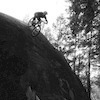
ActivitiesMountain Bike
-
LocationMount Seymour Canada
-
Route
-
AKAnsmba fiver, FWS, Fiver World Series
-
Email
-
Website
-
RegistrationOpen Paid
-
Organizer
-
Series
Our Fiver Series is an upgraded version of our past successful Toonie Series. For $5 (and your 2017 NSMBA Membership) you will enjoy an evening of leisurely racing followed by food and beverages. This is a great community event open to any one, of any ability, and we strongly encourage families to participate
Fivers are hosted bi-weekly on Thursday evenings. Registration opens at 5:45pm at the designated registration point with a rolling start open from 5:45pm to 6:45pm. If the race is at Fromme the registration booth will be found near the second yellow gate and if on Seymour it will be found at Parkgate Park, unless it is stated otherwise in the posted race details.
Fiver Dates and Details:
Thursday Apr 27 – Fromme – Obsession Bikes
Thursday May 11 -Seymour – Endless Biking
Thursday May 25 – Seymour – Giant Canada
Thursday June 8 – Fromme – Rescheduled
Thursday June 22 – Fromme – Lynn Valley Bikes
Thursday July 6 – Seymour – MEC / Intense
Thursday July 20 – Seymour – Rocky Mountain Bikes
Thursday Aug 3rd – Fromme – Norco John Henry Bikes
Saturday Sept 16th - Fromme - Steed Cycles.
Specific course details will be released by the Tuesday morning previous to each weeks race. Reminder that you must have a current 2017 North Shore Mountain Bike Association Membership to race. Purchase your membership NOW!
Comments
-
+ 0
 DaPeach
May 23, 2017 at 12:23
DaPeach
May 23, 2017 at 12:23
-
- Signup Link
- Download
- Subscribe
-
4interested
-
15going
Route
-
2017 FWS - 3
close-
Layers w
- Weather Layers
- Pro
- Pro
- Pro
- Pro
- Pro
- Pro
- More Layers
- Pro
- Pro
- Pro
- Pro
-
Upgrade to

3DTrail Conditions- Unknown
- Snow Groomed
- Snow Packed
- Snow Covered
- Snow Cover Partial
- Freeze/thaw Cycle
- Icy
- Prevalent Mud
- Wet
- Variable
- Ideal
- Dry
- Very Dry
Trail Flow (Ridden Direction)Trailforks scans users ridelogs to determine the most popular direction each trail is ridden. A good flowing trail network will have most trails flowing in a single direction according to their intension.
The colour categories are based on what percentage of riders are riding a trail in its intended direction.- > 96%
- > 90%
- > 80%
- > 70%
- > 50%
- < 50%
- bi-directional trail
- no data
Trail Last RiddenTrailforks scans ridelogs to determine the last time a trail was ridden.- < 2 days
- < 1 week
- < 2 weeks
- < 1 month
- < 6 months
- > 6 months
Trail Ridden DirectionThe intended direction a trail should be ridden.- Downhill Only
- Downhill Primary
- Both Directions
- Uphill Primary
- Uphill Only
- One Direction
Contribute DetailsColors indicate trail is missing specified detail.- Description
- Photos
- Description & Photos
- Videos
Trail Popularity ?Trailforks scans ridelogs to determine which trails are ridden the most in the last 9 months. Trails are compared with nearby trails in the same city region with a possible 25 colour shades. Think of this as a heatmap, more rides = more kinetic energy = warmer colors.- most popular
- popular
- less popular
- not popular
ATV/ORV/OHV FilterMax Vehicle WidthinchesUS Cell CoverageLegend
Radar TimeActivity RecordingsTrailforks uses anonymized public activity data. ?Activity RecordingsTrailforks uses anonymized public activity data. ?Personal Heatmap▶ Activity Typesall / none▶ Options2Date range month–Winter TrailsWarning A routing network for winter maps does not exist. Selecting trails using the winter trails layer has been disabled.Missing TrailsMost PopularLeast PopularTrails are colored based on popularity. The more popular a trail is, the more red. Less popular trails trend towards green.Jump Magnitude HeatmapHeatmap of where riders jump on trails. Zoom in to see individual jumps, click circles to view jump details.BC Backroad Status
Service Road Atlas is a free to use, community-driven service for viewing and creating reports on the numerous back-country service roads around B.C. and Alberta.
![map legend]() Slope AspectDirection the slope facesTrails DeemphasizedTrails are shown in grey.Only show trails with no bike usage.Suggested LayersBased on selected activity type
Slope AspectDirection the slope facesTrails DeemphasizedTrails are shown in grey.Only show trails with no bike usage.Suggested LayersBased on selected activity typeSave the current map location and zoom level as your default home location whenever this page is loaded.
SaveTrail transparency- Singletrack
- Unpaved
- Paved
6.0 milesDistance1,460 ftClimb-1,458 ftDescent1,416 ftHigh Point1 ftAltitude change346 ftAltitude min346 ftAltitude start348 ftAltitude end-37.3%Grade max83.9%Grade min3 milesDistance climb3 milesDistance down1,158 ftDistance flat -
