The 80 mile Black Canyon Trail provides mountain bikers with a long range back country trail riding opportunity. This historic National Recreation Trail is of national significance, following a route used since the times of pre-historic Native American travelers and traders. This trail provides a challenging ride experience characterized by rough, unstable soils and rocks, with various trail grades and numerous elevation changes within a harsh desert climate. The trail meanders through the Sonoran Desert landscape, including saguaro forests and rugged canyons.
One of the Bureau of Land Management's "Backyard to Backcountry" treasures, information on the Black Canyon Trail was developed between IMBA and the Hassayampa, AZ, BLM office to provide world-class riding experiences. IMBA's data on the trail includes elevations, ratings, current conditions, photos, and comments.
One of the Bureau of Land Management's "Backyard to Backcountry" treasures, information on the Black Canyon Trail was developed between IMBA and the Hassayampa, AZ, BLM office to provide world-class riding experiences. IMBA's data on the trail includes elevations, ratings, current conditions, photos, and comments.
- Mountain Bike
- Horse
- Hike
- Trail Running
Login to see your progress towards riding all the trails and routes in this list.
Trails
| title | riding area | rating | distance | completed | |||
|---|---|---|---|---|---|---|---|
| 1 | BCT: Kay Mine South | 3 miles | |||||
| 2 | BCT: Antelope Creek DT | 2,057 ft | |||||
| 3 | BCT: Crown King Road | 1,060 ft | |||||
| 4 | BCT: North Table Mesa Rd | 167 ft | |||||
| 5 | BCT: Osborne Spring Wash | 6 miles | |||||
| 6 | BCT: Russian Well | 15 miles | |||||
| 7 | BCT: Biscuit Flat | 6 miles | |||||
| 8 | BCT: Drinking Snake | 5 miles | |||||
| 9 | BCT: Jeep Connector | 3,871 ft | |||||
| 10 | BCT: Arrastre Creek | 3 miles | |||||
| 11 | BCT: Soap Creek | 4 miles | |||||
| 12 | BCT: Bumble Bee | 3 miles | |||||
| 13 | BCT: Windmill Valley | 2 miles | |||||
| 14 | BCT: Windmill Valley North | 1 mile | |||||
| 15 | BCT: Gasline Road | 4,308 ft | |||||
| 16 | BCT: Doe Valley | 2 miles | |||||
| 17 | BCT: Boy Scout East | 2 miles | |||||
| 18 | BCT: Boy Scout West | 1 mile | |||||
| 19 | BCT: Emery Henderson | 3 miles | |||||
| 20 | BCT: Kay Mine North | 2 miles | |||||
| 21 | BCT: Williams Mesa | 3 miles | |||||
| 22 | BCT: Table Mesa | 2 miles | |||||
| 23 | BCT: Little Pan | 3 miles | |||||
| 24 | BCT: Hidden Treasure | 6 miles | |||||
| 25 | BCT: Antelope Creek | 4 miles | |||||
| 26 | BCT: Bumble Bee Creek | 4,163 ft | |||||
| 27 | BCT: Cheapshot | 3 miles | |||||
| 28 | BCT: Skyline | 5 miles |
Displaying 28
Videos
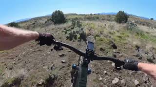
18:24 |
63 |
Apr 5, 2026 , Black Canyon City

18:24 |
70 |
Apr 5, 2026 , Black Canyon City

14:21 |
48 |
Feb 6, 2026 , Black Canyon City
Recent Trail Reports
| status | trail | date | condition | |
|---|---|---|---|---|
| BCT: Bumble Bee Creek | Feb 14, 2026 @ 11:45am (America/Phoenix) Feb 14, 2026 | view | ||
| BCT: Arrastre Creek | Feb 3, 2026 @ 11:46am (America/Phoenix) Feb 3, 2026 | view | ||
| BCT: Soap Creek | Feb 3, 2026 @ 11:45am (America/Phoenix) Feb 3, 2026 | view | ||
| BCT: Skyline | Jul 26, 2025 @ 5:28am Jul 26, 2025 | view | ||
| BCT: Cheapshot | Jul 26, 2025 @ 5:28am Jul 26, 2025 | view |
Total Trails
28
Total Distance
88 miles
Total Descent
-9,470 ft
Total Climb
7,501 ft
close
-
Layers w
- Weather Layers
- Pro
- Pro
- Pro
- Pro
- Pro
- Pro
- More Layers
- Pro
- Pro
- Pro
- Pro
-
Upgrade to

3D
Trail Conditions
- Unknown
- Snow Groomed
- Snow Packed
- Snow Covered
- Snow Cover Partial
- Freeze/thaw Cycle
- Icy
- Prevalent Mud
- Wet
- Variable
- Ideal
- Dry
- Very Dry
Trail Flow (Ridden Direction)
Trailforks scans users ridelogs to determine the most popular direction each trail is ridden. A good flowing trail network will have most trails flowing in a single direction according to their intension.
The colour categories are based on what percentage of riders are riding a trail in its intended direction.
The colour categories are based on what percentage of riders are riding a trail in its intended direction.
- > 96%
- > 90%
- > 80%
- > 70%
- > 50%
- < 50%
- bi-directional trail
- no data
Trail Last Ridden
Trailforks scans ridelogs to determine the last time a trail was ridden.
- < 2 days
- < 1 week
- < 2 weeks
- < 1 month
- < 6 months
- > 6 months
Trail Ridden Direction
The intended direction a trail should be ridden.
- Downhill Only
- Downhill Primary
- Both Directions
- Uphill Primary
- Uphill Only
- One Direction
Contribute Details
Colors indicate trail is missing specified detail.
- Description
- Photos
- Description & Photos
- Videos
Trail Popularity ?
Trailforks scans ridelogs to determine which trails are ridden the most in the last 9 months.
Trails are compared with nearby trails in the same city region with a possible 25 colour shades.
Think of this as a heatmap, more rides = more kinetic energy = warmer colors.
- most popular
- popular
- less popular
- not popular
ATV/ORV/OHV Filter
Max Vehicle Width
inches
US Cell Coverage
Legend

Radar Time
Activity Recordings
Trailforks uses anonymized public activity data.
?
Activity Recordings
Trailforks uses anonymized public activity data.
?
Personal Heatmap
▶
Activity Types
all
/
none
▶
Options
2
Date range
month
–
Winter Trails
Warning
A routing network for winter maps does not exist. Selecting trails using the winter trails layer has been disabled.
Missing Trails
Most Popular
Least Popular
Trails are colored based on popularity. The more popular a trail is, the more red. Less popular trails trend towards green.
Jump Magnitude Heatmap
Heatmap of where riders jump on trails. Zoom in to see individual jumps, click circles to view jump details.
BC Backroad Status
![map legend]()
Service Road Atlas is a free to use, community-driven service for viewing and creating reports on the numerous back-country service roads around B.C. and Alberta.

Slope Aspect
Direction the slope faces
Trails Deemphasized
Trails are shown in grey.
Only show trails with no bike usage.
Suggested Layers
Based on selected activity type
Save the current map location and zoom level as your default home location whenever this page is loaded.
Save
Trail transparency
Featured
Average difficulty
Trails and Routes in List - Distance by Difficulty
Trails and Routes in List - Difficulty Totals
- By PlumbBobM
 TRAILFORKS HCH
 - #876 - 4,065 views