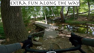
The main stem of Patriots’ Path extends from East Hanover and connects the Lenape Trail in Essex County to Allamuchy Mountain State Park in Sussex County, intersecting with the Columbia Trail in Washington Township. The purpose of the trail system is to provide opportunities for passive outdoor recreation while protecting and enhancing the environmental and aesthetic integrity of the stream valleys and uplands through which it passes.
A portion of the trail is co-aligned with the Highlands Trail, sponsored by the New York-New Jersey Trail Conference. Patriots' Path ends at the junction with another NY-NJTC trail, the Lenape Trail, in Essex County.
Many sections are multi-use, but check each segment for allowable use. Some are hike-only. All use data comes from the current County GIS database, which is extremely comprehensive.
- Mountain Bike
- Horse
- Hike
- Trail Running
- Snowshoe
- Nordic Ski
Login to see your progress towards riding all the trails and routes in this list.
Trails
Displaying 82
Videos
1:11:18 |
644 |
Jun 11, 2023 , Morristown
Recent Trail Reports
| status | trail | date | condition | |
|---|---|---|---|---|
| PP - Old Parsippany Road Sidewalk | May 26, 2026 @ 10:51am (America/New_York) May 26, 2026 | view | ||
| West Morris Greenway - Patriots' Path | May 17, 2026 @ 8:18am (America/New_York) May 17, 2026 | view | ||
| Patriots' Path, Sussex to Combs Hollow | May 3, 2026 @ 8:27am (America/New_York) May 3, 2026 | view | ||
| Patriot's Path, Speedwell Ave to Sussex Tpk | Sep 19, 2025 @ 10:01am (America/New_York) Sep 19, 2025 | view | ||
| Patriots' Path, Whitehead Rd to Lewis Morris | Sep 19, 2025 @ 10:01am (America/New_York) Sep 19, 2025 | view |
Total Trails
82
Total Distance
44 miles
Total Descent
-2,876 ft
Total Climb
2,169 ft
close
-
Layers w
- Weather Layers
- Pro
- Pro
- Pro
- Pro
- Pro
- Pro
- More Layers
- Pro
- Pro
- Pro
- Pro
-
Upgrade to

3D
Trail Conditions
- Unknown
- Snow Groomed
- Snow Packed
- Snow Covered
- Snow Cover Partial
- Freeze/thaw Cycle
- Icy
- Prevalent Mud
- Wet
- Variable
- Ideal
- Dry
- Very Dry
Trail Flow (Ridden Direction)
Trailforks scans users ridelogs to determine the most popular direction each trail is ridden. A good flowing trail network will have most trails flowing in a single direction according to their intension.
The colour categories are based on what percentage of riders are riding a trail in its intended direction.
The colour categories are based on what percentage of riders are riding a trail in its intended direction.
- > 96%
- > 90%
- > 80%
- > 70%
- > 50%
- < 50%
- bi-directional trail
- no data
Trail Last Ridden
Trailforks scans ridelogs to determine the last time a trail was ridden.
- < 2 days
- < 1 week
- < 2 weeks
- < 1 month
- < 6 months
- > 6 months
Trail Ridden Direction
The intended direction a trail should be ridden.
- Downhill Only
- Downhill Primary
- Both Directions
- Uphill Primary
- Uphill Only
- One Direction
Contribute Details
Colors indicate trail is missing specified detail.
- Description
- Photos
- Description & Photos
- Videos
Trail Popularity ?
Trailforks scans ridelogs to determine which trails are ridden the most in the last 9 months.
Trails are compared with nearby trails in the same city region with a possible 25 colour shades.
Think of this as a heatmap, more rides = more kinetic energy = warmer colors.
- most popular
- popular
- less popular
- not popular
ATV/ORV/OHV Filter
Max Vehicle Width
inches
US Cell Coverage
Legend

Radar Time
Activity Recordings
Trailforks uses anonymized public activity data.
?
Activity Recordings
Trailforks uses anonymized public activity data.
?
Personal Heatmap
▶
Activity Types
all
/
none
▶
Options
2
Date range
month
–
Winter Trails
Warning
A routing network for winter maps does not exist. Selecting trails using the winter trails layer has been disabled.
Missing Trails
Most Popular
Least Popular
Trails are colored based on popularity. The more popular a trail is, the more red. Less popular trails trend towards green.
Jump Magnitude Heatmap
Heatmap of where riders jump on trails. Zoom in to see individual jumps, click circles to view jump details.
BC Backroad Status
![map legend]()
Service Road Atlas is a free to use, community-driven service for viewing and creating reports on the numerous back-country service roads around B.C. and Alberta.

Slope Aspect
Direction the slope faces
Trails Deemphasized
Trails are shown in grey.
Only show trails with no bike usage.
Suggested Layers
Based on selected activity type
Save the current map location and zoom level as your default home location whenever this page is loaded.
Save
Trail transparency
This official route list of trails is not complete
Average difficulty
Mountain Bike is not supported on all trail sections, see trails for more details.
Trails and Routes in List - Distance by Difficulty
Trails and Routes in List - Difficulty Totals
- By PlumbBobM
 TRAILFORKS HCH
 - #949 - 1,624 views