close
-
Layers w
- Weather Layers
- Pro
- Pro
- Pro
- Pro
- Pro
- Pro
- More Layers
- Pro
- Pro
- Pro
- Pro
-
Upgrade to

3D
Trail Conditions
- Unknown
- Snow Groomed
- Snow Packed
- Snow Covered
- Snow Cover Partial
- Freeze/thaw Cycle
- Icy
- Prevalent Mud
- Wet
- Variable
- Ideal
- Dry
- Very Dry
Trail Flow (Ridden Direction)
Trailforks scans users ridelogs to determine the most popular direction each trail is ridden. A good flowing trail network will have most trails flowing in a single direction according to their intension.
The colour categories are based on what percentage of riders are riding a trail in its intended direction.
The colour categories are based on what percentage of riders are riding a trail in its intended direction.
- > 96%
- > 90%
- > 80%
- > 70%
- > 50%
- < 50%
- bi-directional trail
- no data
Trail Last Ridden
Trailforks scans ridelogs to determine the last time a trail was ridden.
- < 2 days
- < 1 week
- < 2 weeks
- < 1 month
- < 6 months
- > 6 months
Trail Ridden Direction
The intended direction a trail should be ridden.
- Downhill Only
- Downhill Primary
- Both Directions
- Uphill Primary
- Uphill Only
- One Direction
Contribute Details
Colors indicate trail is missing specified detail.
- Description
- Photos
- Description & Photos
- Videos
Trail Popularity ?
Trailforks scans ridelogs to determine which trails are ridden the most in the last 9 months.
Trails are compared with nearby trails in the same city region with a possible 25 colour shades.
Think of this as a heatmap, more rides = more kinetic energy = warmer colors.
- most popular
- popular
- less popular
- not popular
ATV/ORV/OHV Filter
Max Vehicle Width
inches
US Cell Coverage
Legend

Radar Time
Activity Recordings
Trailforks uses anonymized public activity data.
?
Activity Recordings
Trailforks uses anonymized public activity data.
?
Personal Heatmap
▶
Activity Types
all
/
none
▶
Options
2
Date range
month
–
Winter Trails
Warning
A routing network for winter maps does not exist. Selecting trails using the winter trails layer has been disabled.
Missing Trails
Most Popular
Least Popular
Trails are colored based on popularity. The more popular a trail is, the more red. Less popular trails trend towards green.
Jump Magnitude Heatmap
Heatmap of where riders jump on trails. Zoom in to see individual jumps, click circles to view jump details.
BC Backroad Status
![map legend]()
Service Road Atlas is a free to use, community-driven service for viewing and creating reports on the numerous back-country service roads around B.C. and Alberta.

Slope Aspect
Direction the slope faces
Trails Deemphasized
Trails are shown in grey.
Only show trails with no bike usage.
Suggested Layers
Based on selected activity type
Save the current map location and zoom level as your default home location whenever this page is loaded.
Save
No description for Dalkeith has been added yet!
Login or register to submit one.
This region uses the Uk/Euro style trail grading system.
Activities Click to view
- Mountain Bike
38 trails
- E-Bike
39 trails
- Winter Fat Bike
0 trails
- Hike
39 trails
- Trail Running
39 trails
Region Details
- 33
- 4
- 1
Region Status
Open as of Apr 14, 2026Stats
- Avg Trail Rating
- Trails (view details)
- 39
- Trails Mountain Bike
- 38
- Trails E-Bike
- 39
- Trails Hike
- 39
- Trails Trail Running
- 39
- Total Distance
- 15 miles
- Total Descent
- 1,497 ft
- Total Vertical
- 400 ft
- Highest Trailhead
- 537 ft
- Reports
- 64
- Photos
- 37
- Ridden Counter
- 1,342
Popular Dalkeith Mountain Biking Trails
• 100 ★ 4.5 • 3 miles • 105 ft • 123 •
Popular green difficulty family friendly dirt/gravel road. This mountain bike primary trail can be used both directions and has a easy overall physical rating with a 105 ft green climb. Trail visibility is always easy to follow. On average it takes 18 minutes to complete this trail.
• 100 ★ 0.0 • 2,861 ft • 83 ft • 96 • • hike
Popular green difficulty singletrack. This hike primary trail can be used both directions. On average it takes 3 minutes to complete this trail.
• 85 ★ 0.0 • 3,109 ft • 0 ft • 69 •
Popular red difficulty singletrack. This mountain bike primary trail can be used downhill primary. On average it takes 8 minutes to complete this trail.
• 80 ★ 5.0 • 2,344 ft • 0 ft • 66 •
Popular black difficulty singletrack. This mountain bike primary trail can be used downhill primary and has a moderate overall physical rating. It features drop, gap jump and roller coaster. On average it takes 3 minutes to complete this trail.
• 65 ★ 0.0 • 2,978 ft • 70 ft • 49 •
Moderately popular red difficulty singletrack. This mountain bike primary trail can be used both directions. On average it takes 5 minutes to complete this trail.
• 90 ★ 0.0 • 2,792 ft • 29 ft • 43 • • hike
Popular green difficulty singletrack. This hike primary trail can be used both directions. On average it takes 3 minutes to complete this trail.
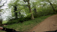
Photos of Dalkeith Mountain Bike
Videos of Dalkeith Mountain Bike
trail: Middle Line
2:04 |
526 |
May 6, 2019
trail: Trail
0:12 |
563 |
May 4, 2011

trail: Middle Line
8:24 |
887 |
Apr 17, 2020 , Dalkeith
Recent Trail Reports
| status | trail | date | condition | info | user |
|---|---|---|---|---|---|
| Eskbank > Penicuik Trailway | Apr 14, 2026 @ 10:21am (Europe/London) Apr 14, 2026 | Ideal | SBMCD | ||
| Trail | Aug 14, 2022 @ 5:27am Aug 14, 2022 | Dry | Judeenduro | ||
| Trail | Aug 29, 2020 @ 5:02am Aug 29, 2020 | Dry | rodmct | ||
| Trail | Jul 21, 2020 @ 6:26am Jul 21, 2020 | Ideal | levo-scott | ||
| Trail | Jul 21, 2020 @ 6:26am Jul 21, 2020 | Ideal | levo-scott | ||
| Trail | Aug 14, 2020 @ 5:29am Aug 14, 2020 | Ideal | levo-scott | ||
| Trail | Aug 3, 2020 @ 6:24am Aug 3, 2020 | Dry | TaylorSugden | ||
| Trail | Jul 7, 2020 @ 9:09am Jul 7, 2020 | Ideal | Stinkykris | ||
| Doghouse Woods | Apr 22, 2020 @ 5:47am Apr 22, 2020 | Very Dry | powtheginge |
Activity Feed
| username | action | type | title | date |
|---|---|---|---|---|
| Yosharian2233 | comment | trail | activity #96102342 | Jun 2, 2026 @ 12:19pm Jun 2, 2026 |
| SBMCD | add | report | activity #92598152 | Apr 14, 2026 @ 8:13am Apr 14, 2026 |
| jkjacobus | ridden | trail | activity #82061245 | Oct 10, 2025 @ 7:03am Oct 10, 2025 |
| IJC | vote | trail | activity #78362604 | Aug 17, 2025 @ 12:42pm Aug 17, 2025 |
| IJC | ridden | trail | activity #78362580 | Aug 17, 2025 @ 12:41pm Aug 17, 2025 |
Recent Comments
| username | type | title | comment | date |
|---|---|---|---|---|
| trail | Have you seen them as of 2026? | Jun 2, 2026 @ 12:22pm Jun 2, 2026 | ||
| trail | I was thinking of going but I heard about it... | Jun 2, 2026 @ 12:19pm Jun 2, 2026 | ||
| trail | Path is currently closed between Auchendinny... | Nov 15, 2024 @ 11:33pm Nov 15, 2024 | ||
| trail | Trail is blocked off by logs | Mar 29, 2021 @ 2:31pm Mar 29, 2021 | ||
| trail | This has now been destroyed. | Aug 31, 2020 @ 12:25pm Aug 31, 2020 |
Local Badges
-

Completionist0 awarded -

Epic Mountain Bike Climb 2k4 awarded -

Climbing 10k Badge26 awarded -

Mountain Biking 100k Badge0 awarded -

Epic Ride Descent 2k4 awarded -

Descent 10k Badge25 awarded
Activity Type Stats
| activitytype | trails | distance | descent | descent distance | total vertical | rating | global rank | state rank | photos | reports | routes | ridelogs |
|---|---|---|---|---|---|---|---|---|---|---|---|---|
| Mountain Bike | 38 | 15 miles | 1,496 ft | 7 miles | 400 ft | #6,467 | #225 | 37 | 64 | 8,665 | ||
| E-Bike | 39 | 15 miles | 1,496 ft | 7 miles | 400 ft | #4,346 | #169 | 26 | 1,018 | |||
| Hike | 39 | 15 miles | 1,496 ft | 7 miles | 400 ft | #5,676 | #135 | 64 | 120 | |||
| Trail Running | 39 | 15 miles | 1,496 ft | 7 miles | 400 ft | #6,624 | #187 | 64 | 356 |
Frequently Asked Questions About Dalkeith
▼
What are the best places to ride in Dalkeith?
▼
What are the highest rated mountain biking trails in Dalkeith?
The highest rated mountain biking trails in Dalkeith are:
- Middle Line (4.2/5)
- Eskbank > Penicuik Trailway (4.1/5)
- Carberry Side Line (3.9/5)
- Doghouse Woods (3.8/5)
- Trail (3.8/5)
▼
What is the best time of the year to ride in Dalkeith?
Based on ride log data, the most popular months to ride in Dalkeith are:
- May (26 activities)
- June (25 activities)
- July (20 activities)
▼
Where can I park to ride in Dalkeith?
Check the Dalkeith trail map for trailhead and parking information. Community members regularly update access and parking details for trails in the area.
- By Cheesymember & contributors
- Admins: DMBinS, FLS
- #16892 - 3,599 views
- dalkeith activity log | embed map of Dalkeith mountain bike trails |
Downloading of trail gps tracks in kml & gpx formats is enabled for Dalkeith.
You must login to download files.