close
-
Layers w
- Weather Layers
- Pro
- Pro
- Pro
- Pro
- Pro
- Pro
- More Layers
- Pro
- Pro
- Pro
- Pro
-
Upgrade to

3D
Trail Conditions
- Unknown
- Snow Groomed
- Snow Packed
- Snow Covered
- Snow Cover Partial
- Freeze/thaw Cycle
- Icy
- Prevalent Mud
- Wet
- Variable
- Ideal
- Dry
- Very Dry
Trail Flow (Ridden Direction)
Trailforks scans users ridelogs to determine the most popular direction each trail is ridden. A good flowing trail network will have most trails flowing in a single direction according to their intension.
The colour categories are based on what percentage of riders are riding a trail in its intended direction.
The colour categories are based on what percentage of riders are riding a trail in its intended direction.
- > 96%
- > 90%
- > 80%
- > 70%
- > 50%
- < 50%
- bi-directional trail
- no data
Trail Last Ridden
Trailforks scans ridelogs to determine the last time a trail was ridden.
- < 2 days
- < 1 week
- < 2 weeks
- < 1 month
- < 6 months
- > 6 months
Trail Ridden Direction
The intended direction a trail should be ridden.
- Downhill Only
- Downhill Primary
- Both Directions
- Uphill Primary
- Uphill Only
- One Direction
Contribute Details
Colors indicate trail is missing specified detail.
- Description
- Photos
- Description & Photos
- Videos
Trail Popularity ?
Trailforks scans ridelogs to determine which trails are ridden the most in the last 9 months.
Trails are compared with nearby trails in the same city region with a possible 25 colour shades.
Think of this as a heatmap, more rides = more kinetic energy = warmer colors.
- most popular
- popular
- less popular
- not popular
ATV/ORV/OHV Filter
Max Vehicle Width
inches
US Cell Coverage
Legend

Radar Time
Activity Recordings
Trailforks uses anonymized public activity data.
?
Activity Recordings
Trailforks uses anonymized public activity data.
?
Personal Heatmap
▶
Activity Types
all
/
none
▶
Options
2
Date range
month
–
Winter Trails
Warning
A routing network for winter maps does not exist. Selecting trails using the winter trails layer has been disabled.
Missing Trails
Most Popular
Least Popular
Trails are colored based on popularity. The more popular a trail is, the more red. Less popular trails trend towards green.
Jump Magnitude Heatmap
Heatmap of where riders jump on trails. Zoom in to see individual jumps, click circles to view jump details.
BC Backroad Status
![map legend]()
Service Road Atlas is a free to use, community-driven service for viewing and creating reports on the numerous back-country service roads around B.C. and Alberta.

Slope Aspect
Direction the slope faces
Trails Deemphasized
Trails are shown in grey.
Only show trails with no bike usage.
Suggested Layers
Based on selected activity type
Save the current map location and zoom level as your default home location whenever this page is loaded.
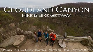
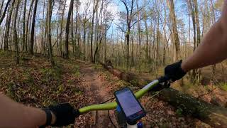
SaveFive Points is a spectacular mountain bike destination that used to be an old coal town area. These well-groomed trails are only 30 minutes from downtown Chattanooga but you'll feel like you're in a far more exotic place. These trails rival Raccoon Mountain for the title of "best in-town trail system." Beginner to advanced, it's all here. The Cloudland Connector Trail is the main multi-use trail, with even horses permitted. Everything else is singletrack with either excellent flow, tough technical sections, or both.
Primary Trail Type: Cross-Country
eBikes Allowed:
Yes
AKA: 5-Points, Cloudlands Canyon State Park
Land Status: State Park
Land Manager: Georgia Department of Natural Resources
 google parking directions
 Region Supporters & Maintainers
Activities Click to view
- Mountain Bike
32 trails
- E-Bike
41 trails
- Hike
42 trails
- Trail Running
42 trails
Region Details
- 3
- 13
- 13
- 3
Region Status
Caution as of May 29, 2026Stats
- Avg Trail Rating
- Trails (view details)
- 42
- Trails Mountain Bike
- 32
- Trails E-Bike
- 41
- Trails Gravel Bike
- 3
- Trails Adaptive Bike
- 3
- Trails Hike
- 42
- Trails Trail Running
- 42
- Total Distance
- 52 miles
- Total Descent
- 5,433 ft
- Total Vertical
- 1,447 ft
- Highest Trailhead
- 2,252 ft
- Reports
- 971
- Photos
- 221
- Ridden Counter
- 14,856
Popular Five Points Mountain Biking Trails
• 100 ★ 3.8 • 1,923 ft • 75 ft • 770 •
Popular green difficulty singletrack. This mountain bike primary trail can be used both directions and has a easy overall physical rating with a 75 ft green climb. On average it takes 5 minutes to complete this trail.
• 95 ★ 4.2 • 2 miles • 194 ft • 703 •
Highly rated popular blue difficulty singletrack. This mountain bike primary trail can be used both directions and has a easy overall physical rating with a 194 ft green climb. On average it takes 13 minutes to complete this trail.
• 95 ★ 4.6 • 1 mile • 51 ft • 658 •
Popular green difficulty singletrack. This multi-use trail can be used both directions and has a easy overall physical rating with a 51 ft green climb. On average it takes 6 minutes to complete this trail.
• 90 ★ 4.2 • 4,800 ft • 54 ft • 615 •
Highly rated popular blue difficulty singletrack. This mountain bike primary trail can be used both directions and has a easy overall physical rating with a 54 ft green climb. It features berm and jump. On average it takes 5 minutes to complete this trail.
• 100 ★ 4.3 • 1 mile • 70 ft • 607 •
Highly rated popular green difficulty singletrack. This mountain bike primary trail can be used both directions and has a easy overall physical rating with a 70 ft green climb. On average it takes 8 minutes to complete this trail.
• 85 ★ 4.7 • 1 mile • 39 ft • 603 •
Highly rated popular blue difficulty singletrack. This mountain bike primary trail can be used both directions and has a moderate overall physical rating with a 39 ft blue climb. On average it takes 7 minutes to complete this trail.
• 75 ★ 4.5 • 2,874 ft • 19 ft • 596 •
Highly rated popular blue difficulty singletrack. This mountain bike primary trail. On average it takes 2 minutes to complete this trail.
Five Points Mountain Bike Routes
5 miles • 231 ft • 3 • Loop •
A welcoming introduction to Five Points’ cross-country flow. Start from the main parking area and cruise...
9 miles • 785 ft • 7 • Loop •
This advanced loop puts you on the most demanding trails Five Points has to offer. You'll climb from the...
8 miles • 572 ft • 6 •
This intermediate loop showcases the depth and variety that make Five Points one of Chattanooga’s best...
31 miles • 2,336 ft • 9 • Point to Point •
The River to Clouds Route is an approximately 34-mile, technical backcountry linkup connecting Cloudland...
14 miles • 1,397 ft • 26 •
Good out and back with lots of climbing. Moderate technical in 1 or 2 places.
• 13 miles • 1,177 ft • 8 •
Photos of Five Points Mountain Bike
Videos of Five Points Mountain Bike

trail: Torino
4:02 |
208 |
Sep 23, 2019

trail: Bankhead/5 Points Connector
13:59 |
247 |
Jan 23, 2018
24:16 |
57 |
May 4, 2025

trail: Kinder Garden
8:52 |
524 |
Jul 12, 2021 , Trenton

trail: Barkeater
21:09 |
352 |
Jul 12, 2021 , Trenton
trail: Atlatl
9:13 |
337 |
Jul 12, 2021 , Trenton

trail: Prince Albert
3:48 |
283 |
Jul 12, 2021 , Trenton

trail: Prince Albert, Upper Loop
5:08 |
245 |
Jul 12, 2021 , Trenton
Recent Trail Reports
| status | trail | date | condition | info | user |
|---|---|---|---|---|---|
| Tailings Run Trail | May 29, 2026 @ 2:14pm (America/New_York) May 29, 2026 | Unknown | pcmerchant | ||
| Long Branch Trail | May 17, 2026 @ 9:25am (America/New_York) May 17, 2026 | Dry | ediddyone | ||
| North Hogsback Trail | May 16, 2026 @ 9:25am (America/New_York) May 16, 2026 | Variable | ediddyone | ||
| Barkeater | May 14, 2026 @ 12:01pm (America/New_York) May 14, 2026 | Unknown | sunshinelove11 SORBA Chatt | ||
| Cloudland Canyon Connector Trail - 5 Points Section | Feb 28, 2026 @ 12:19pm (America/New_York) Feb 28, 2026 | Unknown | cseanard SORBA Chatt | ||
| Kettle Bottom Trail | Oct 23, 2025 @ 2:58pm (America/New_York) Oct 23, 2025 | Unknown | kGx5e3 | ||
| Hanging Wall | Oct 23, 2025 @ 2:58pm (America/New_York) Oct 23, 2025 | Unknown | kGx5e3 | ||
| Bankhead/5 Points Connector | Sep 13, 2025 @ 10:11pm (America/New_York) Sep 13, 2025 | Unknown | errandwolfe | ||
| Bella's Run | Aug 19, 2025 @ 2:57pm Aug 19, 2025 | Unknown | kGx5e3 | ||
| South Hogsback | Aug 17, 2025 @ 6:05am Aug 17, 2025 | Dry | Requiem |
National Scenic Trails & Official Routes
-
River To Clouds
- Mountain Bike
- E-Bike
- Hike
- Trail Running

Activity Feed
| username | action | type | title | date |
|---|---|---|---|---|
| pcmerchant | comment | report | activity #95790867 and 1 more | May 29, 2026 @ 11:17am May 29, 2026 |
| pcmerchant | add | report | activity #95790673 | May 29, 2026 @ 11:14am May 29, 2026 |
| mneiswander | wishlist | route | activity #95480274 | May 25, 2026 @ 5:32am May 25, 2026 |
| mneiswander | wishlist | region | activity #95480244 | May 25, 2026 @ 5:32am May 25, 2026 |
| floridamanracing | wishlist | route | activity #95291926 | May 22, 2026 @ 11:33pm May 22, 2026 |
Recent Comments
| username | type | title | comment | date |
|---|---|---|---|---|
| report | Couple tree down about .2 - .25 from 5 point... | May 29, 2026 @ 11:21am May 29, 2026 | ||
| report | Tree down across trail north just past trail... | May 29, 2026 @ 11:17am May 29, 2026 | ||
| report | Any more specifics on location? | Mar 9, 2026 @ 7:16am Mar 9, 2026 | ||
| report | Do you have a pin for this? | Mar 9, 2026 @ 7:15am Mar 9, 2026 | ||
| report | Tami, do you happen to have a pin of the... | Feb 16, 2026 @ 2:06pm Feb 16, 2026 |
Nearby Areas
| name | distance | ||||
|---|---|---|---|---|---|
| Durham Mine Trails | 10 | 2 | 5 | 2.5 km | |
| Lula Lake Land Trust | 3 | 1 | 7.3 km | ||
| Covenant College / Moonshine Trails | 2 | 2 | 1 | 7.7 km | |
| Lookout Mountain | 3 | 2 | 11.6 km | ||
| Crockford-Pigeon Mountain | 11.8 km |
Local Badges
-

Completionist2 awarded
Activity Type Stats
| activitytype | trails | distance | descent | descent distance | total vertical | rating | global rank | state rank | photos | reports | routes | ridelogs |
|---|---|---|---|---|---|---|---|---|---|---|---|---|
| Mountain Bike | 32 | 41 miles | 4,094 ft | 16 miles | 814 ft | #1,565 | #535 | 210 | 965 | 2 | 6,896 | |
| E-Bike | 41 | 52 miles | 5,433 ft | 20 miles | 1,447 ft | #2,596 | #845 | 4 | 794 | 1 | 231 | |
| Gravel Bike | 3 | 2 miles | 302 ft | 2 miles | 138 ft | #645 | #332 | 107 | 2 | |||
| Adaptive Bike | 3 | 2 miles | 302 ft | 2 miles | 138 ft | #642 | #329 | 11 | ||||
| Hike | 42 | 52 miles | 5,433 ft | 20 miles | 1,447 ft | #3,677 | #1,283 | 6 | 968 | 1 | 802 | |
| Trail Running | 42 | 52 miles | 5,433 ft | 20 miles | 1,447 ft | #3,492 | #946 | 966 | 144 |
Frequently Asked Questions About Five Points
▼
What are the highest rated mountain biking trails in Five Points?
The highest rated mountain biking trails in Five Points are:
- Caprock Trail (4.5/5)
- Tailings Run Trail (4.5/5)
- North Hogsback Trail (4.3/5)
- Shale Flats Trail (4.3/5)
- Hanging Wall (4.2/5)
▼
What is the best time of the year to ride in Five Points?
Based on ride log data, the most popular months to ride in Five Points are:
- May (67 activities)
- October (56 activities)
- July (53 activities)
▼
Where can I park to ride in Five Points?
There are 5 parking locations listed in Five Points. The most popular parking spots are: View all parking and trailhead locations on the map to plan your visit.
▼
What is the longest trail in Five Points?
The longest trail in Five Points is Long Branch Trail at 5.5 miles. View all trails sorted by distance.
Activities
Trails
- By sunshinelove11
 SORBA Chatt SORBA Chatt & contributors
 - Admins: SORBA Chatt, SORBA Chatt, SORBA Chatt
- #4278 - 27,858 views
- five points activity log | embed map of Five Points mountain bike trails | five points mountain biking points of interest
Downloading of trail gps tracks in kml & gpx formats is enabled for Five Points.
You must login to download files.