close
-
Layers w
- Weather Layers
- Pro
- Pro
- Pro
- Pro
- Pro
- Pro
- More Layers
- Pro
- Pro
- Pro
- Pro
-
Upgrade to

3D
Trail Conditions
- Unknown
- Snow Groomed
- Snow Packed
- Snow Covered
- Snow Cover Partial
- Freeze/thaw Cycle
- Icy
- Prevalent Mud
- Wet
- Variable
- Ideal
- Dry
- Very Dry
Trail Flow (Ridden Direction)
Trailforks scans users ridelogs to determine the most popular direction each trail is ridden. A good flowing trail network will have most trails flowing in a single direction according to their intension.
The colour categories are based on what percentage of riders are riding a trail in its intended direction.
The colour categories are based on what percentage of riders are riding a trail in its intended direction.
- > 96%
- > 90%
- > 80%
- > 70%
- > 50%
- < 50%
- bi-directional trail
- no data
Trail Last Ridden
Trailforks scans ridelogs to determine the last time a trail was ridden.
- < 2 days
- < 1 week
- < 2 weeks
- < 1 month
- < 6 months
- > 6 months
Trail Ridden Direction
The intended direction a trail should be ridden.
- Downhill Only
- Downhill Primary
- Both Directions
- Uphill Primary
- Uphill Only
- One Direction
Contribute Details
Colors indicate trail is missing specified detail.
- Description
- Photos
- Description & Photos
- Videos
Trail Popularity ?
Trailforks scans ridelogs to determine which trails are ridden the most in the last 9 months.
Trails are compared with nearby trails in the same city region with a possible 25 colour shades.
Think of this as a heatmap, more rides = more kinetic energy = warmer colors.
- most popular
- popular
- less popular
- not popular
ATV/ORV/OHV Filter
Max Vehicle Width
inches
US Cell Coverage
Legend

Radar Time
Activity Recordings
Trailforks uses anonymized public activity data.
?
Activity Recordings
Trailforks uses anonymized public activity data.
?
Personal Heatmap
▶
Activity Types
all
/
none
▶
Options
2
Date range
month
–
Winter Trails
Warning
A routing network for winter maps does not exist. Selecting trails using the winter trails layer has been disabled.
Missing Trails
Most Popular
Least Popular
Trails are colored based on popularity. The more popular a trail is, the more red. Less popular trails trend towards green.
Jump Magnitude Heatmap
Heatmap of where riders jump on trails. Zoom in to see individual jumps, click circles to view jump details.
BC Backroad Status
![map legend]()
Service Road Atlas is a free to use, community-driven service for viewing and creating reports on the numerous back-country service roads around B.C. and Alberta.

Slope Aspect
Direction the slope faces
Trails Deemphasized
Trails are shown in grey.
Only show trails with no bike usage.
Suggested Layers
Based on selected activity type
Save the current map location and zoom level as your default home location whenever this page is loaded.
Save
No description for Glenealy has been added yet!
Login or register to submit one.
This region uses the Uk/Euro style trail grading system.
Activities Click to view
- Mountain Bike
51 trails
- E-Bike
14 trails
- Gravel Bike
0 trails
- Adaptive Bike
0 trails
- Hike
47 trails
- Trail Running
47 trails
Region Details
- 15
- 1
- 13
- 7
- 12
Region Status
Open as of May 19, 2026Stats
- Avg Trail Rating
- Trails (view details)
- 51
- Trails Mountain Bike
- 51
- Trails E-Bike
- 14
- Trails Horse
- 1
- Trails Hike
- 47
- Trails Trail Running
- 47
- Total Distance
- 28 miles
- Total Descent
- 8,618 ft
- Total Vertical
- 939 ft
- Highest Trailhead
- 1,203 ft
- Reports
- 202
- Photos
- 98
- Ridden Counter
- 4,679
Sub Regions
-
Carrick Mountain
- 1
- 13
- 7
- 12
Popular Glenealy Mountain Biking Trails
• 95 ★ 5.0 • 2,278 ft • 0 ft • 212 •
Popular black difficulty singletrack. This mountain bike primary trail can be used downhill only. It features berm, drop, jump, gap jump, rock face and rock garden. On average it takes 6 minutes to complete this trail.
• 65 ★ 5.0 • 1,278 ft • 0 ft • 167 •
Moderately popular blue difficulty singletrack. This mountain bike primary trail can be used downhill only. On average it takes 2 minutes to complete this trail.
• 35 ★ 4.7 • 974 ft • 3 ft • 159 •
Less popular blue difficulty singletrack. This mountain bike primary trail can be used downhill primary. On average it takes 1 minutes to complete this trail.
• 70 ★ 4.8 • 1,352 ft • 0 ft • 154 •
Highly rated popular black difficulty singletrack. This mountain bike primary trail can be used downhill primary. It features berm, drop and jump. Trail visibility is sometimes hard to follow. On average it takes 7 minutes to complete this trail.
• 100 ★ 4.0 • 959 ft • 0 ft • 152 •
Popular blue difficulty singletrack. This mountain bike primary trail can be used downhill primary. On average it takes minutes to complete this trail.
• 100 ★ 5.0 • 581 ft • 0 ft • 133 •
Popular red difficulty singletrack. This mountain bike primary trail can be used downhill only. It features berm, drop and jump. Trail visibility is sometimes hard to follow. On average it takes minutes to complete this trail.
• 95 ★ 5.0 • 1,125 ft • 0 ft • 130 •
Popular red difficulty singletrack. This mountain bike primary trail can be used downhill primary. It features berm, drop and jump. Trail visibility is sometimes hard to follow. On average it takes 1 minutes to complete this trail.
Glenealy Mountain Bike Routes
★ 5.0 • 22 miles • 4,267 ft • 33 • Loop • Race •
Race course for the Gravity Enduro Series 2025 - Carrick
★ 5.0 • 21 miles • 4,132 ft • 34 • Loop • Race •
Race course for the Gravity Enduro Series 2023 - Carrick
★ 3.0 • 16 miles • 3,407 ft • 24 • Loop • Race •
Race course for the Gravity Enduro Series 2022 - Carrick
• 7 miles • 2,157 ft • 0 •
• 9 miles • 1,524 ft • 9 •
• 16 miles • 2,782 ft • 16 •
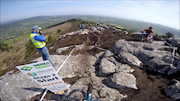
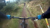
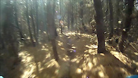
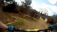
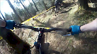
Photos of Glenealy Mountain Bike
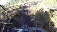
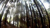
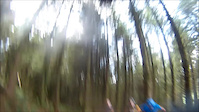
Videos of Glenealy Mountain Bike
trail: Emerald Express Pt 1
0:55 |
973 |
May 20, 2016
trail: Dirty Hucker
3:06 |
395 |
Mar 10, 2015
trail: Dirty Hucker
2:00 |
736 |
Sep 2, 2013
trail: Dirty Hucker
3:18 |
153 |
Sep 2, 2013
trail: Dirty Hucker
2:55 |
639 |
May 21, 2013
trail: Dirty Hucker
5:10 |
189 |
Apr 20, 2013
trail: Dirty Hucker
4:15 |
155 |
Apr 20, 2013
trail: Dirty Hucker
2:57 |
127 |
Apr 20, 2013
Recent Trail Reports
| status | trail | date | condition | info | user |
|---|---|---|---|---|---|
| Emerald Express Pt 1 | May 19, 2026 @ 9:41pm (Europe/Dublin) May 19, 2026 | Wet | menukunz Thun Kandertal | ||
| Slip & Slide Bottom Section | May 19, 2026 @ 9:38pm (Europe/Dublin) May 19, 2026 | Wet | menukunz Thun Kandertal | ||
| Slip & Slide Middle | May 19, 2026 @ 9:37pm (Europe/Dublin) May 19, 2026 | Unknown | menukunz Thun Kandertal | ||
| Slip & Slide Top Section | May 19, 2026 @ 9:36pm (Europe/Dublin) May 19, 2026 | Wet | menukunz Thun Kandertal | ||
| Turkish Delight | May 19, 2024 @ 11:50am May 19, 2024 | Prevalent Mud | AdrianPluskota | ||
| Dirty Hucker | May 19, 2024 @ 11:49am May 19, 2024 | Prevalent Mud | AdrianPluskota | ||
| Forest Road | Apr 23, 2024 @ 2:26pm Apr 23, 2024 | Dry | obez | ||
| Full Gas Pt 4 | Apr 23, 2024 @ 2:25pm Apr 23, 2024 | Variable | obez | ||
| Full Gas Pt 5 | Apr 23, 2024 @ 2:24pm Apr 23, 2024 | Variable | obez | ||
| Full Gas Pt 3 | Apr 23, 2024 @ 2:23pm Apr 23, 2024 | Variable | obez |
Activity Feed
| username | action | type | title | date |
|---|---|---|---|---|
| menukunz | add | photo | activity #95063543 | May 19, 2026 @ 1:43pm May 19, 2026 |
| menukunz | comment | trail | activity #95063460 | May 19, 2026 @ 1:41pm May 19, 2026 |
| menukunz | add | report | activity #95063260 and 3 more | May 19, 2026 @ 1:36pm May 19, 2026 |
| menukunz | vote | trail | activity #95063180 and 3 more | May 19, 2026 @ 1:35pm May 19, 2026 |
| menukunz | ridden | trail | activity #95063178 and 3 more | May 19, 2026 @ 1:35pm May 19, 2026 |
Recent Comments
| username | type | title | comment | date |
|---|---|---|---|---|
| trail | The first 100 meters are extremely technical.... | May 19, 2026 @ 1:41pm May 19, 2026 | ||
| trail | Overgrown half way down, sharp bushes | Oct 6, 2025 @ 9:52am Oct 6, 2025 | ||
| trail | Doesn't exist? | Jul 7, 2025 @ 4:22am Jul 7, 2025 | ||
| trail | Upper section looks to be gone due to tree... | Aug 12, 2023 @ 5:40am Aug 12, 2023 | ||
| trail | Trail impassable does to tree Felling activity... | Apr 5, 2020 @ 6:23am Apr 5, 2020 |
Local Badges
-

Epic Ride Climb 2k60 awarded -

Climbing 10k Badge34 awarded -

Climbing 100k Badge1 awarded -

Epic Ride Descent 2k59 awarded -

Descent 10k Badge34 awarded -

Descent 100k Badge1 awarded
Activity Type Stats
| activitytype | trails | distance | descent | descent distance | total vertical | rating | global rank | state rank | photos | reports | routes | ridelogs |
|---|---|---|---|---|---|---|---|---|---|---|---|---|
| Mountain Bike | 51 | 28 miles | 8,619 ft | 17 miles | 938 ft | #1,446 | #3 | 98 | 201 | 6 | 4,033 | |
| E-Bike | 14 | 4 miles | 2,139 ft | 3 miles | 856 ft | #1,724 | #15 | 152 | 5 | 342 | ||
| Horse | 1 | 1 mile | 233 ft | 3,199 ft | 233 ft | 53 | ||||||
| Hike | 47 | 27 miles | 7,858 ft | 16 miles | 938 ft | #1,963 | #7 | 200 | 150 | |||
| Trail Running | 47 | 27 miles | 7,858 ft | 16 miles | 938 ft | #1,479 | #6 | 200 | 1 | 68 |
Frequently Asked Questions About Glenealy
▼
What are the best places to ride in Glenealy?
Glenealy has 1 areas to explore for mountain biking. The top rated areas are:
▼
What are the highest rated mountain biking trails in Glenealy?
The highest rated mountain biking trails in Glenealy are:
- Emerald Express Pt 1 (4.5/5)
- Henderson (4.4/5)
- Vegas (4.3/5)
- Turkish Delight (4.3/5)
- Emerald Express Pt 2 (4.2/5)
▼
What is the best time of the year to ride in Glenealy?
Based on ride log data, the most popular months to ride in Glenealy are:
- July (59 activities)
- August (28 activities)
- September (27 activities)
▼
Where can I park to ride in Glenealy?
There are 1 parking locations listed in Glenealy. The most popular parking spots are:
Activities
- By brenthillier
 NSMBA TRAILFORKS & contributors
 - Admins: apply
- #8455 - 5,359 views
- glenealy activity log | embed map of Glenealy mountain bike trails | glenealy mountain biking points of interest
Downloading of trail gps tracks in kml & gpx formats is enabled for Glenealy.
You must login to download files.