close
-
Layers w
- Weather Layers
- Pro
- Pro
- Pro
- Pro
- Pro
- Pro
- More Layers
- Pro
- Pro
- Pro
- Pro
-
Upgrade to

3D
Trail Conditions
- Unknown
- Snow Groomed
- Snow Packed
- Snow Covered
- Snow Cover Partial
- Freeze/thaw Cycle
- Icy
- Prevalent Mud
- Wet
- Variable
- Ideal
- Dry
- Very Dry
Trail Flow (Ridden Direction)
Trailforks scans users ridelogs to determine the most popular direction each trail is ridden. A good flowing trail network will have most trails flowing in a single direction according to their intension.
The colour categories are based on what percentage of riders are riding a trail in its intended direction.
The colour categories are based on what percentage of riders are riding a trail in its intended direction.
- > 96%
- > 90%
- > 80%
- > 70%
- > 50%
- < 50%
- bi-directional trail
- no data
Trail Last Ridden
Trailforks scans ridelogs to determine the last time a trail was ridden.
- < 2 days
- < 1 week
- < 2 weeks
- < 1 month
- < 6 months
- > 6 months
Trail Ridden Direction
The intended direction a trail should be ridden.
- Downhill Only
- Downhill Primary
- Both Directions
- Uphill Primary
- Uphill Only
- One Direction
Contribute Details
Colors indicate trail is missing specified detail.
- Description
- Photos
- Description & Photos
- Videos
Trail Popularity ?
Trailforks scans ridelogs to determine which trails are ridden the most in the last 9 months.
Trails are compared with nearby trails in the same city region with a possible 25 colour shades.
Think of this as a heatmap, more rides = more kinetic energy = warmer colors.
- most popular
- popular
- less popular
- not popular
ATV/ORV/OHV Filter
Max Vehicle Width
inches
US Cell Coverage
Legend

Radar Time
Activity Recordings
Trailforks uses anonymized public activity data.
?
Activity Recordings
Trailforks uses anonymized public activity data.
?
Personal Heatmap
▶
Activity Types
all
/
none
▶
Options
2
Date range
month
–
Winter Trails
Warning
A routing network for winter maps does not exist. Selecting trails using the winter trails layer has been disabled.
Missing Trails
Most Popular
Least Popular
Trails are colored based on popularity. The more popular a trail is, the more red. Less popular trails trend towards green.
Jump Magnitude Heatmap
Heatmap of where riders jump on trails. Zoom in to see individual jumps, click circles to view jump details.
BC Backroad Status
![map legend]()
Service Road Atlas is a free to use, community-driven service for viewing and creating reports on the numerous back-country service roads around B.C. and Alberta.

Slope Aspect
Direction the slope faces
Trails Deemphasized
Trails are shown in grey.
Only show trails with no bike usage.
Suggested Layers
Based on selected activity type
Save the current map location and zoom level as your default home location whenever this page is loaded.
SaveEast side of the Klamath basin. Gnarly rocky and exposed
Primary Trail Type: All-Mountain & Downhill
Land Status: Private Property
 google parking directions
 Activities Click to view
- Mountain Bike
1 trails
- Hike
1 trails
- Trail Running
1 trails
Region Details
- 1
Region Status
Open as of Aug 16, 2024Stats
- Avg Trail Rating
- Trails (view details)
- 1
- Trails Mountain Bike
- 1
- Trails Hike
- 1
- Trails Trail Running
- 1
- Total Distance
- 2 miles
- Total Vertical
- 1,767 ft
- Highest Trailhead
- 6,192 ft
- Reports
- 1
- Photos
- 4
- Ridden Counter
- 37
Popular Hogsback Mountain Biking Trails
• 5 ★ 5.0 • 2 miles • 1,767 ft • 10 • • hike
This trail starts as a gnarly rocky exposed ridge line decent that can be very fast at times as well as very technical. Once you cross the dirt 5200 road the trail turns straight down the hill side and becomes a much faster paced trail...
Hogsback Mountain Bike Routes
Videos of Hogsback Mountain Bike
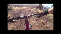
trail: Salted Fatback
0:39 |
660 |
Apr 29, 2015
Recent Trail Reports
no previous reports, add one now!
Activity Feed
| username | action | type | title | date |
|---|---|---|---|---|
| Curranmark | wishlist | region | activity #71028854 | May 4, 2025 @ 6:12pm May 4, 2025 |
| markholloway | add | poi | activity #50016151 and 1 more | Mar 14, 2024 @ 12:11pm Mar 14, 2024 |
| nwrid3r | vote | route | activity #49420691 | Feb 22, 2024 @ 1:01pm Feb 22, 2024 |
| AlexRodiles | wishlist | region | activity #45481058 | Oct 21, 2023 @ 12:22pm Oct 21, 2023 |
| mountzlu | ridden | trail | activity #42149711 | Jul 24, 2023 @ 4:01pm Jul 24, 2023 |
Nearby Areas
| name | distance | ||||
|---|---|---|---|---|---|
| Moore Mountain | 29 | 28 | 9 | 3 | 5.5 km |
| Spence Mountain | 9 | 18 | 8 | 16.9 km | |
| Keno | 3 | 2 | 17.4 km |
Activity Type Stats
| activitytype | trails | distance | descent | descent distance | total vertical | rating | global rank | state rank | photos | reports | routes | ridelogs |
|---|---|---|---|---|---|---|---|---|---|---|---|---|
| Mountain Bike | 1 | 2 miles | 1,768 ft | #14,122 | #5,694 | 1 | 1 | 2 | 628 | |||
| Hike | 1 | 2 miles | 1,768 ft | #17,179 | #8,062 | 3 | 1 | 122 | ||||
| Trail Running | 1 | 2 miles | 1,768 ft | #16,759 | #7,611 | 1 | 9 |
- By kevin11jones
 & contributors
 - Admins: KTA
- #7517 - 4,323 views
- hogsback activity log | embed map of Hogsback mountain bike trails | hogsback mountain biking points of interest
Downloading of trail gps tracks in kml & gpx formats is enabled for Hogsback.
You must login to download files.