close
-
Layers w
- Weather Layers
- Pro
- Pro
- Pro
- Pro
- Pro
- Pro
- More Layers
- Pro
- Pro
- Pro
- Pro
-
Upgrade to

3D
Trail Conditions
- Unknown
- Snow Groomed
- Snow Packed
- Snow Covered
- Snow Cover Partial
- Freeze/thaw Cycle
- Icy
- Prevalent Mud
- Wet
- Variable
- Ideal
- Dry
- Very Dry
Trail Flow (Ridden Direction)
Trailforks scans users ridelogs to determine the most popular direction each trail is ridden. A good flowing trail network will have most trails flowing in a single direction according to their intension.
The colour categories are based on what percentage of riders are riding a trail in its intended direction.
The colour categories are based on what percentage of riders are riding a trail in its intended direction.
- > 96%
- > 90%
- > 80%
- > 70%
- > 50%
- < 50%
- bi-directional trail
- no data
Trail Last Ridden
Trailforks scans ridelogs to determine the last time a trail was ridden.
- < 2 days
- < 1 week
- < 2 weeks
- < 1 month
- < 6 months
- > 6 months
Trail Ridden Direction
The intended direction a trail should be ridden.
- Downhill Only
- Downhill Primary
- Both Directions
- Uphill Primary
- Uphill Only
- One Direction
Contribute Details
Colors indicate trail is missing specified detail.
- Description
- Photos
- Description & Photos
- Videos
Trail Popularity ?
Trailforks scans ridelogs to determine which trails are ridden the most in the last 9 months.
Trails are compared with nearby trails in the same city region with a possible 25 colour shades.
Think of this as a heatmap, more rides = more kinetic energy = warmer colors.
- most popular
- popular
- less popular
- not popular
ATV/ORV/OHV Filter
Max Vehicle Width
inches
US Cell Coverage
Legend

Radar Time
Activity Recordings
Trailforks uses anonymized public activity data.
?
Activity Recordings
Trailforks uses anonymized public activity data.
?
Personal Heatmap
▶
Activity Types
all
/
none
▶
Options
2
Date range
month
–
Winter Trails
Warning
A routing network for winter maps does not exist. Selecting trails using the winter trails layer has been disabled.
Missing Trails
Most Popular
Least Popular
Trails are colored based on popularity. The more popular a trail is, the more red. Less popular trails trend towards green.
Jump Magnitude Heatmap
Heatmap of where riders jump on trails. Zoom in to see individual jumps, click circles to view jump details.
BC Backroad Status
![map legend]()
Service Road Atlas is a free to use, community-driven service for viewing and creating reports on the numerous back-country service roads around B.C. and Alberta.

Slope Aspect
Direction the slope faces
Trails Deemphasized
Trails are shown in grey.
Only show trails with no bike usage.
Suggested Layers
Based on selected activity type
Save the current map location and zoom level as your default home location whenever this page is loaded.
Save
No description for Idro has been added yet!
Login or register to submit one.
This region uses the Uk/Euro style trail grading system.
Activities Click to view
- Mountain Bike
16 trails
- E-Bike
14 trails
- Adaptive Bike
0 trails
- Winter Fat Bike
0 trails
- Hike
15 trails
- Trail Running
15 trails
Region Details
- 3
- 8
Region Status
Open as of 3 daysStats
- Avg Trail Rating
- Trails (view details)
- 15
- Trails Mountain Bike
- 16
- Trails E-Bike
- 14
- Trails Hike
- 15
- Trails Trail Running
- 15
- Total Distance
- 33 miles
- Total Descent
- 22,772 ft
- Total Vertical
- 3,745 ft
- Highest Trailhead
- 4,955 ft
- Reports
- 80
- Photos
- 51
- Ridden Counter
- 688
Sub Regions
-
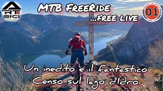
Lago d'Idro
- 8
Popular Idro Mountain Biking Trails
• 90 ★ 4.6 • 6 miles • 669 ft • 105 •
Highly rated popular red difficulty singletrack. This mountain bike primary trail can be used downhill only and has a moderate overall physical rating. Trail visibility is always easy to follow. On average it takes 1 hour24 minutes to complete this trail.
• 95 ★ 4.0 • 4 miles • 855 ft • 87 •
There are 136 switchbacks on this trail (nose press county), very tight at the beginning and then more developed. Narrow but not exposed. 100% on bike.
• 60 ★ 4.5 • 3 miles • 182 ft • 49 •
Steep with tight switchbacks (70 or so), not for pros only but you need good skills. More difficult than trail. Nice environment.
• 75 ★ 4.5 • 2 miles • 135 ft • 40 •
Upper part with an S2 section, follow by easy S0/S1 access road.
• 80 ★ 4.8 • 2 miles • 197 ft • 34 •
Popular red difficulty singletrack. This mountain bike primary trail can be used downhill only and has a moderate overall physical rating. Trail visibility is always easy to follow. On average it takes 14 minutes to complete this trail.
• 15 ★ 4.0 • 1 mile • 19 ft • 22 •
Less popular red difficulty singletrack. This mountain bike primary trail and has a moderate overall physical rating. Trail visibility is always easy to follow. On average it takes 30 minutes to complete this trail.
• 50 ★ 5.0 • 2 miles • 24 ft • 11 •
Stupendo sentiero naturale con vista lago. Prima parte livello S3, seconda parte livello S2
Idro Mountain Bike Routes
11 miles • 3,603 ft • 1 •
Il sentiero dei 100 tornanti è il sentiero più conosciuto del Lago d’Idro ed attira molti appassionati...
★ 2.0 • 17 miles • 4,670 ft • 2 •
Uno dei pochi itinerari in grado di attirare l’attenzione di bikers da tutta Europa, grazie al suo...
25 miles • 5,934 ft • 1 •
Classico tour all mountain in alta quota, con settori di portage da affrontare con la massima cautela....
14 miles • 3,781 ft • 1 •
Il sentiero enduro per eccellenza del Lago d’Idro, adatto a coloro che cercano il divertimento e...
7 miles • 2,327 ft • 0 •
Un grande classico del Lago d’Idro, per chi ama le discese tecniche e trialistiche. Partenza da Anfo, si...
28 miles • 5,980 ft • 0 •
Il giro dei laghetti di Bruffione è un tour adatto a bikers allenati, di livello medio/esperto, che si...
Photos of Idro Mountain Bike
Videos of Idro Mountain Bike
trail: Perlè DH
17:00 |
508 |
Feb 25, 2026 , Idro
trail: Censo DH
125 |
Jun 17, 2025 , Idro

trail: Cocca Bassa
10:00 |
143 |
Dec 10, 2024 , Idro
trail: Censo DH
10:00 |
256 |
Nov 24, 2024 , Idro
trail: Valledrane
6:16 |
318 |
May 4, 2023 , Idro
Recent Trail Reports
| status | trail | date | condition | info | user |
|---|---|---|---|---|---|
| Camisino | Jun 6, 2026 @ 11:03am (Europe/Vaduz) 3 days | Ideal | Sigischwaebli | ||
| Cocca Bassa | Apr 9, 2026 @ 5:30pm (Europe/Rome) Apr 9, 2026 | Dry | ChiliPalmer | ||
| Censo DH | Apr 9, 2026 @ 5:30pm (Europe/Rome) Apr 9, 2026 | Ideal | ChiliPalmer | ||
| 455 Mandoal DH | Apr 8, 2026 @ 8:54pm (Europe/Rome) Apr 8, 2026 | Very Dry | ChiliPalmer | ||
| Breda | Apr 6, 2026 @ 9:35pm (Europe/Rome) Apr 6, 2026 | Dry | ChiliPalmer | ||
| Perlè DH | Feb 22, 2026 @ 10:48pm (Europe/Rome) Feb 22, 2026 | Prevalent Mud | ArteBici | ||
| 136 Tornanti | Aug 9, 2025 @ 12:34pm Aug 9, 2025 | Ideal | ebelettronic | ||
| Vesta DH | Jun 28, 2025 @ 6:59am Jun 28, 2025 | Dry | Berttom | ||
| transfer to calva | Jun 28, 2025 @ 6:59am Jun 28, 2025 | Ideal | Berttom | ||
| Perlè | Jun 16, 2025 @ 7:25am Jun 16, 2025 | Variable | Salmonebossini |
Activity Feed
| username | action | type | title | date |
|---|---|---|---|---|
| j3ronimo | wishlist | trail | activity #96434163 | Jun 7, 2026 @ 12:24am 2 days |
| Sigischwaebli | add | report | activity #96373061 | Jun 6, 2026 @ 8:19am 3 days |
| GemynRCuZg | add | trail | activity #96279735 | Jun 5, 2026 @ 12:15am Jun 5, 2026 |
| Felixshqyqc | difficultyvote | trail | activity #94544943 | May 12, 2026 @ 1:18am May 12, 2026 |
| Crazeychris | wishlist | trail | activity #93265238 | Apr 24, 2026 @ 12:10am Apr 24, 2026 |
Recent Comments
| username | type | title | comment | date |
|---|---|---|---|---|
| trail | “Copy” :) grazie mille per la spiega... | Feb 24, 2026 @ 10:00am Feb 24, 2026 | ||
| trail | Il "POI" non l'ho mai utilizzato ma mi adopero... | Feb 24, 2026 @ 8:30am Feb 24, 2026 | ||
| trail | Riusciresti ad evidenziare il passaggio con... | Feb 23, 2026 @ 1:05am Feb 23, 2026 | ||
| trail | Livello tecnico S3 direi abbondante in molti... | Feb 22, 2026 @ 1:54pm Feb 22, 2026 | ||
| trail | Absolut nicht lohnenswert!!! Beginnt noch... | Jul 17, 2025 @ 6:35am Jul 17, 2025 |
Local Badges
-

Epic Mountain Bike Climb 2k116 awarded -

Climbing 10k Badge12 awarded -

Mountain Biking 100k Badge0 awarded -

Epic Ride Descent 2k116 awarded -

Descent 10k Badge12 awarded -

Descent 100k Badge0 awarded
Activity Type Stats
| activitytype | trails | distance | descent | descent distance | total vertical | rating | global rank | state rank | photos | reports | routes | ridelogs |
|---|---|---|---|---|---|---|---|---|---|---|---|---|
| Mountain Bike | 16 | 33 miles | 22,772 ft | 19 miles | 3,747 ft | #4,150 | #259 | 53 | 80 | 14 | 1,040 | |
| E-Bike | 14 | 26 miles | 22,585 ft | 19 miles | 3,747 ft | #798 | #96 | 79 | 13 | 134 | ||
| Hike | 15 | 32 miles | 22,657 ft | 19 miles | 3,642 ft | #6,152 | #307 | 80 | 149 | |||
| Trail Running | 15 | 32 miles | 22,657 ft | 19 miles | 3,642 ft | #5,659 | #295 | 80 | 5 |
Frequently Asked Questions About Idro
▼
What are the best places to ride in Idro?
Idro has 1 areas to explore for mountain biking. The top rated areas are:
▼
What are the highest rated mountain biking trails in Idro?
The highest rated mountain biking trails in Idro are:
- Vesta DH (4.4/5)
- Breda (4.3/5)
- Censo DH (4.1/5)
- Camisino (4.1/5)
- Valledrane (4.1/5)
▼
What is the best time of the year to ride in Idro?
Based on ride log data, the most popular months to ride in Idro are:
- May (6 activities)
- September (4 activities)
- July (4 activities)
▼
Where can I park to ride in Idro?
There are 1 parking locations listed in Idro. The most popular parking spots are:
Activities
Trails
Points of Interest
- By erripotter & contributors
- Admins: marcoangeletti, adessoomaipiu, micheletraversi
- #28548 - 1,867 views
- idro activity log | embed map of Idro mountain bike trails | idro mountain biking points of interest
Downloading of trail gps tracks in kml & gpx formats is enabled for Idro.
You must login to download files.