close
-
Layers w
- Weather Layers
- Pro
- Pro
- Pro
- Pro
- Pro
- Pro
- More Layers
- Pro
- Pro
- Pro
- Pro
-
Upgrade to

3D
Trail Conditions
- Unknown
- Snow Groomed
- Snow Packed
- Snow Covered
- Snow Cover Partial
- Freeze/thaw Cycle
- Icy
- Prevalent Mud
- Wet
- Variable
- Ideal
- Dry
- Very Dry
Trail Flow (Ridden Direction)
Trailforks scans users ridelogs to determine the most popular direction each trail is ridden. A good flowing trail network will have most trails flowing in a single direction according to their intension.
The colour categories are based on what percentage of riders are riding a trail in its intended direction.
The colour categories are based on what percentage of riders are riding a trail in its intended direction.
- > 96%
- > 90%
- > 80%
- > 70%
- > 50%
- < 50%
- bi-directional trail
- no data
Trail Last Ridden
Trailforks scans ridelogs to determine the last time a trail was ridden.
- < 2 days
- < 1 week
- < 2 weeks
- < 1 month
- < 6 months
- > 6 months
Trail Ridden Direction
The intended direction a trail should be ridden.
- Downhill Only
- Downhill Primary
- Both Directions
- Uphill Primary
- Uphill Only
- One Direction
Contribute Details
Colors indicate trail is missing specified detail.
- Description
- Photos
- Description & Photos
- Videos
Trail Popularity ?
Trailforks scans ridelogs to determine which trails are ridden the most in the last 9 months.
Trails are compared with nearby trails in the same city region with a possible 25 colour shades.
Think of this as a heatmap, more rides = more kinetic energy = warmer colors.
- most popular
- popular
- less popular
- not popular
ATV/ORV/OHV Filter
Max Vehicle Width
inches
US Cell Coverage
Legend

Radar Time
Activity Recordings
Trailforks uses anonymized public activity data.
?
Activity Recordings
Trailforks uses anonymized public activity data.
?
Personal Heatmap
▶
Activity Types
all
/
none
▶
Options
2
Date range
month
–
Winter Trails
Warning
A routing network for winter maps does not exist. Selecting trails using the winter trails layer has been disabled.
Missing Trails
Most Popular
Least Popular
Trails are colored based on popularity. The more popular a trail is, the more red. Less popular trails trend towards green.
Jump Magnitude Heatmap
Heatmap of where riders jump on trails. Zoom in to see individual jumps, click circles to view jump details.
BC Backroad Status
![map legend]()
Service Road Atlas is a free to use, community-driven service for viewing and creating reports on the numerous back-country service roads around B.C. and Alberta.

Slope Aspect
Direction the slope faces
Trails Deemphasized
Trails are shown in grey.
Only show trails with no bike usage.
Suggested Layers
Based on selected activity type
Save the current map location and zoom level as your default home location whenever this page is loaded.
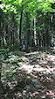
SaveJay is home to Jay Peak Resort a 4 season resort. The town is home to great mountain biking skiing and riding. Area offers single track, log road, and dirt road riding.
Activities Click to view
- Mountain Bike
72 trails
- E-Bike
2 trails
- Gravel Bike
0 trails
- Adaptive Bike
0 trails
- Winter Fat Bike
0 trails
- Hike
64 trails
- Trail Running
64 trails
- Downhill Ski
95 trails
- Backcountry Ski
1 trails
- Nordic Ski
23 trails
Region Details
- 1
- 14
- 17
- 27
- 10
- 1
Region Status
Open as of May 29, 2026Stats
- Avg Trail Rating
- Trails (view details)
- 163
- Trails Mountain Bike
- 72
- Trails E-Bike
- 2
- Trails Hike
- 64
- Trails Trail Running
- 64
- Trails Downhill Ski
- 95
- Trails Backcountry Ski
- 1
- Trails Nordic Ski
- 24
- Total Distance
- 82 miles
- Total Descent
- 41,363 ft
- Total Vertical
- 2,979 ft
- Highest Trailhead
- 3,839 ft
- Reports
- 259
- Photos
- 31
- Ridden Counter
- 48,823
Sub Regions
-
Base Camp
- 2
- 2
- 1
-
Jay Community Recreational Center
- 14
- 11
- 16
- 1
-
Jay Peak Resort
- 6
- 9
- 6
Popular Jay Mountain Biking Trails
• 100 ★ 5.0 • 2,812 ft • 159 ft • 137 •
New dual direction trail provides easy access from top of property to bottom. A great uphill to lap downhill flow trail!
• 95 ★ 0.0 • 788 ft • 0 ft • 122 •
Popular blue difficulty singletrack. This mountain bike primary trail can be used both directions and has a easy overall physical rating with a 0 ft green climb. On average it takes 1 minutes to complete this trail.
• 90 ★ 4.5 • 2,687 ft • 78 ft • 122 •
Popular blue difficulty singletrack. This mountain bike primary trail can be used both directions and has a easy overall physical rating with a 78 ft green climb. On average it takes 7 minutes to complete this trail.
• 100 ★ 3.9 • 2,215 ft • 0 ft • 121 •
Downhill directional flow trail- DOWNHILL TRAFFIC ONLY
• 80 ★ 5.0 • 1,440 ft • 18 ft • 111 •
Popular green difficulty doubletrack. This mountain bike primary trail and has a easy overall physical rating with a 18 ft green climb. On average it takes 2 minutes to complete this trail.
• 70 ★ 0.0 • 2,585 ft • 70 ft • 104 •
Popular blue difficulty singletrack. This mountain bike primary trail can be used both directions and has a easy overall physical rating with a 70 ft blue climb. On average it takes 8 minutes to complete this trail.
• 90 ★ 5.0 • 655 ft • 54 ft • 99 •
Popular blue difficulty singletrack. This mountain bike primary trail can be used both directions with a 54 ft black diamond climb. On average it takes 3 minutes to complete this trail.
Videos of Jay Mountain Bike
trail: Stoney Path
0:14 |
122 |
Jul 19, 2020

trail: Beaver Pond
3:47 |
39326 |
Jun 28, 2011

trail: Big Boss Man
2:12 |
616 |
Sep 3, 2020 , Jay
Recent Trail Reports
| status | trail | date | condition | info | user |
|---|---|---|---|---|---|
| Moss Gone Wild | Aug 31, 2025 @ 1:28pm Aug 31, 2025 | Ideal | waffle-nouche | ||
| Look Out Below | Aug 31, 2025 @ 1:28pm Aug 31, 2025 | Ideal | waffle-nouche | ||
| Big Rock | Aug 31, 2025 @ 1:28pm Aug 31, 2025 | Ideal | waffle-nouche | ||
| Minglewood | Aug 31, 2025 @ 1:28pm Aug 31, 2025 | Ideal | waffle-nouche | ||
| Stoney Path | Aug 31, 2025 @ 1:28pm Aug 31, 2025 | Ideal | waffle-nouche | ||
| Beaver Pond | Aug 31, 2025 @ 1:28pm Aug 31, 2025 | Ideal | waffle-nouche | ||
| Buck Run | Aug 31, 2025 @ 1:28pm Aug 31, 2025 | Ideal | waffle-nouche | ||
| Dan’s Dimension | Aug 31, 2025 @ 1:28pm Aug 31, 2025 | Ideal | waffle-nouche | ||
| Dan’s Dimension | Aug 31, 2025 @ 1:28pm Aug 31, 2025 | Ideal | waffle-nouche | ||
| Heaven's 11 | Aug 31, 2025 @ 1:28pm Aug 31, 2025 | Ideal | waffle-nouche |
Activity Feed
| username | action | type | title | date |
|---|---|---|---|---|
| ge64VekF | ridden | trail | activity #95983740 | May 31, 2026 @ 3:45pm May 31, 2026 |
| GrnmntVT422 | ridden | trail | activity #95796837 | May 29, 2026 @ 12:51pm May 29, 2026 |
| BigMtbBoi900 | wishlist | region | activity #94668645 | May 13, 2026 @ 9:04pm May 13, 2026 |
| markholloway | update | region | activity #87142835 | Jan 13, 2026 @ 12:57pm Jan 13, 2026 |
| markholloway | update | region | activity #87142817 | Jan 13, 2026 @ 12:57pm Jan 13, 2026 |
Recent Comments
| username | type | title | comment | date |
|---|---|---|---|---|
| trail | awesome trail, challenging yet intuitive.. did... | Aug 28, 2024 @ 2:24pm Aug 28, 2024 | ||
| trail | Very techy, fun climb. Gets the blood pumping! | Jul 7, 2024 @ 12:41pm Jul 7, 2024 | ||
| trail | The first half mile of the downhill definitely... | Jul 7, 2024 @ 12:34pm Jul 7, 2024 | ||
| trail | This trail no longer exists. Trail network is... | Jun 23, 2024 @ 2:52pm Jun 23, 2024 | ||
| trail | There actually is no longer a trail named this... | Jun 23, 2024 @ 2:51pm Jun 23, 2024 |
Local Badges
-

10 Green Trails20 awarded -

10 Blue Trails34 awarded -

Epic Ride Climb 2k66 awarded -

Climbing 10k Badge7 awarded -

Climbing 100k Badge0 awarded -

Epic Ride Descent 2k87 awarded
Bike & Skill Parks
| name | type | city | rating |
|---|---|---|---|
| Jay Peak Resort | bike park | Jay | |
| Pumptrack and Skills Park | skill park | Jay |
Local Trail Supporters
![]()
- The Jay Cloud Cylery
Activity Type Stats
| activitytype | trails | distance | descent | descent distance | total vertical | rating | global rank | state rank | photos | reports | routes | ridelogs |
|---|---|---|---|---|---|---|---|---|---|---|---|---|
| Mountain Bike | 72 | 27 miles | 4,144 ft | 12 miles | 1,535 ft | #3,085 | #1,065 | 29 | 181 | 1,713 | ||
| E-Bike | 2 | 1 mile | 312 ft | 4,285 ft | 312 ft | #8,049 | #2,449 | 136 | 20 | |||
| Hike | 64 | 52 miles | 10,344 ft | 25 miles | 2,979 ft | #4,034 | #1,426 | 181 | 424 | |||
| Trail Running | 64 | 52 miles | 10,344 ft | 25 miles | 2,979 ft | #3,685 | #1,100 | 181 | 28 | |||
| Downhill Ski | 95 | 30 miles | 31,020 ft | 29 miles | 1,969 ft | #50 | #21 | 1 | 78 | 5,307 | ||
| Backcountry Ski | 1 | 12 miles | 1,952 ft | 7 miles | 1,470 ft | #335 | #63 | 78 | 571 | |||
| Nordic Ski | 23 | 8 miles | 1,204 ft | 3 miles | 682 ft | #457 | #134 | 1 | 78 | 161 |
Frequently Asked Questions About Jay
▼
What are the best places to ride in Jay?
Jay has 3 areas to explore for mountain biking. The top rated areas are:
▼
What are the highest rated mountain biking trails in Jay?
The highest rated mountain biking trails in Jay are:
- Upper Pass (4.3/5)
- Cloud Drop (4.3/5)
- Alchemist (4.3/5)
- Minglewood (4.1/5)
- Heaven's 11 (4.1/5)
▼
What is the best time of the year to ride in Jay?
Based on ride log data, the most popular months to ride in Jay are:
- July (41 activities)
- August (25 activities)
- June (21 activities)
▼
Where can I park to ride in Jay?
Activities
Trails
- By Beans13
 GTMBC & contributors
 - Admins: GTMBC
- #5410 - 8,780 views
- jay activity log | embed map of Jay mountain bike trails | jay mountain biking points of interest polygons
Downloading of trail gps tracks in kml & gpx formats is enabled for Jay.
You must login to download files.