close
-
Layers w
- Weather Layers
- Pro
- Pro
- Pro
- Pro
- Pro
- Pro
- More Layers
- Pro
- Pro
- Pro
- Pro
-
Upgrade to

3D
Trail Conditions
- Unknown
- Snow Groomed
- Snow Packed
- Snow Covered
- Snow Cover Partial
- Freeze/thaw Cycle
- Icy
- Prevalent Mud
- Wet
- Variable
- Ideal
- Dry
- Very Dry
Trail Flow (Ridden Direction)
Trailforks scans users ridelogs to determine the most popular direction each trail is ridden. A good flowing trail network will have most trails flowing in a single direction according to their intension.
The colour categories are based on what percentage of riders are riding a trail in its intended direction.
The colour categories are based on what percentage of riders are riding a trail in its intended direction.
- > 96%
- > 90%
- > 80%
- > 70%
- > 50%
- < 50%
- bi-directional trail
- no data
Trail Last Ridden
Trailforks scans ridelogs to determine the last time a trail was ridden.
- < 2 days
- < 1 week
- < 2 weeks
- < 1 month
- < 6 months
- > 6 months
Trail Ridden Direction
The intended direction a trail should be ridden.
- Downhill Only
- Downhill Primary
- Both Directions
- Uphill Primary
- Uphill Only
- One Direction
Contribute Details
Colors indicate trail is missing specified detail.
- Description
- Photos
- Description & Photos
- Videos
Trail Popularity ?
Trailforks scans ridelogs to determine which trails are ridden the most in the last 9 months.
Trails are compared with nearby trails in the same city region with a possible 25 colour shades.
Think of this as a heatmap, more rides = more kinetic energy = warmer colors.
- most popular
- popular
- less popular
- not popular
ATV/ORV/OHV Filter
Max Vehicle Width
inches
US Cell Coverage
Legend

Radar Time
Activity Recordings
Trailforks uses anonymized public activity data.
?
Activity Recordings
Trailforks uses anonymized public activity data.
?
Personal Heatmap
▶
Activity Types
all
/
none
▶
Options
2
Date range
month
–
Winter Trails
Warning
A routing network for winter maps does not exist. Selecting trails using the winter trails layer has been disabled.
Missing Trails
Most Popular
Least Popular
Trails are colored based on popularity. The more popular a trail is, the more red. Less popular trails trend towards green.
Jump Magnitude Heatmap
Heatmap of where riders jump on trails. Zoom in to see individual jumps, click circles to view jump details.
BC Backroad Status
![map legend]()
Service Road Atlas is a free to use, community-driven service for viewing and creating reports on the numerous back-country service roads around B.C. and Alberta.

Slope Aspect
Direction the slope faces
Trails Deemphasized
Trails are shown in grey.
Only show trails with no bike usage.
Suggested Layers
Based on selected activity type
Save the current map location and zoom level as your default home location whenever this page is loaded.
Save
No description for Pendleton has been added yet!
Login or register to submit one.
Activities Click to view
- Mountain Bike
19 trails
- E-Bike
16 trails
- Gravel Bike
0 trails
- Adaptive Bike
0 trails
- Hike
23 trails
- Trail Running
23 trails
Region Details
- 1
- 4
- 7
- 2
- 1
Region Status
Open as of May 23, 2026Stats
- Avg Trail Rating
- Trails (view details)
- 15
- Trails Mountain Bike
- 23
- Trails E-Bike
- 16
- Trails Hike
- 23
- Trails Trail Running
- 23
- Total Distance
- 23 miles
- Total Descent
- 2,891 ft
- Total Vertical
- 471 ft
- Highest Trailhead
- 1,517 ft
- Reports
- 252
- Photos
- 113
- Ridden Counter
- 1,354
Sub Regions
-
Pendleton Adventure Trails Recreational Area
- 3
- 7
- 2
- 1
Popular Pendleton Mountain Biking Trails
• 85 ★ 3.0 • 1 mile • 100 ft • 145 •
This trail is accessed through the west gate entrance of the parking lot. The trail heads west along the highway for roughly 3/4 of a mile and then will circle back on varied terrain and turns back east toward the parking lot. There is...
• 90 ★ 4.0 • 3,540 ft • 0 ft • 136 •
This trail begins by going through the west gate and turning left. You will stay left and drop off the small wooden plank drop to start. The trail continues down the ridge through a series of big berms and over a couple jumps. You can...
• 65 ★ 3.0 • 2 miles • 244 ft • 88 •
This trail begins at the main trail crossing/intersection at the bottom of the hill and provides a path to get back to the top. Start heading northwest up the drainage and then work your way back and forth zigzagging your way uphill...
• 35 ★ 4.4 • 2,028 ft • 6 ft • 79 •
Downhill jump line with sweeping berms, gaps and tables. The jumps range from 10 to 25 feet. There are 2 trail crossing gaps at the end of the line, and there are a lot of critters digging holes in berms and landings so look before you...
• 50 ★ 3.5 • 4,767 ft • 60 ft • 79 •
begins off James' trail on the top trail system and ends at the bottom intersection, where all trails come together at the base of the trail network. is a fun trail that cuts back and forth over a few fun terrain obstacles at the top....
• 65 ★ 4.3 • 3,310 ft • 0 ft • 79 •
To start this trail head up the Ricky/ uphill trail. Once you reach the top, you are greeted with a few fast switchbacks, rolling drop over a rock ledge, and then into 2 larger mounts that can be jumped as big as you can go. Roll them...
Pendleton Mountain Bike Routes
5K Route Featured
★ 5.0 • 3 miles • 273 ft • 3 • Loop •
This is a common route for running or walking a 5K. (3.1 Miles) Start out on Jame's then take Turn off...
Rewind / Ricky Bobby Route Featured
3 miles • 344 ft • 4 • Loop •
This route is what the intention of how these two trails were designed to be ridden. Ride up to the top....
Uphill Route (back to parking lot) Featured
1 mile • 320 ft • 0 • Point to Point •
This is the easy way to get back to the parking lot. Taking up to Shortcut Then shortcut to Then to Then...
★ 5.0 • 10 miles • 1,271 ft • 6 • Loop •
James loop to Qit Qit, circle up to back to James loop, turn right at James loop finish down (jumps ahead,...
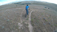
Photos of Pendleton Mountain Bike
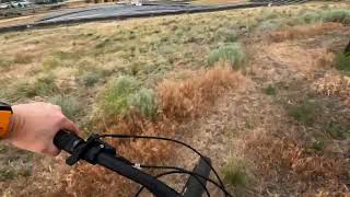
Videos of Pendleton Mountain Bike
trail: LET'ER SEND
0:28 |
348 |
Jan 8, 2021

trail: Toll Bridge
2:46 |
89 |
Sep 23, 2025 , Pendleton
trail: Evan's Trail
2:39 |
173 |
Mar 26, 2024 , Pendleton

trail: Tower Trail
0:57 |
449 |
Mar 24, 2022 , Pendleton

trail: LET'ER SEND
0:57 |
522 |
Mar 24, 2022 , Pendleton

trail: Graveyard
2:59 |
400 |
Feb 20, 2022 , Pendleton

trail: Tower Trail
0:35 |
966 |
Dec 17, 2018 , Pendleton
Recent Trail Reports
| status | trail | date | condition | info | user |
|---|---|---|---|---|---|
| Jump line | May 23, 2026 @ 7:37am (America/Boise) May 23, 2026 | Variable | cbritsch | ||
| Toll Bridge | Sep 22, 2025 @ 5:03pm (America/Boise) Sep 22, 2025 | Ideal | zackrock | ||
| LET'ER SEND | Jul 15, 2025 @ 2:21pm Jul 15, 2025 | Unknown | ggaghdsh | ||
| Parking Access Road | Jun 10, 2025 @ 6:49am Jun 10, 2025 | Dry | fly-navy | ||
| Tim's Shortcut | Jun 10, 2025 @ 6:49am Jun 10, 2025 | Dry | fly-navy | ||
| Zig Zag | Jun 10, 2025 @ 6:49am Jun 10, 2025 | Dry | fly-navy | ||
| Ricky Bobby | Jun 10, 2025 @ 6:49am Jun 10, 2025 | Dry | fly-navy | ||
| Rewind | Jun 10, 2025 @ 6:49am Jun 10, 2025 | Dry | fly-navy | ||
| Rewind / Ricky Bobby Uphill | Jun 10, 2025 @ 6:49am Jun 10, 2025 | Dry | fly-navy | ||
| Stem cell jump runout | Jun 10, 2025 @ 6:49am Jun 10, 2025 | Dry | fly-navy |
Activity Feed
| username | action | type | title | date |
|---|---|---|---|---|
| Brianq4bnoU | ridden | trail | activity #96519975 | Jun 7, 2026 @ 9:28pm 1 day |
| cbritsch | add | report | activity #95341750 | May 23, 2026 @ 11:56am May 23, 2026 |
| kelli99 | ridden | trail | activity #95106568 | May 20, 2026 @ 7:28am May 20, 2026 |
| cbritsch | wishlist | trail | activity #94600292 and 2 more | May 12, 2026 @ 6:23pm May 12, 2026 |
| reidkerr | ridden | trail | activity #94273159 | May 8, 2026 @ 12:57pm May 8, 2026 |
Recent Comments
| username | type | title | comment | date |
|---|---|---|---|---|
| trail | Cool trail, very flowy easy in both... | Feb 28, 2026 @ 7:06pm Feb 28, 2026 | ||
| trail | Trail washout has been temporarily repaired.... | Jan 13, 2025 @ 6:07pm Jan 13, 2025 | ||
| trail | Water has washed out a section of trail... | Jan 9, 2025 @ 7:03am Jan 9, 2025 | ||
| trail | Replaced one of the bridges today To make... | Oct 26, 2024 @ 4:52pm Oct 26, 2024 | ||
| trail | Trail is good shape this is a fun ride there... | Oct 23, 2024 @ 5:54pm Oct 23, 2024 |
Local Badges
-

Epic Ride Climb 2k3 awarded -

Climbing 10k Badge8 awarded -

Climbing 100k Badge0 awarded -

Epic Ride Descent 2k3 awarded -

Descent 10k Badge8 awarded -

Descent 100k Badge0 awarded
Activity Type Stats
| activitytype | trails | distance | descent | descent distance | total vertical | rating | global rank | state rank | photos | reports | routes | ridelogs |
|---|---|---|---|---|---|---|---|---|---|---|---|---|
| Mountain Bike | 19 | 23 miles | 2,890 ft | 8 miles | 472 ft | #6,096 | #2,062 | 113 | 266 | 4 | 1,687 | |
| E-Bike | 16 | 2 miles | 46 ft | 2,264 ft | 272 ft | #8,578 | #2,625 | 203 | 4 | 25 | ||
| Hike | 23 | 23 miles | 2,740 ft | 8 miles | 472 ft | #1,631 | #726 | 5 | 261 | 2 | 160 | |
| Trail Running | 23 | 23 miles | 2,740 ft | 8 miles | 472 ft | #7,343 | #2,429 | 261 | 3 | 117 |
Frequently Asked Questions About Pendleton
▼
What are the best places to ride in Pendleton?
Pendleton has 1 areas to explore for mountain biking. The top rated areas are:
▼
What are the highest rated mountain biking trails in Pendleton?
The highest rated mountain biking trails in Pendleton are:
- LET'ER SEND (4.1/5)
- Ricky Bobby (4.1/5)
- Graveyard (4.1/5)
- Tower Trail (4/5)
- Stem Cell (3.9/5)
▼
What is the best time of the year to ride in Pendleton?
Based on ride log data, the most popular months to ride in Pendleton are:
- April (22 activities)
- June (21 activities)
- March (21 activities)
▼
Where can I park to ride in Pendleton?
There are 1 parking locations listed in Pendleton. The most popular parking spots are:
Activities
Trails
- By level4designs & contributors
- Admins: POW
- #20695 - 6,777 views
- pendleton activity log | embed map of Pendleton mountain bike trails | pendleton mountain biking points of interest
Downloading of trail gps tracks in kml & gpx formats is enabled for Pendleton.
You must login to download files.