close
-
Layers w
- Weather Layers
- Pro
- Pro
- Pro
- Pro
- Pro
- Pro
- More Layers
- Pro
- Pro
- Pro
- Pro
-
Upgrade to

3D
Trail Conditions
- Unknown
- Snow Groomed
- Snow Packed
- Snow Covered
- Snow Cover Partial
- Freeze/thaw Cycle
- Icy
- Prevalent Mud
- Wet
- Variable
- Ideal
- Dry
- Very Dry
Trail Flow (Ridden Direction)
Trailforks scans users ridelogs to determine the most popular direction each trail is ridden. A good flowing trail network will have most trails flowing in a single direction according to their intension.
The colour categories are based on what percentage of riders are riding a trail in its intended direction.
The colour categories are based on what percentage of riders are riding a trail in its intended direction.
- > 96%
- > 90%
- > 80%
- > 70%
- > 50%
- < 50%
- bi-directional trail
- no data
Trail Last Ridden
Trailforks scans ridelogs to determine the last time a trail was ridden.
- < 2 days
- < 1 week
- < 2 weeks
- < 1 month
- < 6 months
- > 6 months
Trail Ridden Direction
The intended direction a trail should be ridden.
- Downhill Only
- Downhill Primary
- Both Directions
- Uphill Primary
- Uphill Only
- One Direction
Contribute Details
Colors indicate trail is missing specified detail.
- Description
- Photos
- Description & Photos
- Videos
Trail Popularity ?
Trailforks scans ridelogs to determine which trails are ridden the most in the last 9 months.
Trails are compared with nearby trails in the same city region with a possible 25 colour shades.
Think of this as a heatmap, more rides = more kinetic energy = warmer colors.
- most popular
- popular
- less popular
- not popular
ATV/ORV/OHV Filter
Max Vehicle Width
inches
US Cell Coverage
Legend

Radar Time
Activity Recordings
Trailforks uses anonymized public activity data.
?
Activity Recordings
Trailforks uses anonymized public activity data.
?
Personal Heatmap
▶
Activity Types
all
/
none
▶
Options
2
Date range
month
–
Winter Trails
Warning
A routing network for winter maps does not exist. Selecting trails using the winter trails layer has been disabled.
Missing Trails
Most Popular
Least Popular
Trails are colored based on popularity. The more popular a trail is, the more red. Less popular trails trend towards green.
Jump Magnitude Heatmap
Heatmap of where riders jump on trails. Zoom in to see individual jumps, click circles to view jump details.
BC Backroad Status
![map legend]()
Service Road Atlas is a free to use, community-driven service for viewing and creating reports on the numerous back-country service roads around B.C. and Alberta.

Slope Aspect
Direction the slope faces
Trails Deemphasized
Trails are shown in grey.
Only show trails with no bike usage.
Suggested Layers
Based on selected activity type
Save the current map location and zoom level as your default home location whenever this page is loaded.
Save
No description for Rytro has been added yet!
Login or register to submit one.
This region uses the Uk/Euro style trail grading system.
Activities Click to view
- Mountain Bike
39 trails
- E-Bike
21 trails
- Gravel Bike
0 trails
- Adaptive Bike
0 trails
- Hike
35 trails
- Trail Running
26 trails
Region Details
- 11
- 4
- 4
- 2
- 1
Region Status
Open as of May 6, 2026Stats
- Avg Trail Rating
- Trails (view details)
- 22
- Trails Mountain Bike
- 39
- Trails E-Bike
- 21
- Trails Hike
- 35
- Trails Trail Running
- 26
- Total Distance
- 28 miles
- Total Descent
- 10,848 ft
- Total Vertical
- 2,951 ft
- Highest Trailhead
- 4,117 ft
- Reports
- 126
- Photos
- 173
- Ridden Counter
- 1,221
Popular Rytro Mountain Biking Trails
• 100 ★ 3.4 • 2 miles • 727 ft • 174 • • hike
Popular blue difficulty mixed. This hike primary trail can be used downhill primary and has a moderate overall physical rating with a 727 ft blue climb. On average it takes 29 minutes to complete this trail.
• 65 ★ 2.8 • 2,493 ft • 0 ft • 133 • • hike
Moderately popular red difficulty singletrack. This hike primary trail can be used downhill primary. It features rock garden. On average it takes 7 minutes to complete this trail.
• 30 ★ 4.2 • 3 miles • 51 ft • 88 • • hike
Less popular blue difficulty singletrack. This hike primary trail can be used downhill primary. It features rock garden. On average it takes 28 minutes to complete this trail.
• 95 ★ 5.0 • 2 miles • 40 ft • 82 •
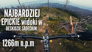
Idealny singiel, który jest świetną alternatywą dla żółtego szlaku z Przełęczy Żłobki do Rytra. Rozpoczyna się zaraz pod szczytem Radziejowej i biegnie przy samej granicy z Rezerwatem Baniska. Od lipca wysokie trawy...
• 85 ★ 5.0 • 1 mile • 0 ft • 48 •
to ścieżka, która odebrała Perci Sosnowskiego miano najtrudniejszego singla w Beskidzie Sądeckim. Jest stromo, jest ekspozycja, są duże i długie rockgardeny. W wielu miejscach trzeba uważać żeby nie spaść w dół po bardzo...
• 75 ★ 5.0 • 1 mile • 16 ft • 46 •
Highly rated popular black difficulty wilderness trail. This mountain bike primary trail can be used downhill only and has a hard overall physical rating. It features drop and rock garden. Trail visibility is sometimes hard to follow. On average it takes 16 minutes to complete this trail.
• 10 ★ 3.0 • 1 mile • 27 ft • 18 • • hike
Less popular blue difficulty mixed. This hike primary trail can be used downhill primary. Trail visibility is sometimes hard to follow. On average it takes 6 minutes to complete this trail.
• 20 ★ 2.5 • 2,081 ft • 0 ft • 13 •
Less popular red difficulty singletrack. This mountain bike primary trail can be used downhill primary and has a easy overall physical rating with a 0 ft black diamond climb. On average it takes 6 minutes to complete this trail.
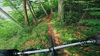
Photos of Rytro Mountain Bike
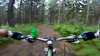
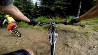
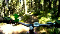
Videos of Rytro Mountain Bike
trail: Perć Sosnowskiego
0:00 |
10 |
Aug 5, 2025
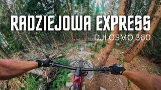
trail: Radziejowa
10:37 |
142 |
Jul 21, 2014
trail: Radziejowa
10:19 |
271 |
Jul 15, 2014
trail: Radziejowa
15:06 |
112 |
Aug 23, 2013
trail: Radziejowa
20:36 |
483 |
Jun 23, 2012
trail: Perć Sosnowskiego
17:11 |
91 |
Jun 16, 2024 , Rytro

trail: Rogasiowy
17:11 |
74 |
Jun 16, 2024 , Rytro
Recent Trail Reports
| status | trail | date | condition | info | user |
|---|---|---|---|---|---|
| Rogasiowy | May 7, 2026 @ 8:43am (Europe/Budapest) May 6, 2026 | Unknown | faryna-n | ||
| Magorzyca | May 7, 2026 @ 8:43am (Europe/Budapest) May 6, 2026 | Dry | faryna-n | ||
| Perć Sosnowskiego | May 7, 2026 @ 8:43am (Europe/Budapest) May 6, 2026 | Dry | faryna-n | ||
| Trawers Radziejowej | May 7, 2026 @ 8:43am (Europe/Budapest) May 6, 2026 | Dry | faryna-n | ||
| Kamyrdolek | Mar 15, 2026 @ 10:03pm (Europe/Warsaw) Mar 15, 2026 | Dry | yavaho | ||
| Dojazdówka do Rogasiowego | Aug 2, 2025 @ 6:17pm Aug 2, 2025 | Variable | Panek | ||
| Roztoczka | Aug 2, 2025 @ 6:17pm Aug 2, 2025 | Variable | Panek | ||
| Niebieski Rytro | Jul 13, 2025 @ 10:07am Jul 13, 2025 | Ideal | KubamgQXl | ||
| Piorun | Jun 14, 2025 @ 3:50pm Jun 14, 2025 | Unknown | xav79 | ||
| Konieczna | Mar 9, 2025 @ 11:54am Mar 9, 2025 | Dry | laughing0amigo |
Activity Feed
| username | action | type | title | date |
|---|---|---|---|---|
| Mathew87 | wishlist | trail | activity #96214773 | Jun 4, 2026 @ 3:42am Jun 4, 2026 |
| jb_tf_spain | wishlist | region | activity #95917072 | May 31, 2026 @ 2:09am May 31, 2026 |
| MarcinQbCznM | comment | trail | activity #95830476 | May 30, 2026 @ 1:59am May 30, 2026 |
| czarolc | wishlist | trail | activity #95559798 | May 26, 2026 @ 6:16am May 26, 2026 |
| szymity | ridden | trail | activity #95545386 | May 25, 2026 @ 11:16pm May 25, 2026 |
Recent Comments
| username | type | title | comment | date |
|---|---|---|---|---|
| trail | Jako całość trasa trudno przejezdna,... | May 30, 2026 @ 1:59am May 30, 2026 | ||
| trail | Absolutny sztos | Mar 23, 2026 @ 12:21am Mar 23, 2026 | ||
| trail | Trasa uprzątnięta i przejezdna w całości :) | Aug 5, 2025 @ 8:58am Aug 5, 2025 | ||
| trail | Trase polecam na końcu z trasa Kamerdolek | Mar 5, 2025 @ 3:03am Mar 5, 2025 | ||
| trail | Świetna alternatywa dla zjazdu z końca Perci... | Mar 3, 2025 @ 2:26am Mar 3, 2025 |
Local Badges
-

Epic Mountain Bike Climb 2k4 awarded -

Climbing 10k Badge0 awarded -

Mountain Biking 100k Badge0 awarded -

Epic Ride Descent 2k4 awarded -

Descent 10k Badge0 awarded -

Descent 100k Badge0 awarded
Activity Type Stats
| activitytype | trails | distance | descent | descent distance | total vertical | rating | global rank | state rank | photos | reports | routes | ridelogs |
|---|---|---|---|---|---|---|---|---|---|---|---|---|
| Mountain Bike | 39 | 28 miles | 10,850 ft | 14 miles | 2,953 ft | #3,971 | #87 | 173 | 126 | 619 | ||
| E-Bike | 21 | 9 miles | 6,791 ft | 8 miles | 2,822 ft | #728 | #267 | 120 | 232 | |||
| Hike | 35 | 27 miles | 10,020 ft | 13 miles | 2,953 ft | #5,300 | #98 | 117 | 154 | |||
| Trail Running | 26 | 26 miles | 8,750 ft | 12 miles | 2,953 ft | #5,323 | #103 | 105 | 11 |
Frequently Asked Questions About Rytro
▼
What are the highest rated mountain biking trails in Rytro?
The highest rated mountain biking trails in Rytro are:
- Perć Sosnowskiego (4.6/5)
- Rogasiowy (4.4/5)
- Raciczka (4.3/5)
- Piorun (4.1/5)
- Kamyrdolek (4.1/5)
▼
What is the best time of the year to ride in Rytro?
Based on ride log data, the most popular months to ride in Rytro are:
- November (4 activities)
- December (4 activities)
- August (3 activities)
▼
Where can I park to ride in Rytro?
Check the Rytro trail map for trailhead and parking information. Community members regularly update access and parking details for trails in the area.
▼
What is the longest trail in Rytro?
The longest trail in Rytro is Niebieski Rytro at 3.3 miles. View all trails sorted by distance.
Activities
Trails
Points of Interest
- By piotrrider
 & contributors
 - Admins: apply
- #24587 - 1,987 views
- rytro activity log | embed map of Rytro mountain bike trails |
Downloading of trail gps tracks in kml & gpx formats is enabled for Rytro.
You must login to download files.