close
-
Layers w
- Weather Layers
- Pro
- Pro
- Pro
- Pro
- Pro
- Pro
- More Layers
- Pro
- Pro
- Pro
- Pro
-
Upgrade to

3D
Trail Conditions
- Unknown
- Snow Groomed
- Snow Packed
- Snow Covered
- Snow Cover Partial
- Freeze/thaw Cycle
- Icy
- Prevalent Mud
- Wet
- Variable
- Ideal
- Dry
- Very Dry
Trail Flow (Ridden Direction)
Trailforks scans users ridelogs to determine the most popular direction each trail is ridden. A good flowing trail network will have most trails flowing in a single direction according to their intension.
The colour categories are based on what percentage of riders are riding a trail in its intended direction.
The colour categories are based on what percentage of riders are riding a trail in its intended direction.
- > 96%
- > 90%
- > 80%
- > 70%
- > 50%
- < 50%
- bi-directional trail
- no data
Trail Last Ridden
Trailforks scans ridelogs to determine the last time a trail was ridden.
- < 2 days
- < 1 week
- < 2 weeks
- < 1 month
- < 6 months
- > 6 months
Trail Ridden Direction
The intended direction a trail should be ridden.
- Downhill Only
- Downhill Primary
- Both Directions
- Uphill Primary
- Uphill Only
- One Direction
Contribute Details
Colors indicate trail is missing specified detail.
- Description
- Photos
- Description & Photos
- Videos
Trail Popularity ?
Trailforks scans ridelogs to determine which trails are ridden the most in the last 9 months.
Trails are compared with nearby trails in the same city region with a possible 25 colour shades.
Think of this as a heatmap, more rides = more kinetic energy = warmer colors.
- most popular
- popular
- less popular
- not popular
ATV/ORV/OHV Filter
Max Vehicle Width
inches
US Cell Coverage
Legend

Radar Time
Activity Recordings
Trailforks uses anonymized public activity data.
?
Activity Recordings
Trailforks uses anonymized public activity data.
?
Personal Heatmap
▶
Activity Types
all
/
none
▶
Options
2
Date range
month
–
Winter Trails
Warning
A routing network for winter maps does not exist. Selecting trails using the winter trails layer has been disabled.
Missing Trails
Most Popular
Least Popular
Trails are colored based on popularity. The more popular a trail is, the more red. Less popular trails trend towards green.
Jump Magnitude Heatmap
Heatmap of where riders jump on trails. Zoom in to see individual jumps, click circles to view jump details.
BC Backroad Status
![map legend]()
Service Road Atlas is a free to use, community-driven service for viewing and creating reports on the numerous back-country service roads around B.C. and Alberta.

Slope Aspect
Direction the slope faces
Trails Deemphasized
Trails are shown in grey.
Only show trails with no bike usage.
Suggested Layers
Based on selected activity type
Save the current map location and zoom level as your default home location whenever this page is loaded.
Save
No description for Surses has been added yet!
Login or register to submit one.
This region uses the Uk/Euro style trail grading system.
Activities Click to view
- Mountain Bike
158 trails
- E-Bike
155 trails
- Adaptive Bike
0 trails
- Hike
151 trails
- Trail Running
151 trails
- Backcountry Ski
4 trails
Region Details
- 21
- 33
- 57
- 32
- 11
Region Status
Open as of May 24, 2026Local Trail Association
Stats
- Avg Trail Rating
- Trails (view details)
- 158
- Trails Mountain Bike
- 158
- Trails E-Bike
- 155
- Trails Hike
- 151
- Trails Trail Running
- 151
- Trails Backcountry Ski
- 4
- Total Distance
- 101 miles
- Total Descent Distance
- 62 miles
- Total Descent
- 50,002 ft
- Total Vertical
- 6,683 ft
- Highest Trailhead
- 10,388 ft
- Reports
- 468
- Photos
- 108
- Ridden Counter
- 3,205
Sub Regions
-
Val Surses
- 1
- 45
- 53
- 36
Popular Surses Mountain Biking Trails
• 100 ★ 4.9 • 1 mile • 60 ft • 47 •
Highly rated popular black difficulty singletrack. This multi-use trail can be used downhill primary and has a moderate overall physical rating. Exposure: Life Threatening Consequences. Trail visibility is always easy to follow. On average it takes 17 minutes to complete this trail.
• 95 ★ 4.7 • 1,070 ft • 0 ft • 44 •
Highly rated popular black difficulty alpine singletrack. This multi-use trail can be used downhill primary. Exposure: High Risk of Serious Injury. Trail visibility is sometimes hard to follow. On average it takes 1 minutes to complete this trail.
• 75 ★ 4.0 • 1 mile • 0 ft • 40 •
Popular red difficulty alpine singletrack. This multi-use trail can be used downhill primary and has a moderate overall physical rating. Exposure: High Risk of Serious Injury. Trail visibility is always easy to follow. On average it takes 29 minutes to complete this trail.
• 100 ★ 2.5 • 535 ft • 0 ft • 39 •
Popular blue difficulty singletrack. This multi-use trail can be used downhill primary and has a easy overall physical rating with a 0 ft green climb. Exposure: Normal Injury Risk. Trail visibility is always easy to follow. On average it takes minutes to complete this trail.
• 80 ★ 4.0 • 2,953 ft • 99 ft • 38 •
Popular blue difficulty singletrack. This multi-use trail can be used both directions. Exposure: High Risk of Serious Injury. Trail visibility is always easy to follow. On average it takes 10 minutes to complete this trail.
• 95 ★ 4.7 • 2,963 ft • 0 ft • 38 •
Highly rated popular black difficulty alpine singletrack. This multi-use trail can be used downhill primary. Exposure: High Risk of Serious Injury. Trail visibility is sometimes hard to follow. On average it takes 1 minutes to complete this trail.
• 80 ★ 4.0 • 2,201 ft • 46 ft • 36 •
Popular red difficulty singletrack. This multi-use trail can be used both directions with a 46 ft black diamond climb. Exposure: Normal Injury Risk. Trail visibility is always easy to follow. On average it takes 2 minutes to complete this trail.
• 95 ★ 4.7 • 4,259 ft • 10 ft • 36 •
Highly rated popular black difficulty alpine singletrack. This multi-use trail can be used downhill primary and has a moderate overall physical rating. Exposure: Life Threatening Consequences. Trail visibility is sometimes hard to follow. On average it takes 10 minutes to complete this trail.
Surses Mountain Bike Routes
4 miles • 136 ft • 4 •
Lift-accessed mountain bike route for beginners, families and advanced riders with a flow trail character.
2 miles • 4 ft • 5 • Point to Point •
Enjoy the winter slopes in summer - lift accessed warm-up trail.
9 miles • 2,769 ft • 7 • Loop •
: a magnificent view across Savognin and of the peaks far into the Surses valley, followed by a great...
7 miles • 222 ft • 13 • Point to Point •
The Family Bike route is available in a difficult and easy version and is therefore ideal for families who...
9 miles • 1,118 ft • 6 • Point to Point •
Wohl die besten Trailabfahrt in der Ferienregion Savognin Bivio Albula
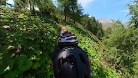
Photos of Surses Mountain Bike
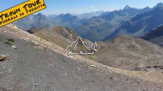
Videos of Surses Mountain Bike
trail: Mot La Ridge
0:53 |
62 |
Aug 26, 2021

trail: Mot La Ridge
0:22 |
58 |
Aug 26, 2021

trail: Tutanchamun
9:58 |
27 |
Mar 24, 2026 , Surses
trail: Laiets
9:58 |
60 |
Mar 24, 2026 , Surses
Recent Trail Reports
| status | trail | date | condition | info | user |
|---|---|---|---|---|---|
| Davains Tetg | May 24, 2026 @ 10:34am (Europe/Vaduz) May 24, 2026 | Ideal | tschiffasiemis Surses | ||
| Senda Stgirat Upper | May 24, 2026 @ 10:34am (Europe/Vaduz) May 24, 2026 | Ideal | tschiffasiemis Surses | ||
| Arsas | May 24, 2026 @ 10:34am (Europe/Vaduz) May 24, 2026 | Ideal | tschiffasiemis Surses | ||
| No Drain No Pain Upper | May 24, 2026 @ 10:34am (Europe/Vaduz) May 24, 2026 | Ideal | tschiffasiemis Surses | ||
| Fine Stone Pine | May 24, 2026 @ 10:34am (Europe/Vaduz) May 24, 2026 | Ideal | tschiffasiemis Surses | ||
| Surmirana Sunday Walk | May 22, 2026 @ 7:28pm (Europe/Zurich) May 22, 2026 | Ideal | tschiffasiemis Surses | ||
| Road To Rome | May 22, 2026 @ 7:28pm (Europe/Zurich) May 22, 2026 | Ideal | tschiffasiemis Surses | ||
| Märliloop | May 22, 2026 @ 7:28pm (Europe/Zurich) May 22, 2026 | Unknown | tschiffasiemis Surses | ||
| Saw To Jaw | May 22, 2026 @ 7:25pm (Europe/Zurich) May 22, 2026 | Unknown | tschiffasiemis Surses | ||
| Goats Tail | May 22, 2026 @ 7:23pm (Europe/Zurich) May 22, 2026 | Variable | tschiffasiemis Surses |
Activity Feed
| username | action | type | title | date |
|---|---|---|---|---|
| delmonhii | like | directory | activity #96629662 | Jun 9, 2026 @ 2:27pm 30 mins |
| trailpapst | difficultyvote | trail | activity #96006649 and 4 more | Jun 1, 2026 @ 3:29am Jun 1, 2026 |
| trailpapst | add | trail | activity #96006138 and 2 more | Jun 1, 2026 @ 3:12am Jun 1, 2026 |
| tschiffasiemis | add | photo | activity #95439348 | May 24, 2026 @ 1:06pm May 24, 2026 |
| tschiffasiemis | add | report | activity #95439250 and 4 more | May 24, 2026 @ 1:04pm May 24, 2026 |
Recent Comments
| username | type | title | comment | date |
|---|---|---|---|---|
| trail | cooler einfacher Trail mit gutem Flow | Oct 13, 2025 @ 5:36am Oct 13, 2025 | ||
| trail | Easy road with a lot of traffic around the lake. | Jul 18, 2025 @ 11:51am Jul 18, 2025 | ||
| trail | Occasionally steep gravel road. | Jul 18, 2025 @ 11:48am Jul 18, 2025 | ||
| trail | Mellow gravel road. | Jul 18, 2025 @ 11:47am Jul 18, 2025 | ||
| trail | Faint grass line in a field. | Jul 18, 2025 @ 11:45am Jul 18, 2025 |
Local Badges
-

10 Blue Trails5 awarded -

Epic Mountain Bike Climb 2k21 awarded -

Climbing 10k Badge3 awarded -

Mountain Biking 100k Badge0 awarded -

Epic Ride Descent 2k21 awarded -

Descent 10k Badge3 awarded
Bike & Skill Parks
| name | type | city | rating |
|---|---|---|---|
| Pumptrack Lai Barnagn | skill park | Surses | |
| Bike Skills Park | skill park | Surses |
Activity Type Stats
| activitytype | trails | distance | descent | descent distance | total vertical | rating | global rank | state rank | photos | reports | routes | ridelogs |
|---|---|---|---|---|---|---|---|---|---|---|---|---|
| Mountain Bike | 158 | 90 miles | 44,019 ft | 57 miles | 6,066 ft | #1,721 | #21 | 108 | 468 | 12 | 637 | |
| E-Bike | 155 | 89 miles | 43,314 ft | 56 miles | 6,066 ft | #366 | #42 | 470 | 15 | 103 | ||
| Hike | 151 | 86 miles | 41,355 ft | 53 miles | 6,066 ft | #1,569 | #32 | 460 | 4 | 191 | ||
| Trail Running | 151 | 86 miles | 41,355 ft | 53 miles | 6,066 ft | #1,286 | #29 | 460 | 3 | 69 | ||
| Backcountry Ski | 4 | 11 miles | 5,984 ft | 5 miles | 4,531 ft | #228 | #16 | 179 |
Frequently Asked Questions About Surses
▼
What are the best places to ride in Surses?
Surses has 1 areas to explore for mountain biking. The top rated areas are:
▼
What are the highest rated mountain biking trails in Surses?
The highest rated mountain biking trails in Surses are:
- Rootsgarden (4.3/5)
- Mot La Ridge (4.3/5)
- The Cave (4.2/5)
- Iras Trail (4.2/5)
- Schitgas (4.2/5)
▼
What is the best time of the year to ride in Surses?
Based on ride log data, the most popular months to ride in Surses are:
- July (5 activities)
- August (4 activities)
- June (4 activities)
▼
Where can I park to ride in Surses?
There are 2 parking locations listed in Surses. The most popular parking spots are:
Activities
Trails
- By steinbockrider
 & contributors
 - Admins: Surses
- #32042 - 2,041 views
- surses activity log | embed map of Surses mountain bike trails | surses mountain biking points of interest polygons
Downloading of trail gps tracks in kml & gpx formats is enabled for Surses.
You must login to download files.