close
-
Layers w
- Weather Layers
- Pro
- Pro
- Pro
- Pro
- Pro
- Pro
- More Layers
- Pro
- Pro
- Pro
- Pro
-
Upgrade to

3D
Trail Conditions
- Unknown
- Snow Groomed
- Snow Packed
- Snow Covered
- Snow Cover Partial
- Freeze/thaw Cycle
- Icy
- Prevalent Mud
- Wet
- Variable
- Ideal
- Dry
- Very Dry
Trail Flow (Ridden Direction)
Trailforks scans users ridelogs to determine the most popular direction each trail is ridden. A good flowing trail network will have most trails flowing in a single direction according to their intension.
The colour categories are based on what percentage of riders are riding a trail in its intended direction.
The colour categories are based on what percentage of riders are riding a trail in its intended direction.
- > 96%
- > 90%
- > 80%
- > 70%
- > 50%
- < 50%
- bi-directional trail
- no data
Trail Last Ridden
Trailforks scans ridelogs to determine the last time a trail was ridden.
- < 2 days
- < 1 week
- < 2 weeks
- < 1 month
- < 6 months
- > 6 months
Trail Ridden Direction
The intended direction a trail should be ridden.
- Downhill Only
- Downhill Primary
- Both Directions
- Uphill Primary
- Uphill Only
- One Direction
Contribute Details
Colors indicate trail is missing specified detail.
- Description
- Photos
- Description & Photos
- Videos
Trail Popularity ?
Trailforks scans ridelogs to determine which trails are ridden the most in the last 9 months.
Trails are compared with nearby trails in the same city region with a possible 25 colour shades.
Think of this as a heatmap, more rides = more kinetic energy = warmer colors.
- most popular
- popular
- less popular
- not popular
ATV/ORV/OHV Filter
Max Vehicle Width
inches
US Cell Coverage
Legend

Radar Time
Activity Recordings
Trailforks uses anonymized public activity data.
?
Activity Recordings
Trailforks uses anonymized public activity data.
?
Personal Heatmap
▶
Activity Types
all
/
none
▶
Options
2
Date range
month
–
Winter Trails
Warning
A routing network for winter maps does not exist. Selecting trails using the winter trails layer has been disabled.
Missing Trails
Most Popular
Least Popular
Trails are colored based on popularity. The more popular a trail is, the more red. Less popular trails trend towards green.
Jump Magnitude Heatmap
Heatmap of where riders jump on trails. Zoom in to see individual jumps, click circles to view jump details.
BC Backroad Status
![map legend]()
Service Road Atlas is a free to use, community-driven service for viewing and creating reports on the numerous back-country service roads around B.C. and Alberta.

Slope Aspect
Direction the slope faces
Trails Deemphasized
Trails are shown in grey.
Only show trails with no bike usage.
Suggested Layers
Based on selected activity type
Save the current map location and zoom level as your default home location whenever this page is loaded.
Save
No description for Viola has been added yet!
Login or register to submit one.
This region uses the Uk/Euro style trail grading system.
Activities Click to view
- Mountain Bike
6 trails
- E-Bike
1 trails
- Adaptive Bike
0 trails
- Hike
0 trails
- Trail Running
0 trails
Region Details
- 1
- 1
- 3
Region Status
Open as of 2 daysStats
- Avg Trail Rating
- Trails (view details)
- 6
- Trails Mountain Bike
- 6
- Trails E-Bike
- 1
- Total Distance
- 10 miles
- Total Descent
- 9,204 ft
- Total Vertical
- 1,815 ft
- Highest Trailhead
- 5,274 ft
- Reports
- 119
- Photos
- 62
- Ridden Counter
- 2,371
Sub Regions
-
Viola ST Gréé
- 1
- 3
Popular Viola Mountain Biking Trails
• 100 ★ 4.8 • 2 miles • 137 ft • 398 •
3 km di puro divertimento. Sponde su sponde e ancore sponde
• 70 ★ 4.3 • 2 miles • 0 ft • 379 •
Highly rated popular blue difficulty machine groomed. This mountain bike primary trail can be used downhill only and has a moderate overall physical rating. On average it takes 14 minutes to complete this trail.
• 85 ★ 4.2 • 2 miles • 114 ft • 295 •
Highly rated popular red difficulty singletrack. This mountain bike primary trail can be used downhill only and has a moderate overall physical rating. On average it takes 14 minutes to complete this trail.
• 35 ★ 4.5 • 1 mile • 62 ft • 239 •
Highly rated less popular blue difficulty singletrack. This mountain bike primary trail can be used downhill only and has a moderate overall physical rating. On average it takes 11 minutes to complete this trail.
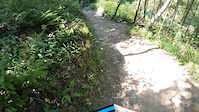
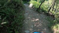
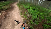
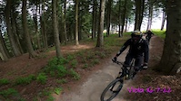
Photos of Viola Mountain Bike
Videos of Viola Mountain Bike
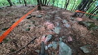
trail: Black Line
0:16 |
58 |
Aug 31, 2023
trail: Black Line
0:42 |
41 |
Aug 31, 2023
3:38 |
12 |
Jul 19, 2023
3:10 |
25 |
Jul 20, 2022
trail: Freccia rossa
2:39 |
57 |
May 15, 2022
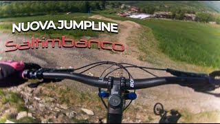
trail: Saltimbanco
4:50 |
64 |
Sep 16, 2025 , Viola
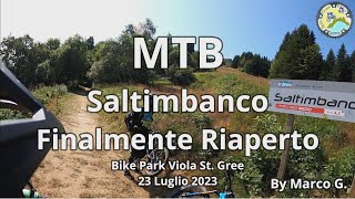
trail: Saltimbanco
5:41 |
158 |
Aug 10, 2023 , Viola

trail: Ottovolante
300 |
Jun 8, 2022 , Viola
Recent Trail Reports
| status | trail | date | condition | info | user |
|---|---|---|---|---|---|
| Freccia rossa | Jun 8, 2026 @ 1:33am (Europe/Rome) 2 days | Ideal | DavideDo | ||
| Ottovolante | Jun 8, 2026 @ 1:33am (Europe/Rome) 2 days | Ideal | DavideDo | ||
| Freeride Line | May 31, 2026 @ 7:50pm (Europe/Rome) May 31, 2026 | Ideal | flyingchicken1 | ||
| Black Line | May 31, 2026 @ 7:49pm (Europe/Rome) May 31, 2026 | Ideal | flyingchicken1 | ||
| Rientro seggiovia (Viola Freeride) | Aug 18, 2025 @ 9:46am Aug 18, 2025 | Ideal | arthurit | ||
| Saltimbanco | Aug 18, 2025 @ 9:46am Aug 18, 2025 | Ideal | arthurit | ||
| Chair lift | Aug 18, 2025 @ 9:46am Aug 18, 2025 | Ideal | arthurit |
Activity Feed
| username | action | type | title | date |
|---|---|---|---|---|
| DavideDo | add | report | activity #96506941 and 1 more | Jun 7, 2026 @ 4:33pm 2 days |
| ronantaylor | wishlist | trail | activity #96320249 | Jun 5, 2026 @ 2:08pm Jun 5, 2026 |
| flyingchicken1 | add | report | activity #95957330 and 3 more | May 31, 2026 @ 10:44am May 31, 2026 |
| Carlo1206 | comment | trail | activity #94548015 | May 12, 2026 @ 3:40am May 12, 2026 |
| Essie37 | wishlist | region | activity #87326965 | Jan 17, 2026 @ 3:58am Jan 17, 2026 |
Recent Comments
| username | type | title | comment | date |
|---|---|---|---|---|
| trail | nice but not green. between blue and red. | May 12, 2026 @ 3:40am May 12, 2026 | ||
| trail | Il vero nero di Viola.. tecnico,... | Sep 7, 2025 @ 3:00pm Sep 7, 2025 | ||
| trail | Trasformata praticamente in proline, salti e... | Jun 24, 2025 @ 12:54pm Jun 24, 2025 | ||
| trail | This trail has been changed as of 2025 to a... | Jun 2, 2025 @ 2:22am Jun 2, 2025 | ||
| trail | Trail molto bello e molto tecnico, decisamente... | Oct 3, 2023 @ 8:54am Oct 3, 2023 |
Bike & Skill Parks
| name | type | city | rating |
|---|---|---|---|
| Viola ST Gréé | bike park | Viola |
Activity Type Stats
| activitytype | trails | distance | descent | descent distance | total vertical | rating | global rank | state rank | photos | reports | routes | ridelogs |
|---|---|---|---|---|---|---|---|---|---|---|---|---|
| Mountain Bike | 6 | 10 miles | 9,206 ft | 9 miles | 1,814 ft | #4,228 | #268 | 62 | 119 | 2,214 | ||
| E-Bike | 1 | 2 miles | 1,650 ft | 2 miles | 1,650 ft | #6,249 | #637 | 98 | 166 |
Frequently Asked Questions About Viola
▼
What are the best places to ride in Viola?
Viola has 1 areas to explore for mountain biking. The top rated areas are:
▼
What are the highest rated mountain biking trails in Viola?
The highest rated mountain biking trails in Viola are:
- Ottovolante (4.4/5)
- Freeride Line (4.3/5)
- Saltimbanco (4.2/5)
- Freccia rossa (4.2/5)
- Black Line (4.1/5)
▼
What is the best time of the year to ride in Viola?
Based on ride log data, the most popular months to ride in Viola are:
- August (20 activities)
- June (18 activities)
- May (11 activities)
▼
Where can I park to ride in Viola?
There are 1 parking locations listed in Viola. The most popular parking spots are:
- By denitopia
 TRAILFORKS VTA & contributors
 - Admins: silviu86, adessoomaipiu
- #20196 - 1,878 views
- viola activity log | embed map of Viola mountain bike trails | viola mountain biking points of interest
Downloading of trail gps tracks in kml & gpx formats is enabled for Viola.
You must login to download files.