close
-
Layers w
- Weather Layers
- Pro
- Pro
- Pro
- Pro
- Pro
- Pro
- More Layers
- Pro
- Pro
- Pro
- Pro
-
Upgrade to

3D
Trail Conditions
- Unknown
- Snow Groomed
- Snow Packed
- Snow Covered
- Snow Cover Partial
- Freeze/thaw Cycle
- Icy
- Prevalent Mud
- Wet
- Variable
- Ideal
- Dry
- Very Dry
Trail Flow (Ridden Direction)
Trailforks scans users ridelogs to determine the most popular direction each trail is ridden. A good flowing trail network will have most trails flowing in a single direction according to their intension.
The colour categories are based on what percentage of riders are riding a trail in its intended direction.
The colour categories are based on what percentage of riders are riding a trail in its intended direction.
- > 96%
- > 90%
- > 80%
- > 70%
- > 50%
- < 50%
- bi-directional trail
- no data
Trail Last Ridden
Trailforks scans ridelogs to determine the last time a trail was ridden.
- < 2 days
- < 1 week
- < 2 weeks
- < 1 month
- < 6 months
- > 6 months
Trail Ridden Direction
The intended direction a trail should be ridden.
- Downhill Only
- Downhill Primary
- Both Directions
- Uphill Primary
- Uphill Only
- One Direction
Contribute Details
Colors indicate trail is missing specified detail.
- Description
- Photos
- Description & Photos
- Videos
Trail Popularity ?
Trailforks scans ridelogs to determine which trails are ridden the most in the last 9 months.
Trails are compared with nearby trails in the same city region with a possible 25 colour shades.
Think of this as a heatmap, more rides = more kinetic energy = warmer colors.
- most popular
- popular
- less popular
- not popular
ATV/ORV/OHV Filter
Max Vehicle Width
inches
US Cell Coverage
Legend

Radar Time
Activity Recordings
Trailforks uses anonymized public activity data.
?
Activity Recordings
Trailforks uses anonymized public activity data.
?
Personal Heatmap
▶
Activity Types
all
/
none
▶
Options
2
Date range
month
–
Winter Trails
Warning
A routing network for winter maps does not exist. Selecting trails using the winter trails layer has been disabled.
Missing Trails
Most Popular
Least Popular
Trails are colored based on popularity. The more popular a trail is, the more red. Less popular trails trend towards green.
Jump Magnitude Heatmap
Heatmap of where riders jump on trails. Zoom in to see individual jumps, click circles to view jump details.
BC Backroad Status
![map legend]()
Service Road Atlas is a free to use, community-driven service for viewing and creating reports on the numerous back-country service roads around B.C. and Alberta.

Slope Aspect
Direction the slope faces
Trails Deemphasized
Trails are shown in grey.
Only show trails with no bike usage.
Suggested Layers
Based on selected activity type
Save the current map location and zoom level as your default home location whenever this page is loaded.
Save
No description for Wardner has been added yet!
Login or register to submit one.
Activities Click to view
- Mountain Bike
11 trails
- E-Bike
11 trails
- Gravel Bike
0 trails
- Adaptive Bike
0 trails
- Winter Fat Bike
0 trails
- Horse
6 trails
- Hike
11 trails
- Trail Running
11 trails
Region Details
- 5
- 4
- 2
Region Status
Open as of Apr 11, 2025Local Trail Association
Stats
- Trails (view details)
- 11
- Trails Mountain Bike
- 11
- Trails E-Bike
- 11
- Trails Horse
- 6
- Trails Hike
- 11
- Trails Trail Running
- 11
- Trails Dirtbike/Moto
- 2
- Trails Observed Trials
- 1
- Trails ATV/ORV/OHV
- 2
- Total Distance
- 22 miles
- Total Descent
- 998 ft
- Total Vertical
- 594 ft
- Highest Trailhead
- 3,073 ft
- Reports
- 29
- Photos
- 30
- Ridden Counter
- 1,552
Popular Wardner Mountain Biking Trails
• 100 ★ 0.0 • 4,887 ft • 23 ft • 250 •
Part of the Great Trail (aka the Canada Trail) Cranbrook to Wardner. Equestrians not allowed on this section. For CIT access go Tokay Hill Trailhead
• 95 ★ 0.0 • 4,276 ft • 125 ft • 239 •
Part of the The Great Trail (formerly Trans Canada Trail) Route Cranbrook to Wardner
• 55 ★ 0.0 • 1 mile • 7 ft • 158 •
Part of the Chief Isadore Trail- part of The Great Trail ( formerly known as theTrans Canada Trail) Cranbrook to Wardner
• 65 ★ 0.0 • 1,736 ft • 0 ft • 152 •
Abandonded road segment converted to trail. Part of Trans Canada Trail Route Cranbrook to Wardner
• 40 ★ 0.0 • 2 miles • 0 ft • 125 •
3 km Rail Trail section with nice overlooks of the Kootenay River
• 20 ★ 0.0 • 2,098 ft • 16 ft • 33 •
Abandoned Road Segment turned into a designated trail. Part of the Chief Isadore Trail (now part of the The Great Trail formerly theTrans Canada Trail)
Wardner Mountain Bike Routes
33 miles • 1,772 ft • 9 • Point to Point •
The route from Wardner towards Elko roughly follows the west shore of the the Kootenay River (Lake...
Photos of Wardner Mountain Bike
Videos of Wardner Mountain Bike
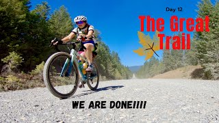
trail: Teepee FSR (The Great Trail)
23:49 |
136 |
Apr 5, 2022 , Wardner
Recent Trail Reports
| status | trail | date | condition | info | user |
|---|---|---|---|---|---|
| Steamboat Hill (Chief Isadore Trail) | Apr 11, 2025 @ 1:29pm Apr 11, 2025 | Dry | Scottmcelligott | ||
| Wardner Road Segment To Trail Terminus | May 28, 2023 @ 2:20am May 28, 2023 | Ideal | hughmcdougs | ||
| Wardner Abandoned Road Segment2 (Chief Isadore Trail) | May 28, 2023 @ 2:20am May 28, 2023 | Ideal | hughmcdougs | ||
| Wardner Abandoned Highway Segment (Chief Isadore Trail) | May 28, 2023 @ 2:20am May 28, 2023 | Ideal | hughmcdougs | ||
| River View (Chief Isadore Trail) | May 28, 2023 @ 2:20am May 28, 2023 | Ideal | hughmcdougs | ||
| Wardner Highway 3 ROW Trail (Chief Isadore Trail) | May 26, 2023 @ 8:17am May 26, 2023 | Ideal | 5Jbk9U | ||
| Rock Creek FSR (The Great Trail) | Apr 29, 2023 @ 1:37am Apr 29, 2023 | Dry | claireallen125 | ||
| Wardner RailTrail (Chief Isadore Trail) | Apr 29, 2023 @ 1:37am Apr 29, 2023 | Dry | claireallen125 | ||
| Wardner-Kikomun Road (The Great Trail) | Aug 19, 2020 @ 6:19pm Aug 19, 2020 | Very Dry | pbuser94604 | ||
| WardnerRoadSection (Chief Isadore Trail) | Jul 2, 2017 @ 6:37pm Jul 2, 2017 | Dry | 4ces |
Activity Feed
| username | action | type | title | date |
|---|---|---|---|---|
| KathrynVG88dY | wishlist | trail | activity #92660656 | Apr 15, 2026 @ 8:06am Apr 15, 2026 |
| MirunaT | wishlist | trail | activity #91826091 | Apr 3, 2026 @ 8:32am Apr 3, 2026 |
| Scottmcelligott | add | report | activity #69428180 and 1 more | Apr 11, 2025 @ 1:27pm Apr 11, 2025 |
| ursaetsx | wishlist | route | activity #58211674 | Sep 2, 2024 @ 7:30am Sep 2, 2024 |
| CraigHinCA | wishlist | route | activity #57820957 | Aug 26, 2024 @ 3:54am Aug 26, 2024 |
Local Badges
-

Epic Mountain Bike Climb 2k6 awarded -

Climbing 10k Badge2 awarded -

Mountain Biking 100k Badge0 awarded -

Epic Ride Descent 2k6 awarded -

Descent 10k Badge2 awarded -

Descent 100k Badge0 awarded
Activity Type Stats
| activitytype | trails | distance | descent | descent distance | total vertical | rating | global rank | state rank | photos | reports | routes | ridelogs |
|---|---|---|---|---|---|---|---|---|---|---|---|---|
| Mountain Bike | 11 | 22 miles | 997 ft | 7 miles | 594 ft | #11,457 | #166 | 30 | 29 | 1 | 624 | |
| E-Bike | 11 | 22 miles | 997 ft | 7 miles | 594 ft | #5,473 | #102 | 29 | 1 | 20 | ||
| Horse | 6 | 19 miles | 1,033 ft | 6 miles | 584 ft | #1,646 | #56 | 15 | 1 | 31 | ||
| Hike | 11 | 22 miles | 997 ft | 7 miles | 594 ft | #8,513 | #150 | 29 | 1 | 193 | ||
| Trail Running | 11 | 22 miles | 997 ft | 7 miles | 594 ft | #8,039 | #141 | 29 | 1 | 26 | ||
| Dirtbike/Moto | 2 | 12 miles | 922 ft | 5 miles | 584 ft | 12 | 7 | |||||
| Observed Trials | 1 | 8 miles | 699 ft | 3 miles | 584 ft | |||||||
| ATV/ORV/OHV | 2 | 12 miles | 922 ft | 5 miles | 584 ft | 12 | 1 |
Frequently Asked Questions About Wardner
▼
What are the highest rated mountain biking trails in Wardner?
The highest rated mountain biking trails in Wardner are:
- Wardner Highway 3 ROW Trail (Chief Isadore Trail) (0/5)
- Steamboat Hill (Chief Isadore Trail) (0/5)
- Wardner Abandoned Highway Segment (Chief Isadore Trail) (0/5)
- Wardner RailTrail (Chief Isadore Trail) (0/5)
- River View (Chief Isadore Trail) (0/5)
▼
What is the best time of the year to ride in Wardner?
Based on ride log data, the most popular months to ride in Wardner are:
- July (18 activities)
- May (17 activities)
- August (13 activities)
▼
Where can I park to ride in Wardner?
There are 1 parking locations listed in Wardner. The most popular parking spots are:
▼
What is the longest trail in Wardner?
The longest trail in Wardner is River View (Chief Isadore Trail) at 1.9 miles. View all trails sorted by distance.
Activities
Trails
Points of Interest
- By TrailsBC
 TrailsBC & contributors
 - Admins: barry-mclane, STMS, RDEK
- #16135 - 3,029 views
- wardner activity log | embed map of Wardner mountain bike trails | wardner mountain biking points of interest
Downloading of trail gps tracks in kml & gpx formats is enabled for Wardner.
You must login to download files.