9.7 miles
Distance
1,366 ft
Climb
-1,377 ft
Descent
492 ft
High Point
This route is archived
Please note that whilst we know there are much better trails in the area that we intended to use we have been restricted by the Land Owners Quensland Parks and Wildlife as land managers to these stages only.
Round 1 of the Shimano Enduro Tour at Nerang on the Gold Coast.
E-bikes to race on the same stages on the Saturday wth a 1.5hour time limit.
Detailed Description
Shimano Enduro Tour Lee is a 10 mile intermediate race route located near Gold Coast. This mountain bike only route. This route includes 10 trails. This route climbs 1,366 ft with a max elevation of 492 ft then descends -1,377 ft.
Local Trail Association
Please consider joining or donating to the local riding association to support trail development & maintenance.
donate to earn trail karma!
39 Reviews & Comments
We hope you've been enjoying Trailforks!
Create a FREE account to view route comments and much more.
Route Sections
| 1 | Stage 1 |
| 2 | Stage 2 |
| 3 | Stage 3 |
| 4 | Stage 5 |
| 5 | Stage 4 |
Trails in Route
| 1 mile | |||||
| 3,760 ft | |||||
| 1,673 ft | |||||
| 2,320 ft | |||||
| 3,360 ft | |||||
| 1,654 ft | |||||
| 2 miles |
Details
-
Race Course
-
Race DateSunday October 14, 2018 at 12:00am
-
Riding area
-
Primary ActivityMountain Bike
-
Difficulty ratingBlue
-
eBike Allowed
-
Ridelogs
More Stats for Shimano Enduro Tour Lee mountain bike route
-
Avg time1 hr 15 min
-
Altitude change-10 ft
-
Altitude min74 ft
-
Altitude start84 ft
-
Altitude end75 ft
-
Grade-0%
-
Grade max-32.1%
-
Grade min27.5%
-
Distance climb5 miles
-
Distance down5 miles
-
Distance flat2,579 ft
close
-
Layers w
- Map Content
- Pro
- Pro
- Pro
- Pro
- Layers
- Pro
- Pro
- Pro
- More Layers
- Pro
- Pro
- Pro
- Pro
- Pro
- Pro
- Pro
- Pro
-
Upgrade to

3D
Trail Conditions
- Unknown
- Snow Groomed
- Snow Packed
- Snow Covered
- Snow Cover Partial
- Freeze/thaw Cycle
- Icy
- Prevalent Mud
- Wet
- Variable
- Ideal
- Dry
- Very Dry
Trail Flow (Ridden Direction)
Trailforks scans users ridelogs to determine the most popular direction each trail is ridden. A good flowing trail network will have most trails flowing in a single direction according to their intension.
The colour categories are based on what percentage of riders are riding a trail in its intended direction.
The colour categories are based on what percentage of riders are riding a trail in its intended direction.
- > 96%
- > 90%
- > 80%
- > 70%
- > 50%
- < 50%
- bi-directional trail
- no data
Trail Last Ridden
Trailforks scans ridelogs to determine the last time a trail was ridden.
- < 2 days
- < 1 week
- < 2 weeks
- < 1 month
- < 6 months
- > 6 months
Trail Ridden Direction
The intended direction a trail should be ridden.
- Downhill Only
- Downhill Primary
- Both Directions
- Uphill Primary
- Uphill Only
- One Direction
Contribute Details
Colors indicate trail is missing specified detail.
- Description
- Photos
- Description & Photos
- Videos
Trail Popularity ?
Trailforks scans ridelogs to determine which trails are ridden the most in the last 9 months.
Trails are compared with nearby trails in the same city region with a possible 25 colour shades.
Think of this as a heatmap, more rides = more kinetic energy = warmer colors.
- most popular
- popular
- less popular
- not popular
ATV/ORV/OHV Filter
Max Vehicle Width
inches
US Cell Coverage
Legend

Radar Time
x
Activity Recordings
Trailforks users anonymized public ridelogs from the past 6 months.
- mountain biking recent
- mountain biking (>6 month)
- hiking (1 year)
- moto (1 year)
Activity Recordings
Trailforks users anonymized public skilogs from the past 12 months.
- Downhill Ski
- Backcountry Ski
- Nordic Ski
- Snowmobile
Winter Trails
Warning
A routing network for winter maps does not exist. Selecting trails using the winter trails layer has been disabled.
x
Missing Trails
Most Popular
Least Popular
Trails are colored based on popularity. The more popular a trail is, the more red. Less popular trails trend towards green.
Jump Magnitude Heatmap
Heatmap of where riders jump on trails. Zoom in to see individual jumps, click circles to view jump details.
Trails Deemphasized
Trails are shown in grey.
Only show trails with NO bikes.
Save the current map location and zoom level as your default home location whenever this page is loaded.
Save
Trail transparency
Photos
Videos
youtuber
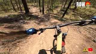
![Does this MTB system suck? | Nerang National Park]()

Does this MTB system suck? | Nerang National Park
trail: GC2018 Loop 1 Downhill
10:29 | 191 | comments: 0 | favs:
Mar 27, 2023
Recent Trail Reports Along Route
more reports »
- By harwox
 & contributors
 - #10030 - 4,088 views