16.4 miles
Distance
3,116 ft
Climb
-3,103 ft
Descent
1,307 ft
High Point
14 ft
Altitude change
495 ft
Altitude min
496 ft
Altitude start
512 ft
Altitude end
-67.9%
Grade max
70.2%
Grade min
8 miles
Distance climb
7 miles
Distance down
2 miles
Distance flat

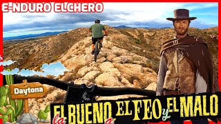
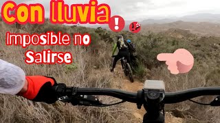
Ruta por Elche tocando sendas mas que conocidas y algunas nuevas que se están abriendo recientemente.
Ruta de nivel medio-alto con alguna senda con exposición, andar con ojo en ciertas zonas, típicas sendas de tierra ,piedra suelta y escalones.

Detailed Description
Tabaià is a 16 mile popular red route located near Alicante. This mountain bike primary route can be used one direction and has a hard overall physical rating. This route includes 18 trails. This route climbs 3,116 ft with a max elevation of 1,307 ft then descends -3,103 ft.

Trail Issues on Route

  • Significant Issue / Amber: 1 trail (newest: May 3, 2026)
  • Minor Issue / Yellow: 1 trail (newest: Mar 19, 2026)
Local Trail Association
Please consider joining or donating to the local riding association to support trail development & maintenance.
Donate to earn trail karma!

Stats

  • Distance
    16 miles
  • Altitude min
    495 ft
  • Altitude start
    496 ft
  • Altitude end
    512 ft
  • Climb
    3,116 ft
  • Descent
    -3,103 ft
  • Grade max
    -67.9%
  • Grade min
    70.2%
  • Distance climb
    8 miles
  • Distance down
    7 miles
  • Distance flat
    2 miles

4 Reviews & Comments


We hope you've been enjoying Trailforks!

Create a FREE account to view route comments and much more.

Details

no votes yet
close
3D
Trail Conditions
  • Unknown
  • Snow Groomed
  • Snow Packed
  • Snow Covered
  • Snow Cover Partial
  • Freeze/thaw Cycle
  • Icy
  • Prevalent Mud
  • Wet
  • Variable
  • Ideal
  • Dry
  • Very Dry
Trail Flow (Ridden Direction)
Trailforks scans users ridelogs to determine the most popular direction each trail is ridden. A good flowing trail network will have most trails flowing in a single direction according to their intension.
The colour categories are based on what percentage of riders are riding a trail in its intended direction.
  • > 96%
  • > 90%
  • > 80%
  • > 70%
  • > 50%
  • < 50%
  • bi-directional trail
  • no data
Trail Last Ridden
Trailforks scans ridelogs to determine the last time a trail was ridden.
  • < 2 days
  • < 1 week
  • < 2 weeks
  • < 1 month
  • < 6 months
  • > 6 months
Trail Ridden Direction
The intended direction a trail should be ridden.
  • Downhill Only
  • Downhill Primary
  • Both Directions
  • Uphill Primary
  • Uphill Only
  • One Direction
Contribute Details
Colors indicate trail is missing specified detail.
  • Description
  • Photos
  • Description & Photos
  • Videos
Trail Popularity ?
Trailforks scans ridelogs to determine which trails are ridden the most in the last 9 months. Trails are compared with nearby trails in the same city region with a possible 25 colour shades. Think of this as a heatmap, more rides = more kinetic energy = warmer colors.
  • most popular
  • popular
  • less popular
  • not popular
ATV/ORV/OHV Filter
Max Vehicle Width
inches
US Cell Coverage
Legend
cell carrier legend

Radar Time
Activity Recordings
Trailforks uses anonymized public activity data. ?
Activity Recordings
Trailforks uses anonymized public activity data. ?
Personal Heatmap
Activity Types
all / none
Options
2
Date range month
Winter Trails
Warning A routing network for winter maps does not exist. Selecting trails using the winter trails layer has been disabled.
Missing Trails
Most Popular
Least Popular
Trails are colored based on popularity. The more popular a trail is, the more red. Less popular trails trend towards green.
Jump Magnitude Heatmap
Heatmap of where riders jump on trails. Zoom in to see individual jumps, click circles to view jump details.
BC Backroad Status

Service Road Atlas is a free to use, community-driven service for viewing and creating reports on the numerous back-country service roads around B.C. and Alberta.

map legend
Slope Aspect
Direction the slope faces
Flat N NE E SE S SW W NW
Trails Deemphasized
Trails are shown in grey.
disable
Only show trails with no bike usage.
Enable
Suggested Layers
Based on selected activity type

    Save the current map location and zoom level as your default home location whenever this page is loaded.

    Save
    Trail transparency
    • Singletrack
    • Unpaved
    34
    41
    23
    20
    Daytona en el minuto 7:38
    Daytona en el minuto 7:38
    trail: Daytona
    24:15 | 216 | comments: 0 | favs:
    Oct 23, 2023

    Recent Trail Reports Along Route

    statustraildateconditiondescription
    Revueltas de Ferriol
    Jun 8, 2026 @ 7:23am (Europe/Madrid)
    2 days
    Daytona
    May 3, 2026 @ 12:51pm (Europe/Madrid)
    May 3, 2026
    Terreno súper seco en la parte que viene después del paso por la cornisa. Se hunden las ruedas por la acumulación de polvo y tierra no compacta.
    Frontera
    Mar 19, 2026 @ 3:40pm (Europe/Madrid)
    Mar 19, 2026
    Erosión menor (más de una línea, pequeñas roderas, marcas de frenado)
    Arizona
    Jan 24, 2026 @ 1:02pm (Europe/Madrid)
    Jan 24, 2026
    Great trail. Mostly flow two technical trails
    Antena Elche
    Feb 20, 2025 @ 3:51pm
    Feb 20, 2025
    more reports »
    • By AMGTF Pro TFSPAIN & contributors
    • #62438 - 234 views

    Hit the Trail

    Open in App

    Get this route on your phone instantly.

    Download Route

    Save to wishlist, Garmin & download.