
close
3D
Trail Conditions
- Unknown
- Snow Groomed
- Snow Packed
- Snow Covered
- Snow Cover Partial
- Freeze/thaw Cycle
- Icy
- Prevalent Mud
- Wet
- Variable
- Ideal
- Dry
- Very Dry
Trail Flow (Ridden Direction)
Trailforks scans users activity logs to determine the most popular direction each trail is ridden. A good flowing trail network will have most trails flowing in a single direction according to their intension.
The colour categories are based on what percentage of users are riding a trail in its intended direction.
The colour categories are based on what percentage of users are riding a trail in its intended direction.
- > 96%
- > 90%
- > 80%
- > 70%
- > 50%
- < 50%
- bi-directional trail
- no data
Trail Last Used
Trailforks scans activity logs to determine the last time a trail was ridden.
- < 2 days
- < 1 week
- < 2 weeks
- < 1 month
- < 6 months
- > 6 months
Trail Ridden Direction
The intended direction a trail should be ridden.
- Downhill Only
- Downhill Primary
- Both Directions
- Uphill Primary
- Uphill Only
- One Direction
Contribute Details
Colors indicate trail is missing specified detail.
- Description
- Photos
- Description & Photos
- Videos
Trail Popularity ?
Trailforks scans activity logs to determine which trails are ridden the most in the last 9 months.
Trails are compared with nearby trails in the same city region with a possible 25 colour shades.
Think of this as a heatmap, more activities = more kinetic energy = warmer colors.
- most popular
- popular
- less popular
- not popular
ATV/ORV/OHV Filter
Max Vehicle Width
inches
US Cell Coverage
Legend

Radar Time
Activity Recordings
Trailforks uses anonymized public activity data.
?
Activity Recordings
Trailforks uses anonymized public activity data.
?
Winter Trails
Warning
A routing network for winter maps does not exist. Selecting trails using the winter trails layer has been disabled.
Missing Trails
Most Popular
Least Popular
Trails are colored based on popularity. The more popular a trail is, the more red. Less popular trails trend towards green.
Jump Magnitude Heatmap
Heatmap of where users jump on trails. Zoom in to see individual jumps, click circles to view jump details.
BC Backroad Status
![map legend]()
Service Road Atlas is a free to use, community-driven service for viewing and creating reports on the numerous back-country service roads around B.C. and Alberta.

Slope Aspect
Direction the slope faces
Trails Deemphasized
Trails are shown in grey.
Only show trails with no bike usage.
Suggested Layers
Based on selected activity type
Save the current map location and zoom level as your default home location whenever this page is loaded.
SaveOverview
Ballinastoe National Mountain Bike Trail Center is a major purpose-built mountain-bike trail network in the Wicklow Mountains of County Wicklow, approximately 4 km north of Roundwood. Managed by Coillte, the network combines purpose-built singletrack with forest roads and traverses a varied landscape of mature forest, open upland and exposed mountain terrain. The trails are renowned for their combination of fast descents, tight and technical singletrack, rocky sections, frequent changes in elevation and spectacular views toward Lough Tay, the Irish Sea, Calary Common and the Sugarloaf. (coillte.ie)
Ballinastoe forms part of Coillte's national network of mountain-bike centres and is one of Ireland's premier dedicated mountain-bike destinations. The network is designed around one-way, waymarked circular routes, with three principal options ranging from blue-grade moderate terrain through demanding red-grade riding to severe black-grade trails. The riding combines substantial forest-road climbing with increasingly technical singletrack, making Ballinastoe suitable for proficient riders through to highly experienced and technically competent mountain bikers. (coillte.ie)
The upper portions of the network are relatively exposed and can become extremely windy in poor weather. Trail surfaces vary considerably, including rock, roots, mud, loose stones and gravel, with conditions becoming particularly slippery when wet. The combination of rugged terrain, technical trail design and extensive views gives Ballinastoe a distinctly mountainous character.
Trails
The Blue Route is approximately 5 km long with around 100 metres of climbing and takes approximately one to two hours to complete. It incorporates Easy Rider, Cool Runnings, Double Trouble, House Bound, Flat Liner and Home Run. Although graded blue, Coillte describes the route as moderate to difficult, with numerous difficult sections. The trail varies from fast and flowing to tight and technical, with occasional steep and narrow sections and changing surfaces including rock, roots, mud, loose stones and gravel. It is intended for proficient cyclists rather than complete beginners. (coillte.ie)
The Red Route provides a significantly longer and more demanding ride, covering approximately 30 km with around 750 metres of climbing and taking approximately two to four hours. It incorporates Zipper, Pump & Grind, Fancy, Pig Dog, Little One, Expressway, Suas, Double Trouble, Dark Loam and Holts. The route is difficult throughout, with numerous severe sections, frequent steep and narrow terrain, technical rocky sections and fast, flowing singletrack. It is not recommended for novice mountain bikers. (coillte.ie)
The Black Route covers approximately 16 km with around 500 metres of climbing and takes approximately two to three hours. It includes Junkers, Ravens, Peaty, Glitch and Steps. The route is severe throughout, with prolonged steep and narrow sections, drop-offs and rapidly changing terrain ranging from fast and flowing to highly technical. It should only be attempted by highly experienced and highly competent mountain-bike riders. (coillte.ie)
All three routes are waymarked in one direction, and riders should follow the arrows throughout the network. The routes use multiple sections of forest road and cross walking trails, so riders should expect encounters with pedestrians, forestry vehicles and other forest users.
Land Managers & Trail Associations
The underlying land and trail network are managed by Coillte, Ireland's state-owned forestry company. Ballinastoe is one of Coillte's national mountain-bike trail centres and forms part of its wider network of dedicated cycling and mountain-bike facilities across Ireland. Coillte is responsible for the management of the forest estate, recreational access, trail infrastructure and coordination with forestry operations. (coillte.ie)
Biking.ie operates mountain-bike services at Ballinastoe, including bike hire, and is a significant local cycling provider associated with the trail centre. Coillte identifies Biking.ie among the nearby services for Ballinastoe. (coillte.ie)
Ballinastoe's development has also formed part of Coillte's broader national mountain-bike development program, which has included significant investment in trail construction, trailhead infrastructure, signage and waymarking. Coillte identifies Ballinastoe alongside Coolaney, Ballyhoura, Slieve Blooms and Ticknock as its national mountain-bike trail centres. (coillte.ie)
Ballinastoe National Mountain Bike Trail Center is a major purpose-built mountain-bike trail network in the Wicklow Mountains of County Wicklow, approximately 4 km north of Roundwood. Managed by Coillte, the network combines purpose-built singletrack with forest roads and traverses a varied landscape of mature forest, open upland and exposed mountain terrain. The trails are renowned for their combination of fast descents, tight and technical singletrack, rocky sections, frequent changes in elevation and spectacular views toward Lough Tay, the Irish Sea, Calary Common and the Sugarloaf. (coillte.ie)
Ballinastoe forms part of Coillte's national network of mountain-bike centres and is one of Ireland's premier dedicated mountain-bike destinations. The network is designed around one-way, waymarked circular routes, with three principal options ranging from blue-grade moderate terrain through demanding red-grade riding to severe black-grade trails. The riding combines substantial forest-road climbing with increasingly technical singletrack, making Ballinastoe suitable for proficient riders through to highly experienced and technically competent mountain bikers. (coillte.ie)
The upper portions of the network are relatively exposed and can become extremely windy in poor weather. Trail surfaces vary considerably, including rock, roots, mud, loose stones and gravel, with conditions becoming particularly slippery when wet. The combination of rugged terrain, technical trail design and extensive views gives Ballinastoe a distinctly mountainous character.
Trails
The Blue Route is approximately 5 km long with around 100 metres of climbing and takes approximately one to two hours to complete. It incorporates Easy Rider, Cool Runnings, Double Trouble, House Bound, Flat Liner and Home Run. Although graded blue, Coillte describes the route as moderate to difficult, with numerous difficult sections. The trail varies from fast and flowing to tight and technical, with occasional steep and narrow sections and changing surfaces including rock, roots, mud, loose stones and gravel. It is intended for proficient cyclists rather than complete beginners. (coillte.ie)
The Red Route provides a significantly longer and more demanding ride, covering approximately 30 km with around 750 metres of climbing and taking approximately two to four hours. It incorporates Zipper, Pump & Grind, Fancy, Pig Dog, Little One, Expressway, Suas, Double Trouble, Dark Loam and Holts. The route is difficult throughout, with numerous severe sections, frequent steep and narrow terrain, technical rocky sections and fast, flowing singletrack. It is not recommended for novice mountain bikers. (coillte.ie)
The Black Route covers approximately 16 km with around 500 metres of climbing and takes approximately two to three hours. It includes Junkers, Ravens, Peaty, Glitch and Steps. The route is severe throughout, with prolonged steep and narrow sections, drop-offs and rapidly changing terrain ranging from fast and flowing to highly technical. It should only be attempted by highly experienced and highly competent mountain-bike riders. (coillte.ie)
All three routes are waymarked in one direction, and riders should follow the arrows throughout the network. The routes use multiple sections of forest road and cross walking trails, so riders should expect encounters with pedestrians, forestry vehicles and other forest users.
Land Managers & Trail Associations
The underlying land and trail network are managed by Coillte, Ireland's state-owned forestry company. Ballinastoe is one of Coillte's national mountain-bike trail centres and forms part of its wider network of dedicated cycling and mountain-bike facilities across Ireland. Coillte is responsible for the management of the forest estate, recreational access, trail infrastructure and coordination with forestry operations. (coillte.ie)
Biking.ie operates mountain-bike services at Ballinastoe, including bike hire, and is a significant local cycling provider associated with the trail centre. Coillte identifies Biking.ie among the nearby services for Ballinastoe. (coillte.ie)
Ballinastoe's development has also formed part of Coillte's broader national mountain-bike development program, which has included significant investment in trail construction, trailhead infrastructure, signage and waymarking. Coillte identifies Ballinastoe alongside Coolaney, Ballyhoura, Slieve Blooms and Ticknock as its national mountain-bike trail centres. (coillte.ie)
 google parking directions plan a road trip here
Access Info:
The principal trailhead is located within Ballinastoe Forest, approximately 4 km north of Roundwood in County Wicklow. Coillte provides a dedicated car park at the trailhead, with picnic facilities and access to the mountain-bike network. Bike hire is available through Biking.ie, while additional food, accommodation and visitor services are available in and around Roundwood. (coillte.ie)
The trailhead provides direct access to the waymarked mountain-bike routes. Riders should not obstruct forest roads or entrances, as these routes must remain available for forestry operations and emergency access. The trail network also intersects walking trails and forest roads, so riders should expect other users and vehicles within the riding area.
Current access conditions should be checked before riding. Coillte currently reports storm-related water damage affecting portions of the network, with Cool Runnings lower, Junkers, Ravens and Expressway closed while repair work is undertaken. Coillte advises riders to use the alternative forest-road climb to Suas and to follow all closure and detour signage. (coillte.ie)
The trailhead provides direct access to the waymarked mountain-bike routes. Riders should not obstruct forest roads or entrances, as these routes must remain available for forestry operations and emergency access. The trail network also intersects walking trails and forest roads, so riders should expect other users and vehicles within the riding area.
Current access conditions should be checked before riding. Coillte currently reports storm-related water damage affecting portions of the network, with Cool Runnings lower, Junkers, Ravens and Expressway closed while repair work is undertaken. Coillte advises riders to use the alternative forest-road climb to Suas and to follow all closure and detour signage. (coillte.ie)
Disclaimer:
Ballinastoe is a designated mountain-bike trail network, and riders should remain on the waymarked cycling routes and follow the directional arrows. Helmets are required, and riders should use a mountain bike in good working condition and select a route appropriate to their fitness, experience and technical ability. Coillte advises all riders to control their speed and show consideration for other forest users. (coillte.ie)
The trails cross walking routes and use forest roads that may also be used by forestry vehicles. Riders should approach crossings and shared sections under control and give appropriate consideration to pedestrians and other users.
Weather conditions can change rapidly in the Wicklow Mountains. Upper sections are exposed and can be extremely windy, while wet weather can make rock, roots, mud, loose stone and gravel particularly slippery. Riders should take weather and trail conditions into account before setting out.
Coillte forestry operations, storm damage and other hazards can result in temporary trail closures or diversions. Riders must obey all closure notices, safety signs and staff instructions. Current Coillte information should be checked before visiting, particularly following severe weather or during active forestry operations. (coillte.ie)
Riders should also follow Leave No Trace principles, carry appropriate equipment and a means of communication, and be prepared for the possibility of being some distance from the trailhead. Coillte's trailhead guidance recommends carrying a mobile phone, drinking water and a first-aid kit and knowing the trail and waymarker information for the route being ridden. (coillte.ie)
The trails cross walking routes and use forest roads that may also be used by forestry vehicles. Riders should approach crossings and shared sections under control and give appropriate consideration to pedestrians and other users.
Weather conditions can change rapidly in the Wicklow Mountains. Upper sections are exposed and can be extremely windy, while wet weather can make rock, roots, mud, loose stone and gravel particularly slippery. Riders should take weather and trail conditions into account before setting out.
Coillte forestry operations, storm damage and other hazards can result in temporary trail closures or diversions. Riders must obey all closure notices, safety signs and staff instructions. Current Coillte information should be checked before visiting, particularly following severe weather or during active forestry operations. (coillte.ie)
Riders should also follow Leave No Trace principles, carry appropriate equipment and a means of communication, and be prepared for the possibility of being some distance from the trailhead. Coillte's trailhead guidance recommends carrying a mobile phone, drinking water and a first-aid kit and knowing the trail and waymarker information for the route being ridden. (coillte.ie)
This region uses the Uk/Euro style trail grading system.
Trail info last updated
Region Supporters & Maintainers

Activities Click to view
- Mountain Bike
34 trails
- E-Bike
39 trails
- Hike
20 trails
- Trail Running
20 trails
Region Details

- 7
- 14
- 8
- 5
Region Status
Open as of Oct 25, 2026Stats
- Avg Trail Rating
- Trails (view details)
- 39
- Trails Mountain Bike
- 34
- Trails E-Bike
- 39
- Trails Gravel Bike
- 13
- Trails Adaptive Bike
- 7
- Trails Winter Fat Bike
- 1
- Trails Hike
- 20
- Trails Trail Running
- 20
- Total Distance
- 34 miles
- Total Descent Distance
- 15 miles
- Total Descent
- 9,550 ft
- Total Vertical
- 1,679 ft
- Highest Trailhead
- 2,365 ft
- Reports
- 804
- Photos
- 63
- Completed Counter
- 12,296
Popular Ballinastoe National Mountain Bike Trail Center Trails
• 85 ★ 4.9 • 4,695 ft • 142 ft • 619 •
Highly rated popular red difficulty singletrack. This mountain bike primary trail and has a moderate overall physical rating with a 142 ft green climb. It features berm, jump, rock garden and roller coaster. Trail visibility is always easy to follow. On average it takes 5 minutes to complete this trail.
• 85 ★ 4.8 • 2,096 ft • 3 ft • 550 •
Popular blue difficulty singletrack. This mountain bike primary trail. On average it takes 2 minutes to complete this trail.
• 65 ★ 4.8 • 3,350 ft • 32 ft • 535 •
Time to get back to the start. This blue flowy trail will make you want to go up and repeat again. Last update by TrailBreaker trail builders (dec 2021) modified 2nd half to make fun as hell, huge berms that allow you to carry plenty of...
• 45 ★ 4.9 • 4,754 ft • 40 ft • 514 •
Highly rated moderately popular red difficulty singletrack. This mountain bike primary trail. On average it takes 7 minutes to complete this trail.
• 75 ★ 4.0 • 1,739 ft • 68 ft • 506 •
Popular blue difficulty singletrack. This mountain bike primary trail. It features jump and pump track. Trail visibility is always easy to follow. On average it takes 2 minutes to complete this trail.
• 40 ★ 4.4 • 3,176 ft • 54 ft • 463 •
Highly rated moderately popular blue difficulty singletrack. This mountain bike primary trail and has a easy overall physical rating with a 54 ft green climb. It features berm and rock garden. On average it takes 6 minutes to complete this trail.
• 95 ★ 5.0 • 1 mile • 62 ft • 414 •
Popular red difficulty machine groomed. This mountain bike primary trail and has a hard overall physical rating with a 62 ft blue climb. It features berm, jump, pump track and roller coaster. Adaptive MTB rating: amtb blue. Trail visibility is always easy to follow. On average it takes 6 minutes to complete this trail.
Mountain Bike Routes
★ 4.0 • 8 miles • 1,036 ft • 16 • Loop •
Easy to follow mtb loop in Ballinastoe woods
★ 5.0 • 30 miles • 4,792 ft • 20 • Loop • Race •
Format There are two types of format, Classic and Mash Up. Classic means the stages need to be ridden in...
★ 5.0 • 16 miles • 3,781 ft • 0 • Shuttled • Race •
Route of the 2014 Djouce Gravity Enduro
9 miles • 1,170 ft • 9 • Loop • Race •
Race route for the Biking Blitz 2022: Ballinastoe. Juniors and Novice one lap, Expert 2 laps.
Photos of Ballinastoe National Mountain Bike Trail Center Mountain Bike
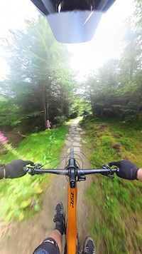
Videos of Ballinastoe National Mountain Bike Trail Center Mountain Bike
mtb
3:18 |
145 |
Sep 2, 2014
mtb
0:18 |
153 |
Aug 18, 2014

mtb
2:04 |
382 |
Jun 9, 2014
mtb
2:21 |
148 |
May 28, 2014
Recent Trail Reports
| status | trail | date | condition | info | user |
|---|---|---|---|---|---|
| parking to hiking path | May 11, 2026 @ 9:39pm (Europe/Dublin) May 11, 2026 | Very Dry | elyari TRAILFORKS | ||
| connector between hiking trails | May 11, 2026 @ 9:39pm (Europe/Dublin) May 11, 2026 | Very Dry | elyari TRAILFORKS | ||
| Zipper | May 11, 2026 @ 9:39pm (Europe/Dublin) May 11, 2026 | Very Dry | elyari TRAILFORKS | ||
| War Hill Summit | May 11, 2026 @ 9:39pm (Europe/Dublin) May 11, 2026 | Very Dry | elyari TRAILFORKS | ||
| Junkers | May 11, 2026 @ 9:39pm (Europe/Dublin) May 11, 2026 | Very Dry | elyari TRAILFORKS | ||
| Indriya (start section) | May 11, 2026 @ 9:39pm (Europe/Dublin) May 11, 2026 | Very Dry | elyari TRAILFORKS | ||
| House Bound | May 11, 2026 @ 9:39pm (Europe/Dublin) May 11, 2026 | Very Dry | elyari TRAILFORKS | ||
| Home Run | May 11, 2026 @ 9:39pm (Europe/Dublin) May 11, 2026 | Very Dry | elyari TRAILFORKS | ||
| Glitch | May 11, 2026 @ 9:39pm (Europe/Dublin) May 11, 2026 | Very Dry | elyari TRAILFORKS | ||
| Flatliner | May 11, 2026 @ 9:39pm (Europe/Dublin) May 11, 2026 | Very Dry | elyari TRAILFORKS |
Activity Feed
| username | action | type | title | date |
|---|---|---|---|---|
| henrywebbs | wishlist | route | activity #107172967 | Nov 4, 2026 @ 4:16am Nov 4, 2026 |
| ChrisBan21 | update | trail | activity #106991471 | Nov 1, 2026 @ 3:44am Nov 1, 2026 |
| ChrisBan21 | update | trail | activity #106682685 and 11 more | Oct 27, 2026 @ 6:25am Oct 27, 2026 |
| SAlan1234 | ridden | trail | activity #106634066 | Oct 26, 2026 @ 9:14am Oct 26, 2026 |
| ChrisBan21 | update | trail | activity #106565937 and 8 more | Oct 25, 2026 @ 8:06am Oct 25, 2026 |
Recent Comments
| username | type | title | comment | date |
|---|---|---|---|---|
| trail | Gnnnnnaaarrr! | Jul 11, 2023 @ 12:32pm Jul 11, 2023 | ||
| trail | So much fun! | Jul 11, 2023 @ 12:31pm Jul 11, 2023 | ||
| trail | thanks! updated! | Jul 24, 2020 @ 3:48am Jul 24, 2020 | ||
| trail | Cool runnings is the official name | Jul 19, 2020 @ 5:32am Jul 19, 2020 | ||
| trail | This trail is called coal minet | Aug 18, 2019 @ 6:53am Aug 18, 2019 |
Nearby Areas
| name | distance | ||||
|---|---|---|---|---|---|
| Lough Dan | 2 | 5 | 2.7 km | ||
| Wicklow | 2.9 km | ||||
| Djouce Woods | 5 | 3.1 km | |||
| Crone | 1 | 5 | 1 | 4 km | |
| Downs Hill | 10 | 1 | 4.8 km |
Local Badges
-

Completionist0 awarded
Activity Type Stats
| activitytype | trails | distance | descent | descent distance | total vertical | rating | global rank | state rank | photos | reports | routes | activity logs |
|---|---|---|---|---|---|---|---|---|---|---|---|---|
| Mountain Bike | 34 | 26 miles | 8,629 ft | 12 miles | 1,394 ft | #840 | #2 | 57 | 803 | 9 | 6,799 | |
| E-Bike | 39 | 34 miles | 9,551 ft | 15 miles | 1,680 ft | #851 | #10 | 1 | 757 | 7 | 1,405 | |
| Gravel Bike | 13 | 14 miles | 2,264 ft | 5 miles | 974 ft | #1,186 | #3 | 167 | 10 | |||
| Adaptive Bike | 7 | 8 miles | 1,414 ft | 3 miles | 646 ft | #1,175 | #3 | 133 | 1 | |||
| Winter Fat Bike | 1 | 4 miles | 82 ft | 4,675 ft | 102 ft | #1,186 | #3 | 36 | ||||
| Hike | 20 | 21 miles | 3,898 ft | 8 miles | 1,680 ft | #1,698 | #9 | 1 | 752 | 222 | ||
| Trail Running | 20 | 21 miles | 3,898 ft | 8 miles | 1,680 ft | #1,061 | #10 | 752 | 163 |
Frequently Asked Questions
▼
What are the highest rated mountain biking trails in Ballinastoe National Mountain Bike Trail Center?
The highest rated mountain biking trails in Ballinastoe National Mountain Bike Trail Center are:
- Expressway (4.5/5)
- Bump & Grind (4.4/5)
- Holts (4.3/5)
- Junkers (4.3/5)
- Flatliner (4.3/5)
▼
What is the best time of the year to ride in Ballinastoe National Mountain Bike Trail Center?
Based on activity log data, the most popular months to ride in Ballinastoe National Mountain Bike Trail Center are:
- August (64 activities)
- October (61 activities)
- May (56 activities)
▼
Where can I park to ride in Ballinastoe National Mountain Bike Trail Center?
There are 5 parking locations listed in Ballinastoe National Mountain Bike Trail Center. The most popular parking spots are: View all parking and trailhead locations on the map to plan your visit.
▼
What is the longest trail in Ballinastoe National Mountain Bike Trail Center?
The longest trail in Ballinastoe National Mountain Bike Trail Center is Junkers at 1.3 miles. View all trails sorted by distance.
▼
What are the best & highest rated hiking trails in Ballinastoe National Mountain Bike Trail Center?
The best hiking trails in Ballinastoe National Mountain Bike Trail Center are:
- Walkers path (boardwalk inside woods)
- Boardwalk Descent
- Upper Vartry Trail
- Upper Vartry Trail
- Djoice Summit
▼
What are the best & highest rated trail running trails in Ballinastoe National Mountain Bike Trail Center?
The best trail running trails in Ballinastoe National Mountain Bike Trail Center are: View all trail running trails sorted by popularity score.
▼
How many trails are in Ballinastoe National Mountain Bike Trail Center?
Ballinastoe National Mountain Bike Trail Center has a total of 39 trails. Of those, 34 are designated for mountain biking. Browse top mountain biking trails in Ballinastoe National Mountain Bike Trail Center to find detailed information including difficulty ratings, distances, and trail conditions.
▼
Which trail has the most elevation gain in Ballinastoe National Mountain Bike Trail Center?
The trail with the most elevation gain in Ballinastoe National Mountain Bike Trail Center is Djoice Summit with 309 ft of elevation gain. View all trails sorted by elevation gain.
▼
Which trail has the most elevation descent in Ballinastoe National Mountain Bike Trail Center?
The trail with the most elevation descent in Ballinastoe National Mountain Bike Trail Center is Junkers with 749 ft of elevation descent. View all trails sorted by elevation descent.
▼
What activities are most popular in Ballinastoe National Mountain Bike Trail Center?
Ballinastoe National Mountain Bike Trail Center supports the following activities: Mountain Biking, E-Biking, Hiking, Trail Running.
▼
What are the steepest mountain biking trails in Ballinastoe National Mountain Bike Trail Center?
The steepest mountain biking trail in Ballinastoe National Mountain Bike Trail Center is Easy Rider with an average grade of 3.1%. View all trails sorted by grade.
▼
Are there any trails with scenic viewpoints in Ballinastoe National Mountain Bike Trail Center?
Yes, there are 3 scenic viewpoints marked along trails in Ballinastoe National Mountain Bike Trail Center. Some popular viewpoints include: Explore more points of interest to find trails with the best views.
▼
Are there any trails with waterfalls in Ballinastoe National Mountain Bike Trail Center?
Yes, there are 1 waterfall locations noted along trails in Ballinastoe National Mountain Bike Trail Center. View the points of interest map to discover trails near waterfalls.
▼
What trails have the biggest jumps in Ballinastoe National Mountain Bike Trail Center?
The trails with the biggest jumps in Ballinastoe National Mountain Bike Trail Center are: Browse all mountain bike trails to find trails with jumps and technical features.
▼
Are the trails open in Ballinastoe National Mountain Bike Trail Center?
The overall region status for Ballinastoe National Mountain Bike Trail Center is Clear / Green. Out of 38 trails:
- Clear / Green: 38
▼
Can I ride an ebike in Ballinastoe National Mountain Bike Trail Center?
Yes, Ballinastoe National Mountain Bike Trail Center supports e-bike riding. There are 39 trails in Ballinastoe National Mountain Bike Trail Center that allow e-bikes. Check the e-bike trails listing for specific trail access details and any local regulations.
▼
What are the most popular mountain biking routes in Ballinastoe National Mountain Bike Trail Center?
The most popular mountain biking routes in Ballinastoe National Mountain Bike Trail Center are: View all mountain biking routes in Ballinastoe National Mountain Bike Trail Center.
▼
What type of bike is most common in Ballinastoe National Mountain Bike Trail Center?
Based on activity log data, the most common bike types used in Ballinastoe National Mountain Bike Trail Center are:
- AM (52 activities)
▼
What are the most popular Strava Segments in Ballinastoe National Mountain Bike Trail Center?
The most popular Strava segments in Ballinastoe National Mountain Bike Trail Center are:
- WGC #4 (6,496 athletes)
- Climb before the boardwalk trail (6,257 athletes)
- The Zipper (6,249 athletes)
▼
What are the most popular mountain biking trails in Ballinastoe National Mountain Bike Trail Center?
The most popular mountain biking trails in Ballinastoe National Mountain Bike Trail Center are: View all mountain biking trails sorted by popularity.
Activities
Trails
- Hard trails in Ballinastoe National Mountain Bike Trail Center
- Easy trails in Ballinastoe National Mountain Bike Trail Center
- Favorite trails in Ballinastoe National Mountain Bike Trail Center
- Most ridden trails in Ballinastoe National Mountain Bike Trail Center
- Singletrack in Ballinastoe National Mountain Bike Trail Center
- Viewpoint trails in Ballinastoe National Mountain Bike Trail Center
- Trails with technical features in Ballinastoe National Mountain Bike Trail Center
- Race routes in Ballinastoe National Mountain Bike Trail Center
Points of Interest
- By brenthillier
 NSMBA TRAILFORKS & contributors
- Admins: COILLTE
- #4905 - 31,877 views
- ballinastoe national mountain bike trail center activity log | embed map of Ballinastoe National Mountain Bike Trail Center mountain bike trails | ballinastoe national mountain bike trail center mountain biking points of interest
Downloading of trail gps tracks in kml & gpx formats is enabled for Ballinastoe National Mountain Bike Trail Center.
You must login to download files.
