The Power of Trailforks
One solution for many users
Trailforks is a trail management system for outdoor enthusiasts, trail builders/associations, government and tourism. It aims to provide the very best tools to inventory, maintain, promote and showcase trail networks and tourism destination. Tools such as statistics empower each group to have accessible data to show local city councils, governments, tourism boards and parks, conveying the popularity and potential economic impact of outdoor recreation on their area in order to receive further support to grow trail networks.
The Trailforks App harnesses all this data and provides users with the best tool for planning their next destination and on-trail experience of navigation and safety. Continue reading to learn about individual features.
Trailforks has a lot of features for different types of users. Riders, trail associations, trail builders & event organizers. Below is more detail on some of the features.
Trail Reporting
Trail reporting is one of the core features of Trailforks and one which we provide a lot of functionality around. We have created many features to make trail reporting faster, more flexible and ultimatly more relevant. The main feature is the versatile "trail reports" which provide several different uses.
- Indicator of the current status of a trail (open, closed, issues or hazards)
- Inform riders of the ground contitions on a trail
- Inform builders of problems or something needing attention on a trail
- Log work done to a trail
- Creating detailed trail assessments
Users can check a riding areas current trail status before heading out on a ride, to avoid closed trails or trails with major issues. After a ride they can report the trail conditions or any issues on the trails they rode. Builders and associations can monitor the reports for issues that require action and send someone out to check or fix the issue and report that work done.
Reports can be added to Trails, Skillparks or POIs

Trail Supporters
The Trailforks trail supporters feature is here to help local trail associations manage and promote their own adopt-a-trail type programs.
We believe this is one of the best models for local groups to attain funding for trail maintenance and construction. The basic premise is to have local business sponsor a trail for a year.

Trailforks for Events
Trailforks offers many free tools to help manage your events. Several of these include an events calendar, map out your race route, badges and virtual events, contests, trails challenges and more.
In addition to these tool, Trailforks also provides multiple ways for you to share your events with others. Embed your course on your website with an interactive widget, display your route on the Trailforks app, create high-resolution prints of your race map, QRCode for easy sharing or integration with our sister site Athlete Reg.
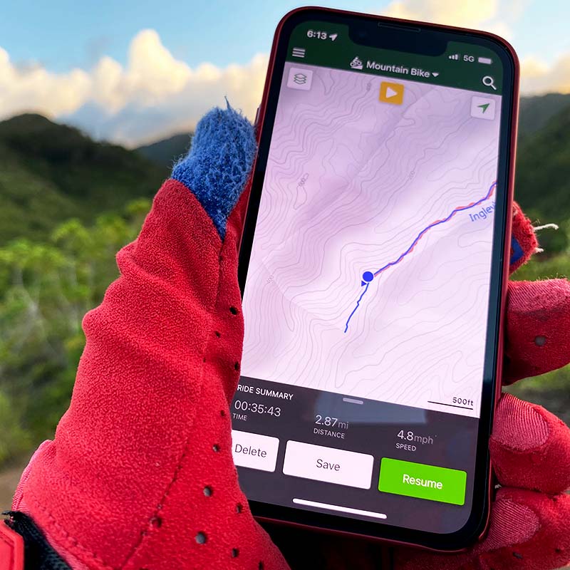
Activity Recording
Recording your ride with the Trailforks app provides many benefits to both you and the community at large.
One of the greatest reasons to use the Trailforks app to record your rides are the navigational benefits. You’ll get access to big, beautiful maps of the area you are riding, along with details on each trail. Never again get lost or climb a trail that would have been more fun riding down!
In addition to having detailed information about hundreds of thousands of trails at your fingertips while you ride, rides recorded with the Trailforks apps automatically generate Ridelogs for you. And unlike rides synced with Strava or Garmin that are sent to the end of a que with tens of thousands of Ridelogs ahead of them, your Ridelogs recorded with the Trailforks App are instantly available for you to view and use.
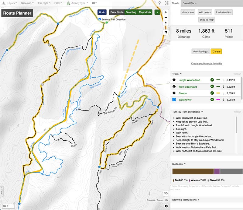
Route Planner
The Trailforks route planner strives to be the best and most flexible route planner for biking, hiking and other outdoor sports. All using the trail data currated on Trailforks.
The route planner allows creating a route with a mixture of auto-routing, freehand drawing, uploading a GPX and manually editing GPS points. The route planner also allows you to create an entire custom map for your route with POIs, polygons, lines and colored sections. It then generates turn-by-turn directions, surface type breakdown, trail list, snapping of messy GPS traces to the trails and more!
The Trailforks route planner is unique compared to other route creation tools in that it's not solely based on OSM data and allows you to create a route anywhere on the map quickly using a variety of methods.
Trail Funding
As a Trail Funder, supporting your local cycling community means they in turn will support you. Your funding immediately makes you a big part of a local trail mapping project and promotes your business as a supporter of something that not only benefits society in general, but also boosts your local economy. Your money goes towards preserving the trails we all love to ride by making the following possible: trail maintenance and safety, trail conditions reporting, trail GPS data acquisition, local trail building & events.

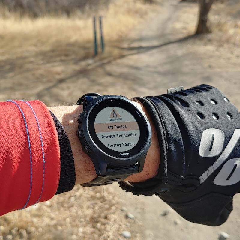
Trailforks for Garmin Devices
Trailforks partnered with Garmin to integrate Trailforks data into a custom MTB map & features on select Garmin Edge devices.
You can install the free Trailforks app on supported Garmin Edge & watch devices.
Downloadable, customer Garmin basemaps that represent a mashup of OpenStreetMap data overlayed with Trailforks trails and some useful POIs (Parking, TTF, and Bike Shops).
Service Tracker
Bike & gear service tracker with service interval reminders to log your bike maintenance and service history.
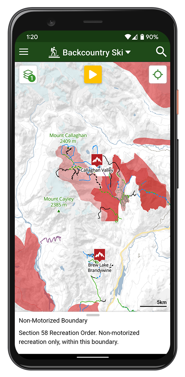
Backcountry Skiing Map & Planning App
Trailforks is dedicated to giving you the best interactive trail maps, custom designed for your selected activity.
We might have started out as a mountain biking platform, but has since expanded to an array of sports that utilize trails. Backcountry skiing or ski touring is one of them. Enjoy all the Trailforks website and app features along with the features below, which are particularly useful for backcountry ski adventures.
Several features geared towards Backcountry Skiing include an avalanche risk layer on our map, closure and danger zone polygons, mapped trails and points of interest, an avalanche forecase, slope layer, snow forecase and many more!