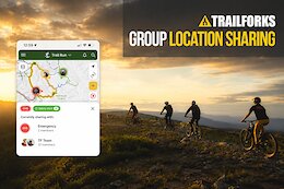
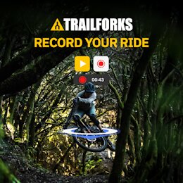
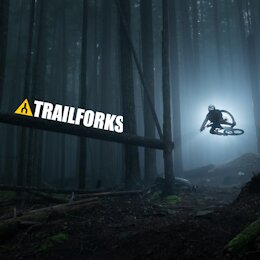
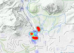
 Trailforks Launches Group Location Sharing - Track Your Crew & Stay Safe On Trail
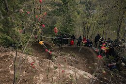
The new 2026 update lets you track your crew in real-time, manage high school league practices, and monitor battery levels directly on the map.
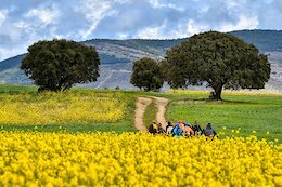
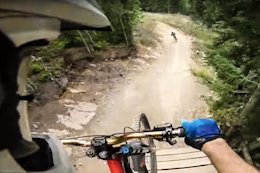
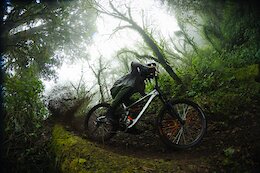 Jungle Loam & Desert Descents: Inside the Into The Gnar Oaxaca Expedition
Jungle loam, desert surfing, and Michelin-star meals - Holly Duncan joins Yoann Barelli and Nate Spitz for a week of cultural immersion in Mexico.
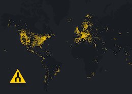
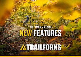
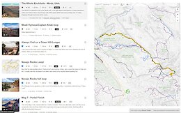 Trailforks 2024-2025 Product Development Updates
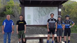
  The Yukon: Land of the Midnight Fun
Mountain biking the Yukon: deep loam, no lines and the days never end.
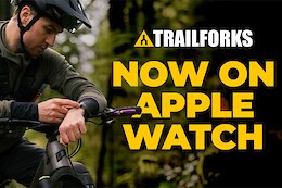 Trailforks Now Available On Apple Watch
We’ve heard your number one request loud and clear: “Give us an Apple Watch app!
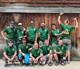 2025 Spanish Trailforks Admins Meetup
 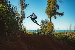 Trail of the Month: Flowjob - Tuscany, Italy
It's called Flowjob, you sickos.
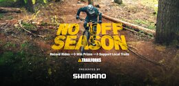 No Off Season? Prove It With The Latest Trailforks Challenge
Ride your bike, win some prizes.
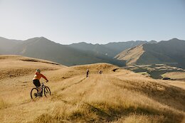 Trail of the Month: Baywatch - Wanaka, New Zealand
Those views are just ridiculously nice.
 What Pump Tracks Really Do For The Riding Community
Pump tracks are the unsung heroes of MTB. Change our mind.
 Changes to Strava Activities Synced to Trailforks
 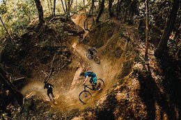 Trail of the Month: Canyon in Massa Marittima, Italy
A natural canyon with buttery-like flow, wide banked turns to rail, and wide open stretches.
 Win the Trip of a Lifetime with the Schwalbe 'Unlock the Trail' 30-Day Riding Challenge
See how many days in the 30-day period you can ride your bike!
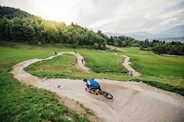 Trail of the Month: Flowgartner - Austria
Nothing like a good flow trail.
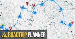
 How to Get the Most Out of Your Next MTB Road Trip Using Trailforks
Use the Trailforks Road Trip Planner to make sure you don't miss the best riding areas on your next trip.
 Trailforks Trail of the Month: Deliverance - Squamish, BC
This old-school steep and deep trail, recently got a new-school makeover.
 Spanish Trailforks Admins Meetup
 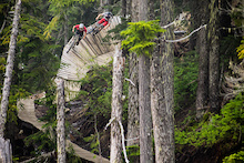 Trailforks Feature: Wallrides from Around the World
Wallrides can be found on trails in every corner of the globe and each location offers its own twist on the classic feature.
 Trailforks Trail of the Month: Coronet DH - Queenstown, NZ
Take a closer look at the iconic trail.
 Your Guide to Viewing the Great North American Eclipse
  Trailforks Introduces New 'Traildar' Feature
Map based proximity alerts that give you audio and haptic as you get closer.
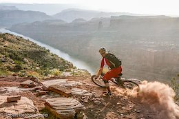 Trailforks Trail of the Month: Porcupine Rim, Utah
Red rock towering around you, endless desert landscapes, and the promise of an epic ride ahead.
 Trailforks Trail of the Month: Old Ghost Road, NZ
We're taking you to the North West corner of the South Island of New Zealand.
 Podcast: What Does A Trailforks Ambassador Do?
An overview of the main features, on how the approach works on the platform and what regular users can do to improve the maps.
 Trailforks Year in Review: 2023
 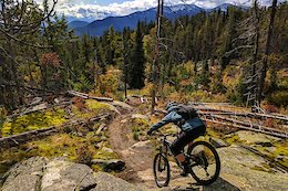 The Top 10 Highest Rated MTB Trails on Trailforks in 2023
These are the trails that Trailforks users gave the most stars to in 2023.
 Trailforks 2023 Development Updates
The Trailforks team has been hard at work in 2023, adding new features and refinements along with bug fixes.
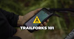 Trailforks 101 Video
  Win the Trip of a Lifetime with the Schwalbe Tacky Chan 30-Day Riding Challenge
Two grand prizes of a trip to Oakridge, Oregon with Trans Cascadia Excursions are up for grabs, along with a bunch of tires!
 A note from Trevor May, the founder of Trailforks
 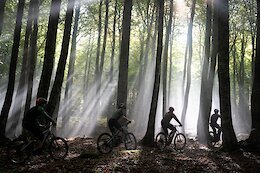 Eremua, redefining flow between huge beech and oak groves trees
 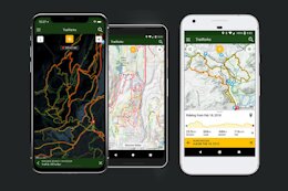 How To: Submit A Trail Report From The Trailforks App
or your computer, if you're old school.
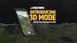 Trailforks Releases 3D Maps
Visualize climbs, descents, and everything in between more easily than ever before.
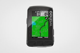 Wahoo Announces Trailforks Integration
The mapping app is now available in their ELEMNT range of GPS bike computers.
 Castejón de Sos: perfect destination for the thrill seeker in Spain
  Auto Track Your Summits in Trailforks
 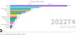 Spain growth on Trailforks: kudos to regional admins and users
 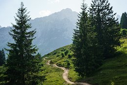 Trailforks Update: Shoulder Season Trail Condition Features
We want to highlight some key features so riders can find the best trail conditions in the shoulder season.
 How to Start Building Mountain Bike Trails
If the tools are calling your name, RSVP for that volunteer trail day and read this.
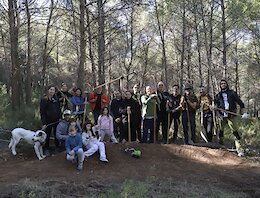 Biketrails Valencia: How We Build Trails
  Trailforks Update: Trail Condition Reporting & New Features
We've added some new features to help riders quickly see which trails are ready to ride.
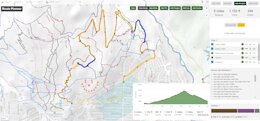
Trailforks Introduces National Scenic Trails
Trailforks now has a feature that made it easy to document and visualize the iconic routes of loosely connected trails.
 New Trailforks Map Layers
Introducing new feature to help you plan your next adventure.
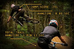 Trailforks Now Provides Garmin Jump Stats
Trailforks now displays information to show how much you are jumping, and helps inform riders about the jump-ability of any trail.
 Announcing The New Trailforks Route Planner
 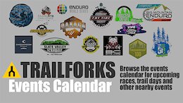 Have you added your upcoming event to the Trailforks Events Calendar yet?
 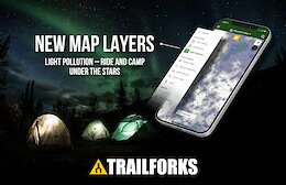 Introducing New Map Layers
  Top Five Reasons Why Trail Submissions Are Rejected
  Trailforks: Did you know? Home Page Activity Feed
  Riding in Spain: Val d'Aran
 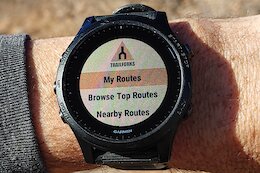 Trailforks Now on Garmin Wearables
Trailforks CIQ app now works on the Garmin wearables like the Forerunner and Fenix watches.
Check out the article about some of the useful features when following a route with a watch.
Check out the article about some of the useful features when following a route with a watch.
 Trailforks Winter Challenge
  Trailforks Introduces Paid Trailforks Pro Option
Trail mapping app Trailforks is introducing a paid option in order to continue improving its mapping and trail management capabilities.
 Prize Winners Announced: Over $145,000 Raised During Trail Karma Month
It's never too late to donate to your local trail association.
Over $16,000 Worth of Prizes to be Won During Trail Karma Month
Trail associations need your help more than ever to maintain the trails for you.
 Trailforks Hits 3 Big Milestones & Updates on New Features, Including Multi-Activity Support
2019 was a huge year for Trailforks. Here are some of the highlights.
 Pinkbike & Trailforks Continue Partnership With Sea Otter Classic Through 2023
We've entered a 4-year agreement through 2023 with the Sea Otter Classic as the Official Media and Mapping Partner of the event.
 2019 Trailforks Awards: Advocate of the Year Winners
These five groups are going above and beyond when it comes to protecting, investing and advocating for public spaces and trails we choose to recreate on.
 Trailforks 30-Day Ride Challenge Prize Winners & Recap
We have an official winner for the 30 Day Ride Challenge. Drum roll please...
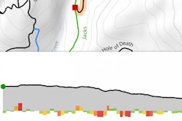 Trailforks Introduces Trail Grade Visualization
This new Trailforks App feature shows a rider the characteristics of a trail. At a glance know if there are punchy climbs, steep sections or hike-a-bike uphills on a trail.
 Trailforks Website Maps Switch to Mapbox
2018 Trailforks Awards: Advocate of the Year Winners
Trailforks Website Maps Switch to Mapbox
2018 Trailforks Awards: Advocate of the Year Winners
Who deserves particular attention for their efforts to improve our riding and our world? Here's our short list.
 A Complete List of 2018 Trailforks Website & App Updates
The Trailforks crew has been hard at work this year and there have been a MASSIVE number of changes to the website, app, and backend. They're all listed here.
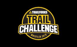 Win Big With the Whistler Trailforks Trail Challenge
Explore Whistler’s trail network and record your rides on Trailforks for your chance to win!
 Win a Trip For 2 to the 2019 UCI Mountain Bike World Championships in Mont-Sainte-Anne
Enter the Emily Batty MSA Challenge presented by Red Bull to win a trip to the 2019 UCI Mountain Bike World Championships in Mont-Sainte-Anne, Quebec.
 Trailforks Partners With Whistler Brewing to Give Back to the Trails
We've partnered with Whistler Brewing to create a hazy, juicy, summer crusher, the "Hazy Trail Pale Ale," just in time for Crankworx Whistler. Join us at our launch event on August 1st in Whistler!
 Find All Your Favourite MTB YouTube Channels in the New Trailforks Directory
Trailforks has a new directory that compiles all of your favourite mountain bike YouTube content in one spot. It's also integrated into the app, and videos from YouTube channels are prioritized when you're exploring for a new spot to ride.
 Trailforks Now Available on Garmin Edge Devices
Leave the phone in your pocket. Trailforks now available on Garmin Edge handle bar mounted devices.
 Free Camping on Bike Trips & Other Advanced Trailforks Features
Land owner overlay, historical heatmaps, ride start heatmaps, auto-direction, and print maps. Tools that we make that help trail associations make and maintain great trail networks.
 Building an Army of Official Trail Reporters
 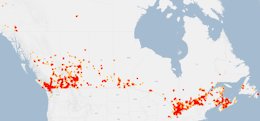 Top 10 Ridden Canadian Cities of Summer 2017
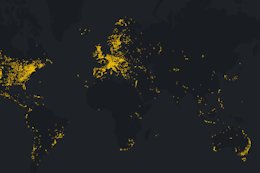
Utilizing the data collected from the Trailforks ridelog we have the top ten riding locations in Canada.
 Trailforks Printable Maps
You can now generate high dpi printable maps for events, kiosks, trail signage.
Using the new Trailforks Print Maps Interface, users are able to select various map layers and produce large scale maps in both screen and printer friendly output formats
Using the new Trailforks Print Maps Interface, users are able to select various map layers and produce large scale maps in both screen and printer friendly output formats
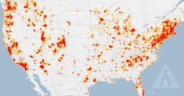 Top 10 Ridden US Biking Destinations in July
We looked at the data for the month of July to see what were the most popular riding areas for the Month of July.
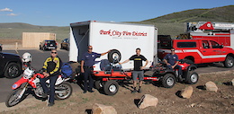 Success Story: Trailforks Search and Rescue
Trailforks benefits Search and Rescue crew. Read more about it here.
 Trailforks App Big Spring Update
GPS Tracking, Strava segment overlay, Event section, Popular routes, US Landowner overlay, Map filtering, Comments, and much more.
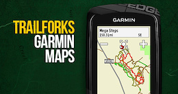 Trailforks Basemap for Garmin
You can now use Trailforks in conjunction with your Garmin using the new Trailforks Garmin Basemap. Currently in its first release, we're busy working on new features and are keen to get user feedback. Full details inside.
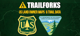 US Land Owner Data on Trailforks
The guys from Trailforks have been splicing an dicing various shapefiles from a variety of sources to build its land owner polygon database.
 Trailforks Tutorial: Adding Builder Details to a Trail
In this latest Trailforks tutorial, we take you through how to add trail builder details to a trail, allowing you to find a professional trail builder and look at their past projects.
 Trailforks Tutorial: Road Trip Planner
Plan a mountain biking road trip using this tool and discover the best riding areas, trails & events along your route.
Trailforks Tutorial: Viewing and Mapping Winter Trails
Following on with the winter theme, this latest installment of Trailforks Tutorials takes you through how to map and view all-season and winter only trails.
Trailforks Tutorial: Closing Trails for the Winter
Don't want people riding certain trails in winter or want to let riders know about the conditions? Check out how to close an entire riding area using the Bulk Trail Report tool in our latest Trailforks tutorial.
 Trailforks Trail of the Month: Kitchen Sink
When you name a trail Kitchen Sink, then you'd better have every type of feature on it.
Trailforks Tutorial: Adding Brands to a Bike Shop Listing
Are you wanting to know what your local shop sells or are you the local shop and you want riders to know what brands that you carry? This Trailforks Tutorial is for you.
Trailforks Tutorial: Adding to the Directory
The Pinkbike/Trailforks Directory is a massive collection of bike shops, club, trail associations, professional builders, guiding outfits, and race organizers and they are all at your finger tips.
Trailforks Tutorial: Planning a Ride with the Ride Planner
With our Ride Planner feature, you can prepare a route ahead of time and save it for future rides.
Trailforks App Anniversary Update
It's been one year since the launch of the Trailforks app and we've recently released a new app update and have a range of new features to follow.
Trailforks Tutorial: Find that "Must Ride" Trail
Rolling into a new zone and wondering which trail is a must ride? Well, the Trailforks app can help.
Trailforks Tutorial: Adding a Trail Report
You're about to go riding and want to know what shape the trails are in, you check the reports. When you are done riding, please add one for the next riders.
Trailforks Tutorial: Syncing Strava Rides
Want to know how to connect Trailforks to Strava to import your rides? We've created this handy guide so you can use Trailforks to view your ride logs, track your rides, and check out your personal statistics.
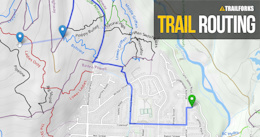 Trailforks Routing Along Roads
You can now route a trail to include roads and work along OpenStreetMap roads near trails on the Trailforks database.
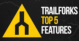 Top 5 Trailforks Features
Trailforks Tutorial: Adding a Route to Your Trailforks App
Top 5 Trailforks Features
Trailforks Tutorial: Adding a Route to Your Trailforks App
Learn how to add a routes found on Trailfork to the App on your Smartphone.
 Trailforks Trail of the Month: El Ciclón
This month we venture to Costa Rica to find out more about the Los Senderos de Colón Bike Park and its newest downhill trail, El Ciclón.
 Front Lines: Klamath Trails Alliance
We are big fans of the riding in Oregon and it's exciting to see a new area like this putting in the time to make some more quality trails for all to enjoy.