


more stats
1.3 miles
Distance
34 ft
Climb
-469 ft
Descent
00:16:34
Avg time
-435 ft
Altitude change
786 ft
Altitude min
1,252 ft
Altitude max
1,231 ft
Altitude start
797 ft
Altitude end
-6.3%
Grade
-43.4%
Grade max
9.9%
Grade min
778 ft
Distance climb
1 mile
Distance down
564 ft
Distance flat
00:16:34
Avg time

Val Nava Details

  • Activities
    • Mountain Bike
    • E-Bike
    • Hike
    • Trail Running
  • Riding Area
    Finale Outdoor Region
    Finale Ligure
  • Ref Number
    #132
  • AKA
    Boragni
  • Difficulty Rating
  • Voted Difficulty
    Blue (4 votes)
  • Local Popularity
    65 in Mountain Biking [+]
    • 60 in E-Biking
    • 80 in Trail Running
    • 5 in Hiking
  • Global Ranking
    #32192 in Mountain Biking [+]
    • #32214 in E-Biking
    • #64327 in Trail Running
    • #41216 in Hiking
  • Hiking SAC Scale
    T1 Hiking
  • Trail Type
    Singletrack
  • Bike Type
    AM, XC
  • Direction
    One Direction
    Popular Direction Shown
  • Climb Difficulty
    Blue
  • Physical Rating
    Moderate
  • Trail Visibility
    Sometimes hard to follow
  • Season
    All-year round
  • Dogs Allowed
    Yes
  • eBike Allowed
    Yes up to Class 1

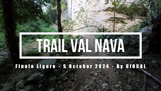
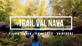
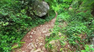
Val Nava is a trail used both by riders and climbers. Given it rides on a ridge in the woods just above the town Orco, it gets really close to some climbing walls. It is divided in 2 different parts, being the first quite flowy and undulating and the second rockier and more technical. It is pretty easy to gain speed on this trail and paying attention and care to hikers and climbers is vital.

source: ...
Access Info

The trails of the Orco-Vezzi area are best reachable either by bike from Nato Base or from the town of Orco.
Getting to Nato Base: reachable from the E80 highway accessing Orco Feglino, then drive north on the SP23 until the windmills under the Base.

Getting to Orco: reachable from the E80 highway accessing Orco Feglino, then drive south on the SP27 and then on the Via Provinciale Regione Brea.

Disclaimer

This gravel road is highly frequented by hikers and climbers. Be careful, respect and give hikers priority on the trail-usage. Given its nature, the trail can change after weather happenings and season changes. Always pay attention.

Trail Supporters
Local Trail Association

Recent Activity on Trail

Past Week
  • 1 rides
  • 40.7 km average
6 Months
  • 67 rides
  • 36.6 km avg distance
All
  • 395 rides
  • Last: Sep 14, 2026
c1c2c3c4
January
February
March
April
May
June
July
August
September
October
November
December
Status:
on May 14, 2026
Ideal
Avg: 4.16 (33 votes)
Your vote: 0

view (1,831)
close
      Directions to val-nava trailhead (44.221550, 8.344820)

      Photos

      9 more »
      mtb
      85 |
      Mar 6, 2024 @ 7:59am
      Mar 6, 2024
      mtb
      87 |
      Mar 6, 2024 @ 7:59am
      Mar 6, 2024
      mtb
      93 |
      Feb 23, 2024 @ 10:26am
      Feb 23, 2024
      mtb
      96 |
      Jul 18, 2023 @ 11:39pm
      Jul 18, 2023

      Videos

      4 more »
      Finale Ligure eMTBing - Trail Val Nava
      ebike
      8:49 | 308 | Oct 25, 2024 , Finale Ligure
      Finale Ligure eMTBing - Trail Val Nava
      ebike
      7:08 | 392 | Apr 10, 2023 , Finale Ligure
      Finale Ligure solo eMTBing - Val Nava tour
      ebike
      14:24 | 352 | May 22, 2022 , Finale Ligure

      Routes with this trail

      30 miles 4,567 ft 9 Shuttled
      percorso con partenza dal melogno volto al rollercoaster + basenato +ludi+val nava+ca du puncin + ponti...
      32 miles 5,093 ft 10 Point to Point
      discesa in ebike con rientro in shuttle al melogno, sui trail più belli di finale
      3.0 24 miles 3,586 ft 31
      Will ride that route in may 19.
      4.2
      33 Ratings
      5 45%
      4 36%
      3 15%
      2
      1 3%

      10 Reviews & Comments

      GiMe GiMe
      Für einen blauen Trail relativ anspruchsvoll mit verblockten Stellen
      zocknroll zocknroll
      Would add only this to the other comments - it looks like a path that has been there for a long time. Very nice for riding though! Hikers use this trail also, be carefull!
      matkoar matkoar
      easy in the top, bottom really cool. one of the nicer trails I rode in finale.

      We hope you've been enjoying Trailforks!

      Create a FREE account to view all trail reviews and much more.

      • By finaleoutdoorregion FOR & contributors
      • #94830 - 6,045 views

      Frequently Asked Questions

      Where is Val Nava located?
      Val Nava is located in Finale Outdoor Region, Finale Ligure, Italy. It is part of the Finale Outdoor Region trail network. The trailhead is located at coordinates 44.22155, 8.34482.
      How hard is Val Nava?
      Val Nava is rated as Blue difficulty. The physical rating is Moderate. The average grade is 6.3%. The climb difficulty is rated Blue.
      What is the elevation gain for Val Nava?
      Val Nava has 34 ft of elevation gain. The trail has 469 ft of elevation descent. The elevation ranges from 786 ft to 1,252 ft.
      Is Val Nava a point to point trail?
      Yes, Val Nava is a point to point trail. The direction is One Direction. The trail type is singletrack.
      How long is Val Nava?
      Val Nava is 1.3 miles long. The trail type is singletrack.
      Are dogs allowed on Val Nava?
      Yes, dogs are allowed on Val Nava. Please keep dogs on a leash where required and clean up after them.
      When is the best time of year to ride Val Nava?
      Based on activity log data, the most popular months to ride Val Nava are:
      • May (45 activities)
      • October (44 activities)
      • April (31 activities)
      Check the reports page for current trail conditions.
      How do I access Val Nava? Where is the closest parking trailhead?
      The closest parking and trailhead locations to Val Nava are: View all parking locations in the area.
      How long does it take to ride Val Nava?
      Based on recorded activities, it takes an average of 16 minutes to ride Val Nava. The trail is 1.3 miles long. Actual times will vary based on fitness level, conditions, and pace. View recent activity logs for more details.
      How busy is Val Nava?
      Val Nava is a moderately popular trail. There have been 1,892 recorded activities on this trail. The trail has received 1,831 check-ins. View recent activity on this trail.

      Hit the Trail

      Open in App

      Get this trail on your phone instantly.

      open trail in app

      Download Trail

      Save to wishlist, Garmin & download.
      save the trail

      Find Related Routes

      Find routes and users activities that include this trail.
      find routes for this trail

      You must enter a description before submitting.