


more stats
1,119 ft
Distance
-96 ft
Descent
00:01:04
Avg time
-96 ft
Altitude change
1,317 ft
Altitude min
1,413 ft
Altitude max
1,413 ft
Altitude start
1,319 ft
Altitude end
-8.6%
Grade
-16.3%
Grade max
-2%
Grade min
1,070 ft
Distance down
49 ft
Distance flat
00:01:04
Avg time

Skyline Details

  • Activities
    • Mountain Bike
    • E-Bike
  • Riding Area
  • Difficulty Rating
  • Voted Difficulty
    Blue (1 vote)
  • Local Popularity
    100 in Mountain Biking heatmap [+]
    • 100 in E-Biking
  • Global Ranking
    #22786 in Mountain Biking [+]
    • #3626 in E-Biking
  • National Ranking
    #135 in Mountain Biking · Ireland [+]
    • #4 in E-Biking
  • Trail Type
    Singletrack
  • Bike Type
    AM, XC
  • Direction
    Downhill Only
    Popular Direction Shown
  • Climb Difficulty
    Blue
  • Physical Rating
    Easy
  • Trail Visibility
    Always easy to follow
  • Season
    all season
  • eBike Allowed
    Yes up to Class 1
  • TTFs on Trail
    Berm, Jump, Roller Coaster
  • Ride in Rain
    Yes
  • Land Owner
    Coillte

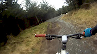
The best well known and flowy trail around. Transformed some couple years ago from a tech trail with the adage of big berms and smooth flowing lines and extended all the way down to the Biking.ie hut.

The surface is firm and hard-packed. On weekends, holidays and good weather days can be crowded with beginner riders.

EDIT: revamped once again in 2025, even better now

Without any doubt is the main trail in Ticknock.

Access Info

www.biking.ie

Tags
BermsFlowyJumpsRollersViews

Recent Activity on Trail

Past Week
  • 12 rides
  • 11 miles average
6 Months
  • 311 rides
  • 11 miles avg distance
All
  • 2,052 rides
  • Last: Nov 15, 2026
c1c2c3c4
January
February
March
April
May
June
July
August
September
October
November
December
Status:
on Nov 5, 2026
Wet
Avg: 4.33 (24 votes)
Your vote: 0

view (18,725)
close
      Directions to skyline-26560 trailhead (53.248090, -6.238400)

      Photos

      5 more »
      mtb
      192 |
      Jan 24, 2021 @ 4:46pm
      Jan 24, 2021
      mtb
      273 |
      Jan 24, 2021 @ 4:46pm
      Jan 24, 2021
      mtb
      188 |
      Jan 24, 2021 @ 4:46pm
      Jan 24, 2021
      mtb
      917 |
      Jun 26, 2013 @ 3:26pm
      Jun 26, 2013

      Videos

      4 more »
      Mountain Bike Road Trip Through Ireland
      mtb
      12:45 | 496 | Jan 13, 2024 , Dublin
      Follow cam, ElYari following Tommy Magnenat
      mtb
      5:54 | 1304 | May 26, 2019 , Dublin
      Ticknock Mountain, Ireland
      mtb
      3:10 | 764 | Apr 16, 2019 , Dublin
      Kom Training on Metro 1
      mtb
      4:08 | 969 | Mar 3, 2013 , Dublin

      Routes with this trail

      more »
      ★ 5.0 • 5 miles • 774 ft • 5 • Loop •
      Ticknock Colette Loop, waymarked route.
      ★ 4.0 • 30 miles • 4,746 ft • 12 • Loop •
      Medium difficulty route from Ticknock to near Djouce Woods, a mix of trails, access roads and asphalt
      10 miles • 2,089 ft • 5 • Loop •
      Wednesday Nighttime spin for winter training and a social pint afterwards in Blue Light!
      4.4 ★★★★★
      24 Ratings
      5 ★ 67%
      4 ★ 21%
      3 ★ 4%
      2 ★ 4%
      1 ★ 4%

      2 Reviews & Comments

      Bianoboy
      Completed on non-suspension Gravel Bike. 38c on front; 40c on back. Easy fun! Fast and flowy. Some rock features, but most have a line through for non-suspension. Not major drops. 100% Gravel Rideable.

      We hope you've been enjoying Trailforks!

      Create a FREE account to view all trail reviews and much more.

      • By IronJockey & contributors
      • #26560 - 9,843 views

      Frequently Asked Questions

      ▼ Where is Skyline located?
      Skyline is located in Ticknock National Mountain Bike Trail Centre, Dublin, Ireland. It is part of the Ticknock National Mountain Bike Trail Centre trail network. The trailhead is located at coordinates 53.24809, -6.2384.
      ▼ How hard is Skyline?
      Skyline is rated as Red difficulty. The physical rating is Easy. The average grade is 8.6%. The climb difficulty is rated Blue.
      ▼ What is the elevation gain for Skyline?
      The trail has 96 ft of elevation descent. The elevation ranges from 1,317 ft to 1,413 ft.
      ▼ Is Skyline a point to point trail?
      Yes, Skyline is a point to point trail. The direction is Downhill Only. The trail type is singletrack.
      ▼ How long is Skyline?
      Skyline is 1,119 ft long. The trail type is singletrack.
      ▼ Are dogs allowed on Skyline?
      There is no information about dogs being allowed on Skyline. Check with local trail managers or the trail page for the latest access rules.
      ▼ When is the best time of year to ride Skyline?
      Based on activity log data, the most popular months to ride Skyline are:
      • October (130 activities)
      • June (117 activities)
      • May (116 activities)
      Check the reports page for current trail conditions.
      ▼ How do I access Skyline? Where is the closest parking trailhead?
      The closest parking and trailhead locations to Skyline are: View all parking locations in the area.
      ▼ How long does it take to ride Skyline?
      Based on recorded activities, it takes an average of 1 minute to ride Skyline. The trail is 1,119 ft long. Actual times will vary based on fitness level, conditions, and pace. View recent activity logs for more details.
      ▼ How busy is Skyline?
      Skyline is a very popular trail. There have been 16,544 recorded activities on this trail. The trail has received 18,725 check-ins. View recent activity on this trail.

      Hit the Trail

      Open in App

      Get this trail on your phone instantly.

      open trail in app

      Download Trail

      Save to wishlist, Garmin & download.
      save the trail

      Find Related Routes

      Find routes and users activities that include this trail.
      find routes for this trail

      You must enter a description before submitting.

