
more stats
1.1 miles
Distance
108 ft
Climb
-62 ft
Descent
00:11:49
Avg time
46 ft
Altitude change
269 ft
Altitude min
339 ft
Altitude max
269 ft
Altitude start
315 ft
Altitude end
0.8%
Grade
-10.4%
Grade max
14%
Grade min
2,638 ft
Distance climb
2,051 ft
Distance down
1,004 ft
Distance flat
00:11:49
Avg time

MORE Fun West Details

  • Activities
    • Mountain Bike
    • Winter Fat Bike
    • Hike
    • Trail Running
  • Riding Area
    Patapsco Valley State Park
    Ellicott City, Maryland
  • Difficulty Rating
  • Local Popularity
    90 in Mountain Biking heatmap [+]
    • 60 in Trail Running
    • 55 in Hiking
    • 5 in Winter Fat Biking
  • Global Ranking
    #65681 in Mountain Biking [+]
    • #139798 in Trail Running
    • #146708 in Hiking
    • #6690 in Winter Fat Biking
  • State Ranking
    #353 in Mountain Biking · Maryland [+]
    • #857 in Trail Running
    • #1,088 in Hiking
    • #46 in Winter Fat Biking
  • Hiking SAC Scale
    T1 Hiking
  • Trail Type
    Singletrack
  • Bike Type
    AM, XC, Fat
  • Direction
    Both Directions
  • Climb Difficulty
    Black Diamond
  • Physical Rating
    Moderate
  • Family Friendly
    Yes
  • Dogs Allowed
    Yes
  • eBike Allowed
  • TTFs on Trail
    Rock Garden

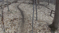
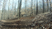
Fun little trail from Woodstock Road to the Davis Trail. If you are going south, the first few tenths of a mile are really rocky. Its tricky but not impossible. There are no horses on this trail and on both sides there is a very clear sign that says hiker and biker use only. So unlike he rest of Patapsco there's no horse poo

Disclaimer

No Horses!

Tags
Family friendlyRock gardens

Local Trail Association

Traditionally Indigenous Territory

Recent Activity on Trail

Past Week
  • 6 rides
  • 13 miles average
6 Months
  • 163 rides
  • 14 miles avg distance
All
  • 1,332 rides
  • Last: Nov 21, 2026
c1c2c3c4
January
February
March
April
May
June
July
August
September
October
November
December
update trails status or condition

MORE Fun West Trail Reports

Status:
on Nov 11, 2026
Ideal
Avg: 3.84 (1 votes)
Your vote: 0

view (6,400)
close
      Directions to more-fun-west trailhead (39.332640, -76.867500)

      Photos

      19 more »
      mtb
      50 |
      May 2, 2026 @ 1:05pm
      May 2, 2026
      mtb
      81 |
      Sep 7, 2020 @ 3:52pm
      Sep 7, 2020
      mtb
      100 |
      Sep 7, 2020 @ 3:52pm
      Sep 7, 2020
      mtb
      84 |
      Sep 7, 2020 @ 3:52pm
      Sep 7, 2020

      Videos

      4 more »
      Cranky Monkey MTB Race 2014 Pt. II
      mtb
      4:50 | 230 | Mar 25, 2014 , Ellicott City
      rebooting new feature
      mtb
      0:32 | 192 | Feb 25, 2013 , Ellicott City
      reboot
      mtb
      0:43 | 79 | Feb 25, 2013 , Ellicott City
      Wildcat
      mtb
      2:09 | 226 | Apr 15, 2011 , Ellicott City

      Routes with this trail

      more »
      ★ 3.5 • 14 miles • 927 ft • 3 •
      Start the ride from the trailhead in the corner of the parking lot by the church/day school. These trails...
      54 miles • 5,613 ft • 31 • Loop •
      50 mile ride going north on the Baltimore Country Thru Trail and south on the Howard County Thru Trail....
      ★ 1.0 • 15 miles • 1,506 ft • 12 • Loop •
      Start at St Alphonsus Church, quarry trail, chevrolet, woodstock, more fun, four by, lower through, little...
      3.0 ★★★★★
      1 Ratings
      5 ★
      4 ★
      3 ★ 100%
      2 ★
      1 ★

      1 Review & Comments

      AWDkqOK
      Closed but not closed. This is purpose-built mountain bike trail that is very fun to ride in either direction. About 2/3 of the way through (S-N) there is a bridge over a small gorge that is not rated for horses but can certainly take bikes. That caused PVSP to close the trail. It still gets plenty of bike traffic though and my memory is that it was always closed to horses. Either way, embrace your inner rebel and ride it either direction.

      We hope you've been enjoying Trailforks!

      Create a FREE account to view all trail reviews and much more.

      • By Moglie & contributors
      • #89190 - 2,088 views

      Frequently Asked Questions

      ▼ Where is MORE Fun West located?
      MORE Fun West is located in Patapsco Valley State Park, Ellicott City, Maryland, United States. It is part of the Patapsco Valley State Park trail network. The trailhead is located at coordinates 39.33264, -76.8675.
      ▼ How hard is MORE Fun West?
      MORE Fun West is rated as Blue difficulty. The physical rating is Moderate. The average grade is 0.8%. The climb difficulty is rated Black Diamond.
      ▼ What is the elevation gain for MORE Fun West?
      MORE Fun West has 108 ft of elevation gain. The trail has 62 ft of elevation descent. The elevation ranges from 269 ft to 339 ft.
      ▼ Is MORE Fun West a point to point trail?
      MORE Fun West is not a point to point trail. The direction is Both Directions. The trail type is singletrack.
      ▼ How long is MORE Fun West?
      MORE Fun West is 1.1 miles long. The trail type is singletrack.
      ▼ Are dogs allowed on MORE Fun West?
      Yes, dogs are allowed on MORE Fun West. Please keep dogs on a leash where required and clean up after them.
      ▼ When is the best time of year to ride MORE Fun West?
      Based on activity log data, the most popular months to ride MORE Fun West are:
      • October (82 activities)
      • May (71 activities)
      • April (68 activities)
      Check the reports page for current trail conditions.
      ▼ How do I access MORE Fun West? Where is the closest parking trailhead?
      The closest parking and trailhead locations to MORE Fun West are: View all parking locations in the area.
      ▼ How long does it take to ride MORE Fun West?
      Based on recorded activities, it takes an average of 12 minutes to ride MORE Fun West. The trail is 1.1 miles long. Actual times will vary based on fitness level, conditions, and pace. View recent activity logs for more details.
      ▼ How busy is MORE Fun West?
      MORE Fun West is a very popular trail. There have been 6,006 recorded activities on this trail. The trail has received 6,400 check-ins. View recent activity on this trail.

      Hit the Trail

      Open in App

      Get this trail on your phone instantly.

      open trail in app

      Download Trail

      Save to wishlist, Garmin & download.
      save the trail

      Find Related Routes

      Find routes and users activities that include this trail.
      find routes for this trail

      You must enter a description before submitting.

