Trail Running Mapping & Planning App
Download Trailforks App
Trailforks is your ultimate resource for interactive trail maps, designed to enhance your trail running adventures.
Even though Trailforks was originally created for mountain biking, it now now offers support for a wide range of outdoor activities, including trail running. Explore everything Trailforks has to offer, from its robust website to its feature-packed app, with tools and insights designed to make your trail run unforgettable.
Plan Your Trail Run
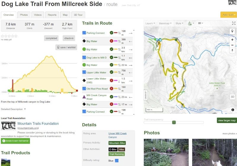
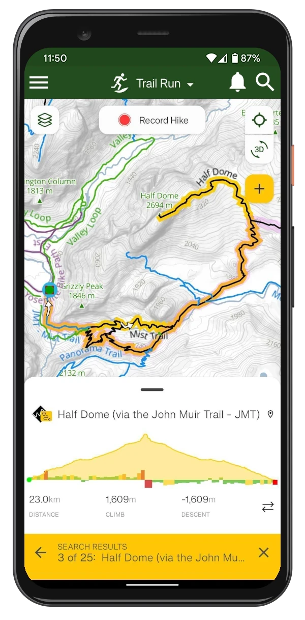
View existing Routes linking popular trails, or use our custom Route Planner to draw your own loop over any of the many layers and sync it to the app for offline use.
Pace Splits & Best Efforts
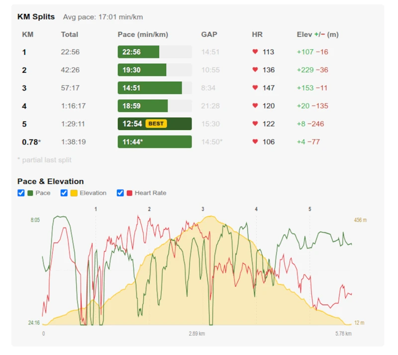
Analyze your performance with detailed kilometer splits showing your pace, grade adjusted pace, heart rate and elevation gain/loss for each segment. The Pace & Elevation chart plots it all against the terrain.
The Best Efforts table highlights your best time for each standard running distance, found anywhere in your run.
Heart Rate Zones
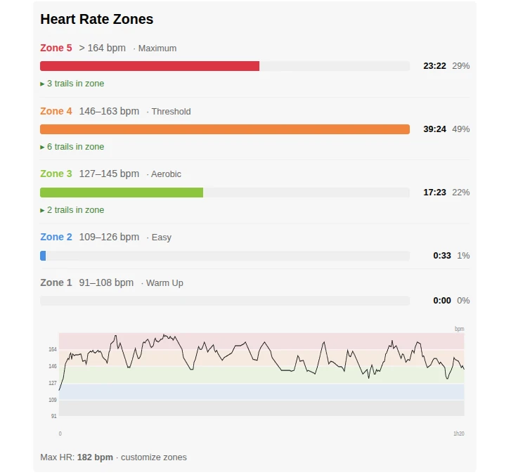
See how much time you spent in each heart rate zone during your run, from easy recovery efforts to maximum intensity.
Use your zone breakdown to gauge training load and confirm your effort matched your goals for the day. You can also see trails in each HR zone.
Trail Leaderboards & Badges
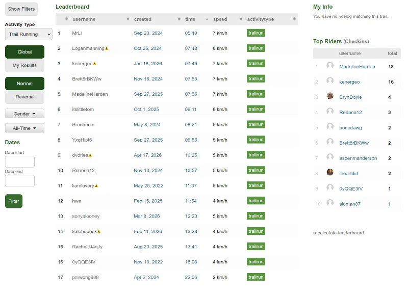
Every trail has a leaderboard where you can compare your time and speed against other runners. Filter by activity type, direction, gender, or date range to find the results that matter to you.
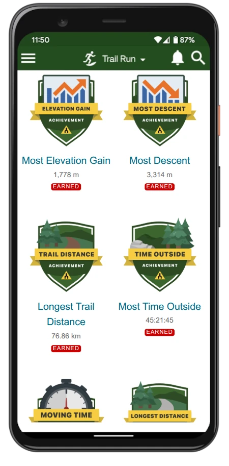
Earn badges for completing trails, reaching milestones, and achieving personal bests.
Activity Lines
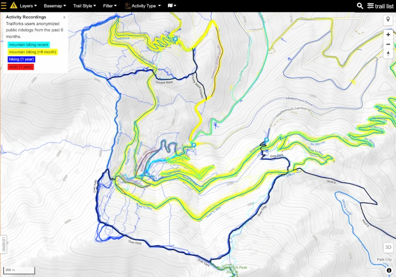
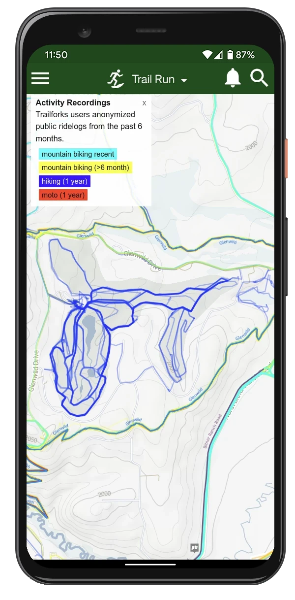
Check the recent activity on the trails and routes in the area and view the conditions reported by other Trailforks users.
Different colors represent different activities, which lets you find trails with heavy MTB traffic — you may want to avoid those trails as a runner.
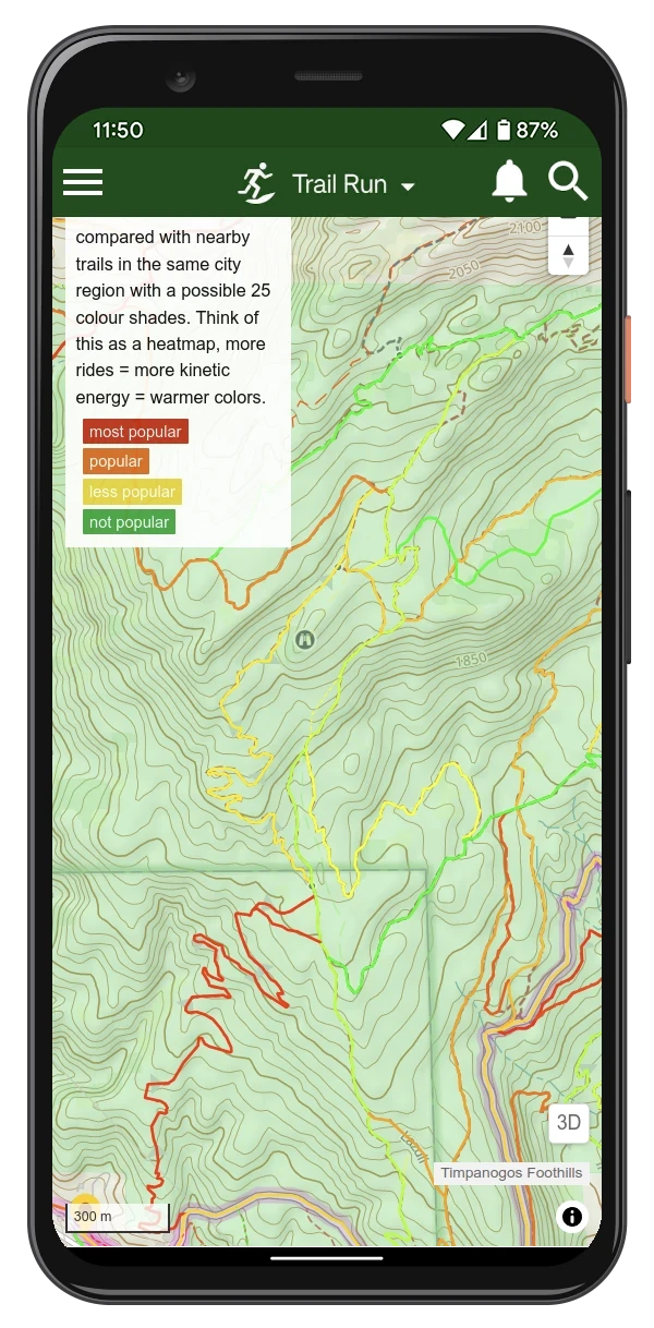
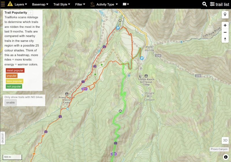
Trail Popularity
We analyze recorded trail running activities and compare them with nearby trails to identify the most popular routes and trails for runners.
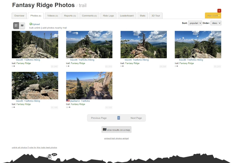
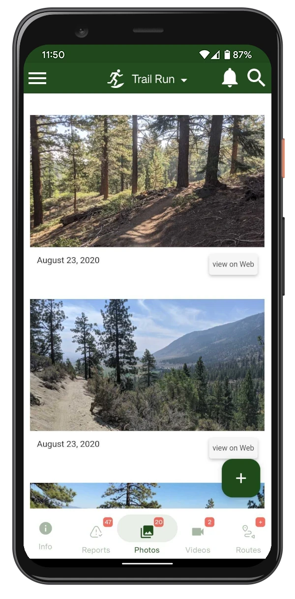
Trail Photos
Capture your own adventure photos or explore the latest ones shared by other users.
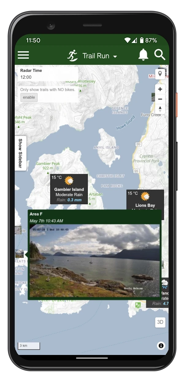
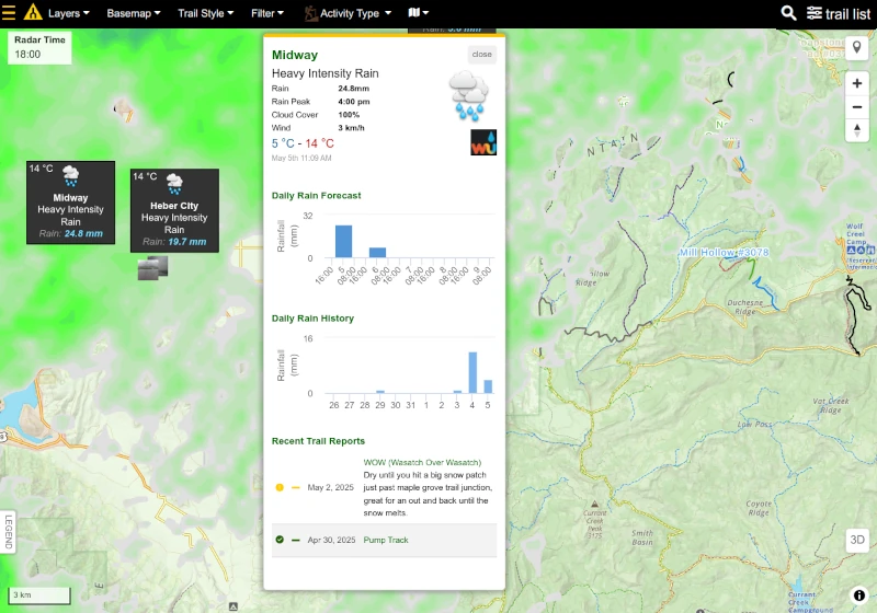
Weather Forecast Layers
Trailforks has several different weather layers that allow you to check past, current and forecasted weather We also offer webcams, air quality, precipitation and other weather data.
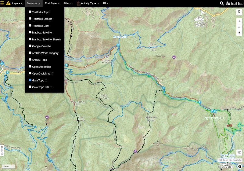
Gaia Basemap
Gaia GPS topo basemap is based on OSM data, with styled inspired by USGS topo maps.
We actively scan our trails and match it with the US Forest Service Trails database.
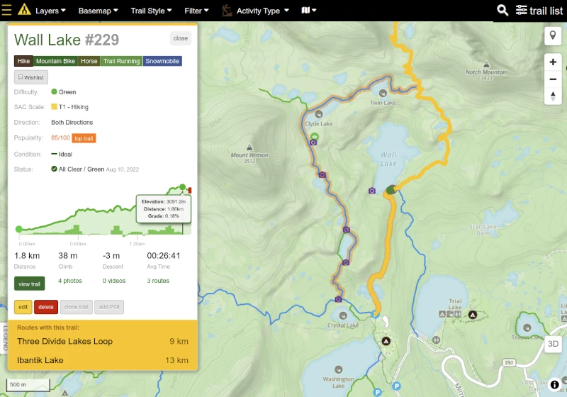
Top Trails
Find Top Trails in the area you are visiting, or view the most popular trails in the world.
Trail Reports & Conditions
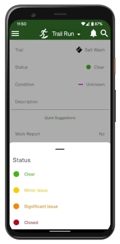
Explore the latest trail reports shared by other Trailforks users to check current trail conditions, statuses, and photos.
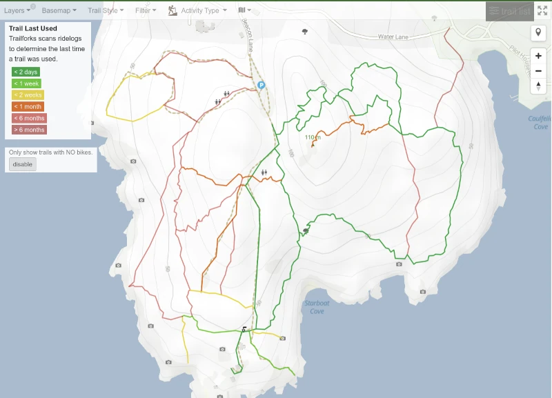
The "Last Used" Trail Style feature shows the most recent time a trail was used.
Wildfires & Smoke Layers
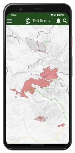
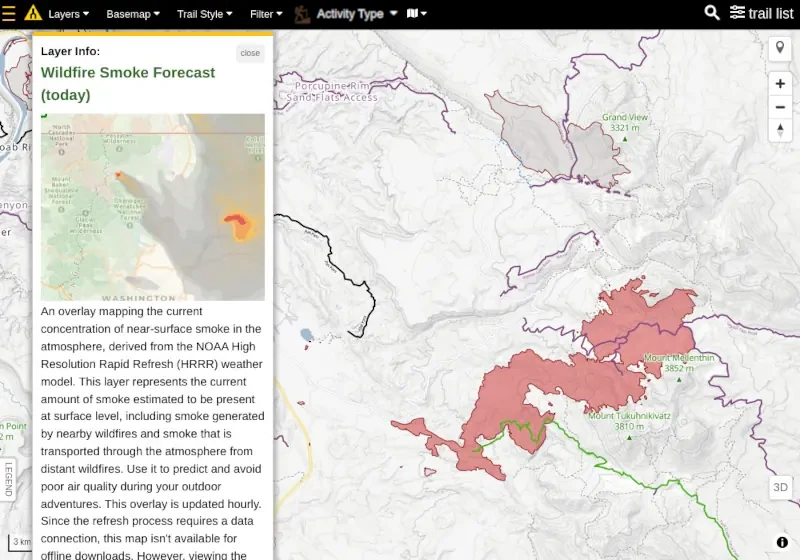
Stay informed by tracking Wildfire and Smoke zones, along with Current and Forecasted Air Quality map layers.
Plan Your Next
Trail Run
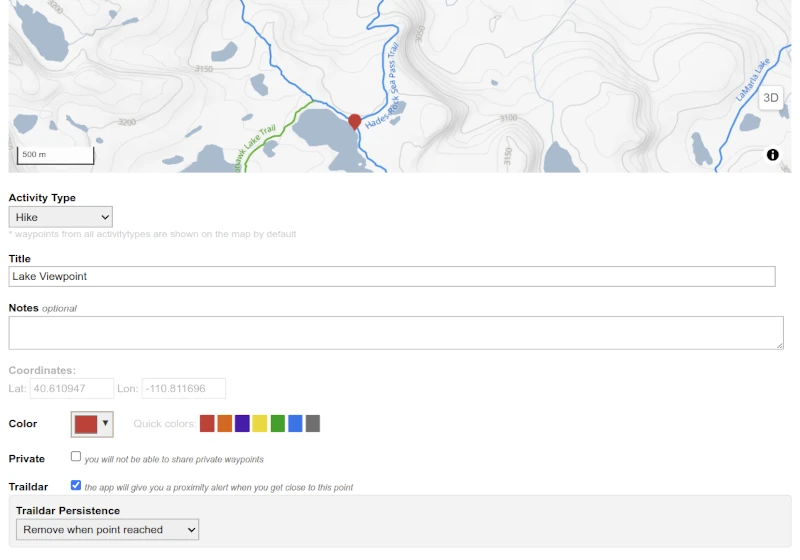
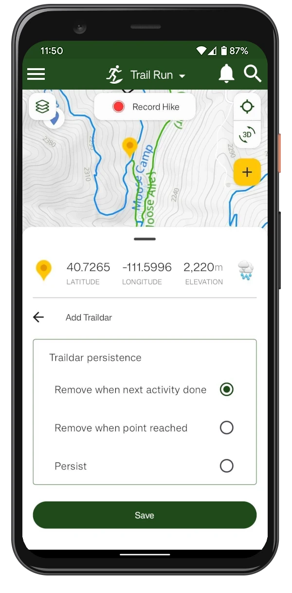
Traildar
Points of Interest like trailheads, intersections or viewpoint can be marked on the map using Trailforks Traildar feature.
You will get a notification when you are near the marked point.
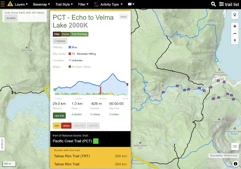
Foot-traffic only trails
Filter trails with no bikes allowed, or see the full network of multi-use trails.
Each trail in our database has a list of supported activities, and you can filter the map to only show activities you are looking for.
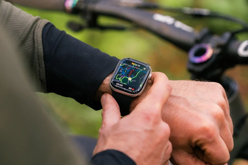
Smartwatch Support
Trailforks offers native support for Apple Watch and selected Garmin devices.
Sync the routes and trails to the watch and have it always available on your wrist.
Trail directions
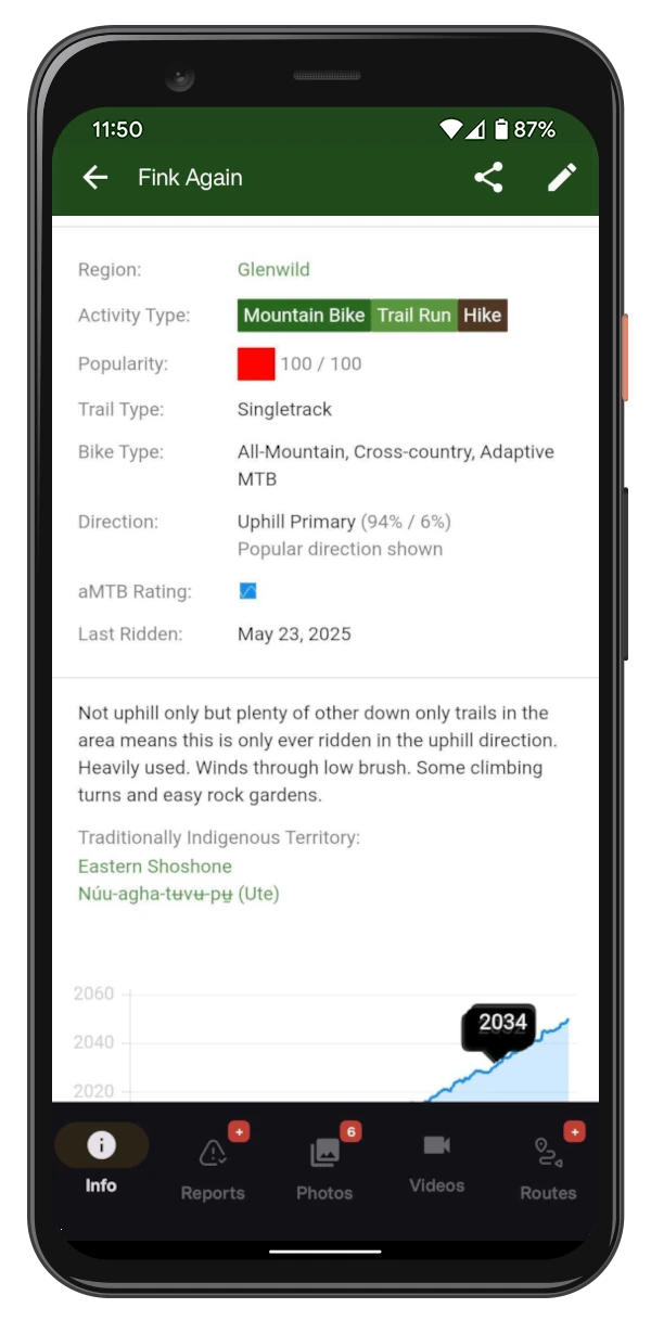
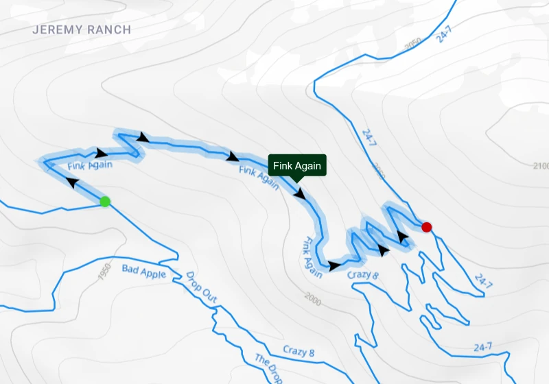
For multi-use trails where mountain bikes are present, you can see an intended trail direction on the map as well as the exact percentage of actual traffic direction.
This will help you to plan your run and avoid trails that are mostly used as a descent by MTB.
Track Your Gear
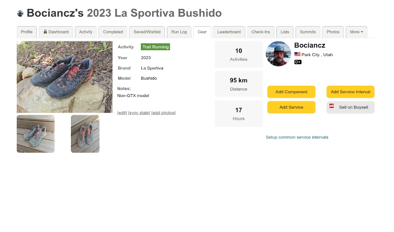
Track your running shoes and gear usage with the Service Tracker. Tag your gear on each activity to automatically update its odometer, and set service interval or replacement reminders based on distance, time or activity count.
Plan on The Website
Use the App out on the trails!
Trail Running Events
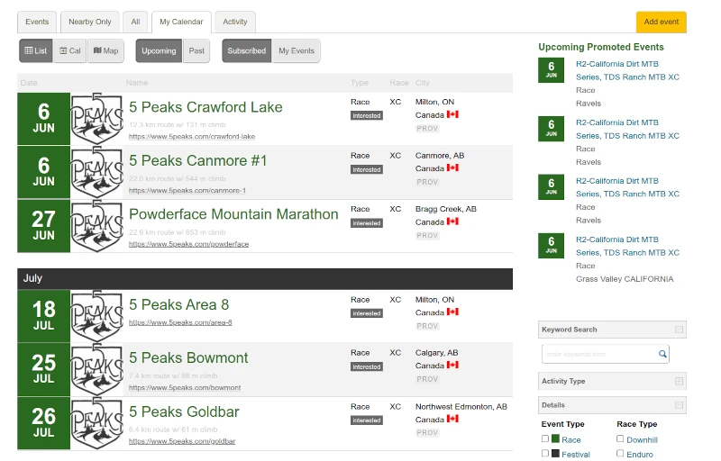
Browse upcoming trail running races and events in the Trailforks Events Calendar. Find local fun runs, ultras and organized races near you or wherever you're traveling.
Event organizers can add their races to the calendar and link them to the exact trails and routes on the map.
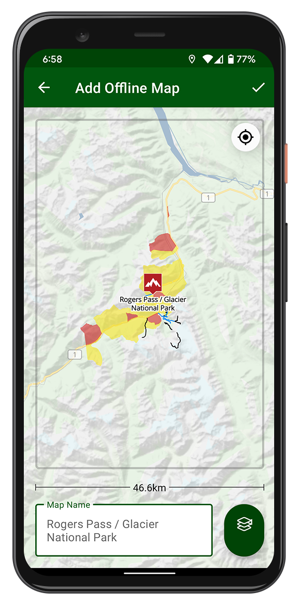
Offline Maps & Layers
All the trails, POIs, polygons and your routes are stored offline. The GPS on your phone works offline, even with no network connection. You can even download the basemap tiles and some other layers for offline use.
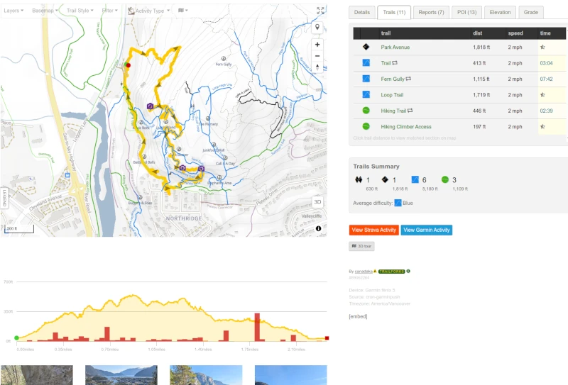
Record and Share Your Workouts
Keep track of all your workouts using the Trailforks app on your phone, or use your Garmin or Apple Watch. Share your runs with your friends and the Trailforks community, or even let them follow you in real time

More Features
- View trail reports with status and conditions
- Discover popular and official scenic routes
- List Routes for a specific trail
- Share a pin of your current location
- Personal Waypoints
- Compass Direction
- Foot-traffic Only trails
- US Land Owner Overlay
- Trail photos and videos
Get More With Outside+
- All the Trailforks Pro functionality
- Gaia GPS Premium
- Unlimited access across the Outside Network
- Live Event Coverage, Films and Series
- Expert Tutorials, Travel Discounts