-
DateSunday February 26, 2017 at
10:30am to 3:30pm MST
past event -
TypeRaceFatbike
-
ActivitiesMountain Bike
-
LocationHappy Creek Canada
-
Route
-
Email
-
Website
-
Facebook
-
RegistrationOpen Paid
-
Organizer
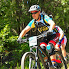
First Annual Hinton Growler Fat Bike Endurance Race
Expert Class, Novice Class, Women's Class and Children Class (1 lap for age 12 and under)
You will have 3 hours to complete as many laps as you can. There is an option to do a half pint ( 1.5 hours )
Race to be ran on groomed trails. Trophies and prizes will be handed out following the main event .
Pre-registration will be open January 2, 2017..The link will be posted here.
Place: Maxwell Lake ( Hinton,AB)
Time: 10:30- 4:00
Entry Fee- TBA
Itinerary:
10:30 AM- Registration Begins at Maxwell Lake
11:00 AM- Fat Bike Demo's
12:00 PM- Rider Meeting
12:15 PM- Kids Race
1:00 PM - Main Event
This is a FAT BIKE ONLY event. Tires must be 3" wide or more and studs are permitted
WATCH THIS PAGE FOR MORE INFO
- www.bikepirate.com
Comments
-
+ 1
 HMBA
HMBA Feb 2, 2017 at 8:48
HMBA
HMBA Feb 2, 2017 at 8:48
 napsack
Dec 20, 2016 at 22:28
napsack
Dec 20, 2016 at 22:28
-
- Signup Link
- Download
- Subscribe
-
118interested
-
24going
Event Photos


Route
-
Growler Race Route
close-
Layers w
- Weather Layers
- Pro
- Pro
- Pro
- Pro
- Pro
- Pro
- More Layers
- Pro
- Pro
- Pro
- Pro
-
Upgrade to

3DTrail Conditions- Unknown
- Snow Groomed
- Snow Packed
- Snow Covered
- Snow Cover Partial
- Freeze/thaw Cycle
- Icy
- Prevalent Mud
- Wet
- Variable
- Ideal
- Dry
- Very Dry
Trail Flow (Ridden Direction)Trailforks scans users ridelogs to determine the most popular direction each trail is ridden. A good flowing trail network will have most trails flowing in a single direction according to their intension.
The colour categories are based on what percentage of riders are riding a trail in its intended direction.- > 96%
- > 90%
- > 80%
- > 70%
- > 50%
- < 50%
- bi-directional trail
- no data
Trail Last RiddenTrailforks scans ridelogs to determine the last time a trail was ridden.- < 2 days
- < 1 week
- < 2 weeks
- < 1 month
- < 6 months
- > 6 months
Trail Ridden DirectionThe intended direction a trail should be ridden.- Downhill Only
- Downhill Primary
- Both Directions
- Uphill Primary
- Uphill Only
- One Direction
Contribute DetailsColors indicate trail is missing specified detail.- Description
- Photos
- Description & Photos
- Videos
Trail Popularity ?Trailforks scans ridelogs to determine which trails are ridden the most in the last 9 months. Trails are compared with nearby trails in the same city region with a possible 25 colour shades. Think of this as a heatmap, more rides = more kinetic energy = warmer colors.- most popular
- popular
- less popular
- not popular
ATV/ORV/OHV FilterMax Vehicle WidthinchesUS Cell CoverageLegend
Radar TimeActivity RecordingsTrailforks uses anonymized public activity data. ?Activity RecordingsTrailforks uses anonymized public activity data. ?Personal Heatmap▶ Activity Typesall / none▶ Options2Date range month–Winter TrailsWarning A routing network for winter maps does not exist. Selecting trails using the winter trails layer has been disabled.Missing TrailsMost PopularLeast PopularTrails are colored based on popularity. The more popular a trail is, the more red. Less popular trails trend towards green.Jump Magnitude HeatmapHeatmap of where riders jump on trails. Zoom in to see individual jumps, click circles to view jump details.BC Backroad Status
Service Road Atlas is a free to use, community-driven service for viewing and creating reports on the numerous back-country service roads around B.C. and Alberta.
![map legend]() Slope AspectDirection the slope facesTrails DeemphasizedTrails are shown in grey.Only show trails with no bike usage.Suggested LayersBased on selected activity type
Slope AspectDirection the slope facesTrails DeemphasizedTrails are shown in grey.Only show trails with no bike usage.Suggested LayersBased on selected activity typeSave the current map location and zoom level as your default home location whenever this page is loaded.
SaveTrail transparency- Singletrack
3.4 milesDistance171 ftClimb-172 ftDescent3,561 ftHigh Point-2 ftAltitude change3,475 ftAltitude min3,507 ftAltitude start3,504 ftAltitude end-11.8%Grade max9.9%Grade min1 mileDistance climb1 mileDistance down4,075 ftDistance flat -
