#6 CONCEPCION - Montenbaik Enduro Series by Banco Bice 2019
Race Details:

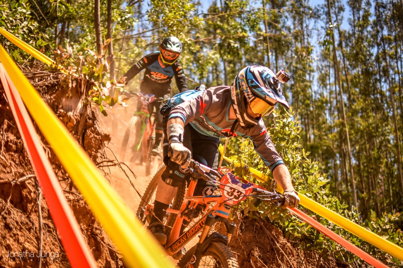
Ahora nuestro norte apunta hacia el sur: Concepción ¡Por fin volvemos a la tierra de Guga Un destino que habíamos extrañado y que no nos ve pedalear desde 2016.

La cita es este 7 y 8 de septiembre en el Fundo el Venado, un clásico penquista. Tenemos ganas de encontrarnos con la comunidad de endureros de Concepción y compartir el gusto por pedalear entre los árboles. ¡Qué buen nivel de mtb que tienen en la octava región!

Las pistas que nos esperan son cortas pero muy intensas. El clima del sur, siempre impredecible, será sin duda un punto a favor para los locales y un nuevo desafío para los afuerinos.

Comments


Login or Sign Up to Comment

Routes

  • Enduro1 Concepcion MES2019

    close
    3D
    Trail Conditions
    • Unknown
    • Snow Groomed
    • Snow Packed
    • Snow Covered
    • Snow Cover Inadequate
    • Freeze/thaw Cycle
    • Icy
    • Prevalent Mud
    • Wet
    • Variable
    • Ideal
    • Dry
    • Very Dry
    Trail Flow (Ridden Direction)
    Trailforks scans users ridelogs to determine the most popular direction each trail is ridden. A good flowing trail network will have most trails flowing in a single direction according to their intension.
    The colour categories are based on what percentage of riders are riding a trail in its intended direction.
    • > 96%
    • > 90%
    • > 80%
    • > 70%
    • > 50%
    • < 50%
    • bi-directional trail
    • no data
    Trail Last Ridden
    Trailforks scans ridelogs to determine the last time a trail was ridden.
    • < 2 days
    • < 1 week
    • < 2 weeks
    • < 1 month
    • < 6 months
    • > 6 months
    Trail Ridden Direction
    The intended direction a trail should be ridden.
    • Downhill Only
    • Downhill Primary
    • Both Directions
    • Uphill Primary
    • Uphill Only
    • One Direction
    Contribute Details
    Colors indicate trail is missing specified detail.
    • Description
    • Photos
    • Description & Photos
    • Videos
    Trail Popularity ?
    Trailforks scans ridelogs to determine which trails are ridden the most in the last 9 months. Trails are compared with nearby trails in the same city region with a possible 25 colour shades. Think of this as a heatmap, more rides = more kinetic energy = warmer colors.
    • most popular
    • popular
    • less popular
    • not popular
    ATV/ORV/OHV Filter
    Max Vehicle Width
    inches

    Radar Time
    x Activity Recordings
    Trailforks users anonymized public ridelogs from the past 6 months.
    • mountain biking recent
    • mountain biking (>6 month)
    • hiking (1 year)
    • moto (1 year)
    Activity Recordings
    Trailforks users anonymized public skilogs from the past 12 months.
    • Downhill Ski
    • Backcountry Ski
    • Nordic Ski
    • Snowmobile
    Jump Magnitude Heatmap
    Heatmap of where riders jump on trails. Zoom in to see individual jumps, click circles to view jump details.
    Trails Deemphasized
    Trails are shown in grey.
    disable
    Only show trails with NO bikes.
    enable

    Save the current map location and zoom level as your default home location whenever this page is loaded.

    Save
    Trail transparency
    17.3 miles
    Distance
    4,724 ft
    Climb
    -4,702 ft
    Descent
    944 ft
    High Point

    Enduro2 Concepcion MES2019

    11.6 miles
    Distance
    3,187 ft
    Climb
    -3,165 ft
    Descent
    891 ft
    High Point
  • By jonathaj MB
  • #4244 - 1,299 views
Audience: world unapproved
[flag]