
-
DateThursday October 5, 2023toSunday October 8, 2023
past event -
TypeRaceDownhill
-
ActivitiesMountain Bike
-
Location
-
Website
-
RegistrationQualification

-
Organizer
-
Series


Race Details:

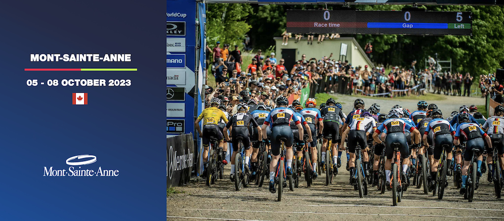
Mont-Sainte-Anne (MSA) is the venue with the longest Mountain Bike World Cup history. Since 1998, the UCI Mountain Bike World Cup has been a must-attend event in Canada, welcoming the cream of the international crop to crown the ultimate Downhill and Cross-country champions in a festive gathering full of action and activity.
In October 2023, Mont-Sainte-Anne will host its 28th UCI Mountain Bike World Cup and celebrate its 31st year of UCI events. Year after year, it is with the same enthusiasm that the organisers, about five hundred volunteers, numerous trusted partners and tens of thousands of visitors warmly welcome the UCI World Cup athletes and their teams.
The Downhill and Cross-country tracks are amongst mountain bike racing’s most revered monuments and have played host to some of its biggest moments over the years. As bike technology and rider skill levels continue to progress there remain few tests tougher than found in MSA.
Located 45 minutes from downtown Quebec City and three and a half hours from Montreal, Mont-Sainte-Anne is recognised worldwide as a mountain biking destination, both for its downhill and cross-country infrastructures. With 40km of downhill and free-ride trails and 125 km of forest trails, downhill and cross-country lovers will find Mont-Sainte-Anne to be a challenge
Overlooking the majestic Saint-Lawrence River, Mont-Sainte-Anne is also a splendid playground for all outdoor sports fans, in both summer and winter.
Event Supporters:







Comments
Commenting is disabled for past events.
-
- Download
- Subscribe
-
1interested
-
6going
close
3D
Trail Conditions
- Unknown
- Snow Groomed
- Snow Packed
- Snow Covered
- Snow Cover Partial
- Freeze/thaw Cycle
- Icy
- Prevalent Mud
- Wet
- Variable
- Ideal
- Dry
- Very Dry
Trail Flow (Ridden Direction)
Trailforks scans users activity logs to determine the most popular direction each trail is ridden. A good flowing trail network will have most trails flowing in a single direction according to their intension.
The colour categories are based on what percentage of users are riding a trail in its intended direction.
The colour categories are based on what percentage of users are riding a trail in its intended direction.
- > 96%
- > 90%
- > 80%
- > 70%
- > 50%
- < 50%
- bi-directional trail
- no data
Trail Last Used
Trailforks scans activity logs to determine the last time a trail was ridden.
- < 2 days
- < 1 week
- < 2 weeks
- < 1 month
- < 6 months
- > 6 months
Trail Ridden Direction
The intended direction a trail should be ridden.
- Downhill Only
- Downhill Primary
- Both Directions
- Uphill Primary
- Uphill Only
- One Direction
Contribute Details
Colors indicate trail is missing specified detail.
- Description
- Photos
- Description & Photos
- Videos
Trail Popularity ?
Trailforks scans activity logs to determine which trails are ridden the most in the last 9 months.
Trails are compared with nearby trails in the same city region with a possible 25 colour shades.
Think of this as a heatmap, more activities = more kinetic energy = warmer colors.
- most popular
- popular
- less popular
- not popular
ATV/ORV/OHV Filter
Max Vehicle Width
inches
US Cell Coverage
Legend

Radar Time
Activity Recordings
Trailforks uses anonymized public activity data.
?
Activity Recordings
Trailforks uses anonymized public activity data.
?
Winter Trails
Warning
A routing network for winter maps does not exist. Selecting trails using the winter trails layer has been disabled.
Missing Trails
Most Popular
Least Popular
Trails are colored based on popularity. The more popular a trail is, the more red. Less popular trails trend towards green.
Jump Magnitude Heatmap
Heatmap of where users jump on trails. Zoom in to see individual jumps, click circles to view jump details.
BC Backroad Status
![map legend]()
Service Road Atlas is a free to use, community-driven service for viewing and creating reports on the numerous back-country service roads around B.C. and Alberta.

Slope Aspect
Direction the slope faces
Trails Deemphasized
Trails are shown in grey.
Only show trails with no bike usage.
Suggested Layers
Based on selected activity type
Save the current map location and zoom level as your default home location whenever this page is loaded.
Save
 La Buckland
