CTP main singletrack trails. Most double tracks and roads are excluded.
- Mountain Bike
Login to see your progress towards riding all the trails and routes in this list.
Trails
| title | riding area | rating | distance | completed | |||
|---|---|---|---|---|---|---|---|
| 1 | 3rd Entrance | 1,145 ft | |||||
| 2 | Bypass | 748 ft | |||||
| 3 | Cliff Section 1 | 856 ft | |||||
| 4 | Cliff View | 1,332 ft | |||||
| 5 | Dazed & Confused | 1,991 ft | |||||
| 6 | Devil's Spine | 443 ft | |||||
| 7 | Dondi's Dip | 679 ft | |||||
| 8 | Down N Out | 479 ft | |||||
| 9 | Down-n-Out DH | 719 ft | |||||
| 10 | Dynamite Loop | 1,297 ft | |||||
| 11 | Former Blue Trail | 623 ft | |||||
| 12 | French Connection | 610 ft | |||||
| 13 | Hamburger Hill | 1,100 ft | |||||
| 14 | Hell N Back | 2,713 ft | |||||
| 15 | Hiking | 846 ft | |||||
| 16 | Junk in the Trunk | 1,706 ft | |||||
| 17 | Le Chute | 705 ft | |||||
| 18 | Lower Pasta | 1,575 ft | |||||
| 19 | Mr. Twisty | 2,221 ft | |||||
| 20 | New Middle Climb | 1,755 ft | |||||
| 21 | Northern Pass | 627 ft | |||||
| 22 | NP Connector | 568 ft | |||||
| 23 | Pasta Loop | 1 mile | |||||
| 24 | Pine Point | 876 ft | |||||
| 25 | Pine Point Extension | 1,401 ft | |||||
| 26 | Rabbit Run | 2,862 ft | |||||
| 27 | Shelter Cove Section 1 | 1,594 ft | |||||
| 28 | Singletrack #1 | 4,056 ft | |||||
| 29 | Singletrack #2 | 2,852 ft | |||||
| 30 | The Ridge | 2,087 ft | |||||
| 31 | Top of the World/King of the Hill | 1,111 ft | |||||
| 32 | Twister Sister | 1,404 ft | |||||
| 33 | Zig Zag | 673 ft | |||||
| 34 | Zoot Chute, Roller Coaster (Doubletrack) | 256 ft |
Displaying 34
Videos
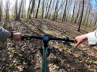
0:39 |
189 |
May 12, 2020
0:10 |
1803 |
Oct 27, 2010

0:35 |
307 |
Sep 21, 2011
Recent Trail Reports
| status | trail | date | condition | |
|---|---|---|---|---|
| Singletrack #1 | Jun 1, 2026 @ 12:00pm (America/New_York) Jun 1, 2026 | view | ||
| The Ridge | Dec 3, 2025 @ 9:48am (America/New_York) Dec 3, 2025 | view | ||
| Mr. Twisty | Oct 27, 2025 @ 12:45pm (America/New_York) Oct 27, 2025 | view | ||
| NP Connector | Oct 27, 2025 @ 12:45pm (America/New_York) Oct 27, 2025 | view | ||
| Le Chute | Oct 27, 2025 @ 12:45pm (America/New_York) Oct 27, 2025 | view |
Total Trails
34
Total Distance
9 miles
Total Descent
-1,001 ft
Total Climb
1,079 ft
close
-
Layers w
- Weather Layers
- Pro
- Pro
- Pro
- Pro
- Pro
- Pro
- More Layers
- Pro
- Pro
- Pro
- Pro
-
Upgrade to

3D
Trail Conditions
- Unknown
- Snow Groomed
- Snow Packed
- Snow Covered
- Snow Cover Partial
- Freeze/thaw Cycle
- Icy
- Prevalent Mud
- Wet
- Variable
- Ideal
- Dry
- Very Dry
Trail Flow (Ridden Direction)
Trailforks scans users ridelogs to determine the most popular direction each trail is ridden. A good flowing trail network will have most trails flowing in a single direction according to their intension.
The colour categories are based on what percentage of riders are riding a trail in its intended direction.
The colour categories are based on what percentage of riders are riding a trail in its intended direction.
- > 96%
- > 90%
- > 80%
- > 70%
- > 50%
- < 50%
- bi-directional trail
- no data
Trail Last Ridden
Trailforks scans ridelogs to determine the last time a trail was ridden.
- < 2 days
- < 1 week
- < 2 weeks
- < 1 month
- < 6 months
- > 6 months
Trail Ridden Direction
The intended direction a trail should be ridden.
- Downhill Only
- Downhill Primary
- Both Directions
- Uphill Primary
- Uphill Only
- One Direction
Contribute Details
Colors indicate trail is missing specified detail.
- Description
- Photos
- Description & Photos
- Videos
Trail Popularity ?
Trailforks scans ridelogs to determine which trails are ridden the most in the last 9 months.
Trails are compared with nearby trails in the same city region with a possible 25 colour shades.
Think of this as a heatmap, more rides = more kinetic energy = warmer colors.
- most popular
- popular
- less popular
- not popular
ATV/ORV/OHV Filter
Max Vehicle Width
inches
US Cell Coverage
Legend

Radar Time
Activity Recordings
Trailforks uses anonymized public activity data.
?
Activity Recordings
Trailforks uses anonymized public activity data.
?
Personal Heatmap
▶
Activity Types
all
/
none
▶
Options
2
Date range
month
–
Winter Trails
Warning
A routing network for winter maps does not exist. Selecting trails using the winter trails layer has been disabled.
Missing Trails
Most Popular
Least Popular
Trails are colored based on popularity. The more popular a trail is, the more red. Less popular trails trend towards green.
Jump Magnitude Heatmap
Heatmap of where riders jump on trails. Zoom in to see individual jumps, click circles to view jump details.
BC Backroad Status
![map legend]()
Service Road Atlas is a free to use, community-driven service for viewing and creating reports on the numerous back-country service roads around B.C. and Alberta.

Slope Aspect
Direction the slope faces
Trails Deemphasized
Trails are shown in grey.
Only show trails with no bike usage.
Suggested Layers
Based on selected activity type
Save the current map location and zoom level as your default home location whenever this page is loaded.
Save
Trail transparency
Average difficulty
Trails and Routes in List - Distance by Difficulty
Trails and Routes in List - Difficulty Totals
- By Jpmche
 FCTPT
FCTPT - #2075 - 273 views