L’itinéraire VTT La TransVerdon vous propose un voyage de 260 km entre les montagnes alpines du Val d’Allos et Gréoux-les-Bains.
260 Km / D+ 7850 m / D- 9750 m
Elle débute aux sources du Verdon, au col d’Allos, situé à 2247 m.
Résolument complet et technique, le Val d’Allos et la vallée du Haut-Verdon offrent un tracé sportif.
L’effort est récompensé par des sentiers variés, ludiques et des paysages grandioses.
Avec l’entrée dans le Parc naturel régional du Verdon se sont de nouveaux émerveillements
Les montagnes, les lacs et les gorges du Verdon, ponctuent cet itinéraire VTT de pauses baignades bien méritées.
Le parcours VTT TransVerdon se termine par les accotements du plateau de Valensole et les champs de lavande.
L’arrivée se fait au pied du château des Templiers à Gréoux-les-Bains.
///
The TransVerdon MTB route offers you a 260 km journey through the alpine mountains of the Val d’Allos and Gréoux-les-Bains.
260 km / +7,850 m ascent / -9,750 m descent
It starts at the source of the Verdon River, at the Col d’Allos, located at 2,247 m altitude.
Thoroughly challenging and technical, the Val d’Allos and the Haut-Verdon valley present a demanding course.
The effort is rewarded with varied, fun trails and breathtaking landscapes.
As you enter the Verdon Regional Natural Park, new wonders await.
The mountains, lakes, and gorges of the Verdon punctuate the route with well-deserved swimming breaks.
The TransVerdon MTB trail ends on the edges of the Valensole plateau, surrounded by lavender fields.
The finish line is at the foot of the Château des Templiers in Gréoux-les-Bains.
- Mountain Bike
- E-Bike
Login to see your progress towards riding all the trails and routes in this list.
Trails
| title | riding area | rating | distance | completed | |||
|---|---|---|---|---|---|---|---|
| 1 | GR 4 - Chasteuil > Ruines du plateau de Suech | 2 miles | |||||
| 2 | Les Fourches | 3,353 ft | |||||
| 3 | La Traversée Des Baussées | 4 miles | |||||
| 4 | Baisse De Détroit | 2 miles | |||||
| 5 | Lac de Lignin | 4 miles | |||||
| 6 | Bagueton | 2 miles | |||||
| 7 | Serre Long Shortcut | 577 ft | |||||
| 8 | Clot Magnan | 2 miles | |||||
| 9 | Pas Plus Vite Qu'a Fond | 912 ft | |||||
| 10 | Direction Galans | 3,698 ft | |||||
| 11 | Blaron Haut | 3,383 ft | |||||
| 12 | Blaron Bas | 1,821 ft | |||||
| 13 | col de la Baume -> Cheiron | 2,074 ft | |||||
| 14 | Col de Cheiron > La Cebière | 2 miles | |||||
| 15 | Plateau du Suech > Rougon | 2 miles | |||||
| 16 | Voie Romaine Notre Dame | 3 miles | |||||
| 17 | Le Pavillon | 1 mile | |||||
| 18 | Chemin de Payanet | 3 miles |
Displaying 18
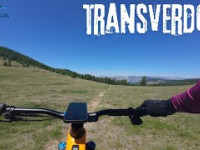
Videos
8:40 |
4 |
Jun 23, 2025
54 |
Jun 19, 2025 , Thorame-Haute
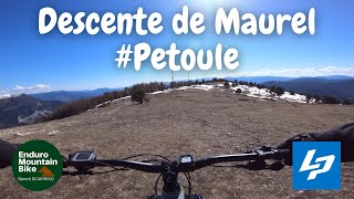
12:01 |
165 |
Jan 8, 2022 , La Mure-Argens
Recent Trail Reports
| status | trail | date | condition | |
|---|---|---|---|---|
| Col de Cheiron > La Cebière | Sep 25, 2025 @ 10:10am (Europe/Paris) Sep 25, 2025 | view | ||
| Serre Long Shortcut | Sep 11, 2025 @ 8:54am Sep 11, 2025 | view | ||
| Baisse De Détroit | Sep 11, 2025 @ 8:54am Sep 11, 2025 | view | ||
| Clot Magnan | May 2, 2025 @ 1:19pm May 2, 2025 | view | ||
| GR 4 - Chasteuil > Ruines du plateau de Suech | Aug 24, 2024 @ 5:12pm Aug 24, 2024 | view |
Total Trails
18
Total Distance
30 miles
Total Descent
-11,784 ft
Total Climb
3,010 ft
close
-
Layers w
- Weather Layers
- Pro
- Pro
- Pro
- Pro
- Pro
- Pro
- More Layers
- Pro
- Pro
- Pro
- Pro
-
Upgrade to

3D
Trail Conditions
- Unknown
- Snow Groomed
- Snow Packed
- Snow Covered
- Snow Cover Partial
- Freeze/thaw Cycle
- Icy
- Prevalent Mud
- Wet
- Variable
- Ideal
- Dry
- Very Dry
Trail Flow (Ridden Direction)
Trailforks scans users ridelogs to determine the most popular direction each trail is ridden. A good flowing trail network will have most trails flowing in a single direction according to their intension.
The colour categories are based on what percentage of riders are riding a trail in its intended direction.
The colour categories are based on what percentage of riders are riding a trail in its intended direction.
- > 96%
- > 90%
- > 80%
- > 70%
- > 50%
- < 50%
- bi-directional trail
- no data
Trail Last Ridden
Trailforks scans ridelogs to determine the last time a trail was ridden.
- < 2 days
- < 1 week
- < 2 weeks
- < 1 month
- < 6 months
- > 6 months
Trail Ridden Direction
The intended direction a trail should be ridden.
- Downhill Only
- Downhill Primary
- Both Directions
- Uphill Primary
- Uphill Only
- One Direction
Contribute Details
Colors indicate trail is missing specified detail.
- Description
- Photos
- Description & Photos
- Videos
Trail Popularity ?
Trailforks scans ridelogs to determine which trails are ridden the most in the last 9 months.
Trails are compared with nearby trails in the same city region with a possible 25 colour shades.
Think of this as a heatmap, more rides = more kinetic energy = warmer colors.
- most popular
- popular
- less popular
- not popular
ATV/ORV/OHV Filter
Max Vehicle Width
inches
US Cell Coverage
Legend

Radar Time
Activity Recordings
Trailforks uses anonymized public activity data.
?
Activity Recordings
Trailforks uses anonymized public activity data.
?
Personal Heatmap
▶
Activity Types
all
/
none
▶
Options
2
Date range
month
–
Winter Trails
Warning
A routing network for winter maps does not exist. Selecting trails using the winter trails layer has been disabled.
Missing Trails
Most Popular
Least Popular
Trails are colored based on popularity. The more popular a trail is, the more red. Less popular trails trend towards green.
Jump Magnitude Heatmap
Heatmap of where riders jump on trails. Zoom in to see individual jumps, click circles to view jump details.
BC Backroad Status
![map legend]()
Service Road Atlas is a free to use, community-driven service for viewing and creating reports on the numerous back-country service roads around B.C. and Alberta.

Slope Aspect
Direction the slope faces
Trails Deemphasized
Trails are shown in grey.
Only show trails with no bike usage.
Suggested Layers
Based on selected activity type
Save the current map location and zoom level as your default home location whenever this page is loaded.
Save
Trail transparency
This official route list of trails is not complete
Average difficulty
Associated Route
Trails and Routes in List - Distance by Difficulty
Trails and Routes in List - Difficulty Totals
- By tomzaniroli
 TRAILFORKS TFFRANCE
 - #2137 - 309 views