The quality of maintenance varies year by year; these are the trails that are supposed to be maintained for hiking/biking. You can check with the main office to confirm which ones have been maintained at the time of your visit.
All the other trails are primarily snowmobile trails that receive little to no summer maintenance. They can all be explored (I've done so myself), though you should expect mud and/or ponds, tall grass, raspberry/blackberry bushes, and possibly downed trees.
All the other trails are primarily snowmobile trails that receive little to no summer maintenance. They can all be explored (I've done so myself), though you should expect mud and/or ponds, tall grass, raspberry/blackberry bushes, and possibly downed trees.
- Mountain Bike
- E-Bike
- Hike
- Trail Running
Login to see your progress towards riding all the trails and routes in this list.
Trails
Displaying 85
Videos
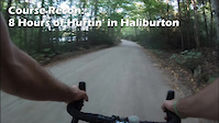
5:00 |
240 |
Oct 24, 2020
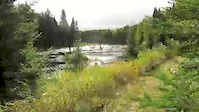
0:40 |
977 |
Dec 17, 2015
Recent Trail Reports
| status | trail | date | condition | |
|---|---|---|---|---|
| Wild Woods Walk (Bottom Side) | Aug 17, 2025 @ 8:45pm Aug 17, 2025 | view | ||
| Wild Woods Walk (Top Side) | Aug 17, 2025 @ 8:45pm Aug 17, 2025 | view | ||
| Poacher's Trail | Aug 17, 2025 @ 8:44pm Aug 17, 2025 | view | ||
| Dog Trail | Aug 17, 2025 @ 8:44pm Aug 17, 2025 | view | ||
| Chico Trail | Aug 17, 2025 @ 8:43pm Aug 17, 2025 | view |
Total Trails
85
Total Distance
154 miles
Total Descent
-11,268 ft
Total Climb
12,805 ft
close
-
Layers w
- Weather Layers
- Pro
- Pro
- Pro
- Pro
- Pro
- Pro
- More Layers
- Pro
- Pro
- Pro
- Pro
-
Upgrade to

3D
Trail Conditions
- Unknown
- Snow Groomed
- Snow Packed
- Snow Covered
- Snow Cover Partial
- Freeze/thaw Cycle
- Icy
- Prevalent Mud
- Wet
- Variable
- Ideal
- Dry
- Very Dry
Trail Flow (Ridden Direction)
Trailforks scans users ridelogs to determine the most popular direction each trail is ridden. A good flowing trail network will have most trails flowing in a single direction according to their intension.
The colour categories are based on what percentage of riders are riding a trail in its intended direction.
The colour categories are based on what percentage of riders are riding a trail in its intended direction.
- > 96%
- > 90%
- > 80%
- > 70%
- > 50%
- < 50%
- bi-directional trail
- no data
Trail Last Ridden
Trailforks scans ridelogs to determine the last time a trail was ridden.
- < 2 days
- < 1 week
- < 2 weeks
- < 1 month
- < 6 months
- > 6 months
Trail Ridden Direction
The intended direction a trail should be ridden.
- Downhill Only
- Downhill Primary
- Both Directions
- Uphill Primary
- Uphill Only
- One Direction
Contribute Details
Colors indicate trail is missing specified detail.
- Description
- Photos
- Description & Photos
- Videos
Trail Popularity ?
Trailforks scans ridelogs to determine which trails are ridden the most in the last 9 months.
Trails are compared with nearby trails in the same city region with a possible 25 colour shades.
Think of this as a heatmap, more rides = more kinetic energy = warmer colors.
- most popular
- popular
- less popular
- not popular
ATV/ORV/OHV Filter
Max Vehicle Width
inches
US Cell Coverage
Legend

Radar Time
Activity Recordings
Trailforks uses anonymized public activity data.
?
Activity Recordings
Trailforks uses anonymized public activity data.
?
Personal Heatmap
▶
Activity Types
all
/
none
▶
Options
2
Date range
month
–
Winter Trails
Warning
A routing network for winter maps does not exist. Selecting trails using the winter trails layer has been disabled.
Missing Trails
Most Popular
Least Popular
Trails are colored based on popularity. The more popular a trail is, the more red. Less popular trails trend towards green.
Jump Magnitude Heatmap
Heatmap of where riders jump on trails. Zoom in to see individual jumps, click circles to view jump details.
BC Backroad Status
![map legend]()
Service Road Atlas is a free to use, community-driven service for viewing and creating reports on the numerous back-country service roads around B.C. and Alberta.

Slope Aspect
Direction the slope faces
Trails Deemphasized
Trails are shown in grey.
Only show trails with no bike usage.
Suggested Layers
Based on selected activity type
Save the current map location and zoom level as your default home location whenever this page is loaded.
Save
Trail transparency
Average difficulty
Trails and Routes in List - Distance by Difficulty
Trails and Routes in List - Difficulty Totals
- By natedagreat

- #615 - 645 views