These trails include the Cub Mountain network and connect directly to the Corner Brook Gorge trails if you cross the highway. These are fun, intermediate difficulty trails with minimal long climbs and include some beginner-friendly routes. Tippings Pond parking lot is the recommended start location as it offers ample parking and good trail access. The Massey Drive Trails also connect to the Duncan's Gulch Trails.
- Mountain Bike
- E-Bike
- Hike
- Trail Running
- Snowshoe
Login to see your progress towards riding all the trails and routes in this list.
Trails
| title | riding area | rating | distance | completed | |||
|---|---|---|---|---|---|---|---|
| 1 | Bunny Blaster | 2,343 ft | |||||
| 2 | Cardio Climb | 2 miles | |||||
| 3 | Cub Mountain | 1,713 ft | |||||
| 4 | Easy Way Out | 1,217 ft | |||||
| 5 | Enchanted Forest | 3,025 ft | |||||
| 6 | Greaser | 1,322 ft | |||||
| 7 | Greasy way out | 837 ft | |||||
| 8 | Jurassic Park | 2,802 ft | |||||
| 9 | Mercury Hill | 955 ft | |||||
| 10 | Mikey's Trail | 1,873 ft | |||||
| 11 | Mudslide | 2,523 ft | |||||
| 12 | Powerline | 3,990 ft | |||||
| 13 | Puddle Path | 3,533 ft | |||||
| 14 | Snake Bite Ridge | 1,591 ft | |||||
| 15 | Stumpy McStump Face | 400 ft | |||||
| 16 | Sub-station road | 2,480 ft | |||||
| 17 | Sweety Pie | 2,283 ft | |||||
| 18 | The Tech Part | 569 ft | |||||
| 19 | Two Pine | 3,042 ft | |||||
| 20 | What's this trail called? | 1,424 ft | |||||
| 21 | Yogi | 5,089 ft |
Displaying 21
Videos
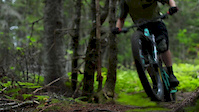
0:47 |
165 |
Sep 10, 2020
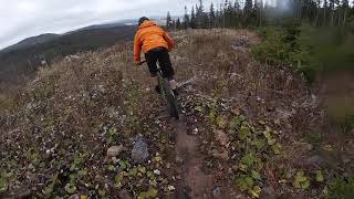
3:04 |
627 |
Oct 29, 2019 , Corner Brook
Recent Trail Reports
| status | trail | date | condition | |
|---|---|---|---|---|
| Sub-station road | May 28, 2026 @ 4:16pm (America/Miquelon) May 28, 2026 | view | ||
| Mudslide | May 28, 2026 @ 4:16pm (America/Miquelon) May 28, 2026 | view | ||
| Mercury Hill | May 28, 2026 @ 4:16pm (America/Miquelon) May 28, 2026 | view | ||
| Powerline | May 28, 2026 @ 4:16pm (America/Miquelon) May 28, 2026 | view | ||
| Two Pine | May 26, 2026 @ 6:44pm (America/St_Johns) May 26, 2026 | view |
Total Trails
21
Total Distance
10 miles
Total Descent
-1,187 ft
Total Climb
898 ft
close
-
Layers w
- Weather Layers
- Pro
- Pro
- Pro
- Pro
- Pro
- Pro
- More Layers
- Pro
- Pro
- Pro
- Pro
-
Upgrade to

3D
Trail Conditions
- Unknown
- Snow Groomed
- Snow Packed
- Snow Covered
- Snow Cover Partial
- Freeze/thaw Cycle
- Icy
- Prevalent Mud
- Wet
- Variable
- Ideal
- Dry
- Very Dry
Trail Flow (Ridden Direction)
Trailforks scans users ridelogs to determine the most popular direction each trail is ridden. A good flowing trail network will have most trails flowing in a single direction according to their intension.
The colour categories are based on what percentage of riders are riding a trail in its intended direction.
The colour categories are based on what percentage of riders are riding a trail in its intended direction.
- > 96%
- > 90%
- > 80%
- > 70%
- > 50%
- < 50%
- bi-directional trail
- no data
Trail Last Ridden
Trailforks scans ridelogs to determine the last time a trail was ridden.
- < 2 days
- < 1 week
- < 2 weeks
- < 1 month
- < 6 months
- > 6 months
Trail Ridden Direction
The intended direction a trail should be ridden.
- Downhill Only
- Downhill Primary
- Both Directions
- Uphill Primary
- Uphill Only
- One Direction
Contribute Details
Colors indicate trail is missing specified detail.
- Description
- Photos
- Description & Photos
- Videos
Trail Popularity ?
Trailforks scans ridelogs to determine which trails are ridden the most in the last 9 months.
Trails are compared with nearby trails in the same city region with a possible 25 colour shades.
Think of this as a heatmap, more rides = more kinetic energy = warmer colors.
- most popular
- popular
- less popular
- not popular
ATV/ORV/OHV Filter
Max Vehicle Width
inches
US Cell Coverage
Legend

Radar Time
Activity Recordings
Trailforks uses anonymized public activity data.
?
Activity Recordings
Trailforks uses anonymized public activity data.
?
Personal Heatmap
▶
Activity Types
all
/
none
▶
Options
2
Date range
month
–
Winter Trails
Warning
A routing network for winter maps does not exist. Selecting trails using the winter trails layer has been disabled.
Missing Trails
Most Popular
Least Popular
Trails are colored based on popularity. The more popular a trail is, the more red. Less popular trails trend towards green.
Jump Magnitude Heatmap
Heatmap of where riders jump on trails. Zoom in to see individual jumps, click circles to view jump details.
BC Backroad Status
![map legend]()
Service Road Atlas is a free to use, community-driven service for viewing and creating reports on the numerous back-country service roads around B.C. and Alberta.

Slope Aspect
Direction the slope faces
Trails Deemphasized
Trails are shown in grey.
Only show trails with no bike usage.
Suggested Layers
Based on selected activity type
Save the current map location and zoom level as your default home location whenever this page is loaded.
Save
Trail transparency
Average difficulty
Trails and Routes in List - Distance by Difficulty
Trails and Routes in List - Difficulty Totals
- By daveincanada

- #638 - 1,510 views