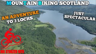
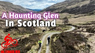
The Great Trossachs Path offers many ways for everyone to enjoy the magic of the Trossachs, the spectacular landscape and its rich history.
Embedded in heart of Loch Lomond and the Trossachs National Park, The Great Trossachs Path has short, long and circular routes of various lengths and challenges. These trails are a series of loop walks each with its own unique character and beauty- from Lochside paths, woodland trails to hilltop vistas. The Great Trossachs Path has it all and all within an hours’ drive from most of Scotland’s population.
Embedded in heart of Loch Lomond and the Trossachs National Park, The Great Trossachs Path has short, long and circular routes of various lengths and challenges. These trails are a series of loop walks each with its own unique character and beauty- from Lochside paths, woodland trails to hilltop vistas. The Great Trossachs Path has it all and all within an hours’ drive from most of Scotland’s population.
- Mountain Bike
- E-Bike
- Hike
- Trail Running
Login to see your progress towards riding all the trails and routes in this list.
Trails
| title | riding area | rating | distance | completed | |||
|---|---|---|---|---|---|---|---|
| 1 | Forest Road | 1 mile | |||||
| 2 | Access Road GTP | 2 miles | |||||
| 3 | Trail | 2,828 ft | |||||
| 4 | Access Road | 1,969 ft | |||||
| 5 | Access Road | 433 ft | |||||
| 6 | Doubletrack | 863 ft | |||||
| 7 | Doubletrack | 2 miles | |||||
| 8 | Doubletrack | 2 miles | |||||
| 9 | Lochard Road | 699 ft | |||||
| 10 | Access Road | 5,213 ft | |||||
| 11 | Access Road | 7 miles | |||||
| 12 | Access Road | 2,031 ft | |||||
| 13 | Access Road | 1 mile | |||||
| 14 | Access Road | 1 mile | |||||
| 15 | Access Road | 1,985 ft | |||||
| 16 | Access Road | 1,903 ft | |||||
| 17 | Ben Venue Path | 449 ft | |||||
| 18 | Forest Road | 1,453 ft | |||||
| 19 | Forest Road | 1,217 ft | |||||
| 20 | Trail | 856 ft | |||||
| 21 | Forest Road | 1 mile | |||||
| 22 | Trail | 1,499 ft | |||||
| 23 | Farm Access | 1,250 ft | |||||
| 24 | Glen Finglas Road | 1,804 ft | |||||
| 25 | Glen Finglas Access Trail | 2,523 ft | |||||
| 26 | Around Ben Ledi | 4 miles | |||||
| 27 | Samson's Stone Path | 4,442 ft |
Displaying 27
Videos
Recent Trail Reports
| status | trail | date | condition | |
|---|---|---|---|---|
| Doubletrack | May 30, 2026 @ 10:32pm (Pacific/Midway) May 31, 2026 | view | ||
| Access Road | May 30, 2026 @ 10:32pm (Pacific/Midway) May 31, 2026 | view | ||
| Access Road | May 30, 2026 @ 10:32pm (Pacific/Midway) May 31, 2026 | view | ||
| Access Road | May 30, 2026 @ 10:32pm (Pacific/Midway) May 31, 2026 | view | ||
| Access Road | May 30, 2026 @ 10:32pm (Pacific/Midway) May 31, 2026 | view |
Total Trails
27
Total Distance
27 miles
Total Descent
-2,423 ft
Total Climb
2,606 ft
close
-
Layers w
- Weather Layers
- Pro
- Pro
- Pro
- Pro
- Pro
- Pro
- More Layers
- Pro
- Pro
- Pro
- Pro
-
Upgrade to

3D
Trail Conditions
- Unknown
- Snow Groomed
- Snow Packed
- Snow Covered
- Snow Cover Partial
- Freeze/thaw Cycle
- Icy
- Prevalent Mud
- Wet
- Variable
- Ideal
- Dry
- Very Dry
Trail Flow (Ridden Direction)
Trailforks scans users ridelogs to determine the most popular direction each trail is ridden. A good flowing trail network will have most trails flowing in a single direction according to their intension.
The colour categories are based on what percentage of riders are riding a trail in its intended direction.
The colour categories are based on what percentage of riders are riding a trail in its intended direction.
- > 96%
- > 90%
- > 80%
- > 70%
- > 50%
- < 50%
- bi-directional trail
- no data
Trail Last Ridden
Trailforks scans ridelogs to determine the last time a trail was ridden.
- < 2 days
- < 1 week
- < 2 weeks
- < 1 month
- < 6 months
- > 6 months
Trail Ridden Direction
The intended direction a trail should be ridden.
- Downhill Only
- Downhill Primary
- Both Directions
- Uphill Primary
- Uphill Only
- One Direction
Contribute Details
Colors indicate trail is missing specified detail.
- Description
- Photos
- Description & Photos
- Videos
Trail Popularity ?
Trailforks scans ridelogs to determine which trails are ridden the most in the last 9 months.
Trails are compared with nearby trails in the same city region with a possible 25 colour shades.
Think of this as a heatmap, more rides = more kinetic energy = warmer colors.
- most popular
- popular
- less popular
- not popular
ATV/ORV/OHV Filter
Max Vehicle Width
inches
US Cell Coverage
Legend

Radar Time
Activity Recordings
Trailforks uses anonymized public activity data.
?
Activity Recordings
Trailforks uses anonymized public activity data.
?
Personal Heatmap
▶
Activity Types
all
/
none
▶
Options
2
Date range
month
–
Winter Trails
Warning
A routing network for winter maps does not exist. Selecting trails using the winter trails layer has been disabled.
Missing Trails
Most Popular
Least Popular
Trails are colored based on popularity. The more popular a trail is, the more red. Less popular trails trend towards green.
Jump Magnitude Heatmap
Heatmap of where riders jump on trails. Zoom in to see individual jumps, click circles to view jump details.
BC Backroad Status
![map legend]()
Service Road Atlas is a free to use, community-driven service for viewing and creating reports on the numerous back-country service roads around B.C. and Alberta.

Slope Aspect
Direction the slope faces
Trails Deemphasized
Trails are shown in grey.
Only show trails with no bike usage.
Suggested Layers
Based on selected activity type
Save the current map location and zoom level as your default home location whenever this page is loaded.
Save
Trail transparency
This official route list of trails is not complete
Average difficulty
Associated Route
Trails and Routes in List - Distance by Difficulty
Trails and Routes in List - Difficulty Totals
- By gav-s

- #819 - 1,262 views