close
-
Layers w
- Weather Layers
- Pro
- Pro
- Pro
- Pro
- Pro
- Pro
- More Layers
- Pro
- Pro
- Pro
- Pro
-
Upgrade to

3D
Trail Conditions
- Unknown
- Snow Groomed
- Snow Packed
- Snow Covered
- Snow Cover Partial
- Freeze/thaw Cycle
- Icy
- Prevalent Mud
- Wet
- Variable
- Ideal
- Dry
- Very Dry
Trail Flow (Ridden Direction)
Trailforks scans users ridelogs to determine the most popular direction each trail is ridden. A good flowing trail network will have most trails flowing in a single direction according to their intension.
The colour categories are based on what percentage of riders are riding a trail in its intended direction.
The colour categories are based on what percentage of riders are riding a trail in its intended direction.
- > 96%
- > 90%
- > 80%
- > 70%
- > 50%
- < 50%
- bi-directional trail
- no data
Trail Last Ridden
Trailforks scans ridelogs to determine the last time a trail was ridden.
- < 2 days
- < 1 week
- < 2 weeks
- < 1 month
- < 6 months
- > 6 months
Trail Ridden Direction
The intended direction a trail should be ridden.
- Downhill Only
- Downhill Primary
- Both Directions
- Uphill Primary
- Uphill Only
- One Direction
Contribute Details
Colors indicate trail is missing specified detail.
- Description
- Photos
- Description & Photos
- Videos
Trail Popularity ?
Trailforks scans ridelogs to determine which trails are ridden the most in the last 9 months.
Trails are compared with nearby trails in the same city region with a possible 25 colour shades.
Think of this as a heatmap, more rides = more kinetic energy = warmer colors.
- most popular
- popular
- less popular
- not popular
ATV/ORV/OHV Filter
Max Vehicle Width
inches
US Cell Coverage
Legend

Radar Time
Activity Recordings
Trailforks uses anonymized public activity data.
?
Activity Recordings
Trailforks uses anonymized public activity data.
?
Personal Heatmap
▶
Activity Types
all
/
none
▶
Options
2
Date range
month
–
Winter Trails
Warning
A routing network for winter maps does not exist. Selecting trails using the winter trails layer has been disabled.
Missing Trails
Most Popular
Least Popular
Trails are colored based on popularity. The more popular a trail is, the more red. Less popular trails trend towards green.
Jump Magnitude Heatmap
Heatmap of where riders jump on trails. Zoom in to see individual jumps, click circles to view jump details.
BC Backroad Status
![map legend]()
Service Road Atlas is a free to use, community-driven service for viewing and creating reports on the numerous back-country service roads around B.C. and Alberta.

Slope Aspect
Direction the slope faces
Trails Deemphasized
Trails are shown in grey.
Only show trails with no bike usage.
Suggested Layers
Based on selected activity type
Save the current map location and zoom level as your default home location whenever this page is loaded.
Save
No description for Anglesea has been added yet!
Login or register to submit one.
Activities Click to view
- Mountain Bike
171 trails
- E-Bike
143 trails
- Gravel Bike
7 trails
- Adaptive Bike
0 trails
- Winter Fat Bike
0 trails
- Hike
143 trails
- Trail Running
143 trails
Region Details
- 69
- 1
- 28
- 57
- 6
- 5
- 2
Region Status
Open as of Jun 11, 2026Stats
- Avg Trail Rating
- Trails (view details)
- 168
- Trails Mountain Bike
- 172
- Trails E-Bike
- 143
- Trails Gravel Bike
- 7
- Trails Horse
- 4
- Trails Hike
- 143
- Trails Trail Running
- 143
- Trails Dirtbike/Moto
- 3
- Trails ATV/ORV/OHV
- 1
- Total Distance
- 245 miles
- Total Descent
- 19,306 ft
- Total Vertical
- 1,364 ft
- Highest Trailhead
- 1,374 ft
- Reports
- 326
- Photos
- 96
- Ridden Counter
- 23,600
Sub Regions
-
Anglesea MTB Park
- 1
- 7
- 3
- 5
- 2
-
Eumeralla MTB Park
- 8
- 15
-
Tanners Camp Ground
- 1
Popular Anglesea Mountain Biking Trails
• 100 ★ 3.0 • 1 mile • 166 ft • 891 •
Winding up and down through the trees, very pretty scenery. Gloves recommended because those grass trees really hurt your hands. Has a fairly steep techy section near the end.
• 100 ★ 2.8 • 4,308 ft • 76 ft • 889 •
Singletrack winding through the trees with a few ups and downs. Has some techy sections and optional features.
• 100 ★ 3.0 • 1,870 ft • 0 ft • 816 •
Popular blue difficulty singletrack. This mountain bike primary trail can be used downhill primary and has a moderate overall physical rating with a 0 ft green climb. On average it takes 1 minutes to complete this trail.
• 95 ★ 2.8 • 4,091 ft • 118 ft • 782 •
Fun rutted descent also can be used as a climbing trail.
• 95 ★ 4.2 • 1 mile • 104 ft • 782 •
Highly rated popular blue difficulty singletrack. This mountain bike primary trail can be used downhill primary. On average it takes 8 minutes to complete this trail.
• 100 ★ 3.5 • 2,549 ft • 4 ft • 685 •
Short flowing section of trail with berms rocks and jumps. Features optional rock lines and gap jumps but is fairly flat so you will have to pedal to maintain speed.
• 95 ★ 3.8 • 4,436 ft • 26 ft • 609 •
Popular blue difficulty family friendly singletrack. This mountain bike primary trail can be used downhill primary and has a moderate overall physical rating with a 26 ft blue climb. On average it takes 4 minutes to complete this trail.
Anglesea Mountain Bike Routes
15 miles • 1,204 ft • 6 •
Course for 2021 Surfcoast Shifty 50 NOTE: "A 2-kilometre section of coastline in Anglesea called Demons...
17 miles • 1,926 ft • 17 •
A loop heading out from Hurst Road using a nice selection of the trails offered
8 miles • 683 ft • 0 •
Short loop for a morning ride. Mostly trails.
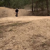
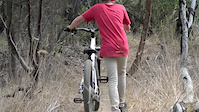
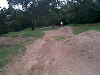
Photos of Anglesea Mountain Bike
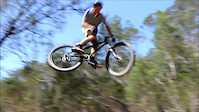
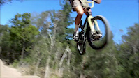
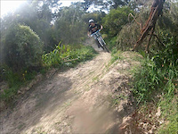
Videos of Anglesea Mountain Bike

trail: Anglesea 4X (Main Line)
0:33 |
199 |
Jun 13, 2022
trail: Anglesea 4X (Main Line)
0:05 |
|
Dec 4, 2020

trail: Lust For Life
3:25 |
417 |
Nov 23, 2020
trail: Dirt Jumps
2:00 |
197 |
Feb 13, 2016
trail: Dirt Jumps
0:45 |
134 |
Feb 6, 2016
trail: Dirt Jumps
0:34 |
888 |
Mar 1, 2014
trail: Dirt Jumps
0:14 |
438 |
Nov 5, 2012
trail: Dirt Jumps
0:14 |
483 |
Sep 27, 2012
Recent Trail Reports
| status | trail | date | condition | info | user |
|---|---|---|---|---|---|
| Clandestino | Jan 22, 2026 @ 11:30am (Australia/Melbourne) Jan 21, 2026 | Unknown | bigbibmtb | ||
| Lust For Life | Nov 10, 2025 @ 11:43am (Australia/Melbourne) Nov 9, 2025 | Ideal | HamishYoPEAV | ||
| Scar Tissue | Nov 10, 2025 @ 11:42am (Australia/Melbourne) Nov 9, 2025 | Ideal | HamishYoPEAV | ||
| Black Wattle Trail | Jul 10, 2025 @ 11:40pm Jul 10, 2025 | Prevalent Mud | Riegnaholic | ||
| Clandestino/Scar Tissue Connector | Jul 10, 2025 @ 11:40pm Jul 10, 2025 | Wet | Riegnaholic | ||
| Gap Tooth | Jun 4, 2025 @ 8:45am Jun 4, 2025 | Dry | erikds924 ATA | ||
| Wolverine Bowl Trail | Feb 8, 2025 @ 1:00pm Feb 8, 2025 | Snow Packed | bam907 | ||
| Chute | Jan 25, 2025 @ 12:53pm Jan 25, 2025 | Ideal | deepoceankenny | ||
| Orchid | Jan 25, 2025 @ 12:53pm Jan 25, 2025 | Ideal | deepoceankenny | ||
| Baby Heads | Jan 25, 2025 @ 12:53pm Jan 25, 2025 | Ideal | deepoceankenny |
Activity Feed
| username | action | type | title | date |
|---|---|---|---|---|
| dandru | wishlist | route | activity #97103392 | Jun 16, 2026 @ 5:54am 2 days |
| PeaceSpider | add | trail | activity #96532548 | Jun 8, 2026 @ 5:23am Jun 8, 2026 |
| Otway | add | photo | activity #95233541 | May 22, 2026 @ 4:51am May 22, 2026 |
| LiamBTAyqe | wishlist | route | activity #95224872 | May 21, 2026 @ 11:15pm May 21, 2026 |
| LiamBTAyqe | wishlist | route | activity #95224531 | May 21, 2026 @ 11:06pm May 21, 2026 |
Recent Comments
| username | type | title | comment | date |
|---|---|---|---|---|
| trail | Fun little dh trail, pretty skittish though | Oct 5, 2025 @ 6:40pm Oct 5, 2025 | ||
| trail | Rockroll is blue at best, far from a double black! | Aug 30, 2023 @ 11:48pm Aug 30, 2023 | ||
| trail | Definitely suited to bikes although you will... | Apr 1, 2023 @ 4:31am Apr 1, 2023 | ||
| trail | This is so not green. It is a very solid... | Jan 20, 2023 @ 10:39pm Jan 20, 2023 | ||
| trail | still pretty sandy! | Feb 13, 2022 @ 4:28pm Feb 13, 2022 |
Local Badges
-

10 Blue Trails467 awarded -

Epic Ride Climb 2k185 awarded -

Climbing 10k Badge92 awarded -

Climbing 100k Badge8 awarded -

Epic Ride Descent 2k183 awarded -

Descent 10k Badge95 awarded
Bike & Skill Parks
| name | type | city | rating |
|---|---|---|---|
| Anglesea Bike Park | skill park | Anglesea |
Activity Type Stats
| activitytype | trails | distance | descent | descent distance | total vertical | rating | global rank | state rank | photos | reports | routes | ridelogs |
|---|---|---|---|---|---|---|---|---|---|---|---|---|
| Mountain Bike | 171 | 245 miles | 19,308 ft | 101 miles | 1,365 ft | #345 | #20 | 94 | 326 | 4 | 22,466 | |
| E-Bike | 143 | 221 miles | 16,939 ft | 90 miles | 1,365 ft | #392 | #40 | 2 | 283 | 1 | 1,266 | |
| Gravel Bike | 7 | 4 miles | 102 ft | 5,039 ft | 568 ft | #147 | #90 | 3 | 1 | 23 | ||
| Horse | 4 | 9 miles | 1,207 ft | 7 miles | 948 ft | 22 | 2 | |||||
| Hike | 143 | 231 miles | 17,864 ft | 95 miles | 1,365 ft | #752 | #27 | 306 | 307 | |||
| Trail Running | 143 | 231 miles | 17,864 ft | 95 miles | 1,365 ft | #500 | #15 | 306 | 6 | 857 | ||
| Dirtbike/Moto | 3 | 6 miles | 932 ft | 4 miles | 610 ft | 21 | 30 | |||||
| ATV/ORV/OHV | 1 | 3 miles | 276 ft | 3 miles | 276 ft | 21 | 28 |
Frequently Asked Questions About Anglesea
▼
What are the best places to ride in Anglesea?
Anglesea has 3 areas to explore for mountain biking. The top rated areas are:
▼
What are the highest rated mountain biking trails in Anglesea?
The highest rated mountain biking trails in Anglesea are:
- Lust For Life (4.2/5)
- Clandestino (4.1/5)
- The Flying Scotsman (4.1/5)
- Anglesea 4X (Main Line) (4/5)
- The Great Escape (3.9/5)
▼
What is the best time of the year to ride in Anglesea?
Based on ride log data, the most popular months to ride in Anglesea are:
- January (175 activities)
- October (140 activities)
- December (124 activities)
▼
Where can I park to ride in Anglesea?
There are 10 parking locations listed in Anglesea. The most popular parking spots are: View all parking and trailhead locations on the map to plan your visit.
Activities
Trails
- By Gusewers & contributors
- Admins: Victoria
- #9779 - 21,746 views
- anglesea activity log | embed map of Anglesea mountain bike trails | anglesea mountain biking points of interest polygons
Downloading of trail gps tracks in kml & gpx formats is enabled for Anglesea.
You must login to download files.