close
-
Layers w
- Weather Layers
- Pro
- Pro
- Pro
- Pro
- Pro
- Pro
- More Layers
- Pro
- Pro
- Pro
- Pro
-
Upgrade to

3D
Trail Conditions
- Unknown
- Snow Groomed
- Snow Packed
- Snow Covered
- Snow Cover Partial
- Freeze/thaw Cycle
- Icy
- Prevalent Mud
- Wet
- Variable
- Ideal
- Dry
- Very Dry
Trail Flow (Ridden Direction)
Trailforks scans users ridelogs to determine the most popular direction each trail is ridden. A good flowing trail network will have most trails flowing in a single direction according to their intension.
The colour categories are based on what percentage of riders are riding a trail in its intended direction.
The colour categories are based on what percentage of riders are riding a trail in its intended direction.
- > 96%
- > 90%
- > 80%
- > 70%
- > 50%
- < 50%
- bi-directional trail
- no data
Trail Last Ridden
Trailforks scans ridelogs to determine the last time a trail was ridden.
- < 2 days
- < 1 week
- < 2 weeks
- < 1 month
- < 6 months
- > 6 months
Trail Ridden Direction
The intended direction a trail should be ridden.
- Downhill Only
- Downhill Primary
- Both Directions
- Uphill Primary
- Uphill Only
- One Direction
Contribute Details
Colors indicate trail is missing specified detail.
- Description
- Photos
- Description & Photos
- Videos
Trail Popularity ?
Trailforks scans ridelogs to determine which trails are ridden the most in the last 9 months.
Trails are compared with nearby trails in the same city region with a possible 25 colour shades.
Think of this as a heatmap, more rides = more kinetic energy = warmer colors.
- most popular
- popular
- less popular
- not popular
ATV/ORV/OHV Filter
Max Vehicle Width
inches
US Cell Coverage
Legend

Radar Time
Activity Recordings
Trailforks uses anonymized public activity data.
?
Activity Recordings
Trailforks uses anonymized public activity data.
?
Personal Heatmap
▶
Activity Types
all
/
none
▶
Options
2
Date range
month
–
Winter Trails
Warning
A routing network for winter maps does not exist. Selecting trails using the winter trails layer has been disabled.
Missing Trails
Most Popular
Least Popular
Trails are colored based on popularity. The more popular a trail is, the more red. Less popular trails trend towards green.
Jump Magnitude Heatmap
Heatmap of where riders jump on trails. Zoom in to see individual jumps, click circles to view jump details.
BC Backroad Status
![map legend]()
Service Road Atlas is a free to use, community-driven service for viewing and creating reports on the numerous back-country service roads around B.C. and Alberta.

Slope Aspect
Direction the slope faces
Trails Deemphasized
Trails are shown in grey.
Only show trails with no bike usage.
Suggested Layers
Based on selected activity type
Save the current map location and zoom level as your default home location whenever this page is loaded.
Save
No description for Arres has been added yet!
Login or register to submit one.
This region uses the Uk/Euro style trail grading system.
Activities Click to view
- Mountain Bike
5 trails
- E-Bike
5 trails
Region Details
- 1
- 2
- 1
Region Status
Open as of Jul 11, 2026Stats
- Avg Trail Rating
- Trails (view details)
- 4
- Trails Mountain Bike
- 5
- Trails E-Bike
- 5
- Trails Horse
- 1
- Trails Hike
- 2
- Trails Trail Running
- 2
- Total Distance
- 7 miles
- Total Descent Distance
- 6 miles
- Total Descent
- 5,187 ft
- Total Vertical
- 2,298 ft
- Highest Trailhead
- 5,060 ft
- Reports
- 22
- Photos
- 8
- Ridden Counter
- 195
Popular Arres Mountain Biking Trails
• 50 ★ 4.7 • 1 mile • 56 ft • 49 •
A new trail specifically built for the practice of Trail/Enduro as an alternative to the traditional path of Melics, which is reserved for pedestrians. The first part of the descent combines comfortable sections of flow with more...
• 75 ★ 3.7 • 1 mile • 0 ft • 48 •
Camí històric ràpid i fluid. Atenció amb els peatons, evitar els matins i migdies de l'estiu, hi ha molta gent
• 25 ★ 5.0 • 1 mile • 35 ft • 24 •
De Arres de Jos, salen dos senderos, en este caso cogeremos en que sale de la calle Fabia, sendero rápido, con peraltes naturales. El primer tramo es hasta un cruce de senderos, si sigues recto te lleva a Benós, en este caso haremos...
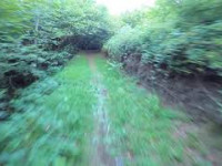
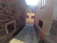
Photos of Arres Mountain Bike
Videos of Arres Mountain Bike

trail: Arres de Jos a Arró GR
6:33 |
126 |
Sep 4, 2023 , Arres
youtuber
![Vilamos hasta cruce de Benos]()
trail: Arres de Jos a Arró GR
2:41 |
313 |
Aug 21, 2020 , Arres
youtuber
![Bassa d'Oles a Casau]()
trail: Arres de Jos a Arró GR
8:37 |
363 |
Aug 20, 2020 , Arres
Recent Trail Reports
| status | trail | date | condition | info | user |
|---|---|---|---|---|---|
| Sanabiera | Jul 11, 2026 @ 9:50am (Europe/Madrid) Jul 11, 2026 | Very Dry | didacam91 | ||
| Pista Bassa d'Arres | Jul 11, 2026 @ 9:50am (Europe/Madrid) Jul 11, 2026 | Ideal | didacam91 | ||
| Prats d'Arres | Sep 10, 2025 @ 7:32am Sep 10, 2025 | Ideal | MouSa29 |
Activity Feed
| username | action | type | title | date |
|---|---|---|---|---|
| didacam91 | add | report | activity #99085555 and 1 more | Jul 13, 2026 @ 2:42am 3 days |
| Dimass | ridden | trail | activity #97166637 | Jun 17, 2026 @ 12:25am Jun 17, 2026 |
| Dimass | vote | trail | activity #97166635 | Jun 17, 2026 @ 12:25am Jun 17, 2026 |
| MouSa29 | add | report | activity #80046303 | Sep 10, 2025 @ 7:32am Sep 10, 2025 |
| MouSa29 | vote | trail | activity #80046290 | Sep 10, 2025 @ 7:32am Sep 10, 2025 |
Recent Comments
| username | type | title | comment | date |
|---|---|---|---|---|
| trail | Sentier très fun et en très bon état | Oct 30, 2024 @ 11:12am Oct 30, 2024 | ||
| trail | La bajada transcurre por un bosque precioso,... | Aug 17, 2024 @ 7:43am Aug 17, 2024 | ||
| trail | Top trail! this trail has less support in the... | Jul 2, 2024 @ 4:48am Jul 2, 2024 |
Activity Type Stats
| activitytype | trails | distance | descent | descent distance | total vertical | rating | global rank | state rank | photos | reports | routes | ridelogs |
|---|---|---|---|---|---|---|---|---|---|---|---|---|
| Mountain Bike | 5 | 7 miles | 5,187 ft | 6 miles | 2,297 ft | #8,361 | #409 | 8 | 22 | 24 | ||
| E-Bike | 5 | 7 miles | 5,187 ft | 6 miles | 2,297 ft | #7,363 | #504 | 20 | 11 | |||
| Horse | 1 | 2 miles | 774 ft | 2 miles | 761 ft | |||||||
| Hike | 2 | 2 miles | 1,955 ft | 2 miles | 2,014 ft | 18 | 5 | |||||
| Trail Running | 2 | 2 miles | 1,955 ft | 2 miles | 2,014 ft | 18 | 14 |
- By ivanmoner
 TFSPAIN & contributors
 - Admins: snaker4, kai-bcn, OCB, Kalamarrrrrdo
- #58275 - 534 views
- arres activity log | embed map of Arres mountain bike trails |
Downloading of trail gps tracks in kml & gpx formats is enabled for Arres.
You must login to download files.