close
-
Layers w
- Weather Layers
- Pro
- Pro
- Pro
- Pro
- Pro
- Pro
- More Layers
- Pro
- Pro
- Pro
- Pro
-
Upgrade to

3D
Trail Conditions
- Unknown
- Snow Groomed
- Snow Packed
- Snow Covered
- Snow Cover Partial
- Freeze/thaw Cycle
- Icy
- Prevalent Mud
- Wet
- Variable
- Ideal
- Dry
- Very Dry
Trail Flow (Ridden Direction)
Trailforks scans users ridelogs to determine the most popular direction each trail is ridden. A good flowing trail network will have most trails flowing in a single direction according to their intension.
The colour categories are based on what percentage of riders are riding a trail in its intended direction.
The colour categories are based on what percentage of riders are riding a trail in its intended direction.
- > 96%
- > 90%
- > 80%
- > 70%
- > 50%
- < 50%
- bi-directional trail
- no data
Trail Last Ridden
Trailforks scans ridelogs to determine the last time a trail was ridden.
- < 2 days
- < 1 week
- < 2 weeks
- < 1 month
- < 6 months
- > 6 months
Trail Ridden Direction
The intended direction a trail should be ridden.
- Downhill Only
- Downhill Primary
- Both Directions
- Uphill Primary
- Uphill Only
- One Direction
Contribute Details
Colors indicate trail is missing specified detail.
- Description
- Photos
- Description & Photos
- Videos
Trail Popularity ?
Trailforks scans ridelogs to determine which trails are ridden the most in the last 9 months.
Trails are compared with nearby trails in the same city region with a possible 25 colour shades.
Think of this as a heatmap, more rides = more kinetic energy = warmer colors.
- most popular
- popular
- less popular
- not popular
ATV/ORV/OHV Filter
Max Vehicle Width
inches
US Cell Coverage
Legend

Radar Time
Activity Recordings
Trailforks uses anonymized public activity data.
?
Activity Recordings
Trailforks uses anonymized public activity data.
?
Personal Heatmap
▶
Activity Types
all
/
none
▶
Options
2
Date range
month
–
Winter Trails
Warning
A routing network for winter maps does not exist. Selecting trails using the winter trails layer has been disabled.
Missing Trails
Most Popular
Least Popular
Trails are colored based on popularity. The more popular a trail is, the more red. Less popular trails trend towards green.
Jump Magnitude Heatmap
Heatmap of where riders jump on trails. Zoom in to see individual jumps, click circles to view jump details.
BC Backroad Status
![map legend]()
Service Road Atlas is a free to use, community-driven service for viewing and creating reports on the numerous back-country service roads around B.C. and Alberta.

Slope Aspect
Direction the slope faces
Trails Deemphasized
Trails are shown in grey.
Only show trails with no bike usage.
Suggested Layers
Based on selected activity type
Save the current map location and zoom level as your default home location whenever this page is loaded.
Save
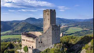
No description for Barr has been added yet!
Login or register to submit one.
This region uses the Uk/Euro style trail grading system.
Activities Click to view
- Mountain Bike
84 trails
- E-Bike
62 trails
- Hike
57 trails
- Trail Running
58 trails
Region Details
- 13
- 12
- 28
- 16
- 8
- 1
Region Status
Open as of May 16, 2026Stats
- Avg Trail Rating
- Trails (view details)
- 83
- Trails Mountain Bike
- 84
- Trails E-Bike
- 62
- Trails Gravel Bike
- 3
- Trails Adaptive Bike
- 3
- Trails Hike
- 57
- Trails Trail Running
- 58
- Total Distance
- 35 miles
- Total Descent
- 18,019 ft
- Total Vertical
- 2,821 ft
- Highest Trailhead
- 3,606 ft
- Reports
- 42
- Photos
- 11
- Ridden Counter
- 1,166
Sub Regions
-
Heidenkopf
- 6
- 9
Popular Barr Mountain Biking Trails
• 100 ★ 3.2 • 3,894 ft • 0 ft • 78 •
Popular red difficulty singletrack. This mountain bike primary trail can be used downhill only. On average it takes 8 minutes to complete this trail.
• 100 ★ 0.0 • 1 mile • 0 ft • 54 • • hike
Ludique en descente et exigeant à la montée
• 100 ★ 0.0 • 4,905 ft • 8 ft • 45 • • hike
Ludique en descente et très exigeant à la montée
• 95 ★ 4.0 • 1,703 ft • 0 ft • 45 •
Trail entre enduro et DH, avec pas mal de saut (certain a reussite obligatoire) de et de virage relevé, bien shapé, tres fun ! EN : A trail that’s a mix of enduro and downhill, with plenty of jumps (some of which you have to land)...
• 60 ★ 3.0 • 3,104 ft • 0 ft • 35 •
Moderately popular red difficulty singletrack. This multi-use trail can be used downhill only. On average it takes 12 minutes to complete this trail.
• 90 ★ 5.0 • 3,501 ft • 0 ft • 32 •
Popular black difficulty singletrack. This mountain bike primary trail can be used downhill only. On average it takes 19 minutes to complete this trail.
• 60 ★ 3.7 • 1 mile • 89 ft • 31 • • hike
Moderately popular blue difficulty singletrack. This hike primary trail. On average it takes 15 minutes to complete this trail.
• 95 ★ 0.0 • 2 miles • 177 ft • 29 • • hike
Nice path parallel to the road, direction Odilienberg, no particular difficulties. --- Joli chemin parallèle à la route, direction Odilienberg, pas de difficultés particulières --- Schöner Weg parallel zur Straße, Richtung...
Photos of Barr Mountain Bike
Videos of Barr Mountain Bike
trail: Le loup
8:31 |
336 |
Sep 11, 2014
trail: Le loup
6:20 |
144 |
Jul 13, 2013
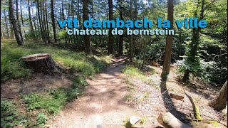
trail: Les épingles du Bernstein
8:12 |
172 |
Mar 9, 2023 , Barr
trail: Les épingles du Bernstein
8:12 |
183 |
Jan 29, 2023 , Barr
Recent Trail Reports
| status | trail | date | condition | info | user |
|---|---|---|---|---|---|
| Compression | May 16, 2026 @ 10:39am (America/Vancouver) May 16, 2026 | Ideal | provencemb B MTB Co | ||
| Fun Kienberg | May 16, 2026 @ 10:37am (America/Vancouver) May 16, 2026 | Ideal | provencemb B MTB Co | ||
| Terre de Barrens Lower | May 16, 2026 @ 10:36am (America/Vancouver) May 16, 2026 | Ideal | provencemb B MTB Co | ||
| Terre de Barrens | May 16, 2026 @ 10:36am (America/Vancouver) May 16, 2026 | Ideal | provencemb B MTB Co | ||
| Terre de Barrens Upper | May 16, 2026 @ 10:35am (America/Vancouver) May 16, 2026 | Ideal | provencemb B MTB Co | ||
| Les Chameaux Lower | May 16, 2026 @ 10:34am (America/Vancouver) May 16, 2026 | Ideal | provencemb B MTB Co | ||
| Les Chameaux | May 16, 2026 @ 10:33am (America/Vancouver) May 16, 2026 | Ideal | provencemb B MTB Co | ||
| Salamandre | Oct 1, 2025 @ 2:29pm (Europe/Busingen) Oct 1, 2025 | Ideal | supercollider0 | ||
| Steep Kienberg | Sep 2, 2025 @ 12:11am Sep 2, 2025 | Dry | lap1 | ||
| Lessiveuse Lower | Aug 16, 2025 @ 4:44pm Aug 16, 2025 | Dry | basvdl |
Activity Feed
| username | action | type | title | date |
|---|---|---|---|---|
| clemz | vote | trail | activity #95794892 | May 29, 2026 @ 12:20pm May 29, 2026 |
| clemz | ridden | trail | activity #95794882 | May 29, 2026 @ 12:20pm May 29, 2026 |
| lueginsland | wishlist | trail | activity #95734057 | May 28, 2026 @ 2:43pm May 28, 2026 |
| provencemb | add | photo | activity #95240243 and 3 more | May 22, 2026 @ 7:18am May 22, 2026 |
| provencemb | update | trail | activity #94914445 | May 17, 2026 @ 9:45am May 17, 2026 |
Recent Comments
| username | type | title | comment | date |
|---|---|---|---|---|
| trail | Unfortunately, parts of the forest there have... | Aug 16, 2025 @ 10:43am Aug 16, 2025 | ||
| trail | I have ridden the part from the waterfall to... | Aug 14, 2025 @ 2:06am Aug 14, 2025 | ||
| trail | I’m not sure if this trail exists anymore | Jul 23, 2025 @ 12:50pm Jul 23, 2025 | ||
| trail | Propper steeps, the start has eroded quite a... | May 1, 2025 @ 1:10pm May 1, 2025 | ||
| trail | Tricky trail. Bien enroulable. | Apr 24, 2025 @ 2:01pm Apr 24, 2025 |
Local Badges
-

Epic Ride Climb 2k151 awarded -

Climbing 10k Badge23 awarded -

Climbing 100k Badge3 awarded -

Epic Ride Descent 2k164 awarded -

Descent 10k Badge25 awarded -

Descent 100k Badge3 awarded
Activity Type Stats
| activitytype | trails | distance | descent | descent distance | total vertical | rating | global rank | state rank | photos | reports | routes | ridelogs |
|---|---|---|---|---|---|---|---|---|---|---|---|---|
| Mountain Bike | 84 | 35 miles | 18,018 ft | 27 miles | 2,822 ft | #2,974 | #84 | 11 | 42 | 2,833 | ||
| E-Bike | 62 | 10 miles | 7,664 ft | 9 miles | 2,136 ft | #3,631 | #203 | 41 | 816 | |||
| Gravel Bike | 3 | #5,321 | #174 | 19 | ||||||||
| Adaptive Bike | 3 | #5,338 | #174 | |||||||||
| Hike | 57 | 31 miles | 13,304 ft | 23 miles | 2,822 ft | #4,212 | #124 | 33 | 154 | |||
| Trail Running | 58 | 31 miles | 14,285 ft | 24 miles | 2,822 ft | #4,176 | #138 | 34 | 36 |
Frequently Asked Questions About Barr
▼
What are the best places to ride in Barr?
Barr has 1 areas to explore for mountain biking. The top rated areas are:
▼
What are the highest rated mountain biking trails in Barr?
The highest rated mountain biking trails in Barr are:
- Terre de Barrens Lower (4.1/5)
- Les Chameaux Upper (4.1/5)
- Les Chameaux (4.1/5)
- Compression (4.1/5)
- Lessiveuse Lower (4.1/5)
▼
What is the best time of the year to ride in Barr?
Based on ride log data, the most popular months to ride in Barr are:
- July (21 activities)
- May (20 activities)
- June (8 activities)
▼
Where can I park to ride in Barr?
Activities
Trails
- By maxreeb & contributors
- Admins: provencemb
- #7701 - 4,790 views
- barr activity log | embed map of Barr mountain bike trails | barr mountain biking points of interest
Downloading of trail gps tracks in kml & gpx formats is enabled for Barr.
You must login to download files.