close
-
Layers w
- Weather Layers
- Pro
- Pro
- Pro
- Pro
- Pro
- Pro
- More Layers
- Pro
- Pro
- Pro
- Pro
-
Upgrade to

3D
Trail Conditions
- Unknown
- Snow Groomed
- Snow Packed
- Snow Covered
- Snow Cover Partial
- Freeze/thaw Cycle
- Icy
- Prevalent Mud
- Wet
- Variable
- Ideal
- Dry
- Very Dry
Trail Flow (Ridden Direction)
Trailforks scans users ridelogs to determine the most popular direction each trail is ridden. A good flowing trail network will have most trails flowing in a single direction according to their intension.
The colour categories are based on what percentage of riders are riding a trail in its intended direction.
The colour categories are based on what percentage of riders are riding a trail in its intended direction.
- > 96%
- > 90%
- > 80%
- > 70%
- > 50%
- < 50%
- bi-directional trail
- no data
Trail Last Ridden
Trailforks scans ridelogs to determine the last time a trail was ridden.
- < 2 days
- < 1 week
- < 2 weeks
- < 1 month
- < 6 months
- > 6 months
Trail Ridden Direction
The intended direction a trail should be ridden.
- Downhill Only
- Downhill Primary
- Both Directions
- Uphill Primary
- Uphill Only
- One Direction
Contribute Details
Colors indicate trail is missing specified detail.
- Description
- Photos
- Description & Photos
- Videos
Trail Popularity ?
Trailforks scans ridelogs to determine which trails are ridden the most in the last 9 months.
Trails are compared with nearby trails in the same city region with a possible 25 colour shades.
Think of this as a heatmap, more rides = more kinetic energy = warmer colors.
- most popular
- popular
- less popular
- not popular
ATV/ORV/OHV Filter
Max Vehicle Width
inches
US Cell Coverage
Legend

Radar Time
Activity Recordings
Trailforks uses anonymized public activity data.
?
Activity Recordings
Trailforks uses anonymized public activity data.
?
Personal Heatmap
▶
Activity Types
all
/
none
▶
Options
2
Date range
month
–
Winter Trails
Warning
A routing network for winter maps does not exist. Selecting trails using the winter trails layer has been disabled.
Missing Trails
Most Popular
Least Popular
Trails are colored based on popularity. The more popular a trail is, the more red. Less popular trails trend towards green.
Jump Magnitude Heatmap
Heatmap of where riders jump on trails. Zoom in to see individual jumps, click circles to view jump details.
BC Backroad Status
![map legend]()
Service Road Atlas is a free to use, community-driven service for viewing and creating reports on the numerous back-country service roads around B.C. and Alberta.

Slope Aspect
Direction the slope faces
Trails Deemphasized
Trails are shown in grey.
Only show trails with no bike usage.
Suggested Layers
Based on selected activity type
Save the current map location and zoom level as your default home location whenever this page is loaded.
Save
No description for Beatenberg has been added yet!
Login or register to submit one.
This region uses the Uk/Euro style trail grading system.
Activities Click to view
- Mountain Bike
7 trails
- E-Bike
6 trails
- Hike
6 trails
- Trail Running
6 trails
Region Details
- 3
- 3
- 1
Region Status
Caution as of Jun 14, 2026Stats
- Avg Trail Rating
- Trails (view details)
- 7
- Trails Mountain Bike
- 7
- Trails E-Bike
- 6
- Trails Hike
- 6
- Trails Trail Running
- 6
- Total Distance
- 7 miles
- Total Descent Distance
- 6 miles
- Total Descent
- 4,146 ft
- Total Vertical
- 4,371 ft
- Highest Trailhead
- 6,359 ft
- Reports
- 33
- Photos
- 8
- Ridden Counter
- 242
Sub Regions
-
Niederhorn Beatenberg
- 3
- 3
- 1
Popular Beatenberg Mountain Biking Trails
• 100 ★ 4.7 • 1 mile • 0 ft • 162 •
Over 2,7 kilometres lead you from Beatenberg Station to Beatenbucht on the . The decrease of the flowtrail is 520 meters in total.
• 75 ★ 0.0 • 938 ft • 0 ft • 15 • • hike
Steiler, rumpliger weg direkt runter. Kann über die Strasse umfahren werden.
• 5 ★ 3.3 • 2 miles • 68 ft • 12 • • hike
Wenig begangener Weg von Glunten (Beatenberg) nach (Habkern). Zwar flach aber viele Wurzeln und Steine und desshalb nicht einfach zu Fahren. Wer es Technisch heruasfordernd mag oder beim Schieben die Landschaft geniesst wird auf seine...
• 90 ★ 2.0 • 4,075 ft • 0 ft • 11 • • hike
don't go there on the weekends and go very early or very late, don't disturb the hikers, but the uphill is almost rideable and the downhill makes fun, ride soft and don't ruin the path(s).
• 60 ★ 2.0 • 1 mile • 96 ft • 9 • • hike
Trail von Bort (Habkern) nach Birmse (Unterseen), leider nach Baurabeiten Breit und Langweilig
• 5 ★ 3.0 • 1 mile • 10 ft • 2 • • hike
Less popular red difficulty alpine singletrack. This hike primary trail can be used both directions and has a easy overall physical rating with a 10 ft blue climb.
Beatenberg Mountain Bike Routes
19 miles • 2,606 ft • 5 • Point to Point •
Start with the Niederhornbahn (Funiculaire). Climb the Road to Vorsass. Follow the Trail up leading to...
Photos of Beatenberg Mountain Bike
Videos of Beatenberg Mountain Bike
youtuber
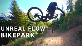
![Immer noch der BESTE Downhilltrail im Berner...]()

trail: Heartbeat Trail
18:07 |
91 |
Nov 18, 2025 , Beatenberg
youtuber
![Blue Trail?! Can't believe it! Some of the...]()
trail: Heartbeat Trail
9:22 |
585 |
Nov 17, 2022 , Beatenberg
youtuber
![Sam Pilgrim is a Shred Machine on this...]()

trail: Heartbeat Trail
14:25 |
688 |
Nov 10, 2022 , Beatenberg
Recent Trail Reports
| status | trail | date | condition | info | user |
|---|---|---|---|---|---|
| Heartbeat Trail | Jun 14, 2026 @ 10:21am (Europe/Zurich) Jun 14, 2026 | Ideal | hiltix | ||
| Thunersee-Beatenberg-Bahn | Sep 22, 2024 @ 9:20am Sep 22, 2024 | Unknown | chriguc | ||
| Burgfeld 2 | Sep 6, 2024 @ 12:39pm Sep 6, 2024 | Wet | markusfyupDd | ||
| Burgfeld | Sep 6, 2024 @ 12:38pm Sep 6, 2024 | Unknown | markusfyupDd | ||
| Rüti | Aug 14, 2021 @ 1:20am Aug 14, 2021 | Variable | ryfreto | ||
| Stolle | Aug 14, 2021 @ 1:20am Aug 14, 2021 | Ideal | ryfreto | ||
| Pfengi | Aug 14, 2021 @ 1:20am Aug 14, 2021 | Ideal | ryfreto |
Activity Feed
| username | action | type | title | date |
|---|---|---|---|---|
| hiltix | add | report | activity #96944273 | Jun 14, 2026 @ 1:21am Jun 14, 2026 |
| PetraundElmarT44wPV | wishlist | route | activity #94630548 | May 13, 2026 @ 8:54am May 13, 2026 |
| JeremDH | wishlist | trail | activity #91813619 | Apr 3, 2026 @ 5:02am Apr 3, 2026 |
| Seregon7 | wishlist | trail | activity #89061605 | Feb 17, 2026 @ 1:13am Feb 17, 2026 |
| 5BNEv8 | wishlist | trail | activity #80782865 | Sep 20, 2025 @ 4:21pm Sep 20, 2025 |
Recent Comments
| username | type | title | comment | date |
|---|---|---|---|---|
| trail | Endlich mal nicht eine Murmelbahn Jumpline und... | Oct 29, 2024 @ 6:02am Oct 29, 2024 | ||
| trail | Der Trail ist eine richtige Downhillstrecke -... | Oct 7, 2024 @ 7:30am Oct 7, 2024 | ||
| trail | Super fun trail, loamy sections at the top are... | Nov 8, 2023 @ 1:06pm Nov 8, 2023 | ||
| trail | Big Difference between Green and Black... | May 13, 2022 @ 9:17pm May 13, 2022 | ||
| trail | I'd say BD. | Aug 15, 2021 @ 8:15pm Aug 15, 2021 |
Activity Type Stats
| activitytype | trails | distance | descent | descent distance | total vertical | rating | global rank | state rank | photos | reports | routes | ridelogs |
|---|---|---|---|---|---|---|---|---|---|---|---|---|
| Mountain Bike | 7 | 7 miles | 4,147 ft | 6 miles | 4,370 ft | #9,890 | #371 | 8 | 33 | 1 | 661 | |
| E-Bike | 6 | 6 miles | 3,517 ft | 5 miles | 3,760 ft | #5,314 | #236 | 29 | 1 | 79 | ||
| Hike | 6 | 6 miles | 2,566 ft | 5 miles | 3,606 ft | #7,949 | #226 | 31 | 243 | |||
| Trail Running | 6 | 6 miles | 2,566 ft | 5 miles | 3,606 ft | #8,022 | #222 | 31 | 18 |
Frequently Asked Questions About Beatenberg
▼
What are the best places to ride in Beatenberg?
Beatenberg has 1 areas to explore for mountain biking. The top rated areas are:
▼
What are the highest rated mountain biking trails in Beatenberg?
The highest rated mountain biking trails in Beatenberg are:
- Heartbeat Trail (4.3/5)
- Burgfeld 2 (3.8/5)
- NHorndown (3.7/5)
- Stolle (3.7/5)
- Pfengi (3.7/5)
▼
What is the best time of the year to ride in Beatenberg?
Based on ride log data, the most popular months to ride in Beatenberg are:
- August (9 activities)
- July (5 activities)
- October (3 activities)
▼
Where can I park to ride in Beatenberg?
Check the Beatenberg trail map for trailhead and parking information. Community members regularly update access and parking details for trails in the area.
Activities
Trails
Points of Interest
- By inversedotch
 & contributors
 - Admins: apply
- #46547 - 1,560 views
- beatenberg activity log | embed map of Beatenberg mountain bike trails |
Downloading of trail gps tracks in kml & gpx formats is enabled for Beatenberg.
You must login to download files.