close
-
Layers w
- Weather Layers
- Pro
- Pro
- Pro
- Pro
- Pro
- Pro
- More Layers
- Pro
- Pro
- Pro
- Pro
-
Upgrade to

3D
Trail Conditions
- Unknown
- Snow Groomed
- Snow Packed
- Snow Covered
- Snow Cover Partial
- Freeze/thaw Cycle
- Icy
- Prevalent Mud
- Wet
- Variable
- Ideal
- Dry
- Very Dry
Trail Flow (Ridden Direction)
Trailforks scans users ridelogs to determine the most popular direction each trail is ridden. A good flowing trail network will have most trails flowing in a single direction according to their intension.
The colour categories are based on what percentage of riders are riding a trail in its intended direction.
The colour categories are based on what percentage of riders are riding a trail in its intended direction.
- > 96%
- > 90%
- > 80%
- > 70%
- > 50%
- < 50%
- bi-directional trail
- no data
Trail Last Ridden
Trailforks scans ridelogs to determine the last time a trail was ridden.
- < 2 days
- < 1 week
- < 2 weeks
- < 1 month
- < 6 months
- > 6 months
Trail Ridden Direction
The intended direction a trail should be ridden.
- Downhill Only
- Downhill Primary
- Both Directions
- Uphill Primary
- Uphill Only
- One Direction
Contribute Details
Colors indicate trail is missing specified detail.
- Description
- Photos
- Description & Photos
- Videos
Trail Popularity ?
Trailforks scans ridelogs to determine which trails are ridden the most in the last 9 months.
Trails are compared with nearby trails in the same city region with a possible 25 colour shades.
Think of this as a heatmap, more rides = more kinetic energy = warmer colors.
- most popular
- popular
- less popular
- not popular
ATV/ORV/OHV Filter
Max Vehicle Width
inches
US Cell Coverage
Legend

Radar Time
Activity Recordings
Trailforks uses anonymized public activity data.
?
Activity Recordings
Trailforks uses anonymized public activity data.
?
Personal Heatmap
▶
Activity Types
all
/
none
▶
Options
2
Date range
month
–
Winter Trails
Warning
A routing network for winter maps does not exist. Selecting trails using the winter trails layer has been disabled.
Missing Trails
Most Popular
Least Popular
Trails are colored based on popularity. The more popular a trail is, the more red. Less popular trails trend towards green.
Jump Magnitude Heatmap
Heatmap of where riders jump on trails. Zoom in to see individual jumps, click circles to view jump details.
BC Backroad Status
![map legend]()
Service Road Atlas is a free to use, community-driven service for viewing and creating reports on the numerous back-country service roads around B.C. and Alberta.

Slope Aspect
Direction the slope faces
Trails Deemphasized
Trails are shown in grey.
Only show trails with no bike usage.
Suggested Layers
Based on selected activity type
Save the current map location and zoom level as your default home location whenever this page is loaded.
Save
No description for Bédoin has been added yet!
Login or register to submit one.
This region uses the Uk/Euro style trail grading system.
Activities Click to view
- Mountain Bike
135 trails
- E-Bike
131 trails
- Adaptive Bike
0 trails
- Winter Fat Bike
0 trails
- Hike
136 trails
- Trail Running
136 trails
- Downhill Ski
7 trails
Region Details
- 32
- 3
- 63
- 29
- 6
Region Status
Open as of May 23, 2026Stats
- Avg Trail Rating
- Trails (view details)
- 146
- Trails Mountain Bike
- 135
- Trails E-Bike
- 131
- Trails Horse
- 3
- Trails Hike
- 136
- Trails Trail Running
- 136
- Trails Downhill Ski
- 7
- Total Distance
- 226 miles
- Total Descent
- 76,305 ft
- Total Vertical
- 5,397 ft
- Highest Trailhead
- 6,145 ft
- Reports
- 114
- Photos
- 109
- Ridden Counter
- 3,422
Sub Regions
-
Parc Naturel Régional du Mont-Ventoux
- 2
- 61
- 28
- 6
Popular Bédoin Mountain Biking Trails
• 100 ★ 4.6 • 1 mile • 0 ft • 170 •
Tronçon le plus intéressant de la descente balisée enduro rouge N°5. Segment le plus populaire du massif sur Strava, c'est le seul sentier du coin dépourvu de cailloux. Tracé par les pratiquants locaux il joue avec le terrain pour...
• 100 ★ 3.0 • 2 miles • 0 ft • 146 •
Popular blue difficulty singletrack. This multi-use trail can be used downhill primary and has a hard overall physical rating with a 0 ft black diamond climb. It features rock garden. Trail visibility is always easy to follow. On average it takes 11 minutes to complete this trail.
• 100 ★ 3.0 • 2 miles • 35 ft • 121 •
Popular blue difficulty singletrack. This multi-use trail can be used downhill only. It features rock garden. Trail visibility is always easy to follow. On average it takes 17 minutes to complete this trail.
• 100 ★ 4.0 • 2,172 ft • 0 ft • 107 •
Popular blue difficulty singletrack. This mountain bike primary trail can be used downhill primary and has a moderate overall physical rating with a 0 ft black diamond climb. On average it takes 3 minutes to complete this trail.
• 95 ★ 2.0 • 1,946 ft • 0 ft • 80 •
Popular blue difficulty singletrack. This multi-use trail can be used downhill primary. On average it takes 1 minutes to complete this trail.
• 95 ★ 4.4 • 2 miles • 0 ft • 75 •
Sentier en fond de combe sans difficulté majeure. Souvent caillouteuse (comme souvent ici), la trace offre quelques jolies séries de virages. C'est le sentier idéal pour faire connaissance avec le terrain local. Peut se prendre à la...
• 95 ★ 4.8 • 2,913 ft • 0 ft • 70 •
Un des plus beaux sentiers en descente du coin. Son tracé naturel en fond de combe offre de beaux enchaînements de virages en jouant avec le relief. Quelques obstacles naturels (rochers, racines ou encore talus) rendent le pilotage...
• 100 ★ 4.0 • 2,894 ft • 0 ft • 63 •
Variante s'intégrant parfaitement dans la descente balisée N°5. Plus sympa que le balisé.
Bédoin Mountain Bike Routes
★ 2.0 • 15 miles • 308 ft • 3 • Shuttled •
Au départ du col des Tempêtes (1841 m), ce parcours enduro offre des points de vue exceptionnels sur les...
★ 4.0 • 7 miles • 399 ft • 0 • Loop •
Parcours d’initiation, idéal en famille. L’itinéraire serpente dans la campagne de...
★ 3.0 • 14 miles • 1,999 ft • 0 • Loop •
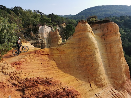
Pour pratiquants aguerris, l’itinéraire traverse les terres ocrées des Demoiselles coiffées et le...
9 miles • 633 ft • 0 • Shuttled •
Au départ de la station du Mont-Serein, cet itinéraire descendant s’adresse aux vrais pratiquants VTT...
15 miles • 1,560 ft • 0 • Loop •
Entre champs de lavande et de petit épeautre, ce parcours alterne passages en sous-bois et sentiers...
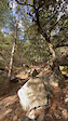
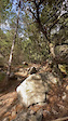
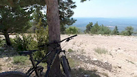
Photos of Bédoin Mountain Bike
Videos of Bédoin Mountain Bike
trail: Combe Malaval
0:09 |
55 |
Oct 20, 2023
trail: Combe Malaval
0:09 |
21 |
Oct 20, 2023
trail: Combe Malaval
13:38 |
367 |
Aug 16, 2019
youtuber
![Enduro MTB at Mont Ventoux (VTT5) // MTB Challenge]()
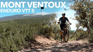
9:41 |
354 |
Jan 2, 2024 , Bédoin

trail: Col du Comte
4:31 |
404 |
Feb 2, 2022 , Bédoin
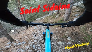
trail: Chapelle Saint Sidoine
269 |
Jan 30, 2022 , Bédoin

trail: Combe Malaval
6:18 |
476 |
Jan 12, 2022 , Bédoin

trail: Le coste inverse
4:21 |
223 |
Jan 11, 2022 , Bédoin
Current Trail Warnings
| status | trail | date | condition | user | info |
|---|---|---|---|---|---|
| La Pierre Droite | May 23, 2026 @ 2:24pm (Europe/Paris) May 23, 2026 | Dry | Guibolle | I fully agree with @RonBorger : what a... |
Recent Trail Reports
| status | trail | date | condition | info | user |
|---|---|---|---|---|---|
| De la Cédraie aux Bruns | Dec 29, 2025 @ 1:31am (Pacific/Midway) Dec 29, 2025 | Ideal | Bens59 | ||
| Vallon des pointes | Dec 29, 2025 @ 1:31am (Pacific/Midway) Dec 29, 2025 | Dry | Bens59 | ||
| Bike park, "ROCK’N ROX" | Dec 29, 2025 @ 1:31am (Pacific/Midway) Dec 29, 2025 | Ideal | Bens59 | ||
| Piste de la Tête du Chauva | Dec 29, 2025 @ 1:31am (Pacific/Midway) Dec 29, 2025 | Snow Cover Partial | Bens59 | ||
| Baume de Chat | Nov 15, 2025 @ 7:22pm (Europe/Paris) Nov 15, 2025 | Dry | Giloulacantoche | ||
| La top variante | Apr 24, 2025 @ 9:09am Apr 24, 2025 | Dry | rajo6 | ||
| Liaison cédraie | Apr 24, 2025 @ 9:09am Apr 24, 2025 | Ideal | rajo6 | ||
| Combe Malaval | Sep 13, 2024 @ 3:23am Sep 13, 2024 | Ideal | ibonze | ||
| Combe Obscure | Sep 12, 2024 @ 9:41am Sep 12, 2024 | Ideal | ibonze | ||
| Combe De Comentige | Sep 12, 2024 @ 9:35am Sep 12, 2024 | Ideal | ibonze |
National Scenic Trails & Official Routes
-
Grande Traversée VTT du Vaucluse
- Mountain Bike
- E-Bike
Activity Feed
| username | action | type | title | date |
|---|---|---|---|---|
| AndreucciINBTeP | wishlist | trail | activity #96394475 and 1 more | Jun 6, 2026 @ 12:00pm Jun 6, 2026 |
| NRRETQ | vote | route | activity #95873916 | May 30, 2026 @ 11:44am May 30, 2026 |
| NRRETQ | checkin | route | activity #95802270 | May 29, 2026 @ 2:26pm May 29, 2026 |
| NRRETQ | ridden | route | activity #95802269 | May 29, 2026 @ 2:26pm May 29, 2026 |
| vkallmann | wishlist | region | activity #95794212 | May 29, 2026 @ 12:09pm May 29, 2026 |
Recent Comments
| username | type | title | comment | date |
|---|---|---|---|---|
| report | I fully agree with @RonBorger : what a pitty... | May 23, 2026 @ 5:23am May 23, 2026 | ||
| trail | Best trail on the mountain. Most off the other... | Aug 30, 2025 @ 5:24am Aug 30, 2025 | ||
| trail | Boring and disappointing: Top part is to... | Aug 29, 2025 @ 5:47am Aug 29, 2025 | ||
| trail | Nicht wirklich ein Biketrail. Nur Geröll. | Aug 6, 2025 @ 7:23am Aug 6, 2025 | ||
| trail | closed | Apr 28, 2025 @ 7:32am Apr 28, 2025 |
Local Badges
-

10 Blue Trails20 awarded -

10 Black Trails0 awarded -

Epic Ride Climb 2k893 awarded -

Climbing 10k Badge55 awarded -

Climbing 100k Badge1 awarded -

Epic Ride Descent 2k908 awarded
Activity Type Stats
| activitytype | trails | distance | descent | descent distance | total vertical | rating | global rank | state rank | photos | reports | routes | ridelogs |
|---|---|---|---|---|---|---|---|---|---|---|---|---|
| Mountain Bike | 135 | 209 miles | 65,748 ft | 110 miles | 5,253 ft | #1,110 | #20 | 104 | 114 | 28 | 4,770 | |
| E-Bike | 131 | 202 miles | 62,884 ft | 106 miles | 5,253 ft | #580 | #45 | 5 | 109 | 3 | 414 | |
| Horse | 3 | 4 miles | 184 ft | 3,412 ft | 1,335 ft | 3 | ||||||
| Hike | 136 | 218 miles | 70,699 ft | 115 miles | 5,397 ft | #879 | #21 | 108 | 1 | 227 | ||
| Trail Running | 136 | 218 miles | 70,699 ft | 115 miles | 5,397 ft | #624 | #21 | 108 | 1 | 133 | ||
| Downhill Ski | 7 | 3 miles | 2,215 ft | 3 miles | 604 ft | #434 | #49 | 1 |
Frequently Asked Questions About Bédoin
▼
What are the best places to ride in Bédoin?
Bédoin has 2 areas to explore for mountain biking. The top rated areas are:
▼
What are the highest rated mountain biking trails in Bédoin?
The highest rated mountain biking trails in Bédoin are:
- De la Cédraie aux Bruns (4.4/5)
- Baume de Chat (4.3/5)
- Combe d'Ansis part1 (4.3/5)
- Le Jas du Tomple (4.2/5)
- Chapelle Saint Sidoine (4.2/5)
▼
What is the best time of the year to ride in Bédoin?
Based on ride log data, the most popular months to ride in Bédoin are:
- June (11 activities)
- May (10 activities)
- July (8 activities)
▼
Where can I park to ride in Bédoin?
There are 11 parking locations listed in Bédoin. The most popular parking spots are: View all parking and trailhead locations on the map to plan your visit.
Activities
Trails
- By tomzaniroli
 TRAILFORKS TFFRANCE & contributors
 - Admins: tomzaniroli, Climent
- #23337 - 3,147 views
- bédoin activity log | embed map of Bédoin mountain bike trails | bédoin mountain biking points of interest
Downloading of trail gps tracks in kml & gpx formats is enabled for Bédoin.
You must login to download files.