close
-
Layers w
- Weather Layers
- Pro
- Pro
- Pro
- Pro
- Pro
- Pro
- More Layers
- Pro
- Pro
- Pro
- Pro
-
Upgrade to

3D
Trail Conditions
- Unknown
- Snow Groomed
- Snow Packed
- Snow Covered
- Snow Cover Partial
- Freeze/thaw Cycle
- Icy
- Prevalent Mud
- Wet
- Variable
- Ideal
- Dry
- Very Dry
Trail Flow (Ridden Direction)
Trailforks scans users ridelogs to determine the most popular direction each trail is ridden. A good flowing trail network will have most trails flowing in a single direction according to their intension.
The colour categories are based on what percentage of riders are riding a trail in its intended direction.
The colour categories are based on what percentage of riders are riding a trail in its intended direction.
- > 96%
- > 90%
- > 80%
- > 70%
- > 50%
- < 50%
- bi-directional trail
- no data
Trail Last Ridden
Trailforks scans ridelogs to determine the last time a trail was ridden.
- < 2 days
- < 1 week
- < 2 weeks
- < 1 month
- < 6 months
- > 6 months
Trail Ridden Direction
The intended direction a trail should be ridden.
- Downhill Only
- Downhill Primary
- Both Directions
- Uphill Primary
- Uphill Only
- One Direction
Contribute Details
Colors indicate trail is missing specified detail.
- Description
- Photos
- Description & Photos
- Videos
Trail Popularity ?
Trailforks scans ridelogs to determine which trails are ridden the most in the last 9 months.
Trails are compared with nearby trails in the same city region with a possible 25 colour shades.
Think of this as a heatmap, more rides = more kinetic energy = warmer colors.
- most popular
- popular
- less popular
- not popular
ATV/ORV/OHV Filter
Max Vehicle Width
inches
US Cell Coverage
Legend

Radar Time
Activity Recordings
Trailforks uses anonymized public activity data.
?
Activity Recordings
Trailforks uses anonymized public activity data.
?
Personal Heatmap
▶
Activity Types
all
/
none
▶
Options
2
Date range
month
–
Winter Trails
Warning
A routing network for winter maps does not exist. Selecting trails using the winter trails layer has been disabled.
Missing Trails
Most Popular
Least Popular
Trails are colored based on popularity. The more popular a trail is, the more red. Less popular trails trend towards green.
Jump Magnitude Heatmap
Heatmap of where riders jump on trails. Zoom in to see individual jumps, click circles to view jump details.
BC Backroad Status
![map legend]()
Service Road Atlas is a free to use, community-driven service for viewing and creating reports on the numerous back-country service roads around B.C. and Alberta.

Slope Aspect
Direction the slope faces
Trails Deemphasized
Trails are shown in grey.
Only show trails with no bike usage.
Suggested Layers
Based on selected activity type
Save the current map location and zoom level as your default home location whenever this page is loaded.
Save
No description for Bicheno has been added yet!
Login or register to submit one.
Activities Click to view
- Mountain Bike
20 trails
- E-Bike
5 trails
- Hike
15 trails
- Trail Running
15 trails
Region Details
- 2
- 5
- 9
- 2
Region Status
Caution as of May 24, 2026Stats
- Avg Trail Rating
- Trails (view details)
- 18
- Trails Mountain Bike
- 20
- Trails E-Bike
- 5
- Trails Hike
- 15
- Trails Trail Running
- 15
- Total Distance
- 6 miles
- Total Descent
- 1,559 ft
- Total Vertical
- 748 ft
- Highest Trailhead
- 857 ft
- Reports
- 25
- Photos
- 18
- Ridden Counter
- 282
Popular Bicheno Mountain Biking Trails
• 100 ★ 0.0 • 633 ft • 0 ft • 29 •
Short trail with a few gap jumps and berms Make sure to exit the trail through fire trails and not to enter any property at the bottom of the trail There is a road gap though it can be quite hard to clear and lip may be damaged
• 85 ★ 3.5 • 1,801 ft • 5 ft • 25 •
From top to bottom, this trail starts off with some relatively fun trail, quickly descending in to a steep rock garden then opening up to a rock roller and some tight, twisty corners followed by some tight berms. Quickly after that...
• 5 ★ 4.0 • 2 miles • 170 ft • 20 •
Known as a walking track along the , but can be ridden with due care and right of way given consideration when riding for walkers. Some sections are gravel path, with rock steps and ledges that are encountered. A beach crossing and some...
• 5 ★ 0.0 • 736 ft • 0 ft • 11 •
Less popular blue difficulty singletrack. This mountain bike primary trail can be used downhill primary. It features berm, drop, jump and wallride. On average it takes 1 minutes to complete this trail.
• 5 ★ 0.0 • 1,223 ft • 0 ft • 9 •
Less popular blue difficulty mixed. This mountain bike primary trail can be used downhill primary. On average it takes minutes to complete this trail.
• 5 ★ 0.0 • 941 ft • 0 ft • 9 •
Less popular green difficulty singletrack. This mountain bike primary trail can be used downhill primary. It features rock garden. On average it takes 1 minutes to complete this trail.
• 5 ★ 0.0 • 1,270 ft • 0 ft • 9 •
Less popular black diamond difficulty singletrack. This mountain bike primary trail can be used downhill primary. It features berm, bridge and rock garden. On average it takes 6 minutes to complete this trail.
• 5 ★ 0.0 • 424 ft • 0 ft • 7 •
Less popular blue difficulty singletrack. This mountain bike primary trail can be used downhill primary. It features drop, log ride and rock garden. On average it takes 2 minutes to complete this trail.
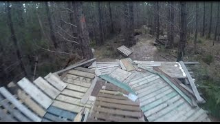
Videos of Bicheno Mountain Bike
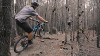
trail: Oysters
2:19 |
5494 |
Aug 16, 2018
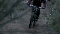
trail: Rabbit Trap
0:39 |
997 |
May 18, 2018

trail: Rabbit Trap
0:57 |
787 |
Jul 11, 2015

trail: Rabbit Trap
0:59 |
552 |
Apr 19, 2011

trail: Pinball
6:42 |
288 |
Feb 4, 2018 , Bicheno

trail: Lorax
6:42 |
393 |
Feb 4, 2018 , Bicheno

trail: Munchies
6:42 |
330 |
Feb 4, 2018 , Bicheno
trail: Wired
6:42 |
273 |
Feb 4, 2018 , Bicheno
Recent Trail Reports
| status | trail | date | condition | info | user |
|---|---|---|---|---|---|
| Sketchbook | Jan 9, 2026 @ 3:23pm (Australia/Hobart) Jan 8, 2026 | Ideal | Pokey3 | ||
| Spikey Boy | Jan 9, 2026 @ 3:23pm (Australia/Hobart) Jan 8, 2026 | Ideal | Pokey3 | ||
| Rabbit Trap | Jan 8, 2026 @ 12:45pm (Australia/Hobart) Jan 7, 2026 | Unknown | Pokey3 | ||
| Oysters | Aug 5, 2024 @ 6:07am Aug 5, 2024 | Dry | hamjos | ||
| Foreshore | Jan 24, 2020 @ 9:39pm Jan 24, 2020 | Dry | Cceman | ||
| Munchies | Jan 8, 2020 @ 11:09pm Jan 8, 2020 | Dry | Ianoptom |
Activity Feed
| username | action | type | title | date |
|---|---|---|---|---|
| qua3000 | ridden | trail | activity #95907139 | May 30, 2026 @ 8:10pm May 30, 2026 |
| SkidMarkWahlberg | wishlist | skillpark | activity #93637709 | Apr 29, 2026 @ 4:02am Apr 29, 2026 |
| ak0047 | add | photo | activity #92157681 and 1 more | Apr 7, 2026 @ 6:47pm Apr 7, 2026 |
| ak0047 | ridden | trail | activity #92157221 | Apr 7, 2026 @ 6:38pm Apr 7, 2026 |
| Thrasher26 | ridden | trail | activity #90535609 and 2 more | Mar 14, 2026 @ 2:13am Mar 14, 2026 |
Recent Comments
| username | type | title | comment | date |
|---|---|---|---|---|
| trail | Go fast or go home 🤣 | Oct 1, 2025 @ 4:44pm Oct 1, 2025 |
Local Badges
-

Epic Mountain Bike Climb 2k5 awarded -

Climbing 10k Badge1 awarded -

Mountain Biking 100k Badge0 awarded -

Epic Ride Descent 2k5 awarded -

Descent 10k Badge1 awarded -

Descent 100k Badge0 awarded
Bike & Skill Parks
| name | type | city | rating |
|---|---|---|---|
| Bicheno Bike Park | skill park | Bicheno |
Activity Type Stats
| activitytype | trails | distance | descent | descent distance | total vertical | rating | global rank | state rank | photos | reports | routes | ridelogs |
|---|---|---|---|---|---|---|---|---|---|---|---|---|
| Mountain Bike | 20 | 6 miles | 1,558 ft | 3 miles | 748 ft | #6,480 | #224 | 16 | 25 | 1,010 | ||
| E-Bike | 5 | 633 ft | 66 ft | 633 ft | 66 ft | #5,978 | #244 | 11 | 69 | |||
| Hike | 15 | 5 miles | 896 ft | 2 miles | 748 ft | #7,825 | #241 | 19 | 428 | |||
| Trail Running | 15 | 5 miles | 896 ft | 2 miles | 748 ft | #7,500 | #230 | 2 | 19 | 1 | 16 |
Frequently Asked Questions About Bicheno
▼
What are the highest rated mountain biking trails in Bicheno?
The highest rated mountain biking trails in Bicheno are:
- Foreshore (4/5)
- Rabbit Trap (3.9/5)
- Sketchbook (0/5)
- Spikey Boy (0/5)
- Wenhoos (0/5)
▼
What is the best time of the year to ride in Bicheno?
Based on ride log data, the most popular months to ride in Bicheno are:
- January (28 activities)
- February (14 activities)
- October (10 activities)
▼
Where can I park to ride in Bicheno?
There are 1 parking locations listed in Bicheno. The most popular parking spots are:
▼
What is the longest trail in Bicheno?
The longest trail in Bicheno is Foreshore at 2.7 km. View all trails sorted by distance.
Activities
Trails
- By hamjos
 & contributors
 - Admins: Jake-Hannah, Addzz, Sekt, SchrodingersGat
- #10011 - 7,152 views
- bicheno activity log | embed map of Bicheno mountain bike trails | bicheno mountain biking points of interest
Downloading of trail gps tracks in kml & gpx formats is enabled for Bicheno.
You must login to download files.