
close
3D
Trail Conditions
- Unknown
- Snow Groomed
- Snow Packed
- Snow Covered
- Snow Cover Partial
- Freeze/thaw Cycle
- Icy
- Prevalent Mud
- Wet
- Variable
- Ideal
- Dry
- Very Dry
Trail Flow (Ridden Direction)
Trailforks scans users activity logs to determine the most popular direction each trail is ridden. A good flowing trail network will have most trails flowing in a single direction according to their intension.
The colour categories are based on what percentage of users are riding a trail in its intended direction.
The colour categories are based on what percentage of users are riding a trail in its intended direction.
- > 96%
- > 90%
- > 80%
- > 70%
- > 50%
- < 50%
- bi-directional trail
- no data
Trail Last Used
Trailforks scans activity logs to determine the last time a trail was ridden.
- < 2 days
- < 1 week
- < 2 weeks
- < 1 month
- < 6 months
- > 6 months
Trail Ridden Direction
The intended direction a trail should be ridden.
- Downhill Only
- Downhill Primary
- Both Directions
- Uphill Primary
- Uphill Only
- One Direction
Contribute Details
Colors indicate trail is missing specified detail.
- Description
- Photos
- Description & Photos
- Videos
Trail Popularity ?
Trailforks scans activity logs to determine which trails are ridden the most in the last 9 months.
Trails are compared with nearby trails in the same city region with a possible 25 colour shades.
Think of this as a heatmap, more activities = more kinetic energy = warmer colors.
- most popular
- popular
- less popular
- not popular
ATV/ORV/OHV Filter
Max Vehicle Width
inches
US Cell Coverage
Legend

Radar Time
Activity Recordings
Trailforks uses anonymized public activity data.
?
Activity Recordings
Trailforks uses anonymized public activity data.
?
Winter Trails
Warning
A routing network for winter maps does not exist. Selecting trails using the winter trails layer has been disabled.
Missing Trails
Most Popular
Least Popular
Trails are colored based on popularity. The more popular a trail is, the more red. Less popular trails trend towards green.
Jump Magnitude Heatmap
Heatmap of where users jump on trails. Zoom in to see individual jumps, click circles to view jump details.
BC Backroad Status
![map legend]()
Service Road Atlas is a free to use, community-driven service for viewing and creating reports on the numerous back-country service roads around B.C. and Alberta.

Slope Aspect
Direction the slope faces
Trails Deemphasized
Trails are shown in grey.
Only show trails with no bike usage.
Suggested Layers
Based on selected activity type
Save the current map location and zoom level as your default home location whenever this page is loaded.
SaveBielawa trails and routes are listed on Trailforks with interactive trail maps, difficulty ratings, photos, and user-reported trail conditions. The Trailforks community has shared hundreds of photos from this region. Supported activity types include Mountain Biking, E-Biking, Hiking, Trail Running, Gravel Biking, Nordic Skiing, Adaptive Biking and Backcountry Skiing. Trails here are often rocky, rooty and faint trail. Scenery includes views. Common trail features include rock gardens, drops and berms. Amenities include picnic spots and huts. Popular destinations include Góry Sowie.
This is an auto-generated description of Bielawa.
Login or register to submit a custom description.
This region uses the Uk/Euro style trail grading system.
Trail info last updated
Activities Click to view
- Mountain Bike
78 trails
- E-Bike
78 trails
- Gravel Bike
32 trails
- Adaptive Bike
8 trails
- Hike
65 trails
- Trail Running
65 trails
- Backcountry Ski
6 trails
- Nordic Ski
10 trails
Region Details
- 36
- 9
- 15
- 16
- 2
Region Status
Caution as of Oct 25, 2026Local Trail Association

Stats
- Avg Trail Rating
- Trails (view details)
- 82
- Trails Mountain Bike
- 78
- Trails E-Bike
- 78
- Trails Gravel Bike
- 31
- Trails Adaptive Bike
- 9
- Trails Horse
- 1
- Trails Hike
- 65
- Trails Trail Running
- 65
- Trails Backcountry Ski
- 6
- Trails Nordic Ski
- 10
- Total Distance
- 74 miles
- Total Descent
- 20,214 ft
- Total Vertical
- 2,018 ft
- Highest Trailhead
- 3,323 ft
- Reports
- 498
- Photos
- 235
- Completed Counter
- 5,523
Sub Regions
-
Góry Sowie
- 9
- 15
- 16
- 2
Popular Bielawa Mountain Biking Trails
• 80 ★ 4.4 • 3,901 ft • 30 ft • 211 • • hike
Czerwony i żółty szlak turystyczny.
• 85 ★ 4.0 • 1 mile • 126 ft • 203 • • hike
Tą "dziką" drogą w przeważającej części prowadzi czerwony szlak turystyczny z Przełęczy Jugowskiej na !Kozie Siodło. Jest to także niebieski i czarny szlak rowerowy.
• 65 ★ 3.0 • 1,594 ft • 0 ft • 177 • • hike
Czerwony szlak turystyczny, mocno kamienista i korzenista ścieżka. Rower: Zjazdowo dość trudna, nachylenie duże, potem wypłaszczenie. Wjazdowo ciężko, raczej wypych.
• 80 ★ 4.5 • 3,169 ft • 0 ft • 161 • • hike
Po lewej stronie od czerwonego szlaku. Krotkie fragmenty po szlaku
• 85 ★ 4.0 • 1 mile • 6 ft • 140 •
Czerwony szlak turystyczny, przez połowę żółty. Czerwony i żółty, a przez połowę także czarny szlak rowerowy. Masa kamieni i korzeni, ale niezbyt duże nachylenie.
Bielawa Mountain Bike Routes
★ 4.5 • 19 miles • 3,089 ft • 0 • Loop •
Pętla liczy lekko ponad 30 km długości i pomimo dość sporych różnic wysokości nie powinna...
★ 5.0 • 26 miles • 4,788 ft • 0 • Loop •
Czarna Bielawa jest ciekawą, lecz wymagająca kondycyjnie trasą, na którą proponujemy wybrać się...
★ 5.0 • 13 miles • 1,740 ft • 0 • Loop •
Żółta Trasa Nowa Ruda – Strefy MTB Sudety jest górską trasą, która swój początek ma na...
★ 5.0 • 18 miles • 2,990 ft • 0 • Loop •
Żeby zjechać, trzeba najpierw podjechać. Ta trasa ma wszystko co trzeba, żeby wymęczyć nas podjazdem...
32 miles • 6,459 ft • 0 • Loop • Race •
Trasa MEGA Bike Maratonu 2025 w Bielawie.
18 miles • 3,414 ft • 1 • Loop • Race •
Trasa CLASSIC Bike Maratonu 2025 w Bielawie.
Photos of Bielawa Mountain Bike
Videos of Bielawa Mountain Bike
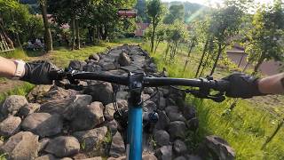
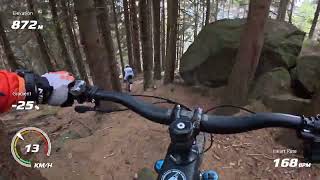
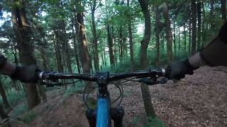
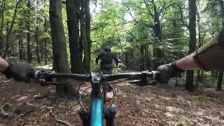
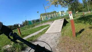
mtb
2:35 |
257 |
Apr 29, 2025


Recent Trail Reports
Activity Feed
| username | action | type | title | date |
|---|---|---|---|---|
| xaoo | add | photo | activity #107117807 and 10 more | Nov 3, 2026 @ 5:11am Nov 3, 2026 |
| Wr4MO6 | wishlist | route | activity #106794994 | Oct 29, 2026 @ 3:34am Oct 29, 2026 |
| xaoo | vote | trail | activity #106599877 | Oct 25, 2026 @ 2:40pm Oct 25, 2026 |
| xaoo | ridden | trail | activity #106599866 and 3 more | Oct 25, 2026 @ 2:40pm Oct 25, 2026 |
| xaoo | add | trail | activity #106597217 and 1 more | Oct 25, 2026 @ 2:08pm Oct 25, 2026 |
Recent Comments
| username | type | title | comment | date |
|---|---|---|---|---|
| trail | Dla mnie to perła w koronie sowiogórskiego... | Sep 21, 2026 @ 7:20am Sep 21, 2026 | ||
| trail | Kilka zjazdów, na których początkujący... | Jun 8, 2026 @ 10:03am Jun 8, 2026 | ||
| trail | Pierwsza część niebieska, ale w drugiej... | Aug 17, 2025 @ 12:02pm Aug 17, 2025 | ||
| trail | Szlak dosyc zmienny, w tej chwili miejscami... | Mar 16, 2024 @ 8:31am Mar 16, 2024 | ||
| trail | Wy ktorzy tu wjezdzacie, porzuccie wszelka... | Mar 16, 2024 @ 6:14am Mar 16, 2024 |
Local Badges
-

Epic Ride Climb 2k60 awarded -

Climbing 10k Badge25 awarded -

Climbing 100k Badge0 awarded -

Epic Ride Descent 2k60 awarded -

Descent 10k Badge25 awarded -

Descent 100k Badge0 awarded
Bike & Skill Parks
| name | type | city | rating |
|---|---|---|---|
| Pumptrack Bielawa | skill park | Bielawa | |
| Rowerowy Park Umiejętności w Bielawie | skill park | Bielawa |
Activity Type Stats
| activitytype | trails | distance | descent | descent distance | total vertical | rating | global rank | state rank | photos | reports | routes | activity logs |
|---|---|---|---|---|---|---|---|---|---|---|---|---|
| Mountain Bike | 78 | 64 miles | 18,743 ft | 33 miles | 2,018 ft | #2,207 | #37 | 218 | 484 | 7 | 4,511 | |
| E-Bike | 78 | 64 miles | 18,743 ft | 33 miles | 2,018 ft | #1,817 | #287 | 1 | 453 | 3 | 378 | |
| Gravel Bike | 32 | 47 miles | 4,839 ft | 16 miles | 2,018 ft | #1,082 | #26 | 51 | 83 | |||
| Adaptive Bike | 8 | 16 miles | 571 ft | 3 miles | 1,978 ft | #1,739 | #34 | 27 | ||||
| Horse | 1 | 4,137 ft | 3 ft | 299 ft | 197 ft | #380 | 44 | |||||
| Hike | 65 | 56 miles | 12,848 ft | 26 miles | 2,018 ft | #692 | #29 | 16 | 416 | 1,005 | ||
| Trail Running | 65 | 56 miles | 12,848 ft | 26 miles | 2,018 ft | #2,936 | #45 | 416 | 236 | |||
| Backcountry Ski | 6 | 2 miles | 935 ft | 1 mile | 574 ft | #330 | #31 | 24 | 17 | |||
| Nordic Ski | 10 | 17 miles | 2,224 ft | 8 miles | 617 ft | #350 | #30 | 25 | 1 | 167 |
Frequently Asked Questions
▼
What are the best places to ride in Bielawa?
Bielawa has 1 areas to explore for mountain biking. The top rated areas are:
▼
What are the highest rated mountain biking trails in Bielawa?
The highest rated mountain biking trails in Bielawa are:
- Dzikus (4.4/5)
- Słoneczna (4.3/5)
- Rymarz 1 (4.3/5)
- Edek (4.2/5)
- Zimne Buki (4.2/5)
▼
Where can I park to ride in Bielawa?
There are 9 parking locations listed in Bielawa. The most popular parking spots are:
- Parking bezpłatny
- Parking na Przełęczy Walimskiej
- Parking płatny na Przełęczy Jugowskiej
- Parking
- Parking płatny
▼
What is the longest trail in Bielawa?
The longest trail in Bielawa is Przełęcz Jugowska - Bielawska Polana at 2.7 miles. View all trails sorted by distance.
▼
What are the best & highest rated hiking trails in Bielawa?
The best hiking trails in Bielawa are: View all hiking trails sorted by popularity score.
▼
What are the best & highest rated trail running trails in Bielawa?
The best trail running trails in Bielawa are:
- Access Road
- Przełęcz Jugowska - Bielawska Polana
- Pod Rymarzem
- Wielka Sowa - Kozie Siodło
- Nic Takiego
▼
How many trails are in Bielawa?
Bielawa has a total of 82 trails. Of those, 78 are designated for mountain biking. Browse top mountain biking trails in Bielawa to find detailed information including difficulty ratings, distances, and trail conditions.
▼
Which trail has the most elevation gain in Bielawa?
The trail with the most elevation gain in Bielawa is Żółta Sowa with 568 ft of elevation gain. View all trails sorted by elevation gain.
▼
Which trail has the most elevation descent in Bielawa?
The trail with the most elevation descent in Bielawa is Mała Sowa with 1,135 ft of elevation descent. View all trails sorted by elevation descent.
▼
What activities are most popular in Bielawa?
Bielawa supports the following activities: Mountain Biking, E-Biking, Gravel Biking, Adaptive Biking, Hiking, Trail Running, Backcountry Skiing, Nordic Skiing.
▼
What are the steepest mountain biking trails in Bielawa?
The steepest mountain biking trail in Bielawa is Niebieska Koza with an average grade of 13.8%. View all trails sorted by grade.
▼
Are there any trails with scenic viewpoints in Bielawa?
Yes, there are 9 scenic viewpoints marked along trails in Bielawa. Some popular viewpoints include:
- Wieża widokowa na Kalenicy
- Wieża widokowa na Włodzickiej Górze
- Wieża widokowa na Wielkiej Sowie
- Punkt widokowy
- Platforma widokowa
▼
Are the trails open in Bielawa?
The overall region status for Bielawa is Minor Issue / Yellow. Out of 64 trails:
- Clear / Green: 54
- Minor Issue / Yellow: 6
- Significant Issue / Amber: 3
- Closed: 1
▼
Can I ride an ebike in Bielawa?
Yes, Bielawa supports e-bike riding. There are 74 trails in Bielawa that allow e-bikes. Check the e-bike trails listing for specific trail access details and any local regulations.
▼
What are the most popular mountain biking routes in Bielawa?
The most popular mountain biking routes in Bielawa are: View all mountain biking routes in Bielawa.
▼
What is the highest summit in Bielawa?
The highest summit in Bielawa is Kalenica at 3,173 ft elevation.
▼
What are the most popular Strava Segments in Bielawa?
The most popular Strava segments in Bielawa are:
- No to lecę, Sowo (3,518 athletes)
- końcówka pod zimną wodę (3,456 athletes)
- Wielka Sowa - ostatnia prosta (3,270 athletes)
▼
What trails are closed in Bielawa?
There are currently 1 closed trails in Bielawa. The breakdown of all trail statuses is:
- Clear / Green: 54
- Minor Issue / Yellow: 6
- Significant Issue / Amber: 3
- Closed: 1
▼
Are there accessible or adaptive trails in Bielawa?
Yes, there are 8 accessible/adaptive trails in Bielawa. View all adaptive trails in Bielawa for specific accessibility information.
▼
What are the most popular mountain biking trails in Bielawa?
The most popular mountain biking trails in Bielawa are: View all mountain biking trails sorted by popularity.
▼
What are the best beginner ride trails in Bielawa?
The best beginner mountain biking trails in Bielawa are:
- Pod Rymarzem (4.5/5)
- Kalenica z Prawej (0/5)
- Wielka Sowa - Kozie Siodło (4/5)
Activities
Trails
Points of Interest
- Wieża widokowa na Kalenicy Viewpoint
- Wieża widokowa na Włodzickiej Górze Viewpoint
- Wieża widokowa na Wielkiej Sowie Viewpoint
- Punkt widokowy Viewpoint
- Platforma widokowa Viewpoint
- Platforma widokowa Viewpoint
- Schronisko PTTK "Zygmuntówka" Cabin
- Punkt widokowy Viewpoint
- Punkt widokowy Viewpoint
- Schronisko Orzeł Cabin
- Kalenica (3,173 ft)
- Słoneczna (3,120 ft)
- Rymarz (2,992 ft)

- bielawa activity log | embed map of Bielawa mountain bike trails | bielawa mountain biking points of interest
Downloading of trail gps tracks in kml & gpx formats is enabled for Bielawa.
You must login to download files.
