close
-
Layers w
- Weather Layers
- Pro
- Pro
- Pro
- Pro
- Pro
- Pro
- More Layers
- Pro
- Pro
- Pro
- Pro
-
Upgrade to

3D
Trail Conditions
- Unknown
- Snow Groomed
- Snow Packed
- Snow Covered
- Snow Cover Partial
- Freeze/thaw Cycle
- Icy
- Prevalent Mud
- Wet
- Variable
- Ideal
- Dry
- Very Dry
Trail Flow (Ridden Direction)
Trailforks scans users ridelogs to determine the most popular direction each trail is ridden. A good flowing trail network will have most trails flowing in a single direction according to their intension.
The colour categories are based on what percentage of riders are riding a trail in its intended direction.
The colour categories are based on what percentage of riders are riding a trail in its intended direction.
- > 96%
- > 90%
- > 80%
- > 70%
- > 50%
- < 50%
- bi-directional trail
- no data
Trail Last Ridden
Trailforks scans ridelogs to determine the last time a trail was ridden.
- < 2 days
- < 1 week
- < 2 weeks
- < 1 month
- < 6 months
- > 6 months
Trail Ridden Direction
The intended direction a trail should be ridden.
- Downhill Only
- Downhill Primary
- Both Directions
- Uphill Primary
- Uphill Only
- One Direction
Contribute Details
Colors indicate trail is missing specified detail.
- Description
- Photos
- Description & Photos
- Videos
Trail Popularity ?
Trailforks scans ridelogs to determine which trails are ridden the most in the last 9 months.
Trails are compared with nearby trails in the same city region with a possible 25 colour shades.
Think of this as a heatmap, more rides = more kinetic energy = warmer colors.
- most popular
- popular
- less popular
- not popular
ATV/ORV/OHV Filter
Max Vehicle Width
inches
US Cell Coverage
Legend

Radar Time
Activity Recordings
Trailforks uses anonymized public activity data.
?
Activity Recordings
Trailforks uses anonymized public activity data.
?
Personal Heatmap
▶
Activity Types
all
/
none
▶
Options
2
Date range
month
–
Winter Trails
Warning
A routing network for winter maps does not exist. Selecting trails using the winter trails layer has been disabled.
Missing Trails
Most Popular
Least Popular
Trails are colored based on popularity. The more popular a trail is, the more red. Less popular trails trend towards green.
Jump Magnitude Heatmap
Heatmap of where riders jump on trails. Zoom in to see individual jumps, click circles to view jump details.
BC Backroad Status
![map legend]()
Service Road Atlas is a free to use, community-driven service for viewing and creating reports on the numerous back-country service roads around B.C. and Alberta.

Slope Aspect
Direction the slope faces
Trails Deemphasized
Trails are shown in grey.
Only show trails with no bike usage.
Suggested Layers
Based on selected activity type
Save the current map location and zoom level as your default home location whenever this page is loaded.
Save
No description for Blaker has been added yet!
Login or register to submit one.
This region uses the Uk/Euro style trail grading system.
Activities Click to view
- Mountain Bike
77 trails
- E-Bike
73 trails
- Adaptive Bike
0 trails
- Winter Fat Bike
0 trails
- Horse
52 trails
- Hike
77 trails
- Trail Running
77 trails
- ATV/ORV/OHV
14 trails
- Snowmobile
9 trails
- Snowshoe
71 trails
- Backcountry Ski
47 trails
- Nordic Ski
6 trails
Region Details
- 21
- 42
- 12
- 2
Region Status
Open as of Mar 15, 2025Stats
- Avg Trail Rating
- Trails (view details)
- 77
- Trails Mountain Bike
- 77
- Trails E-Bike
- 73
- Trails Horse
- 52
- Trails Hike
- 77
- Trails Trail Running
- 77
- Trails Dirtbike/Moto
- 1
- Trails ATV/ORV/OHV
- 14
- Trails Snowmobile
- 9
- Trails Snowshoe
- 71
- Trails Backcountry Ski
- 47
- Trails Nordic Ski
- 6
- Total Distance
- 45 miles
- Total Descent Distance
- 21 miles
- Total Descent
- 6,252 ft
- Total Vertical
- 726 ft
- Highest Trailhead
- 1,089 ft
- Reports
- 3
- Photos
- 11
- Ridden Counter
- 478
Sub Regions
-
Breisjøen
- 1
- 1
-
Fjuk / Armoen
- 12
- 7
- 2
-
Igletjern
- 7
- 4
-
Skytebaneåsen
- 21
Popular Blaker Mountain Biking Trails
• 60 ★ 0.0 • 4,731 ft • 0 ft • 12 •
Tight and physical singletrack with some great flowy sections, and some technical elements as well - pedaling sections in the middle and a sprint section at the end on a fire road (PAIN!!) Great trail - there is also a shorter version...
• 35 ★ 5.0 • 4,088 ft • 0 ft • 12 •
From the top of a small hill "behind" Igletjern this trail leads us towards down an awesome descent - it's fast, flowy and has lots of tight twists and turns that keep you on your toes at all times. Great fun and one of our favourite...
• 75 ★ 0.0 • 3,173 ft • 6 ft • 12 •
The trail starts with a slow incline before heading down a tight singletrack with some techy twists and turns. No scary drops or jumps, but enough rocks, roots and tight corners to make it a bit of a challenge. It ends with a fire road...
• 85 ★ 0.0 • 5,249 ft • 84 ft • 12 •
Great singletrack trail from Varsjøen up to Abbortjern. It is a steady climb in terrain that keeps up fairly well in the wet, but does have some wet holes, and is quite physically demanding.
• 55 ★ 0.0 • 1 mile • 5 ft • 11 •
This is a nice little track with lots of ladder bridges built across marshy patches - but we haven't gotten them all yet!! Fast, fun and hard with lots of pedaling and also some areas where you can really open your brakes and let the...
• 90 ★ 0.0 • 4,701 ft • 0 ft • 11 •
Starts from one of the most photographed view points in Sørum on the trail to Fjuktjern - and then follows the trail down to the bottom. There are a few pedaling sections, some rocks, drops and roots which combines to make this trail...
• 5 ★ 0.0 • 1,194 ft • 26 ft • 11 •
Trail leading from Innleggen up to Pump them legs!! - this trail gets really muddy and rough in the wet.
• 5 ★ 0.0 • 1 mile • 11 ft • 11 •
A nice trail leading from the top of the gravel path to Igletjernet down towards Kompveien - it is a very challenging trail physically, where you really have to pump your legs to keep the speed up. Can be very challenging in wet...
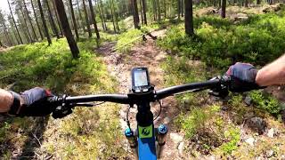
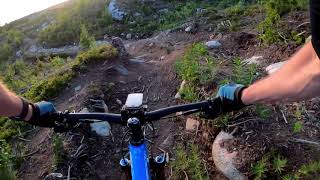
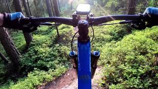
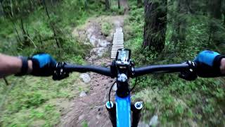
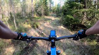
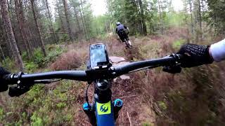
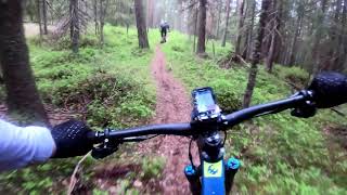
Photos of Blaker Mountain Bike
Videos of Blaker Mountain Bike
trail: Fett og fort
4:11 |
271 |
Jun 2, 2020 , Blaker
trail: Utsikten
5:12 |
213 |
Jun 1, 2020 , Blaker
trail: Kjetils kjipe
4:28 |
256 |
Jun 1, 2020 , Blaker
trail: Horses head 2
3:41 |
221 |
Jun 1, 2020 , Blaker
trail: Ta i litt da, snart nede
5:22 |
320 |
May 25, 2020 , Blaker
4:24 |
271 |
May 25, 2020 , Blaker

trail: I bakgården til Ken
4:10 |
244 |
May 25, 2020 , Blaker
trail: Klovehøgda DH
3:14 |
269 |
May 25, 2020 , Blaker
Recent Trail Reports
| status | trail | date | condition | info | user |
|---|---|---|---|---|---|
| Promillevegen over Huseby | Mar 15, 2025 @ 1:21pm Mar 15, 2025 | Wet | knutbs | ||
| Klovehøgda DH | Apr 21, 2022 @ 6:19am Apr 21, 2022 | Prevalent Mud | pugtheblack | ||
| Fra Kompveien til snuplass ved Setervika | Jun 8, 2021 @ 11:05am Jun 8, 2021 | Dry | Smartlook |
Activity Feed
| username | action | type | title | date |
|---|---|---|---|---|
| Espeno38RbX | like | directory | activity #79920057 | Sep 8, 2025 @ 8:55am Sep 8, 2025 |
| knutbs | add | report | activity #67806641 | Mar 15, 2025 @ 10:57am Mar 15, 2025 |
| BecauseAnimeLogic | wishlist | region | activity #50697747 | Apr 1, 2024 @ 4:32am Apr 1, 2024 |
| markholloway | update | trail | activity #34214903 | Oct 4, 2022 @ 7:56am Oct 4, 2022 |
| daturnbull | wishlist | trail | activity #32080025 and 1 more | Aug 3, 2022 @ 12:11am Aug 3, 2022 |
Local Badges
-

Completionist0 awarded -
Completionist0 awarded -

Epic Mountain Bike Climb 2k2 awarded -

Climbing 10k Badge3 awarded -

Mountain Biking 100k Badge0 awarded -

Epic Ride Descent 2k2 awarded
Activity Type Stats
| activitytype | trails | distance | descent | descent distance | total vertical | rating | global rank | state rank | photos | reports | routes | ridelogs |
|---|---|---|---|---|---|---|---|---|---|---|---|---|
| Mountain Bike | 77 | 45 miles | 6,253 ft | 21 miles | 725 ft | #2,145 | #27 | 11 | 3 | 2 | 461 | |
| E-Bike | 73 | 43 miles | 6,076 ft | 20 miles | 725 ft | #2,356 | #31 | 3 | 1 | 52 | ||
| Horse | 52 | 29 miles | 3,287 ft | 12 miles | 705 ft | #750 | #13 | 1 | ||||
| Hike | 77 | 45 miles | 6,253 ft | 21 miles | 725 ft | #3,894 | #42 | 3 | 34 | |||
| Trail Running | 77 | 45 miles | 6,253 ft | 21 miles | 725 ft | #3,311 | #42 | 3 | 1 | 30 | ||
| Dirtbike/Moto | 1 | 4,849 ft | 46 ft | 1,299 ft | 75 ft | 1 | ||||||
| ATV/ORV/OHV | 14 | 12 miles | 541 ft | 3 miles | 627 ft | #229 | #5 | |||||
| Snowmobile | 9 | 7 miles | 554 ft | 3 miles | 377 ft | #115 | #7 | |||||
| Snowshoe | 71 | 39 miles | 6,047 ft | 20 miles | 725 ft | #117 | #4 | 1 | 1 | |||
| Backcountry Ski | 47 | 24 miles | 2,293 ft | 10 miles | 663 ft | #205 | #8 | 1 | ||||
| Nordic Ski | 6 | 3 miles | 374 ft | 2 miles | 581 ft | #698 | #30 | 1 | 134 |
Frequently Asked Questions About Blaker
▼
What are the best places to ride in Blaker?
Blaker has 4 areas to explore for mountain biking. The top rated areas are:
▼
What are the highest rated mountain biking trails in Blaker?
The highest rated mountain biking trails in Blaker are:
- I bakgården til Ken (4.1/5)
- Klovehøgda DH (4.1/5)
- Fra traktorvei til stikryss mot Fjuktjern (0/5)
- Utsikten (0/5)
- Flyt langs 171 Sandbakk (0/5)
▼
What is the best time of the year to ride in Blaker?
Based on ride log data, the most popular months to ride in Blaker are:
- April (2 activities)
- October (1 activities)
▼
Where can I park to ride in Blaker?
There are 2 parking locations listed in Blaker. The most popular parking spots are:
Activities
Trails
Points of Interest
- By pugtheblack
 & contributors
 - Admins: mtbboy1993, Cykeljohan
- #31296 - 1,780 views
- blaker activity log | embed map of Blaker mountain bike trails | blaker mountain biking points of interest
Downloading of trail gps tracks in kml & gpx formats is enabled for Blaker.
You must login to download files.