close
-
Layers w
- Weather Layers
- Pro
- Pro
- Pro
- Pro
- Pro
- Pro
- More Layers
- Pro
- Pro
- Pro
- Pro
-
Upgrade to

3D
Trail Conditions
- Unknown
- Snow Groomed
- Snow Packed
- Snow Covered
- Snow Cover Partial
- Freeze/thaw Cycle
- Icy
- Prevalent Mud
- Wet
- Variable
- Ideal
- Dry
- Very Dry
Trail Flow (Ridden Direction)
Trailforks scans users ridelogs to determine the most popular direction each trail is ridden. A good flowing trail network will have most trails flowing in a single direction according to their intension.
The colour categories are based on what percentage of riders are riding a trail in its intended direction.
The colour categories are based on what percentage of riders are riding a trail in its intended direction.
- > 96%
- > 90%
- > 80%
- > 70%
- > 50%
- < 50%
- bi-directional trail
- no data
Trail Last Ridden
Trailforks scans ridelogs to determine the last time a trail was ridden.
- < 2 days
- < 1 week
- < 2 weeks
- < 1 month
- < 6 months
- > 6 months
Trail Ridden Direction
The intended direction a trail should be ridden.
- Downhill Only
- Downhill Primary
- Both Directions
- Uphill Primary
- Uphill Only
- One Direction
Contribute Details
Colors indicate trail is missing specified detail.
- Description
- Photos
- Description & Photos
- Videos
Trail Popularity ?
Trailforks scans ridelogs to determine which trails are ridden the most in the last 9 months.
Trails are compared with nearby trails in the same city region with a possible 25 colour shades.
Think of this as a heatmap, more rides = more kinetic energy = warmer colors.
- most popular
- popular
- less popular
- not popular
ATV/ORV/OHV Filter
Max Vehicle Width
inches
US Cell Coverage
Legend

Radar Time
Activity Recordings
Trailforks uses anonymized public activity data.
?
Activity Recordings
Trailforks uses anonymized public activity data.
?
Personal Heatmap
▶
Activity Types
all
/
none
▶
Options
2
Date range
month
–
Winter Trails
Warning
A routing network for winter maps does not exist. Selecting trails using the winter trails layer has been disabled.
Missing Trails
Most Popular
Least Popular
Trails are colored based on popularity. The more popular a trail is, the more red. Less popular trails trend towards green.
Jump Magnitude Heatmap
Heatmap of where riders jump on trails. Zoom in to see individual jumps, click circles to view jump details.
BC Backroad Status
![map legend]()
Service Road Atlas is a free to use, community-driven service for viewing and creating reports on the numerous back-country service roads around B.C. and Alberta.

Slope Aspect
Direction the slope faces
Trails Deemphasized
Trails are shown in grey.
Only show trails with no bike usage.
Suggested Layers
Based on selected activity type
Save the current map location and zoom level as your default home location whenever this page is loaded.
SaveBotswana (/bɒtˈswɑːnə/ (listen), also UK: /bʊt-, bʊˈtʃw-/[10]), officially the Republic of Botswana (Setswana: Lefatshe la Botswana), is a landlocked country in Southern Africa. Formerly the British protectorate of Bechuanaland, Botswana adopted its name after becoming independent within the Commonwealth on 30 September 1966.[11] Since then, it has been a representative republic, with a consistent record of uninterrupted democratic elections and the lowest perceived corruption ranking in Africa since at least 1998.[12] It is currently Africa's oldest continuous democracy.[13] Botswana is topographically flat, with up to 70 percent of its territory being the Kalahari Desert. It is bordered by South Africa to the south and southeast, Namibia to the west and north, and Zimbabwe to the northeast. Its border with Zambia to the north near Kazungula is poorly defined but is, at most, a few hundred metres long.[14]
A mid-sized country of just over 2.3 million people, Botswana is one of the most sparsely populated countries in the world. Around 10 percent of the population lives in the capital and largest city, Gaborone. Formerly one of the poorest countries in the world—with a GDP per capita of about US$70 per year in the late 1960s—Botswana has since transformed itself into one of the world's fastest-growing economies. The economy is dominated by mining, cattle, and tourism. Botswana boasts a GDP (purchasing power parity) per capita of about $18,825 per year as of 2015, which is one of the highest in Africa.[15] Its high gross national income (by some estimates the fourth-largest in Africa) gives the country a relatively high standard of living and one of the highest Human Development Index of continental Sub-Saharan Africa.[16]
Botswana is a member of the African Union, the Southern African Development Community, the Commonwealth of Nations, and the United Nations.
source: Botswana - Wikipedia
Region Details
- 16
- 5
- 13
- 1
Stats
- Avg Trail Rating
- Trails (view details)
- 35
- Trails Mountain Bike
- 35
- Trails E-Bike
- 34
- Trails Horse
- 26
- Trails Hike
- 35
- Trails Trail Running
- 35
- Total Distance
- 88 miles
- Total Descent Distance
- 34 miles
- Total Descent
- 2,896 ft
- Total Vertical
- 2,051 ft
- Highest Trailhead
- 3,791 ft
- Reports
- 28
- Photos
- 25
- Ridden Counter
- 36
Sub Regions
- Central District (26)
- Northern Tuli Game Reserve (26)
- Mashatu (26)
- Northern Tuli Game Reserve (26)
- Chobe (0)
- Kgaligadi District (1)
- Hukuntsi (1)
- Hukuntsi (1)
- Kgatleng District (1)
- Mochudi (1)
- Mochudi (1)
- Kweneng District (0)
- Ngamiland (0)
- North East District (0)
- South East District (8)
- Gaberone (8)
- Gaberone (8)
- Southern District (0)
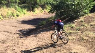
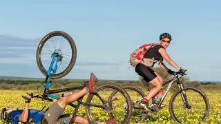
Popular Botswana Mountain Biking Trails
• 75 ★ 0.0 • 4,137 ft • 6 ft • 3 •
Popular green difficulty singletrack. This mountain bike primary trail can be used both directions. On average it takes 4 minutes to complete this trail.
• 100 ★ 0.0 • 2 miles • 76 ft • 3 •
The track runs from the dump to the bottom of the Saddle track. Some jeep track and single track. Only one small section of sand. Normally well cleared
• 65 ★ 0.0 • 4,944 ft • 153 ft • 3 •
Moderately popular blue difficulty singletrack. This mountain bike primary trail can be used both directions and has a moderate overall physical rating with a 153 ft blue climb. On average it takes 9 minutes to complete this trail.
• 5 ★ 0.0 • 2 miles • 67 ft • 3 •
A very nice single track running between the tar road of Mokolodi 1 and Mokolodi 2. Fast sweeping bends, some light rocks and a river crossing.
• 5 ★ 5.0 • 3 miles • 98 ft • 2 •
Less popular blue difficulty singletrack. This multi-use trail can be used both directions and has a moderate overall physical rating with a 98 ft green climb. Trail visibility is always easy to follow.
• 90 ★ 0.0 • 4,662 ft • 0 ft • 1 •
Popular blue difficulty singletrack. This mountain bike primary trail can be used both directions with a 0 ft black diamond climb. It features rock garden. Trail visibility is always easy to follow.
• 5 ★ 0.0 • 3 miles • 374 ft • 1 •
Less popular black diamond difficulty singletrack. This mountain bike primary trail can be used both directions and has a hard overall physical rating. Trail visibility is sometimes hard to follow.
• 5 ★ 0.0 • 3,350 ft • 63 ft • 1 •
Less popular green difficulty singletrack. This mountain bike primary trail can be used both directions. On average it takes 14 minutes to complete this trail.
Botswana Mountain Bike Routes
41 miles • 1,834 ft • 0 •
A 65k loop from the Rugby club heading South to some of the High spots close to Gaborone
Recent Comments
| username | type | title | comment | date |
|---|---|---|---|---|
| trail | hi | Apr 3, 2023 @ 8:33am Apr 3, 2023 |
Activity Type Stats
| activitytype | trails | distance | descent | descent distance | total vertical | rating | global rank | state rank | photos | reports | routes | ridelogs |
|---|---|---|---|---|---|---|---|---|---|---|---|---|
| Mountain Bike | 35 | 88 miles | 2,897 ft | 34 miles | 2,051 ft | #85 | 24 | 28 | 2 | 1,783 | ||
| E-Bike | 34 | 87 miles | 2,897 ft | 34 miles | 2,051 ft | #75 | 28 | 41 | ||||
| Horse | 26 | 76 miles | 1,985 ft | 28 miles | 292 ft | #49 | 27 | |||||
| Hike | 35 | 88 miles | 2,897 ft | 34 miles | 2,051 ft | #92 | 28 | 226 | ||||
| Trail Running | 35 | 88 miles | 2,897 ft | 34 miles | 2,051 ft | #87 | 28 | 1 | 9 |
Activities
Trails
- By markholloway
 Trailforks Map Team & contributors
 - Admins: WillieJacobsz
- #35804 - 3,808 views
- botswana activity log | embed map of Botswana mountain bike trails | botswana mountain biking points of interest polygons
Downloading of trail gps tracks in kml & gpx formats is enabled for Botswana.
You must login to download files.