close
-
Layers w
- Weather Layers
- Pro
- Pro
- Pro
- Pro
- Pro
- Pro
- More Layers
- Pro
- Pro
- Pro
- Pro
-
Upgrade to

3D
Trail Conditions
- Unknown
- Snow Groomed
- Snow Packed
- Snow Covered
- Snow Cover Partial
- Freeze/thaw Cycle
- Icy
- Prevalent Mud
- Wet
- Variable
- Ideal
- Dry
- Very Dry
Trail Flow (Ridden Direction)
Trailforks scans users ridelogs to determine the most popular direction each trail is ridden. A good flowing trail network will have most trails flowing in a single direction according to their intension.
The colour categories are based on what percentage of riders are riding a trail in its intended direction.
The colour categories are based on what percentage of riders are riding a trail in its intended direction.
- > 96%
- > 90%
- > 80%
- > 70%
- > 50%
- < 50%
- bi-directional trail
- no data
Trail Last Ridden
Trailforks scans ridelogs to determine the last time a trail was ridden.
- < 2 days
- < 1 week
- < 2 weeks
- < 1 month
- < 6 months
- > 6 months
Trail Ridden Direction
The intended direction a trail should be ridden.
- Downhill Only
- Downhill Primary
- Both Directions
- Uphill Primary
- Uphill Only
- One Direction
Contribute Details
Colors indicate trail is missing specified detail.
- Description
- Photos
- Description & Photos
- Videos
Trail Popularity ?
Trailforks scans ridelogs to determine which trails are ridden the most in the last 9 months.
Trails are compared with nearby trails in the same city region with a possible 25 colour shades.
Think of this as a heatmap, more rides = more kinetic energy = warmer colors.
- most popular
- popular
- less popular
- not popular
ATV/ORV/OHV Filter
Max Vehicle Width
inches
US Cell Coverage
Legend

Radar Time
Activity Recordings
Trailforks uses anonymized public activity data.
?
Activity Recordings
Trailforks uses anonymized public activity data.
?
Personal Heatmap
▶
Activity Types
all
/
none
▶
Options
2
Date range
month
–
Winter Trails
Warning
A routing network for winter maps does not exist. Selecting trails using the winter trails layer has been disabled.
Missing Trails
Most Popular
Least Popular
Trails are colored based on popularity. The more popular a trail is, the more red. Less popular trails trend towards green.
Jump Magnitude Heatmap
Heatmap of where riders jump on trails. Zoom in to see individual jumps, click circles to view jump details.
BC Backroad Status
![map legend]()
Service Road Atlas is a free to use, community-driven service for viewing and creating reports on the numerous back-country service roads around B.C. and Alberta.

Slope Aspect
Direction the slope faces
Trails Deemphasized
Trails are shown in grey.
Only show trails with no bike usage.
Suggested Layers
Based on selected activity type
Save the current map location and zoom level as your default home location whenever this page is loaded.
Save
No description for Bow has been added yet!
Login or register to submit one.
Activities Click to view
- Mountain Bike
78 trails
- E-Bike
5 trails
- Gravel Bike
0 trails
- Adaptive Bike
0 trails
- Hike
79 trails
- Trail Running
79 trails
- Snowmobile
19 trails
- Snowshoe
13 trails
- Nordic Ski
14 trails
Region Details
- 10
- 32
- 23
- 8
- 3
Region Status
Caution as of May 1, 2026Stats
- Avg Trail Rating
- Trails (view details)
- 77
- Trails Mountain Bike
- 79
- Trails E-Bike
- 5
- Trails Hike
- 79
- Trails Trail Running
- 79
- Trails Snowmobile
- 20
- Trails Snowshoe
- 13
- Trails Backcountry Ski
- 1
- Trails Nordic Ski
- 14
- Total Distance
- 44 miles
- Total Descent
- 7,210 ft
- Total Vertical
- 594 ft
- Highest Trailhead
- 899 ft
- Reports
- 177
- Photos
- 28
- Ridden Counter
- 8,203
Sub Regions
-
Hammond Nature Preserve & Walker Forest
- 16
- 11
-
Knox and School Forests
- 8
- 6
- 1
-
Nottingcook Forest
- 2
- 7
- 2
-
Shaw Divide Trails
- 10
- 7
Popular Bow Mountain Biking Trails
• 100 ★ 3.0 • 1,001 ft • 0 ft • 261 •
Quick little piece of nice singletrack that leads nicely from into , for a longer trail when you include .
• 100 ★ 4.5 • 2,306 ft • 73 ft • 237 •
is another fun, short singletrack that connects up nicely with for a bit longer ride if you so desire.
• 100 ★ 4.0 • 3,948 ft • 185 ft • 237 •
Medium length trail with some good flow and technical sections. Has some fun downhill and short climbs, rides great both ways. Think of this as an easier .
• 100 ★ 4.0 • 787 ft • 0 ft • 232 •
Super short, zippy piece of trail that leads nicely into for a little longer opener from the north parking lot.
• 95 ★ 4.5 • 2,055 ft • 108 ft • 228 •
is a great appetite-whetter if you park at the north lot which, along with trail gives you a quick, fun section of singletrack that will get you hungry for more. Very nice flow from east to west.
• 90 ★ 4.6 • 1 mile • 220 ft • 226 •
Solid trail. Awesome trail building on this one. Great lines with some flow, in addition to some wicked steep sections and some techy bits to keep it interesting. It'll even get you winded. Solid riding.
• 80 ★ 3.8 • 4,658 ft • 181 ft • 205 •
Similar to , is one of the more interesting singletrack trails in this area. Well-built and appropriately tough in spots, will keep you on your toes.
Bow Mountain Bike Routes
7 miles • 538 ft • 11 • Loop •
This little loop covers just about everything in this section of Bow trails. / are the only two trails...
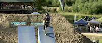
Photos of Bow Mountain Bike
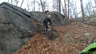
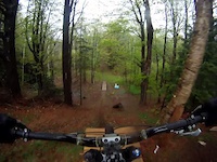
Videos of Bow Mountain Bike

trail: Woods
2:19 |
173 |
Jan 28, 2017
trail: Woods
0:41 |
108 |
Dec 11, 2016
trail: Woods
0:36 |
45 |
Oct 16, 2016
trail: Parker
15:58 |
112 |
Feb 10, 2016

trail: Woods
3:40 |
496 |
Oct 28, 2013
trail: Snowmobile
3:54 |
156 |
Feb 20, 2013
trail: Robertson
3:23 |
4327 |
Jul 26, 2012
trail: Go
0:34 |
128 |
May 9, 2012
Recent Trail Reports
| status | trail | date | condition | info | user |
|---|---|---|---|---|---|
| Storm Drain | May 1, 2026 @ 4:52pm (America/New_York) May 1, 2026 | Ideal | Oldbikersam | ||
| Sawmill Hill | May 1, 2026 @ 4:52pm (America/New_York) May 1, 2026 | Ideal | Oldbikersam | ||
| Rogue Ridge | May 1, 2026 @ 4:52pm (America/New_York) May 1, 2026 | Ideal | Oldbikersam | ||
| Snowboarder | May 1, 2026 @ 4:52pm (America/New_York) May 1, 2026 | Variable | Oldbikersam | ||
| Stinger Trail | May 1, 2026 @ 4:52pm (America/New_York) May 1, 2026 | Variable | Oldbikersam | ||
| Warner Trail (Pandemic) | May 1, 2026 @ 4:52pm (America/New_York) May 1, 2026 | Variable | Oldbikersam | ||
| Mossy | Apr 9, 2026 @ 4:47pm (America/New_York) Apr 9, 2026 | Variable | Oldbikersam | ||
| Boundary | Apr 9, 2026 @ 4:47pm (America/New_York) Apr 9, 2026 | Variable | Oldbikersam | ||
| Boundary Alt | Apr 9, 2026 @ 4:47pm (America/New_York) Apr 9, 2026 | Variable | Oldbikersam | ||
| Miss Smith | Apr 9, 2026 @ 4:47pm (America/New_York) Apr 9, 2026 | Variable | Oldbikersam |
Activity Feed
| username | action | type | title | date |
|---|---|---|---|---|
| jibbysspeedshop | vote | trail | activity #95201425 | May 21, 2026 @ 2:42pm May 21, 2026 |
| DonaldFqFoOc | wishlist | region | activity #94472753 | May 10, 2026 @ 6:20pm May 10, 2026 |
| Oldbikersam | add | report | activity #93814311 and 5 more | May 1, 2026 @ 3:25pm May 1, 2026 |
| kfignewton | wishlist | region | activity #93599325 | Apr 28, 2026 @ 12:34pm Apr 28, 2026 |
| trailforks | add | video | activity #92430044 | Apr 11, 2026 @ 3:00pm Apr 11, 2026 |
Recent Comments
| username | type | title | comment | date |
|---|---|---|---|---|
| trail | Excellent view from overlook at north end of... | Oct 14, 2025 @ 6:52am Oct 14, 2025 | ||
| report | Absolutely perfect! Just rode today no wet... | Sep 17, 2024 @ 4:09pm Sep 17, 2024 | ||
| trail | So legit having some real Enduro terrain in snh | May 29, 2023 @ 9:29am May 29, 2023 | ||
| trail | Page hill development has started, two spots... | Sep 10, 2022 @ 8:21am Sep 10, 2022 | ||
| trail | Comment below incorrect, it is the next trail... | Sep 10, 2022 @ 8:21am Sep 10, 2022 |
Local Badges
-

10 Green Trails122 awarded -

10 Blue Trails130 awarded -

Epic Ride Climb 2k4 awarded -

Climbing 10k Badge36 awarded -

Climbing 100k Badge3 awarded -

Epic Ride Descent 2k4 awarded
Activity Type Stats
| activitytype | trails | distance | descent | descent distance | total vertical | rating | global rank | state rank | photos | reports | routes | ridelogs |
|---|---|---|---|---|---|---|---|---|---|---|---|---|
| Mountain Bike | 78 | 43 miles | 7,208 ft | 20 miles | 594 ft | #2,108 | #754 | 28 | 181 | 3 | 7,797 | |
| E-Bike | 5 | 2 miles | 410 ft | 1 mile | 259 ft | #9,172 | #2,819 | 114 | 98 | |||
| Hike | 79 | 44 miles | 7,201 ft | 20 miles | 594 ft | #4,766 | #1,677 | 181 | 654 | |||
| Trail Running | 79 | 44 miles | 7,201 ft | 20 miles | 594 ft | #4,051 | #1,229 | 181 | 1 | 1,233 | ||
| Snowmobile | 19 | 10 miles | 1,142 ft | 4 miles | 367 ft | #275 | #144 | 9 | 3 | |||
| Snowshoe | 13 | 7 miles | 400 ft | 2 miles | 308 ft | #1,145 | #600 | 30 | 54 | |||
| Backcountry Ski | 1 | 1 mile | 66 ft | 1,368 ft | 131 ft | 1 | 20 | |||||
| Nordic Ski | 14 | 9 miles | 400 ft | 2 miles | 308 ft | #1,315 | #597 | 26 | 63 |
Frequently Asked Questions About Bow
▼
What are the best places to ride in Bow?
Bow has 4 areas to explore for mountain biking. The top rated areas are:
▼
What are the highest rated mountain biking trails in Bow?
The highest rated mountain biking trails in Bow are:
- Boulder (4.3/5)
- Mooseknuckles (4.2/5)
- Rogue Ridge (4.1/5)
- Rookery trail (4.1/5)
- Hemlock Trail (4.1/5)
▼
What is the best time of the year to ride in Bow?
Based on ride log data, the most popular months to ride in Bow are:
- May (136 activities)
- July (136 activities)
- June (119 activities)
▼
Where can I park to ride in Bow?
Activities
Trails
Points of Interest
- By zdwagner & contributors
- Admins: SNH NEMBA, UWV
- #19008 - 7,449 views
- bow activity log | embed map of Bow mountain bike trails | bow mountain biking points of interest
Downloading of trail gps tracks in kml & gpx formats is enabled for Bow.
You must login to download files.