close
-
Layers w
- Weather Layers
- Pro
- Pro
- Pro
- Pro
- Pro
- Pro
- More Layers
- Pro
- Pro
- Pro
- Pro
-
Upgrade to

3D
Trail Conditions
- Unknown
- Snow Groomed
- Snow Packed
- Snow Covered
- Snow Cover Partial
- Freeze/thaw Cycle
- Icy
- Prevalent Mud
- Wet
- Variable
- Ideal
- Dry
- Very Dry
Trail Flow (Ridden Direction)
Trailforks scans users ridelogs to determine the most popular direction each trail is ridden. A good flowing trail network will have most trails flowing in a single direction according to their intension.
The colour categories are based on what percentage of riders are riding a trail in its intended direction.
The colour categories are based on what percentage of riders are riding a trail in its intended direction.
- > 96%
- > 90%
- > 80%
- > 70%
- > 50%
- < 50%
- bi-directional trail
- no data
Trail Last Ridden
Trailforks scans ridelogs to determine the last time a trail was ridden.
- < 2 days
- < 1 week
- < 2 weeks
- < 1 month
- < 6 months
- > 6 months
Trail Ridden Direction
The intended direction a trail should be ridden.
- Downhill Only
- Downhill Primary
- Both Directions
- Uphill Primary
- Uphill Only
- One Direction
Contribute Details
Colors indicate trail is missing specified detail.
- Description
- Photos
- Description & Photos
- Videos
Trail Popularity ?
Trailforks scans ridelogs to determine which trails are ridden the most in the last 9 months.
Trails are compared with nearby trails in the same city region with a possible 25 colour shades.
Think of this as a heatmap, more rides = more kinetic energy = warmer colors.
- most popular
- popular
- less popular
- not popular
ATV/ORV/OHV Filter
Max Vehicle Width
inches
US Cell Coverage
Legend

Radar Time
Activity Recordings
Trailforks uses anonymized public activity data.
?
Activity Recordings
Trailforks uses anonymized public activity data.
?
Personal Heatmap
▶
Activity Types
all
/
none
▶
Options
2
Date range
month
–
Winter Trails
Warning
A routing network for winter maps does not exist. Selecting trails using the winter trails layer has been disabled.
Missing Trails
Most Popular
Least Popular
Trails are colored based on popularity. The more popular a trail is, the more red. Less popular trails trend towards green.
Jump Magnitude Heatmap
Heatmap of where riders jump on trails. Zoom in to see individual jumps, click circles to view jump details.
BC Backroad Status
![map legend]()
Service Road Atlas is a free to use, community-driven service for viewing and creating reports on the numerous back-country service roads around B.C. and Alberta.

Slope Aspect
Direction the slope faces
Trails Deemphasized
Trails are shown in grey.
Only show trails with no bike usage.
Suggested Layers
Based on selected activity type
Save the current map location and zoom level as your default home location whenever this page is loaded.
Save
No description for Brilon has been added yet!
Login or register to submit one.
This region uses the Uk/Euro style trail grading system.
Activities Click to view
- Mountain Bike
18 trails
- E-Bike
18 trails
- Gravel Bike
0 trails
- Adaptive Bike
0 trails
- Hike
3 trails
- Trail Running
3 trails
Region Details
- 1
- 11
- 1
Region Status
Open as of 1 dayStats
- Avg Trail Rating
- Trails (view details)
- 13
- Trails Mountain Bike
- 18
- Trails E-Bike
- 18
- Trails Hike
- 3
- Trails Trail Running
- 3
- Total Distance
- 6 miles
- Total Descent
- 1,240 ft
- Total Vertical
- 510 ft
- Highest Trailhead
- 2,089 ft
- Reports
- 146
- Photos
- 9
- Ridden Counter
- 2,685
Sub Regions
-
Trailground Brilon
- 11
- 1
Popular Brilon Mountain Biking Trails
• 85 ★ 4.5 • 1,834 ft • 0 ft • 261 •
Der schwierigste Trail der Trailgrounds Brilon. Anfangs relativ technisch mit ein paar engen Kurven zum Ende hin wird er schneller mit Anliegerkurven.
• 95 ★ 4.4 • 1,243 ft • 0 ft • 257 •
Kurzer Trail mit großen Anliegern und kleinen Drops. Kleines Highlight.
• 80 ★ 4.4 • 3,976 ft • 42 ft • 252 •
Highly rated popular green difficulty singletrack. This mountain bike primary trail can be used downhill only. On average it takes 4 minutes to complete this trail.
• 70 ★ 3.8 • 2,536 ft • 6 ft • 248 •
Nach dem Bilstein-Downhill einer der steinigeren Trails.
• 40 ★ 4.0 • 2,548 ft • 48 ft • 238 •
Highly rated moderately popular green difficulty singletrack. This mountain bike primary trail can be used downhill only. On average it takes 4 minutes to complete this trail.
• 15 ★ 3.2 • 2,986 ft • 22 ft • 183 •
Less popular green difficulty singletrack. This mountain bike primary trail can be used downhill only. On average it takes 4 minutes to complete this trail.
• 25 ★ 4.0 • 4,022 ft • 29 ft • 177 •
Erst Uphill-Trail mit Anliegern, dann Downhill mit leicht technischen Features (Wurzel, Steine, etc.).
• 50 ★ 3.5 • 1,385 ft • 0 ft • 147 •
Nice flowtrail with rollable Jumps and some twisty Berms.
Brilon Mountain Bike Routes
★ 5.0 • 11 miles • 1,572 ft • 8 • Loop •
This is the full red route at the Brilon Trailground which takes in their green, blue & red trails...
11 miles • 1,473 ft • 9 • Loop •
Trailground Brilon route. It's an easy loop for intermediate riders
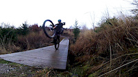
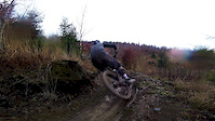
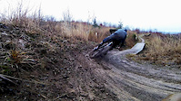
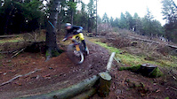
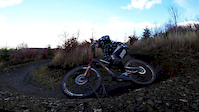
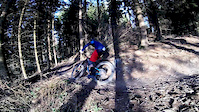
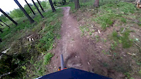
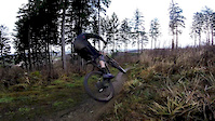
Photos of Brilon Mountain Bike
Videos of Brilon Mountain Bike
trail: Panorama-Trail
0:12 |
131 |
May 31, 2020
trail: Panorama-Trail
0:15 |
55 |
May 31, 2020
trail: Panorama-Trail
0:20 |
54 |
May 31, 2020
trail: Um den Plattenberg
0:04 |
53 |
May 13, 2020
trail: Achterbahn
0:00 |
46 |
Apr 29, 2020
trail: Um den Plattenberg
0:39 |
34 |
Apr 27, 2020
trail: Bilstein Downhill
0:24 |
121 |
Mar 17, 2020
trail: Bilstein Downhill
0:14 |
61 |
Mar 17, 2020
Recent Trail Reports
| status | trail | date | condition | info | user |
|---|---|---|---|---|---|
| Schöne Aussicht | Jun 18, 2026 @ 6:10pm (Europe/Luxembourg) 1 day | Ideal | Lobiwan8 | ||
| Panorama-Trail | Jun 18, 2026 @ 6:10pm (Europe/Luxembourg) 1 day | Ideal | Lobiwan8 | ||
| Steinbruch Uphill | Jun 18, 2026 @ 6:10pm (Europe/Luxembourg) 1 day | Ideal | Lobiwan8 | ||
| Schwarzes Haupt | Jun 18, 2026 @ 6:10pm (Europe/Luxembourg) 1 day | Ideal | Lobiwan8 | ||
| Um den Plattenberg | Jun 18, 2026 @ 6:10pm (Europe/Luxembourg) 1 day | Ideal | Lobiwan8 | ||
| Kohlweg Flow | Jun 18, 2026 @ 6:10pm (Europe/Luxembourg) 1 day | Ideal | Lobiwan8 | ||
| Achterbahn | Jun 18, 2026 @ 6:10pm (Europe/Luxembourg) 1 day | Ideal | Lobiwan8 | ||
| Bilstein Downhill | Jun 18, 2026 @ 6:10pm (Europe/Luxembourg) 1 day | Ideal | Lobiwan8 | ||
| Hängberg Trail | Jun 18, 2026 @ 6:10pm (Europe/Luxembourg) 1 day | Ideal | Lobiwan8 | ||
| Kyrill-Uphill | May 10, 2026 @ 1:19pm (Europe/Luxembourg) May 10, 2026 | Ideal | Doerch |
Activity Feed
| username | action | type | title | date |
|---|---|---|---|---|
| Lobiwan8 | add | report | activity #97278370 and 8 more | Jun 18, 2026 @ 3:11pm 1 day |
| Doerch | add | report | activity #94420101 and 9 more | May 10, 2026 @ 6:18am May 10, 2026 |
| Doerch | add | report | activity #93802389 and 9 more | May 1, 2026 @ 12:11pm May 1, 2026 |
| klausx | vote | trail | activity #93330843 | Apr 25, 2026 @ 12:14am Apr 25, 2026 |
| cTJSF0 | ridden | trail | activity #91913916 and 7 more | Apr 4, 2026 @ 10:49am Apr 4, 2026 |
Local Badges
-

Epic Mountain Bike Climb 2k1 awarded -

Climbing 10k Badge0 awarded -

Mountain Biking 100k Badge0 awarded -

Epic Ride Descent 2k1 awarded -

Descent 10k Badge0 awarded -

Descent 100k Badge0 awarded
Activity Type Stats
| activitytype | trails | distance | descent | descent distance | total vertical | rating | global rank | state rank | photos | reports | routes | ridelogs |
|---|---|---|---|---|---|---|---|---|---|---|---|---|
| Mountain Bike | 18 | 6 miles | 1,240 ft | 3 miles | 509 ft | #7,568 | #306 | 9 | 146 | 2 | 2,051 | |
| E-Bike | 18 | 6 miles | 1,240 ft | 3 miles | 509 ft | #4,259 | #118 | 145 | 281 | |||
| Hike | 3 | 1 mile | 13 ft | 515 ft | 423 ft | #12,361 | #414 | 122 | 50 | |||
| Trail Running | 3 | 1 mile | 13 ft | 515 ft | 423 ft | #11,888 | #408 | 122 | 1 |
Frequently Asked Questions About Brilon
▼
What are the best places to ride in Brilon?
Brilon has 1 areas to explore for mountain biking. The top rated areas are:
▼
What are the highest rated mountain biking trails in Brilon?
The highest rated mountain biking trails in Brilon are:
- Bilstein Downhill (4.3/5)
- Achterbahn (4.2/5)
- Panorama-Trail (4.2/5)
- Hängberg Trail (4/5)
- Kohlweg-Trail (4/5)
▼
What is the best time of the year to ride in Brilon?
Based on ride log data, the most popular months to ride in Brilon are:
- May (8 activities)
- June (8 activities)
- August (7 activities)
▼
Where can I park to ride in Brilon?
There are 1 parking locations listed in Brilon. The most popular parking spots are:
Trails
- By canadaka
 Trailforks & contributors
 - Admins: apply
- #15842 - 2,268 views
- brilon activity log | embed map of Brilon mountain bike trails | brilon mountain biking points of interest
Downloading of trail gps tracks in kml & gpx formats is enabled for Brilon.
You must login to download files.