close
-
Layers w
- Weather Layers
- Pro
- Pro
- Pro
- Pro
- Pro
- Pro
- More Layers
- Pro
- Pro
- Pro
- Pro
-
Upgrade to

3D
Trail Conditions
- Unknown
- Snow Groomed
- Snow Packed
- Snow Covered
- Snow Cover Partial
- Freeze/thaw Cycle
- Icy
- Prevalent Mud
- Wet
- Variable
- Ideal
- Dry
- Very Dry
Trail Flow (Ridden Direction)
Trailforks scans users ridelogs to determine the most popular direction each trail is ridden. A good flowing trail network will have most trails flowing in a single direction according to their intension.
The colour categories are based on what percentage of riders are riding a trail in its intended direction.
The colour categories are based on what percentage of riders are riding a trail in its intended direction.
- > 96%
- > 90%
- > 80%
- > 70%
- > 50%
- < 50%
- bi-directional trail
- no data
Trail Last Ridden
Trailforks scans ridelogs to determine the last time a trail was ridden.
- < 2 days
- < 1 week
- < 2 weeks
- < 1 month
- < 6 months
- > 6 months
Trail Ridden Direction
The intended direction a trail should be ridden.
- Downhill Only
- Downhill Primary
- Both Directions
- Uphill Primary
- Uphill Only
- One Direction
Contribute Details
Colors indicate trail is missing specified detail.
- Description
- Photos
- Description & Photos
- Videos
Trail Popularity ?
Trailforks scans ridelogs to determine which trails are ridden the most in the last 9 months.
Trails are compared with nearby trails in the same city region with a possible 25 colour shades.
Think of this as a heatmap, more rides = more kinetic energy = warmer colors.
- most popular
- popular
- less popular
- not popular
ATV/ORV/OHV Filter
Max Vehicle Width
inches
US Cell Coverage
Legend

Radar Time
Activity Recordings
Trailforks uses anonymized public activity data.
?
Activity Recordings
Trailforks uses anonymized public activity data.
?
Personal Heatmap
▶
Activity Types
all
/
none
▶
Options
2
Date range
month
–
Winter Trails
Warning
A routing network for winter maps does not exist. Selecting trails using the winter trails layer has been disabled.
Missing Trails
Most Popular
Least Popular
Trails are colored based on popularity. The more popular a trail is, the more red. Less popular trails trend towards green.
Jump Magnitude Heatmap
Heatmap of where riders jump on trails. Zoom in to see individual jumps, click circles to view jump details.
BC Backroad Status
![map legend]()
Service Road Atlas is a free to use, community-driven service for viewing and creating reports on the numerous back-country service roads around B.C. and Alberta.

Slope Aspect
Direction the slope faces
Trails Deemphasized
Trails are shown in grey.
Only show trails with no bike usage.
Suggested Layers
Based on selected activity type
Save the current map location and zoom level as your default home location whenever this page is loaded.
Save
No description for Brixen has been added yet!
Login or register to submit one.
eBikes Allowed:
Yes
AKA: Bressanone
This region uses the Uk/Euro style trail grading system.
Activities Click to view
- Mountain Bike
23 trails
- E-Bike
23 trails
- Adaptive Bike
0 trails
- Winter Fat Bike
0 trails
- Horse
3 trails
- Hike
16 trails
- Trail Running
18 trails
- Dirtbike/Moto
1 trails
- ATV/ORV/OHV
1 trails
- Downhill Ski
50 trails
Region Details
- 4
- 1
- 5
- 5
- 6
- 1
Region Status
Open as of Aug 27, 2025Stats
- Avg Trail Rating
- Trails (view details)
- 77
- Trails Mountain Bike
- 23
- Trails E-Bike
- 23
- Trails Horse
- 3
- Trails Hike
- 16
- Trails Trail Running
- 18
- Trails Dirtbike/Moto
- 1
- Trails ATV/ORV/OHV
- 1
- Trails Downhill Ski
- 50
- Trails Backcountry Ski
- 2
- Total Distance
- 143 miles
- Total Descent
- 67,581 ft
- Total Vertical
- 8,096 ft
- Highest Trailhead
- 8,943 ft
- Reports
- 125
- Photos
- 39
- Ridden Counter
- 2,587
Popular Brixen Mountain Biking Trails
• 90 ★ 4.5 • 1 mile • 2 ft • 307 •
First part (from mountain to middle station) of the "old" Skyline. The trail has been strongly modified between 2023 and 2024.Now the name SKYLINE refers only to this first part. The first section has some jumps, mainly tables, which...
• 85 ★ 3.0 • 26 miles • 727 ft • 104 •
Popular white difficulty family friendly paved path. This multi-use trail can be used both directions and has a easy overall physical rating with a 727 ft green climb. Trail visibility is always easy to follow. On average it takes 3 hours25 minutes to complete this trail.
• 75 ★ 2.5 • 34 miles • 1,507 ft • 70 •
Eurovelo 7 - From Cape North to Sicily
• ★ 5.0 • 2 miles • 6 ft • 55 •
From the middle to the valley station, this trail was the 2nd half of the former , now renamed ROCK LINE. Same as for the 1st section, also this lower part features rocks, roots, flow, and a lot of rithm.
• 55 ★ 4.4 • 4 miles • 392 ft • 38 •
Moderately popular red difficulty singletrack. This mountain bike primary trail can be used downhill primary. Trail visibility is always easy to follow. On average it takes 1 hour35 minutes to complete this trail.
Brixen Mountain Bike Routes
★ 2.5 • 21 miles • 8,339 ft • 1 • Loop •
easy tour starting and ending in Mulbach. using the 3 gondolas you can manage almost 3000m downhill...
17 miles • 5,135 ft • 0 • Loop •
Uphill from Schnauders to Latzfonser Kreuz hut on forest roads and downhill on tech trails passing through...
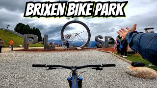
Photos of Brixen Mountain Bike
Videos of Brixen Mountain Bike
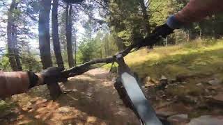
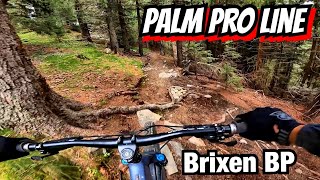
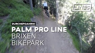
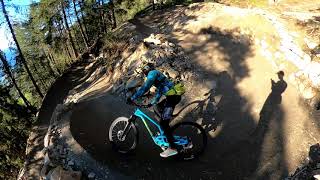
trail: Palm Pro Line
8:35 |
60 |
Sep 16, 2025 , Brixen
trail: Palm Pro Line
11:10 |
58 |
Aug 16, 2025 , Brixen

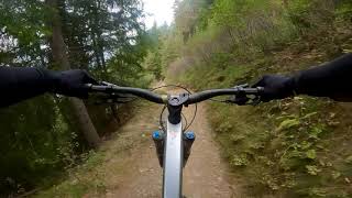
trail: Rock Line
20:25 |
105 |
Aug 16, 2025 , Brixen
trail: Sky-Line
20:25 |
88 |
Aug 16, 2025 , Brixen
trail: Sky-Line
2:32 |
255 |
Oct 16, 2023 , Brixen
trail: Palm Pro Line
7:09 |
322 |
Jul 26, 2021 , Brixen
trail: Sky-Line
11:23 |
531 |
Jun 11, 2021 , Brixen

trail: Sky-Line
12:44 |
622 |
Apr 9, 2020 , Brixen
Recent Trail Reports
| status | trail | date | condition | info | user |
|---|---|---|---|---|---|
| Jerry Line | Aug 27, 2025 @ 3:00pm Aug 27, 2025 | Ideal | succhiafort3 | ||
| Königsanger trail | Aug 4, 2025 @ 8:30am Aug 4, 2025 | Ideal | crisotop UpperTrails | ||
| Rock Line | Jul 27, 2025 @ 10:46am Jul 27, 2025 | Ideal | Benni23186 | ||
| Sky-Line | Jul 27, 2025 @ 10:46am Jul 27, 2025 | Ideal | Benni23186 | ||
| Palm Pro Line | Jul 27, 2025 @ 10:46am Jul 27, 2025 | Ideal | Benni23186 | ||
| Plose Hütte Access | Jul 27, 2025 @ 10:46am Jul 27, 2025 | Ideal | Benni23186 | ||
| Hammer Line | Jul 27, 2025 @ 10:46am Jul 27, 2025 | Ideal | Benni23186 | ||
| Palmschoß | Jul 7, 2025 @ 9:07am Jul 7, 2025 | Ideal | arthurit | ||
| Plose | Jul 7, 2025 @ 9:07am Jul 7, 2025 | Ideal | arthurit | ||
| Passo del Brennero - Bressanone (Ciclovia dell'Adige) | Sep 2, 2024 @ 2:41am Sep 2, 2024 | Variable | SlayerHippie |
Activity Feed
| username | action | type | title | date |
|---|---|---|---|---|
| Michael7v3q5s | ridden | trail | activity #96820421 | Jun 12, 2026 @ 12:08pm Jun 12, 2026 |
| KatrinGCDGbD | ridden | trail | activity #96654669 and 2 more | Jun 9, 2026 @ 10:51pm Jun 9, 2026 |
| KatrinGCDGbD | ridden | trail | activity #96536993 and 2 more | Jun 8, 2026 @ 7:04am Jun 8, 2026 |
| PaulPhilippiznm6n | ridden | trail | activity #95480860 and 4 more | May 25, 2026 @ 5:44am May 25, 2026 |
| Stefanof2Io9R | ridden | trail | activity #94581816 and 1 more | May 12, 2026 @ 1:44pm May 12, 2026 |
Recent Comments
| username | type | title | comment | date |
|---|---|---|---|---|
| trail | A description from a popular blog... | Aug 14, 2025 @ 5:25am Aug 14, 2025 | ||
| report | Yeah sure, but then it should be „dashed“... | Aug 5, 2025 @ 7:22am Aug 5, 2025 | ||
| report | But I guess that the trail is still open to... | Aug 4, 2025 @ 9:23am Aug 4, 2025 | ||
| trail | Top section (alpine Rocky, but not overly... | Aug 4, 2025 @ 8:30am Aug 4, 2025 | ||
| trail | Perfect conditions 🤘🏼 | Feb 14, 2025 @ 9:38am Feb 14, 2025 |
Local Badges
-

Epic Mountain Bike Climb 2k273 awarded -

Climbing 10k Badge11 awarded -

Mountain Biking 100k Badge1 awarded -

Epic Ride Descent 2k273 awarded -

Descent 10k Badge20 awarded -

Descent 100k Badge1 awarded
Activity Type Stats
| activitytype | trails | distance | descent | descent distance | total vertical | rating | global rank | state rank | photos | reports | routes | ridelogs |
|---|---|---|---|---|---|---|---|---|---|---|---|---|
| Mountain Bike | 23 | 97 miles | 23,694 ft | 60 miles | 8,097 ft | #2,102 | #91 | 39 | 100 | 2 | 2,883 | |
| E-Bike | 23 | 113 miles | 35,958 ft | 74 miles | 8,097 ft | #350 | #32 | 70 | 608 | |||
| Horse | 3 | 6 miles | 518 ft | 1 mile | 3,530 ft | #1,288 | #47 | 7 | ||||
| Hike | 16 | 41 miles | 20,827 ft | 25 miles | 7,021 ft | #3,223 | #99 | 72 | 669 | |||
| Trail Running | 18 | 101 miles | 26,719 ft | 63 miles | 8,097 ft | #1,355 | #42 | 73 | 20 | |||
| Dirtbike/Moto | 1 | 4 miles | 13 ft | 843 ft | 2,497 ft | #622 | #14 | 7 | ||||
| ATV/ORV/OHV | 1 | 4 miles | 13 ft | 843 ft | 2,497 ft | #410 | #7 | 7 | ||||
| Downhill Ski | 50 | 30 miles | 31,621 ft | 29 miles | 4,711 ft | #103 | #9 | 25 | 227 | |||
| Backcountry Ski | 2 | 1 mile | 1,007 ft | 1 mile | 2,474 ft | 44 |
Frequently Asked Questions About Brixen
▼
What are the best places to ride in Brixen?
Brixen has 2 areas to explore for mountain biking.
▼
What are the highest rated mountain biking trails in Brixen?
The highest rated mountain biking trails in Brixen are:
- Sky-Line (4.4/5)
- Rock Line (4.3/5)
- Palm Pro Line (4.3/5)
- Hammer Line (4.2/5)
- Plose - Hochsenalm - 4 (4.1/5)
▼
What is the best time of the year to ride in Brixen?
Based on ride log data, the most popular months to ride in Brixen are:
- September (33 activities)
- August (20 activities)
- June (11 activities)
▼
Where can I park to ride in Brixen?
There are 1 parking locations listed in Brixen. The most popular parking spots are:
Activities
Trails
- By alexmarengo
 & contributors
 - Admins: caval, larry81541, micheletraversi
- #20711 - 7,978 views
- brixen activity log | embed map of Brixen mountain bike trails | brixen mountain biking points of interest
Downloading of trail gps tracks in kml & gpx formats is enabled for Brixen.
You must login to download files.