close
-
Layers w
- Map Content
- More Layers
- Pro
- Pro
- Pro
- Pro
- Pro
- Pro
- Pro
- Pro
-
Upgrade to

3D
Trail Conditions
- Unknown
- Snow Groomed
- Snow Packed
- Snow Covered
- Snow Cover Partial
- Freeze/thaw Cycle
- Icy
- Prevalent Mud
- Wet
- Variable
- Ideal
- Dry
- Very Dry
Trail Flow (Ridden Direction)
Trailforks scans users ridelogs to determine the most popular direction each trail is ridden. A good flowing trail network will have most trails flowing in a single direction according to their intension.
The colour categories are based on what percentage of riders are riding a trail in its intended direction.
The colour categories are based on what percentage of riders are riding a trail in its intended direction.
- > 96%
- > 90%
- > 80%
- > 70%
- > 50%
- < 50%
- bi-directional trail
- no data
Trail Last Ridden
Trailforks scans ridelogs to determine the last time a trail was ridden.
- < 2 days
- < 1 week
- < 2 weeks
- < 1 month
- < 6 months
- > 6 months
Trail Ridden Direction
The intended direction a trail should be ridden.
- Downhill Only
- Downhill Primary
- Both Directions
- Uphill Primary
- Uphill Only
- One Direction
Contribute Details
Colors indicate trail is missing specified detail.
- Description
- Photos
- Description & Photos
- Videos
Trail Popularity ?
Trailforks scans ridelogs to determine which trails are ridden the most in the last 9 months.
Trails are compared with nearby trails in the same city region with a possible 25 colour shades.
Think of this as a heatmap, more rides = more kinetic energy = warmer colors.
- most popular
- popular
- less popular
- not popular
ATV/ORV/OHV Filter
Max Vehicle Width
inches
US Cell Coverage
Legend

Radar Time
x
Activity Recordings
Trailforks users anonymized public ridelogs from the past 6 months.
- mountain biking recent
- mountain biking (>6 month)
- hiking (1 year)
- moto (1 year)
Activity Recordings
Trailforks users anonymized public skilogs from the past 12 months.
- Downhill Ski
- Backcountry Ski
- Nordic Ski
- Snowmobile
Winter Trails
Warning
A routing network for winter maps does not exist. Selecting trails using the winter trails layer has been disabled.
x
Missing Trails
Most Popular
Least Popular
Trails are colored based on popularity. The more popular a trail is, the more red. Less popular trails trend towards green.
Jump Magnitude Heatmap
Heatmap of where riders jump on trails. Zoom in to see individual jumps, click circles to view jump details.
Trails Deemphasized
Trails are shown in grey.
Only show trails with NO bikes.
Save the current map location and zoom level as your default home location whenever this page is loaded.
SaveThis region is Unsanctioned, Ride at your own Risk!
Riding area around "Koksilah River Park". Lots of XC singletrack with some DH trails and rooty trails.
Things get a bit tricky in terms of trail finding, the area is fairly large and its possible to ride for a few days in any given direction and never see another human. Might be best to have a guide with you.
This area is in a state of constant active logging.
Things get a bit tricky in terms of trail finding, the area is fairly large and its possible to ride for a few days in any given direction and never see another human. Might be best to have a guide with you.
This area is in a state of constant active logging.
 google parking directions
Links
Activities Click to view
- Mountain Bike
31 trails
- Hike
33 trails
- Trail Running
33 trails
Region Details
- 12
- 6
- 12
Region Status
Caution as of May 15, 2024Stats
- Avg Trail Rating
- Trails (view details)
- 32
- Trails Mountain Bike
- 31
- Trails E-Bike
- 10
- Trails Hike
- 33
- Trails Trail Running
- 33
- Trails Dirtbike/Moto
- 10
- Total Distance
- 40 miles
- Total Descent
- 8,063 ft
- Total Vertical
- 2,466 ft
- Highest Trailhead
- 2,781 ft
- Reports
- 193
- Photos
- 73
- Ridden Counter
- 2,167
Popular Burnt Bridge Mountain Biking Trails
Burnt Bridge Mountain Bike Routes
| title | rating | distance |
|---|---|---|
| Burnt Bridge - Top to Bottom | 4 miles | |
| 10 mile Burnt Bridge Ride | popular ridelog | 10 miles |
| 8 mile Burnt Bridge Ride | popular ridelog | 8 miles |
| 25 mile Burnt Bridge Ride | popular ridelog | 25 miles |
| 9 mile Burnt Bridge Ride | popular ridelog | 9 miles |
| 9 mile Burnt Bridge All-Mountain Ride | popular ridelog | 9 miles |
| 15 mile Burnt Bridge Ride | popular ridelog | 15 miles |
| 9 mile Burnt Bridge Ride | popular ridelog | 9 miles |
| 11 mile Burnt Bridge Ride | popular ridelog | 11 miles |
| 17 mile Burnt Bridge Ride | popular ridelog | 17 miles |
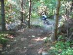
Photos of Burnt Bridge Mountain Bike
trail: Access Road
13 |
Aug 22, 2023 @ 9:58am
Aug 22, 2023
trail: Access Road
19 |
Aug 22, 2023 @ 9:58am
Aug 22, 2023
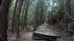
trail: Pandemic
208 |
Nov 11, 2022 @ 7:24am
Nov 11, 2022
trail: Pandemic
153 |
May 21, 2022 @ 6:05pm
May 21, 2022
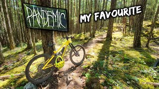
trail: Pandemic
258 |
May 21, 2022 @ 6:05pm
May 21, 2022
trail: Pandemic
174 |
May 21, 2022 @ 6:04pm
May 21, 2022
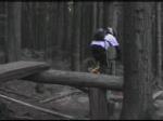
trail: Pandemic
144 |
May 8, 2022 @ 8:16pm
May 8, 2022
trail: Pandemic
199 |
Apr 20, 2022 @ 9:55pm
Apr 20, 2022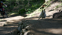

Recent Trail Reports
| status | trail | date | condition | info | user |
|---|---|---|---|---|---|
| Pandemic | May 15, 2024 @ 4:48pm May 15, 2024 | Very Dry | dktully | ||
| Knatty Tread Reroute | May 11, 2024 @ 10:05am May 11, 2024 | Dry | VladAbramov | ||
| Burnt Bridge Climb | May 11, 2024 @ 10:05am May 11, 2024 | Dry | VladAbramov | ||
| Dear Bones | Apr 1, 2024 @ 11:03pm Apr 1, 2024 | Unknown | trailforks Trailforks | ||
| Spike | Mar 20, 2024 @ 3:59pm Mar 20, 2024 | Dry | HeyClayton | ||
| Knatty Tread (Lower) | Feb 19, 2024 @ 2:03am Feb 19, 2024 | Ideal | Justinperkins | ||
| Forest Service Road Climb | Feb 10, 2024 @ 9:50am Feb 10, 2024 | Ideal | Daver250 | ||
| Short Chute | Oct 21, 2023 @ 3:35am Oct 21, 2023 | Variable | Stasher CTSS | ||
| Eagle Heights 2 | Oct 21, 2023 @ 3:35am Oct 21, 2023 | Variable | Stasher CTSS | ||
| Access Road | Oct 6, 2023 @ 6:03am Oct 6, 2023 | Ideal | Stasher CTSS |
Activity Feed
| username | action | type | title | date |
|---|---|---|---|---|
| Mandyride | comment | trail | activity #52679566 | May 16, 2024 @ 8:10am May 16, 2024 |
| dktully | add | report | activity #52656228 | May 15, 2024 @ 4:48pm May 15, 2024 |
| J-Dove | wishlist | trail | activity #52573724 and 1 more | May 13, 2024 @ 9:26pm May 13, 2024 |
| HankmOgqJb | comment | trail | activity #52496592 | May 12, 2024 @ 2:15pm May 12, 2024 |
| VladAbramov | add | report | activity #52476128 and 1 more | May 12, 2024 @ 6:04am May 12, 2024 |
Recent Comments
| username | type | title | comment | date |
|---|---|---|---|---|
| trail | Super dry, loose and rutted out | May 16, 2024 @ 8:10am May 16, 2024 | ||
| trail | In | May 12, 2024 @ 2:15pm May 12, 2024 | ||
| trail | I’m | Apr 10, 2024 @ 7:52pm Apr 10, 2024 | ||
| trail | Amazing trail! Has everything you want in a trail | Feb 3, 2024 @ 4:46pm Feb 3, 2024 | ||
| trail | Tree down right at eye level at the trail... | Nov 4, 2023 @ 7:03pm Nov 4, 2023 |
Nearby Areas
| name | distance | ||||
|---|---|---|---|---|---|
| Shawnigan Lake Quarry | 3 | 3 | 5 | 3.5 km | |
| Shawnigan Lake School | 4.9 km | ||||
| Cobble Hill | 5 | 11 | 9 | 6.3 km | |
| Cowichan River Provincal Park | 3 | 2 | 7.4 km | ||
| Mount Wood | 1 | 1 | 8.1 km |
Local Badges
-

Completionist0 awarded
Local Products
Activity Type Stats
| activitytype | trails | distance | descent | descent distance | total vertical | rating | global rank | state rank | photos | reports | routes | ridelogs |
|---|---|---|---|---|---|---|---|---|---|---|---|---|
| Mountain Bike | 31 | 38 miles | 7,828 ft | 13 miles | 2,411 ft | #5,981 | #264 | 71 | 193 | 1 | 2,413 | |
| E-Bike | 10 | 24 miles | 892 ft | 4 miles | 2,254 ft | 80 | 173 | |||||
| Hike | 33 | 40 miles | 8,064 ft | 13 miles | 2,467 ft | #5,055 | #246 | 193 | 73 | |||
| Trail Running | 33 | 40 miles | 8,064 ft | 13 miles | 2,467 ft | #5,076 | #243 | 193 | 22 | |||
| Dirtbike/Moto | 10 | 8 miles | 2,500 ft | 4 miles | 2,411 ft | 2 | 27 | 34 |
- By canadaka
 Trailforks & contributors
 - Admins: Dubnyk, CRD-Parks
- #1042 - 15,111 views
- burnt bridge activity log | embed map of Burnt Bridge mountain bike trails | burnt bridge mountain biking points of interest
Downloading of trail gps tracks in kml & gpx formats is enabled for Burnt Bridge.
You must login to download files.