close
-
Layers w
- Weather Layers
- Pro
- Pro
- Pro
- Pro
- Pro
- Pro
- More Layers
- Pro
- Pro
- Pro
- Pro
-
Upgrade to

3D
Trail Conditions
- Unknown
- Snow Groomed
- Snow Packed
- Snow Covered
- Snow Cover Partial
- Freeze/thaw Cycle
- Icy
- Prevalent Mud
- Wet
- Variable
- Ideal
- Dry
- Very Dry
Trail Flow (Ridden Direction)
Trailforks scans users ridelogs to determine the most popular direction each trail is ridden. A good flowing trail network will have most trails flowing in a single direction according to their intension.
The colour categories are based on what percentage of riders are riding a trail in its intended direction.
The colour categories are based on what percentage of riders are riding a trail in its intended direction.
- > 96%
- > 90%
- > 80%
- > 70%
- > 50%
- < 50%
- bi-directional trail
- no data
Trail Last Ridden
Trailforks scans ridelogs to determine the last time a trail was ridden.
- < 2 days
- < 1 week
- < 2 weeks
- < 1 month
- < 6 months
- > 6 months
Trail Ridden Direction
The intended direction a trail should be ridden.
- Downhill Only
- Downhill Primary
- Both Directions
- Uphill Primary
- Uphill Only
- One Direction
Contribute Details
Colors indicate trail is missing specified detail.
- Description
- Photos
- Description & Photos
- Videos
Trail Popularity ?
Trailforks scans ridelogs to determine which trails are ridden the most in the last 9 months.
Trails are compared with nearby trails in the same city region with a possible 25 colour shades.
Think of this as a heatmap, more rides = more kinetic energy = warmer colors.
- most popular
- popular
- less popular
- not popular
ATV/ORV/OHV Filter
Max Vehicle Width
inches
US Cell Coverage
Legend

Radar Time
Activity Recordings
Trailforks uses anonymized public activity data.
?
Activity Recordings
Trailforks uses anonymized public activity data.
?
Personal Heatmap
▶
Activity Types
all
/
none
▶
Options
2
Date range
month
–
Winter Trails
Warning
A routing network for winter maps does not exist. Selecting trails using the winter trails layer has been disabled.
Missing Trails
Most Popular
Least Popular
Trails are colored based on popularity. The more popular a trail is, the more red. Less popular trails trend towards green.
Jump Magnitude Heatmap
Heatmap of where riders jump on trails. Zoom in to see individual jumps, click circles to view jump details.
BC Backroad Status
![map legend]()
Service Road Atlas is a free to use, community-driven service for viewing and creating reports on the numerous back-country service roads around B.C. and Alberta.

Slope Aspect
Direction the slope faces
Trails Deemphasized
Trails are shown in grey.
Only show trails with no bike usage.
Suggested Layers
Based on selected activity type
Save the current map location and zoom level as your default home location whenever this page is loaded.
Save
No description for Cadca has been added yet!
Login or register to submit one.
Activities Click to view
- Mountain Bike
24 trails
- E-Bike
13 trails
- Gravel Bike
0 trails
- Adaptive Bike
0 trails
- Hike
20 trails
- Trail Running
20 trails
Region Details
- 13
- 3
- 4
- 3
- 1
Region Status
Caution as of May 13, 2026Stats
- Avg Trail Rating
- Trails (view details)
- 27
- Trails Mountain Bike
- 24
- Trails E-Bike
- 13
- Trails Horse
- 2
- Trails Hike
- 20
- Trails Trail Running
- 20
- Trails Backcountry Ski
- 3
- Total Distance
- 56 miles
- Total Descent
- 9,113 ft
- Total Vertical
- 2,280 ft
- Highest Trailhead
- 3,541 ft
- Reports
- 72
- Photos
- 17
- Ridden Counter
- 463
Sub Regions
-
Veľká Rača - Dedovka
- 1
- 1
Popular Cadca Mountain Biking Trails
• 85 ★ 5.0 • 2,482 ft • 2 ft • 33 •
Popular blue difficulty singletrack. This mountain bike primary trail can be used downhill only. On average it takes 3 minutes to complete this trail.
• 50 ★ 4.0 • 4,573 ft • 0 ft • 33 •
Moderately popular black diamond difficulty singletrack. This mountain bike primary trail can be used downhill only and has a hard overall physical rating. Trail visibility is always easy to follow. On average it takes 9 minutes to complete this trail.
• 40 ★ 0.0 • 1,667 ft • 11 ft • 6 • • hike
Techy trail left behind long time ago after moving logs, now sed by bikers and hikers included
• 45 ★ 0.0 • 1 mile • 0 ft • 6 •
Moderately popular blue difficulty singletrack. This mountain bike primary trail can be used downhill primary. Trail visibility is always easy to follow. On average it takes 7 minutes to complete this trail.
• 5 ★ 0.0 • 3 miles • 762 ft • 4 •
Less popular green difficulty mixed. This multi-use trail can be used both directions and has a moderate overall physical rating with a 762 ft blue climb. On average it takes 40 minutes to complete this trail.
Cadca Mountain Bike Routes
18 miles • 3,175 ft • 1 • Loop •
Okruh pre svižnejších pod dve hodiny, minimum asfaltu, spevnená cesta sa strieda s fajnou lesnou...
17 miles • 1,925 ft • 0 • Loop •
Rekreačná trasa po spojovačke smerom cez dolinu, neodbočí sa k medvedej skale ale pokračuje sa rovno...
9 miles • 868 ft • 0 • Loop •
loop, starting from Martinik pub to Jurosovsky hill, most of loop is on dirt,sometime gravel/rocks. single...
Videos of Cadca Mountain Bike

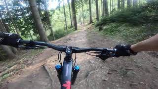
trail: Vychylovka
4:04 |
231 |
May 2, 2014
trail: Ruženec
123 |
Oct 17, 2023 , Cadca
Recent Trail Reports
| status | trail | date | condition | info | user |
|---|---|---|---|---|---|
| Zarasťák | May 13, 2026 @ 9:41am (America/Vancouver) May 13, 2026 | Variable | lehotagomtb | ||
| Dare2win | May 11, 2026 @ 12:15am (America/Vancouver) May 11, 2026 | Variable | lehotagomtb | ||
| Zákopecká cesta cez kopanice | Feb 22, 2026 @ 1:32pm (Europe/Bratislava) Feb 22, 2026 | Snow Covered | miskolci | ||
| Modrá pod polomom na dolinu | Jan 1, 2026 @ 11:13am (Europe/Bratislava) Jan 1, 2026 | Snow Covered | miskolci | ||
| Briava trail | Dec 8, 2025 @ 7:54am (America/Vancouver) Dec 8, 2025 | Unknown | lehotagomtb | ||
| Ruženec | Jun 29, 2025 @ 1:25pm Jun 29, 2025 | Dry | Yaro72 | ||
| DH stará vetva | Jun 7, 2025 @ 2:23pm Jun 7, 2025 | Variable | katko | ||
| Maďarský Everest | Jun 7, 2025 @ 2:23pm Jun 7, 2025 | Ideal | katko | ||
| Husárik Access Road | Dec 28, 2024 @ 1:36pm Dec 28, 2024 | Ideal | miskolci | ||
| Okolo Kysuce | Jul 31, 2024 @ 7:48am Jul 31, 2024 | Dry | Yaro72 |
Activity Feed
| username | action | type | title | date |
|---|---|---|---|---|
| jxxw | update | trail | activity #95024229 | May 19, 2026 @ 12:13am May 19, 2026 |
| lehotagomtb | add | report | activity #94633321 | May 13, 2026 @ 9:41am May 13, 2026 |
| lehotagomtb | checkin | trail | activity #94481234 | May 11, 2026 @ 12:15am May 11, 2026 |
| lehotagomtb | add | report | activity #94481232 | May 11, 2026 @ 12:15am May 11, 2026 |
| MartindlEhd7 | comment | trail | activity #93459553 | Apr 26, 2026 @ 10:50am Apr 26, 2026 |
Recent Comments
| username | type | title | comment | date |
|---|---|---|---|---|
| trail | Kde presne boli popadané? Lebo pred... | Apr 26, 2026 @ 10:55am Apr 26, 2026 | ||
| trail | Dnes som bol pozrieť na peši. Sú tam... | Apr 26, 2026 @ 10:50am Apr 26, 2026 | ||
| report | Dnes som bol pozrieť na peši. Sú tam... | Apr 26, 2026 @ 6:44am Apr 26, 2026 | ||
| trail | Super trail, vyzerá že sa ho aj snažíte... | Nov 7, 2025 @ 1:55am Nov 7, 2025 | ||
| trail | Idem sa na neho tento týždeň pozrieť, a... | Nov 2, 2025 @ 7:29am Nov 2, 2025 |
Local Badges
-

Epic Ride Climb 2k18 awarded -

Climbing 10k Badge9 awarded -

Climbing 100k Badge0 awarded -

Epic Ride Descent 2k31 awarded -

Descent 10k Badge9 awarded -

Descent 100k Badge0 awarded
Bike & Skill Parks
| name | type | city | rating |
|---|---|---|---|
| Veľká Rača - Dedovka | bike park | Cadca | |
| Pumptrack pod Hríbom | skill park | Cadca | |
| Skillpark U Halušky-Work in progress | skill park | Cadca |
Activity Type Stats
| activitytype | trails | distance | descent | descent distance | total vertical | rating | global rank | state rank | photos | reports | routes | ridelogs |
|---|---|---|---|---|---|---|---|---|---|---|---|---|
| Mountain Bike | 24 | 54 miles | 9,114 ft | 19 miles | 2,280 ft | #2,238 | #26 | 17 | 72 | 6 | 1,486 | |
| E-Bike | 13 | 33 miles | 4,698 ft | 12 miles | 1,886 ft | #1,818 | #23 | 67 | 1 | 342 | ||
| Horse | 2 | 5 miles | 348 ft | 1 mile | 643 ft | 8 | ||||||
| Hike | 20 | 49 miles | 7,234 ft | 17 miles | 2,280 ft | #2,375 | #24 | 70 | 276 | |||
| Trail Running | 20 | 49 miles | 7,234 ft | 17 miles | 2,280 ft | #1,934 | #23 | 70 | 46 | |||
| Backcountry Ski | 3 | 2 miles | 1,234 ft | 155 |
Frequently Asked Questions About Cadca
▼
What are the best places to ride in Cadca?
Cadca has 1 areas to explore for mountain biking. The top rated areas are:
▼
What are the highest rated mountain biking trails in Cadca?
The highest rated mountain biking trails in Cadca are:
- Velká Rača DH4 (4.3/5)
- Enduro trail lower (4.2/5)
- U Grapov - U Jantov (DH) (4.1/5)
- Freeride Dedovka (4/5)
- Jurošák - Raková Trstená (4/5)
▼
What is the best time of the year to ride in Cadca?
Based on ride log data, the most popular months to ride in Cadca are:
- June (7 activities)
- July (5 activities)
- May (5 activities)
▼
Where can I park to ride in Cadca?
There are 1 parking locations listed in Cadca. The most popular parking spots are:
Activities
Trails
Points of Interest
- By jxxw
 TRAILFORKS & contributors
 - Admins: apply
- #19616 - 3,455 views
- cadca activity log | embed map of Cadca mountain bike trails | cadca mountain biking points of interest
Downloading of trail gps tracks in kml & gpx formats is enabled for Cadca.
You must login to download files.