close
-
Layers w
- Weather Layers
- Pro
- Pro
- Pro
- Pro
- Pro
- Pro
- More Layers
- Pro
- Pro
- Pro
- Pro
-
Upgrade to

3D
Trail Conditions
- Unknown
- Snow Groomed
- Snow Packed
- Snow Covered
- Snow Cover Partial
- Freeze/thaw Cycle
- Icy
- Prevalent Mud
- Wet
- Variable
- Ideal
- Dry
- Very Dry
Trail Flow (Ridden Direction)
Trailforks scans users ridelogs to determine the most popular direction each trail is ridden. A good flowing trail network will have most trails flowing in a single direction according to their intension.
The colour categories are based on what percentage of riders are riding a trail in its intended direction.
The colour categories are based on what percentage of riders are riding a trail in its intended direction.
- > 96%
- > 90%
- > 80%
- > 70%
- > 50%
- < 50%
- bi-directional trail
- no data
Trail Last Ridden
Trailforks scans ridelogs to determine the last time a trail was ridden.
- < 2 days
- < 1 week
- < 2 weeks
- < 1 month
- < 6 months
- > 6 months
Trail Ridden Direction
The intended direction a trail should be ridden.
- Downhill Only
- Downhill Primary
- Both Directions
- Uphill Primary
- Uphill Only
- One Direction
Contribute Details
Colors indicate trail is missing specified detail.
- Description
- Photos
- Description & Photos
- Videos
Trail Popularity ?
Trailforks scans ridelogs to determine which trails are ridden the most in the last 9 months.
Trails are compared with nearby trails in the same city region with a possible 25 colour shades.
Think of this as a heatmap, more rides = more kinetic energy = warmer colors.
- most popular
- popular
- less popular
- not popular
ATV/ORV/OHV Filter
Max Vehicle Width
inches
US Cell Coverage
Legend

Radar Time
Activity Recordings
Trailforks uses anonymized public activity data.
?
Activity Recordings
Trailforks uses anonymized public activity data.
?
Personal Heatmap
▶
Activity Types
all
/
none
▶
Options
2
Date range
month
–
Winter Trails
Warning
A routing network for winter maps does not exist. Selecting trails using the winter trails layer has been disabled.
Missing Trails
Most Popular
Least Popular
Trails are colored based on popularity. The more popular a trail is, the more red. Less popular trails trend towards green.
Jump Magnitude Heatmap
Heatmap of where riders jump on trails. Zoom in to see individual jumps, click circles to view jump details.
BC Backroad Status
![map legend]()
Service Road Atlas is a free to use, community-driven service for viewing and creating reports on the numerous back-country service roads around B.C. and Alberta.

Slope Aspect
Direction the slope faces
Trails Deemphasized
Trails are shown in grey.
Only show trails with no bike usage.
Suggested Layers
Based on selected activity type
Save the current map location and zoom level as your default home location whenever this page is loaded.
Save
No description for Cairate has been added yet!
Login or register to submit one.
This region uses the Uk/Euro style trail grading system.
Activities Click to view
- Mountain Bike
6 trails
- E-Bike
6 trails
- Gravel Bike
0 trails
- Adaptive Bike
0 trails
- Horse
0 trails
- Hike
5 trails
- Trail Running
4 trails
Region Details
- 3
- 2
- 1
Region Status
Open as of Jun 13, 2026Stats
- Avg Trail Rating
- Trails (view details)
- 7
- Trails Mountain Bike
- 6
- Trails E-Bike
- 6
- Trails Hike
- 5
- Trails Trail Running
- 4
- Trails Observed Trials
- 1
- Total Distance
- 4 miles
- Total Descent Distance
- 1 mile
- Total Descent
- 201 ft
- Total Vertical
- 259 ft
- Highest Trailhead
- 1,020 ft
- Reports
- 183
- Photos
- 12
- Ridden Counter
- 619
Popular Cairate Mountain Biking Trails
• 100 ★ 2.0 • 3,130 ft • 18 ft • 258 •
Porzione della pista ciclo-pedonale della Valle Olona percorribile con qualunque tipo di bicicletta su fondo misto cemento-asfalto, percorribile con i bambini in quanto non ha un dislivello importante. Questo tratto a differenza degli...
• 85 ★ 3.0 • 3,199 ft • 45 ft • 243 •
Tratto pista ciclabile Lonate - Cairate Semplice e adatta a tutti. E' possibile lungo il tratto che costeggia il fiume Olona avvistare l'airone cenerino e anatre selvatiche
• 20 ★ 3.0 • 1 mile • 53 ft • 38 •
La prima parte di questa traccia, fino al ponte di Cairate, è un piacevole e veloce single track, poi diventa una stradina dismessa con molte pozze (generalmente ben evitabili ai lati) nei periodi piovosi.
Cairate Mountain Bike Routes
3 miles • 7 ft • 0 • Point to Point •
Traccia che collega la stazione Trenord di Tradate con il pumptrack realizzato da Velosolutions a Cairate....
Videos of Cairate Mountain Bike
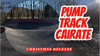
2:03 |
259 |
Dec 29, 2024
Recent Trail Reports
| status | trail | date | condition | info | user |
|---|---|---|---|---|---|
| Via per Lonate (Ciclo-pedonale Valle Olona) | Jun 13, 2026 @ 2:53pm (Europe/Rome) Jun 13, 2026 | Ideal | Alexfallu | ||
| Lonate Ceppino - Cairate (Ciclo-pedonale Valle Olona) | Jun 13, 2026 @ 2:53pm (Europe/Rome) Jun 13, 2026 | Ideal | Alexfallu | ||
| Pumptrack Cairate | Feb 8, 2026 @ 2:28pm (Europe/Vaduz) Feb 8, 2026 | Ideal | MG74 | ||
| Castelseprio connection #1 | Jul 8, 2025 @ 9:16am Jul 8, 2025 | Variable | marcoangeletti TRAILFORKS | ||
| Ciclovia connection | Sep 27, 2023 @ 2:25pm Sep 27, 2023 | Dry | adessoomaipiu | ||
| Prato del Pecoraio | Sep 27, 2023 @ 2:25pm Sep 27, 2023 | Variable | adessoomaipiu |
Activity Feed
| username | action | type | title | date |
|---|---|---|---|---|
| Alexfallu | add | report | activity #96994355 and 1 more | Jun 14, 2026 @ 12:15pm Jun 14, 2026 |
| Stefanof2Io9R | ridden | trail | activity #94515376 and 1 more | May 11, 2026 @ 1:51pm May 11, 2026 |
| MG74 | add | report | activity #88622626 and 2 more | Feb 9, 2026 @ 6:03am Feb 9, 2026 |
| Lazio67 | add | report | activity #86203233 | Dec 28, 2025 @ 5:25am Dec 28, 2025 |
| MG74 | add | report | activity #83383737 and 1 more | Nov 1, 2025 @ 10:31am Nov 1, 2025 |
Recent Comments
| username | type | title | comment | date |
|---|---|---|---|---|
| report | @adessoomaipiu: facile che siano le basi della... | Mar 24, 2025 @ 1:54pm Mar 24, 2025 | ||
| report | Sembrerebbe di si. Da fuori la recinzione si... | Mar 24, 2025 @ 4:55am Mar 24, 2025 | ||
| report | Quindi sono iniziati i lavori per completare... | Mar 24, 2025 @ 2:51am Mar 24, 2025 | ||
| skillpark | 4 stelle in attesa di mettere la quinta quando... | Dec 29, 2024 @ 7:46am Dec 29, 2024 | ||
| report | Un cancello non passa inosservato. Possibile... | Nov 1, 2020 @ 1:48pm Nov 1, 2020 |
Bike & Skill Parks
| name | type | city | rating |
|---|---|---|---|
| Pumptrack Cairate | skill park | Cairate |
Activity Type Stats
| activitytype | trails | distance | descent | descent distance | total vertical | rating | global rank | state rank | photos | reports | routes | ridelogs |
|---|---|---|---|---|---|---|---|---|---|---|---|---|
| Mountain Bike | 6 | 4 miles | 200 ft | 1 mile | 259 ft | #11,061 | #1,077 | 5 | 183 | 1 | 216 | |
| E-Bike | 6 | 4 miles | 200 ft | 1 mile | 259 ft | #7,564 | #822 | 2 | 183 | 1 | 10 | |
| Hike | 5 | 3 miles | 187 ft | 1 mile | 253 ft | #11,775 | #869 | 182 | 2 | |||
| Trail Running | 4 | 2 miles | 115 ft | 2,808 ft | 253 ft | #11,488 | #881 | 182 | 121 | |||
| Observed Trials | 1 | 1,325 ft | 85 ft | 1 |
Frequently Asked Questions About Cairate
▼
What are the highest rated mountain biking trails in Cairate?
The highest rated mountain biking trails in Cairate are:
- Lonate Ceppino - Cairate (Ciclo-pedonale Valle Olona) (3.8/5)
- Prato del Pecoraio (3.8/5)
- Via per Lonate (Ciclo-pedonale Valle Olona) (3.7/5)
▼
What is the best time of the year to ride in Cairate?
Based on ride log data, the most popular months to ride in Cairate are:
- June (4 activities)
- May (2 activities)
- August (1 activities)
▼
Where can I park to ride in Cairate?
Check the Cairate trail map for trailhead and parking information. Community members regularly update access and parking details for trails in the area.
▼
What is the longest trail in Cairate?
The longest trail in Cairate is Prato del Pecoraio at 1.2 miles. View all trails sorted by distance.
- By marcoangeletti
 TRAILFORKS & contributors
 - Admins: marcoangeletti, adessoomaipiu, micheletraversi, adessoomaipiu
- #45413 - 901 views
- cairate activity log | embed map of Cairate mountain bike trails | cairate mountain biking points of interest
Downloading of trail gps tracks in kml & gpx formats is enabled for Cairate.
You must login to download files.