close
-
Layers w
- Weather Layers
- Pro
- Pro
- Pro
- Pro
- Pro
- Pro
- More Layers
- Pro
- Pro
- Pro
- Pro
-
Upgrade to

3D
Trail Conditions
- Unknown
- Snow Groomed
- Snow Packed
- Snow Covered
- Snow Cover Partial
- Freeze/thaw Cycle
- Icy
- Prevalent Mud
- Wet
- Variable
- Ideal
- Dry
- Very Dry
Trail Flow (Ridden Direction)
Trailforks scans users ridelogs to determine the most popular direction each trail is ridden. A good flowing trail network will have most trails flowing in a single direction according to their intension.
The colour categories are based on what percentage of riders are riding a trail in its intended direction.
The colour categories are based on what percentage of riders are riding a trail in its intended direction.
- > 96%
- > 90%
- > 80%
- > 70%
- > 50%
- < 50%
- bi-directional trail
- no data
Trail Last Ridden
Trailforks scans ridelogs to determine the last time a trail was ridden.
- < 2 days
- < 1 week
- < 2 weeks
- < 1 month
- < 6 months
- > 6 months
Trail Ridden Direction
The intended direction a trail should be ridden.
- Downhill Only
- Downhill Primary
- Both Directions
- Uphill Primary
- Uphill Only
- One Direction
Contribute Details
Colors indicate trail is missing specified detail.
- Description
- Photos
- Description & Photos
- Videos
Trail Popularity ?
Trailforks scans ridelogs to determine which trails are ridden the most in the last 9 months.
Trails are compared with nearby trails in the same city region with a possible 25 colour shades.
Think of this as a heatmap, more rides = more kinetic energy = warmer colors.
- most popular
- popular
- less popular
- not popular
ATV/ORV/OHV Filter
Max Vehicle Width
inches
US Cell Coverage
Legend

Radar Time
Activity Recordings
Trailforks uses anonymized public activity data.
?
Activity Recordings
Trailforks uses anonymized public activity data.
?
Personal Heatmap
▶
Activity Types
all
/
none
▶
Options
2
Date range
month
–
Winter Trails
Warning
A routing network for winter maps does not exist. Selecting trails using the winter trails layer has been disabled.
Missing Trails
Most Popular
Least Popular
Trails are colored based on popularity. The more popular a trail is, the more red. Less popular trails trend towards green.
Jump Magnitude Heatmap
Heatmap of where riders jump on trails. Zoom in to see individual jumps, click circles to view jump details.
BC Backroad Status
![map legend]()
Service Road Atlas is a free to use, community-driven service for viewing and creating reports on the numerous back-country service roads around B.C. and Alberta.

Slope Aspect
Direction the slope faces
Trails Deemphasized
Trails are shown in grey.
Only show trails with no bike usage.
Suggested Layers
Based on selected activity type
Save the current map location and zoom level as your default home location whenever this page is loaded.
Save
No description for Carleton has been added yet!
Login or register to submit one.
Activities Click to view
- Mountain Bike
31 trails
- E-Bike
30 trails
- Adaptive Bike
0 trails
- Winter Fat Bike
0 trails
- Horse
0 trails
- Hike
26 trails
- Trail Running
26 trails
- Dirtbike/Moto
0 trails
- ATV/ORV/OHV
0 trails
- Snowshoe
1 trails
- Backcountry Ski
1 trails
Region Details
- 7
- 11
- 8
Region Status
Open as of Jul 26, 2025Stats
- Avg Trail Rating
- Trails (view details)
- 26
- Trails Mountain Bike
- 32
- Trails E-Bike
- 30
- Trails Hike
- 26
- Trails Trail Running
- 26
- Trails Snowshoe
- 1
- Trails Backcountry Ski
- 1
- Total Distance
- 26 miles
- Total Descent Distance
- 13 miles
- Total Descent
- 4,645 ft
- Total Vertical
- 1,848 ft
- Highest Trailhead
- 1,852 ft
- Reports
- 178
- Photos
- 16
- Ridden Counter
- 4,337
Sub Regions
-
Mont Saint-Joseph
- 11
- 8
Popular Carleton Mountain Biking Trails
• 90 ★ 3.0 • 1,608 ft • 47 ft • 345 •
Popular blue difficulty singletrack. This mountain bike primary trail can be used both directions and has a easy overall physical rating with a 47 ft green climb. Trail visibility is always easy to follow. On average it takes 5 minutes to complete this trail.
• 100 ★ 4.8 • 2,444 ft • 0 ft • 333 •
Le plus long MUR de la province, avec vue spectaculaire. Vous aller vouloir refaire en boucle...
• 35 ★ 4.5 • 3,163 ft • 159 ft • 301 •
Sentier multi usage, utilisé principalement pour remonter vers le stationnement du Pic-Pic. Belle boucle facile avec « ».
• 80 ★ 4.0 • 4,406 ft • 50 ft • 279 •
Sentier étroit, traversant un terrain en forte pente. Sensations garanties.
• 70 ★ 2.4 • 3,373 ft • 73 ft • 252 •
Sentier d'initiation à la descente. Accessible à tous.
• 50 ★ 3.8 • 3,307 ft • 250 ft • 218 •
Moderately popular blue difficulty family friendly singletrack. This mountain bike primary trail can be used uphill primary and has a easy overall physical rating with a 250 ft green climb. Trail visibility is always easy to follow. On average it takes 7 minutes to complete this trail.
Carleton Mountain Bike Routes
3 miles • 1,706 ft • 0 • Point to Point •
Chemin pavé. Route d'accès au sommet.
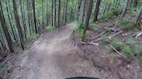
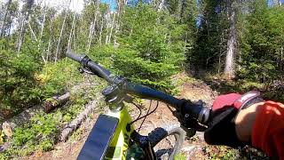
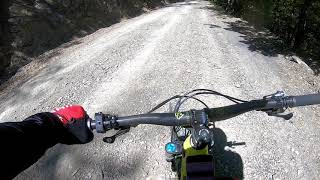
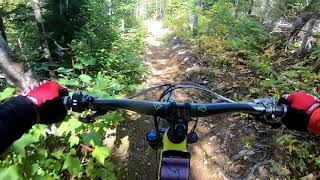
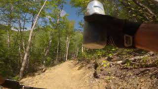
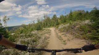
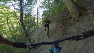
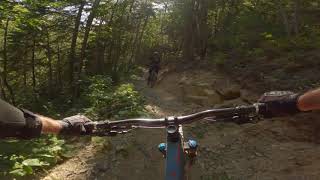
Photos of Carleton Mountain Bike
Videos of Carleton Mountain Bike
trail: La MEC
0:15 |
233 |
Mar 6, 2019
trail: Trait carré partagé
2:46 |
521 |
Apr 6, 2021 , Carleton
trail: Chemin à Bouchard
0:12 |
475 |
Apr 6, 2021 , Carleton
trail: La Côte Rouge
4:43 |
773 |
Apr 6, 2021 , Carleton
trail: Le Cric
11:48 |
771 |
Aug 25, 2020 , Carleton
trail: La Tracadigash DESCENTE
0:45 |
506 |
Aug 25, 2020 , Carleton
trail: La MEC
0:21 |
325 |
Aug 25, 2020 , Carleton
trail: La MEC
0:10 |
188 |
Aug 25, 2020 , Carleton
Recent Trail Reports
| status | trail | date | condition | info | user |
|---|---|---|---|---|---|
| Trait carré partagé | Jun 20, 2023 @ 12:32pm Jun 20, 2023 | Ideal | Joeyfug | ||
| Retour officiel vers le stationnement de la Plage | Jun 20, 2023 @ 12:32pm Jun 20, 2023 | Ideal | Joeyfug | ||
| Rescapés Est | Jun 20, 2023 @ 12:32pm Jun 20, 2023 | Ideal | Joeyfug | ||
| Le Monti | Jun 20, 2023 @ 12:32pm Jun 20, 2023 | Ideal | Joeyfug | ||
| La TRACK | Jun 20, 2023 @ 12:32pm Jun 20, 2023 | Ideal | Joeyfug | ||
| La Tracadigash DESCENTE | Jun 20, 2023 @ 12:32pm Jun 20, 2023 | Ideal | Joeyfug | ||
| La Sports | Jun 20, 2023 @ 12:32pm Jun 20, 2023 | Ideal | Joeyfug | ||
| La Pic Poc | Jun 20, 2023 @ 12:32pm Jun 20, 2023 | Ideal | Joeyfug | ||
| L'Experts | Jun 20, 2023 @ 12:32pm Jun 20, 2023 | Ideal | Joeyfug | ||
| Connecteur Tracadigash | Jun 20, 2023 @ 12:32pm Jun 20, 2023 | Ideal | Joeyfug |
Activity Feed
| username | action | type | title | date |
|---|---|---|---|---|
| Pluck28 | wishlist | region | activity #95456355 | May 24, 2026 @ 5:07pm May 24, 2026 |
| Eti842pTTHL | ridden | trail | activity #80758650 | Sep 20, 2025 @ 11:32am Sep 20, 2025 |
| JacquesWOsIXB | wishlist | region | activity #79110185 | Aug 28, 2025 @ 6:31am Aug 28, 2025 |
| vegetox | wishlist | region | activity #78409983 | Aug 18, 2025 @ 7:55am Aug 18, 2025 |
| Whyti | vote | trail | activity #77317012 and 1 more | Aug 3, 2025 @ 8:58am Aug 3, 2025 |
Recent Comments
| username | type | title | comment | date |
|---|---|---|---|---|
| report | Merci. C’est réglé | Jul 26, 2025 @ 9:11am Jul 26, 2025 | ||
| report | fonte des neiges | Apr 25, 2021 @ 12:57pm Apr 25, 2021 | ||
| report | fonte des neiges | Apr 25, 2021 @ 12:57pm Apr 25, 2021 | ||
| report | fonte des neiges | Apr 25, 2021 @ 12:56pm Apr 25, 2021 | ||
| report | fonte des neiges | Apr 25, 2021 @ 12:43pm Apr 25, 2021 |
Local Badges
-

Epic Ride Climb 2k7 awarded -

Climbing 10k Badge5 awarded -

Climbing 100k Badge0 awarded -

Epic Ride Descent 2k9 awarded -

Descent 10k Badge5 awarded -

Descent 100k Badge0 awarded
Bike & Skill Parks
| name | type | city | rating |
|---|---|---|---|
| Parc d'initiation pour les jeunes | skill park | Carleton |
Activity Type Stats
| activitytype | trails | distance | descent | descent distance | total vertical | rating | global rank | state rank | photos | reports | routes | ridelogs |
|---|---|---|---|---|---|---|---|---|---|---|---|---|
| Mountain Bike | 31 | 26 miles | 4,646 ft | 13 miles | 1,847 ft | #4,141 | #65 | 16 | 188 | 1 | 1,291 | |
| E-Bike | 30 | 25 miles | 4,613 ft | 13 miles | 1,847 ft | #4,035 | #37 | 186 | 43 | |||
| Hike | 26 | 22 miles | 2,831 ft | 9 miles | 1,847 ft | #6,292 | #55 | 180 | 156 | |||
| Trail Running | 26 | 22 miles | 2,831 ft | 9 miles | 1,847 ft | #6,279 | #56 | 180 | 98 | |||
| Snowshoe | 1 | 3,212 ft | 3 ft | 282 ft | 226 ft | #1,599 | #69 | 80 | 19 | |||
| Backcountry Ski | 1 | 3,212 ft | 3 ft | 282 ft | 226 ft | #674 | #27 | 80 | 304 |
Frequently Asked Questions About Carleton
▼
What are the best places to ride in Carleton?
Carleton has 1 areas to explore for mountain biking. The top rated areas are:
▼
What are the highest rated mountain biking trails in Carleton?
The highest rated mountain biking trails in Carleton are:
- La Tracadigash DESCENTE (4.3/5)
- Le Cric (4.3/5)
- La "Carleton Brand" (4.2/5)
- L'Experts (4.2/5)
- La Pic Poc (4.1/5)
▼
What is the best time of the year to ride in Carleton?
Based on ride log data, the most popular months to ride in Carleton are:
- August (54 activities)
- July (47 activities)
- September (28 activities)
▼
Where can I park to ride in Carleton?
There are 4 parking locations listed in Carleton. The most popular parking spots are:
- Stationnement Éperlans
- Stationnement Pic Poc P2
- Stationnement Plage municipale
- Stationnement 3e rang Ouest
Activities
Trails
Points of Interest
- By Joeyfug
 & contributors
 - Admins: VQ, bigjay, StephaneMarceau, Canadmos, MSJ, vilan25
- #24686 - 4,561 views
- carleton activity log | embed map of Carleton mountain bike trails | carleton mountain biking points of interest
Downloading of trail gps tracks in kml & gpx formats is enabled for Carleton.
You must login to download files.