close
-
Layers w
- Weather Layers
- Pro
- Pro
- Pro
- Pro
- Pro
- Pro
- More Layers
- Pro
- Pro
- Pro
- Pro
-
Upgrade to

3D
Trail Conditions
- Unknown
- Snow Groomed
- Snow Packed
- Snow Covered
- Snow Cover Partial
- Freeze/thaw Cycle
- Icy
- Prevalent Mud
- Wet
- Variable
- Ideal
- Dry
- Very Dry
Trail Flow (Ridden Direction)
Trailforks scans users ridelogs to determine the most popular direction each trail is ridden. A good flowing trail network will have most trails flowing in a single direction according to their intension.
The colour categories are based on what percentage of riders are riding a trail in its intended direction.
The colour categories are based on what percentage of riders are riding a trail in its intended direction.
- > 96%
- > 90%
- > 80%
- > 70%
- > 50%
- < 50%
- bi-directional trail
- no data
Trail Last Ridden
Trailforks scans ridelogs to determine the last time a trail was ridden.
- < 2 days
- < 1 week
- < 2 weeks
- < 1 month
- < 6 months
- > 6 months
Trail Ridden Direction
The intended direction a trail should be ridden.
- Downhill Only
- Downhill Primary
- Both Directions
- Uphill Primary
- Uphill Only
- One Direction
Contribute Details
Colors indicate trail is missing specified detail.
- Description
- Photos
- Description & Photos
- Videos
Trail Popularity ?
Trailforks scans ridelogs to determine which trails are ridden the most in the last 9 months.
Trails are compared with nearby trails in the same city region with a possible 25 colour shades.
Think of this as a heatmap, more rides = more kinetic energy = warmer colors.
- most popular
- popular
- less popular
- not popular
ATV/ORV/OHV Filter
Max Vehicle Width
inches
US Cell Coverage
Legend

Radar Time
Activity Recordings
Trailforks uses anonymized public activity data.
?
Activity Recordings
Trailforks uses anonymized public activity data.
?
Personal Heatmap
▶
Activity Types
all
/
none
▶
Options
2
Date range
month
–
Winter Trails
Warning
A routing network for winter maps does not exist. Selecting trails using the winter trails layer has been disabled.
Missing Trails
Most Popular
Least Popular
Trails are colored based on popularity. The more popular a trail is, the more red. Less popular trails trend towards green.
Jump Magnitude Heatmap
Heatmap of where riders jump on trails. Zoom in to see individual jumps, click circles to view jump details.
BC Backroad Status
![map legend]()
Service Road Atlas is a free to use, community-driven service for viewing and creating reports on the numerous back-country service roads around B.C. and Alberta.

Slope Aspect
Direction the slope faces
Trails Deemphasized
Trails are shown in grey.
Only show trails with no bike usage.
Suggested Layers
Based on selected activity type
Save the current map location and zoom level as your default home location whenever this page is loaded.
Save
No description for Cedaredge has been added yet!
Login or register to submit one.
Activities Click to view
- Mountain Bike
50 trails
- E-Bike
9 trails
- Gravel Bike
2 trails
- Adaptive Bike
0 trails
- Winter Fat Bike
0 trails
- Horse
16 trails
- Hike
57 trails
- Trail Running
54 trails
- Dirtbike/Moto
7 trails
- Downhill Ski
49 trails
Region Details
- 6
- 12
- 24
- 6
- 2
Region Status
Caution as of May 2, 2026Local Trail Association
Stats
- Avg Trail Rating
- Trails (view details)
- 112
- Trails Mountain Bike
- 50
- Trails E-Bike
- 9
- Trails Gravel Bike
- 2
- Trails Horse
- 16
- Trails Hike
- 57
- Trails Trail Running
- 54
- Trails Dirtbike/Moto
- 7
- Trails ATV/ORV/OHV
- 4
- Trails Downhill Ski
- 49
- Total Distance
- 159 miles
- Total Descent
- 44,874 ft
- Total Vertical
- 5,089 ft
- Highest Trailhead
- 11,179 ft
- Reports
- 94
- Photos
- 53
- Ridden Counter
- 8,806
Articles

Race Report & Video: REV Enduro Series Final at Powderhorn
Sep 18, 2023 from pinkbike.com
Good times and great racing at the Colorado Western Slope's Powderhorn Mountain Resort.
Sub Regions
-
Flowing Park
- 8
- 18
- 4
- 2
-
Kannah Creek Basin
-
Powderhorn Mountain Resort
- 6
- 5
- 1
Popular Cedaredge Mountain Biking Trails
• 100 ★ 5.0 • 1,749 ft • 9 ft • 365 •
Green connector trail, linking or to the Base Area. Access from or
• 95 ★ 4.7 • 2 miles • 17 ft • 263 •
New flow trail with tons of jumps and little booters and gaps. Machine made with lots of flow, big berms and whoops.
• 55 ★ 5.0 • 3,819 ft • 23 ft • 260 •
Green flow trail (RO/Lower RO/ ). Access from or
• 75 ★ 3.9 • 2 miles • 0 ft • 239 •
Tough tech upper section then fast/flowy/jumps on lower section.
• 95 ★ 4.5 • 3 miles • 12 ft • 138 •
This trail alternates between blue and green level.
• 20 ★ 3.7 • 3 miles • 202 ft • 128 •
Less popular blue difficulty singletrack. This multi-use trail can be used both directions and has a moderate overall physical rating with a 202 ft blue climb. Trail visibility is always easy to follow. On average it takes 36 minutes to complete this trail.
• 100 ★ 4.0 • 3 miles • 117 ft • 109 •
Partly double track, first half mile gravel. Then dirt which is nasty mud if wet. Provides access to loop.
Cedaredge Mountain Bike Routes
★ 3.0 • 17 miles • 588 ft • 4 • Loop •
Start at Reservoir Parking lot at the end of FS 109. There are 3 sections, totaling ~15 miles. Part 1&4...
28 miles • 1,684 ft • 5 • Shuttled •
This is a point to point 'Tour' of the Grand Mesa. This ride starts at the Mesa Top trailhead and ends at...
2 miles • 699 ft • 0 • Point to Point •
Short climb up Land's End from Wild Road Gate
★ 1.0 • 20 miles • 1,398 ft • 0 •
2024 Bikeboom: Palisade Plunge (Sun Sept 15)
★ 5.0 • 18 miles • 5,619 ft • 4 • Loop • Race •
Revolution is back at Powderhorn! This resort may be small, but it packs a punch! Riders can expect a...
• 22 miles • 1,493 ft • 3 •
Photos of Cedaredge Mountain Bike
Videos of Cedaredge Mountain Bike
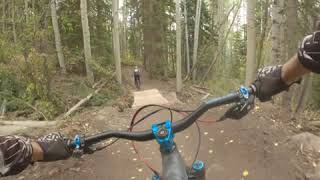
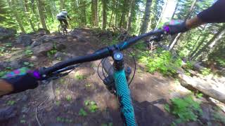
trail: Indian Point
3:01 |
274 |
Mar 9, 2016

trail: Ramble On
12:22 |
457 |
Apr 25, 2022 , Cedaredge
trail: Prospector
7:09 |
657 |
Dec 19, 2020 , Cedaredge
youtuber
![Kannah Creek Is A Single Track Dream]()
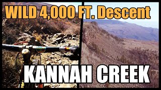
trail: Kannah Creek
23:42 |
1463 |
Jan 8, 2020 , Cedaredge
youtuber
![Pinball Alley - MTB DH - Powderhorn Bike Park...]()
trail: Pinball Alley
14:24 |
1779 |
Jun 11, 2018 , Cedaredge
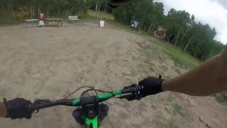
trail: Pinball Alley
10:34 |
913 |
Apr 13, 2018 , Cedaredge

0:18 |
336 |
Apr 13, 2018
Recent Trail Reports
| status | trail | date | condition | info | user |
|---|---|---|---|---|---|
| Mesa Top | Sep 20, 2025 @ 11:55am (America/Denver) Sep 20, 2025 | Ideal | IcemanCO | ||
| Lake of the Woods | Aug 15, 2025 @ 11:06am Aug 15, 2025 | Unknown | tiggeriider | ||
| Scales Lake Road | Jul 26, 2025 @ 3:38pm Jul 26, 2025 | Dry | armandhughes1994 | ||
| County Line East | Jul 26, 2025 @ 3:38pm Jul 26, 2025 | Ideal | armandhughes1994 | ||
| West Bench | Jul 12, 2025 @ 1:19pm Jul 12, 2025 | Variable | armandhughes1994 | ||
| Jumbo Dam | Jul 12, 2025 @ 1:19pm Jul 12, 2025 | Variable | armandhughes1994 | ||
| Indian Point | Aug 7, 2024 @ 6:30pm Aug 7, 2024 | Dry | Fco2 | ||
| Prospector | Aug 3, 2024 @ 5:35am Aug 3, 2024 | Ideal | rlaca001 | ||
| Paddy Wagon | Aug 3, 2024 @ 5:35am Aug 3, 2024 | Ideal | rlaca001 | ||
| Lower Ramble On | Aug 3, 2024 @ 5:35am Aug 3, 2024 | Ideal | rlaca001 |
Activity Feed
| username | action | type | title | date |
|---|---|---|---|---|
| Beep04 | wishlist | route | activity #95990607 | May 31, 2026 @ 5:41pm May 31, 2026 |
| mattm254 | add | trail | activity #95637392 | May 27, 2026 @ 8:48am May 27, 2026 |
| mattm254 | update | trail | activity #95637000 and 4 more | May 27, 2026 @ 8:41am May 27, 2026 |
| gravityjunkiepr | wishlist | region | activity #95537172 | May 25, 2026 @ 6:18pm May 25, 2026 |
| gravityjunkiepr | wishlist | route | activity #95537055 | May 25, 2026 @ 6:15pm May 25, 2026 |
Recent Comments
| username | type | title | comment | date |
|---|---|---|---|---|
| trail | Easy, pedal-y, some short dh sections that are... | Jul 26, 2025 @ 5:39pm Jul 26, 2025 | ||
| trail | Perfectly pleasant flowing XC single track! | Jul 12, 2025 @ 7:59pm Jul 12, 2025 | ||
| trail | Some chunk, some flow, some tech, some speed.... | Jul 12, 2025 @ 7:57pm Jul 12, 2025 | ||
| trail | Prepare to walk some (most) of this! Great... | Jul 12, 2025 @ 7:56pm Jul 12, 2025 | ||
| trail | Agree should be rated black d/t steep terrain,... | Jun 28, 2025 @ 4:36pm Jun 28, 2025 |
Local Badges
-

10 Blue Trails60 awarded -

Epic Ride Climb 2k262 awarded -

Climbing 10k Badge44 awarded -

Climbing 100k Badge1 awarded -

Epic Ride Descent 2k631 awarded -

Descent 10k Badge72 awarded
Bike & Skill Parks
| name | type | city | rating |
|---|---|---|---|
| Powderhorn Mountain Resort | bike park | Cedaredge |
Local Trail Supporters
![Grand Valley Trails Alliance]()
- Powderhorn
Activity Type Stats
| activitytype | trails | distance | descent | descent distance | total vertical | rating | global rank | state rank | photos | reports | routes | ridelogs |
|---|---|---|---|---|---|---|---|---|---|---|---|---|
| Mountain Bike | 50 | 112 miles | 16,749 ft | 52 miles | 5,089 ft | #1,931 | #698 | 47 | 94 | 5 | 5,232 | |
| E-Bike | 9 | 17 miles | 1,864 ft | 7 miles | 2,103 ft | #5,177 | #1,613 | 1 | 60 | 168 | ||
| Gravel Bike | 2 | 3 miles | 7 ft | 230 ft | 1,552 ft | #502 | #1,110 | 9 | 6 | |||
| Horse | 16 | 28 miles | 3,294 ft | 13 miles | 2,011 ft | #1,381 | #824 | 7 | 2 | |||
| Hike | 57 | 130 miles | 16,946 ft | 55 miles | 5,089 ft | #1,777 | #775 | 4 | 79 | 883 | ||
| Trail Running | 54 | 127 miles | 16,299 ft | 54 miles | 5,089 ft | #1,575 | #541 | 79 | 73 | |||
| Dirtbike/Moto | 7 | 13 miles | 1,857 ft | 7 miles | 1,512 ft | #1,047 | #405 | 6 | 3 | |||
| ATV/ORV/OHV | 4 | 7 miles | 1,348 ft | 5 miles | 1,512 ft | 6 | 2 | |||||
| Downhill Ski | 49 | 24 miles | 24,216 ft | 23 miles | 1,686 ft | #326 | #128 | 21 | 2,057 |
Frequently Asked Questions About Cedaredge
▼
What are the best places to ride in Cedaredge?
Cedaredge has 3 areas to explore for mountain biking. The top rated areas are:
▼
What are the highest rated mountain biking trails in Cedaredge?
The highest rated mountain biking trails in Cedaredge are:
- Kannah Creek (4.4/5)
- Lower Ramble On (4.2/5)
- Prospector (4.2/5)
- Paddy Wagon (4.1/5)
- County Line East (4.1/5)
▼
What is the best time of the year to ride in Cedaredge?
Based on ride log data, the most popular months to ride in Cedaredge are:
- July (103 activities)
- August (97 activities)
- June (68 activities)
▼
Where can I park to ride in Cedaredge?
There are 19 parking locations listed in Cedaredge. The most popular parking spots are: View all parking and trailhead locations on the map to plan your visit.
Activities
Trails
- By brenthillier
 NSMBA TRAILFORKS & contributors
 - Admins: COPMOBA-GVT
- #3491 - 4,083 views
- cedaredge activity log | embed map of Cedaredge mountain bike trails | cedaredge mountain biking points of interest
Downloading of trail gps tracks in kml & gpx formats is enabled for Cedaredge.
You must login to download files.