close
-
Layers w
- Weather Layers
- Pro
- Pro
- Pro
- Pro
- Pro
- Pro
- More Layers
- Pro
- Pro
- Pro
- Pro
-
Upgrade to

3D
Trail Conditions
- Unknown
- Snow Groomed
- Snow Packed
- Snow Covered
- Snow Cover Partial
- Freeze/thaw Cycle
- Icy
- Prevalent Mud
- Wet
- Variable
- Ideal
- Dry
- Very Dry
Trail Flow (Ridden Direction)
Trailforks scans users ridelogs to determine the most popular direction each trail is ridden. A good flowing trail network will have most trails flowing in a single direction according to their intension.
The colour categories are based on what percentage of riders are riding a trail in its intended direction.
The colour categories are based on what percentage of riders are riding a trail in its intended direction.
- > 96%
- > 90%
- > 80%
- > 70%
- > 50%
- < 50%
- bi-directional trail
- no data
Trail Last Ridden
Trailforks scans ridelogs to determine the last time a trail was ridden.
- < 2 days
- < 1 week
- < 2 weeks
- < 1 month
- < 6 months
- > 6 months
Trail Ridden Direction
The intended direction a trail should be ridden.
- Downhill Only
- Downhill Primary
- Both Directions
- Uphill Primary
- Uphill Only
- One Direction
Contribute Details
Colors indicate trail is missing specified detail.
- Description
- Photos
- Description & Photos
- Videos
Trail Popularity ?
Trailforks scans ridelogs to determine which trails are ridden the most in the last 9 months.
Trails are compared with nearby trails in the same city region with a possible 25 colour shades.
Think of this as a heatmap, more rides = more kinetic energy = warmer colors.
- most popular
- popular
- less popular
- not popular
ATV/ORV/OHV Filter
Max Vehicle Width
inches
US Cell Coverage
Legend

Radar Time
Activity Recordings
Trailforks uses anonymized public activity data.
?
Activity Recordings
Trailforks uses anonymized public activity data.
?
Personal Heatmap
▶
Activity Types
all
/
none
▶
Options
2
Date range
month
–
Winter Trails
Warning
A routing network for winter maps does not exist. Selecting trails using the winter trails layer has been disabled.
Missing Trails
Most Popular
Least Popular
Trails are colored based on popularity. The more popular a trail is, the more red. Less popular trails trend towards green.
Jump Magnitude Heatmap
Heatmap of where riders jump on trails. Zoom in to see individual jumps, click circles to view jump details.
BC Backroad Status
![map legend]()
Service Road Atlas is a free to use, community-driven service for viewing and creating reports on the numerous back-country service roads around B.C. and Alberta.

Slope Aspect
Direction the slope faces
Trails Deemphasized
Trails are shown in grey.
Only show trails with no bike usage.
Suggested Layers
Based on selected activity type
Save the current map location and zoom level as your default home location whenever this page is loaded.
Save
No description for Central Java has been added yet!
Login or register to submit one.
Region Details
- 4
- 12
- 11
Stats
- Avg Trail Rating
- Trails (view details)
- 27
- Trails Mountain Bike
- 27
- Trails E-Bike
- 3
- Trails Hike
- 18
- Trails Trail Running
- 18
- Total Distance
- 75 miles
- Total Descent
- 24,278 ft
- Total Vertical
- 5,963 ft
- Highest Trailhead
- 6,459 ft
- Reports
- 3
- Photos
- 102
- Ridden Counter
- 34
Sub Regions
- Muntilan (2)
- Pemalang (3)
- Purwokerto (5)
- Salatiga (4)
- Semarang (1)
- Gunung Ungaran (1)
- Surakarta (1)
- Wonosobo (2)
- Yogyakarta (7)
- Jogja (2)
Popular Central Java Mountain Biking Trails
• 5 ★ 5.0 • 4,328 ft • 2 ft • 10 •
Less popular black diamond difficulty singletrack. This mountain bike primary trail can be used downhill only and has a moderate overall physical rating. It features berm, bridge, drop, jump and gap jump. On average it takes 3 hours19 minutes to complete this trail.
• 5 ★ 4.0 • 3,024 ft • 406 ft • 6 •
Walking trail to reach Klangon am trail. This is the only access to reach start point frim the parking yard. Riders can hire locals to bring bike up to the start point.
• 5 ★ 0.0 • 4,941 ft • 15 ft • 6 •
Less popular blue difficulty mixed. This mountain bike primary trail can be used downhill primary and has a moderate overall physical rating with a 15 ft green climb. It features drop, log ride, rock garden and other. On average it takes 4 minutes to complete this trail.
• 5 ★ 4.0 • 1 mile • 0 ft • 5 •
Less popular black diamond difficulty singletrack. This mountain bike primary trail can be used downhill only and has a moderate overall physical rating. It features berm, bridge, drop, jump and gap jump. On average it takes 3 minutes to complete this trail.
• 5 ★ 4.0 • 7 miles • 269 ft • 5 •
From Kalitengah (under Klangon Pass) we will meet large field at Kalitengah. Just following the track then finish at Jalan Pakem - Kalasan ( Komeng's Meatball shop) Cangkringan
• 5 ★ 0.0 • 5,272 ft • 109 ft • 3 •
Less popular black diamond difficulty mixed. This mountain bike primary trail can be used downhill only and has a hard overall physical rating. It features bridge, drop, jump, rock face and roller coaster.
• 5 ★ 4.0 • 2 miles • 21 ft • 2 •
Natural short xc-trail,some parts of trail previously used by asean xc championship
Central Java Mountain Bike Routes
7 miles • 20 ft • 0 •
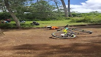
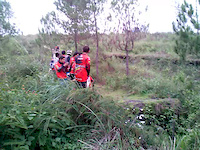
Photos of Central Java Mountain Bike
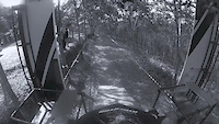
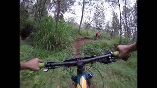
Videos of Central Java Mountain Bike
trail: Thekelan Bike Park
0:09 |
85 |
Feb 10, 2022
trail: Jurang Jero DH
0:15 |
554 |
Dec 27, 2015
trail: Tlogo Resort Track
3:21 |
47 |
Jun 14, 2015

trail: Tlogo Resort Track
4:11 |
118 |
Jun 13, 2015
trail: Ngaduman Polobogo
10:07 |
156 |
Jun 4, 2021 , Salatiga
Recent Trail Reports
no previous reports, add one now!
Activity Feed
| username | action | type | title | date |
|---|---|---|---|---|
| StefanGabel | ridden | trail | activity #56976402 | Aug 10, 2024 @ 1:35am Aug 10, 2024 |
| StefanGabel | comment | trail | activity #56976391 | Aug 10, 2024 @ 1:35am Aug 10, 2024 |
| StefanGabel | wishlist | trail | activity #55813392 | Jul 18, 2024 @ 2:46am Jul 18, 2024 |
| StefanGabel | wishlist | trail | activity #55813386 | Jul 18, 2024 @ 2:46am Jul 18, 2024 |
| StefanGabel | wishlist | trail | activity #55813383 | Jul 18, 2024 @ 2:45am Jul 18, 2024 |
Recent Comments
| username | type | title | comment | date |
|---|---|---|---|---|
| trail | No longer active | Aug 10, 2024 @ 1:35am Aug 10, 2024 |
Activity Type Stats
| activitytype | trails | distance | descent | descent distance | total vertical | rating | global rank | state rank | photos | reports | routes | ridelogs |
|---|---|---|---|---|---|---|---|---|---|---|---|---|
| Mountain Bike | 27 | 75 miles | 24,278 ft | 43 miles | 5,965 ft | 102 | 3 | 1 | 1,514 | |||
| E-Bike | 3 | 5 miles | 3,087 ft | 4 miles | 4,088 ft | 3 | 8 | |||||
| Hike | 18 | 57 miles | 15,604 ft | 29 miles | 5,154 ft | 3 | 196 | |||||
| Trail Running | 18 | 57 miles | 15,604 ft | 29 miles | 5,154 ft | 3 | 23 |
Activities
Trails
Points of Interest
- By canadaka
 Trailforks & contributors
 - Admins: jack-jacobs, rifu
- #17884 - 2,537 views
- central java activity log | embed map of Central Java mountain bike trails | central java mountain biking points of interest
Downloading of trail gps tracks in kml & gpx formats is enabled for Central Java.
You must login to download files.