close
-
Layers w
- Weather Layers
- Pro
- Pro
- Pro
- Pro
- Pro
- Pro
- More Layers
- Pro
- Pro
- Pro
- Pro
-
Upgrade to

3D
Trail Conditions
- Unknown
- Snow Groomed
- Snow Packed
- Snow Covered
- Snow Cover Partial
- Freeze/thaw Cycle
- Icy
- Prevalent Mud
- Wet
- Variable
- Ideal
- Dry
- Very Dry
Trail Flow (Ridden Direction)
Trailforks scans users ridelogs to determine the most popular direction each trail is ridden. A good flowing trail network will have most trails flowing in a single direction according to their intension.
The colour categories are based on what percentage of riders are riding a trail in its intended direction.
The colour categories are based on what percentage of riders are riding a trail in its intended direction.
- > 96%
- > 90%
- > 80%
- > 70%
- > 50%
- < 50%
- bi-directional trail
- no data
Trail Last Ridden
Trailforks scans ridelogs to determine the last time a trail was ridden.
- < 2 days
- < 1 week
- < 2 weeks
- < 1 month
- < 6 months
- > 6 months
Trail Ridden Direction
The intended direction a trail should be ridden.
- Downhill Only
- Downhill Primary
- Both Directions
- Uphill Primary
- Uphill Only
- One Direction
Contribute Details
Colors indicate trail is missing specified detail.
- Description
- Photos
- Description & Photos
- Videos
Trail Popularity ?
Trailforks scans ridelogs to determine which trails are ridden the most in the last 9 months.
Trails are compared with nearby trails in the same city region with a possible 25 colour shades.
Think of this as a heatmap, more rides = more kinetic energy = warmer colors.
- most popular
- popular
- less popular
- not popular
ATV/ORV/OHV Filter
Max Vehicle Width
inches
US Cell Coverage
Legend

Radar Time
Activity Recordings
Trailforks uses anonymized public activity data.
?
Activity Recordings
Trailforks uses anonymized public activity data.
?
Personal Heatmap
▶
Activity Types
all
/
none
▶
Options
2
Date range
month
–
Winter Trails
Warning
A routing network for winter maps does not exist. Selecting trails using the winter trails layer has been disabled.
Missing Trails
Most Popular
Least Popular
Trails are colored based on popularity. The more popular a trail is, the more red. Less popular trails trend towards green.
Jump Magnitude Heatmap
Heatmap of where riders jump on trails. Zoom in to see individual jumps, click circles to view jump details.
BC Backroad Status
![map legend]()
Service Road Atlas is a free to use, community-driven service for viewing and creating reports on the numerous back-country service roads around B.C. and Alberta.

Slope Aspect
Direction the slope faces
Trails Deemphasized
Trails are shown in grey.
Only show trails with no bike usage.
Suggested Layers
Based on selected activity type
Save the current map location and zoom level as your default home location whenever this page is loaded.
Save
No description for Chalkida has been added yet!
Login or register to submit one.
Activities Click to view
- Mountain Bike
7 trails
- Hike
7 trails
- Trail Running
7 trails
Region Details
- 2
- 5
Region Status
Open as of Dec 26, 2025Stats
- Avg Trail Rating
- Trails (view details)
- 7
- Trails Mountain Bike
- 7
- Trails E-Bike
- 3
- Trails Hike
- 7
- Trails Trail Running
- 7
- Total Distance
- 5 miles
- Total Descent Distance
- 5 miles
- Total Descent
- 3,392 ft
- Total Vertical
- 2,696 ft
- Highest Trailhead
- 2,932 ft
- Reports
- 12
- Ridden Counter
- 77
Sub Regions
-
Ritsona
- 2
- 5
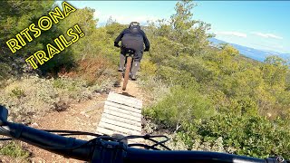
Popular Chalkida Mountain Biking Trails
• 100 ★ 3.0 • 4,252 ft • 0 ft • 18 •
Popular blue difficulty singletrack. This mountain bike primary trail can be used both directions. On average it takes 4 minutes to complete this trail.
• 75 ★ 3.0 • 1,591 ft • 0 ft • 15 •
Popular green difficulty singletrack. This mountain bike primary trail can be used both directions. On average it takes 2 minutes to complete this trail.
• 90 ★ 3.0 • 2,907 ft • 3 ft • 15 •
Popular green difficulty singletrack. This mountain bike primary trail can be used downhill primary. On average it takes 2 minutes to complete this trail.
• 45 ★ 0.0 • 1,854 ft • 0 ft • 12 •
Moderately popular blue difficulty singletrack. This mountain bike primary trail can be used both directions. On average it takes 3 minutes to complete this trail.
• 60 ★ 0.0 • 2,034 ft • 0 ft • 10 •
Moderately popular blue difficulty singletrack. This mountain bike primary trail can be used downhill primary. On average it takes 3 minutes to complete this trail.
• 30 ★ 3.0 • 2 miles • 19 ft • 8 •
Less popular blue difficulty singletrack. This mountain bike primary trail can be used both directions. On average it takes 17 minutes to complete this trail.
• 15 ★ 0.0 • 1,250 ft • 0 ft • 6 •
Less popular blue difficulty singletrack. This mountain bike primary trail can be used downhill only. It features berm and jump.
Recent Trail Reports
| status | trail | date | condition | info | user |
|---|---|---|---|---|---|
| Old Man Bacalla | Apr 14, 2024 @ 3:38am Apr 14, 2024 | Very Dry | Petros-K | ||
| Young Man Baccala | Apr 14, 2024 @ 3:38am Apr 14, 2024 | Very Dry | Petros-K | ||
| Jump Line Pt.2 | Apr 14, 2024 @ 3:38am Apr 14, 2024 | Very Dry | Petros-K | ||
| Jump Line | Apr 14, 2024 @ 3:38am Apr 14, 2024 | Very Dry | Petros-K | ||
| Cyclone | Feb 18, 2024 @ 5:58am Feb 18, 2024 | Variable | mikesf |
Activity Feed
| username | action | type | title | date |
|---|---|---|---|---|
| Ak-12345 | wishlist | region | activity #76010049 | Jul 16, 2025 @ 2:33am Jul 16, 2025 |
| Nikolakopoulosgiorgos | comment | trail | activity #67046107 | Mar 2, 2025 @ 2:43am Mar 2, 2025 |
| Nikolakopoulosgiorgos | ridden | trail | activity #67046014 | Mar 2, 2025 @ 2:42am Mar 2, 2025 |
| Petros-K | vote | trail | activity #62368868 and 3 more | Nov 27, 2024 @ 11:45am Nov 27, 2024 |
| Petros-K | add | report | activity #51206223 and 3 more | Apr 15, 2024 @ 1:59am Apr 15, 2024 |
Recent Comments
| username | type | title | comment | date |
|---|---|---|---|---|
| trail | Wonderful. Steep slopes at start and very... | Mar 2, 2025 @ 2:43am Mar 2, 2025 |
Activity Type Stats
| activitytype | trails | distance | descent | descent distance | total vertical | rating | global rank | state rank | photos | reports | routes | ridelogs |
|---|---|---|---|---|---|---|---|---|---|---|---|---|
| Mountain Bike | 7 | 5 miles | 3,392 ft | 5 miles | 2,697 ft | #9,778 | #52 | 12 | 157 | |||
| E-Bike | 3 | 4 miles | 2,736 ft | 3 miles | 2,362 ft | 12 | 16 | |||||
| Hike | 7 | 5 miles | 3,392 ft | 5 miles | 2,697 ft | #7,070 | #57 | 12 | 4 | |||
| Trail Running | 7 | 5 miles | 3,392 ft | 5 miles | 2,697 ft | #6,514 | #57 | 12 |
Frequently Asked Questions About Chalkida
▼
What are the best places to ride in Chalkida?
Chalkida has 1 areas to explore for mountain biking. The top rated areas are:
▼
What are the highest rated mountain biking trails in Chalkida?
The highest rated mountain biking trails in Chalkida are:
- Jump Line (3.8/5)
- Young Man Baccala (3.8/5)
- Jump Line Pt.2 (3.8/5)
- Old Man Bacalla (3.8/5)
- Let Me See (0/5)
▼
Where can I park to ride in Chalkida?
Check the Chalkida trail map for trailhead and parking information. Community members regularly update access and parking details for trails in the area.
▼
What is the longest trail in Chalkida?
The longest trail in Chalkida is Old Man Bacalla at 2.4 miles. View all trails sorted by distance.
- By mikesf
 & contributors
 - Admins: apply
- #62929 - 906 views
- chalkida activity log | embed map of Chalkida mountain bike trails |
Downloading of trail gps tracks in kml & gpx formats is enabled for Chalkida.
You must login to download files.